Punta (Dragunica), Ražanac Beach, Croatia
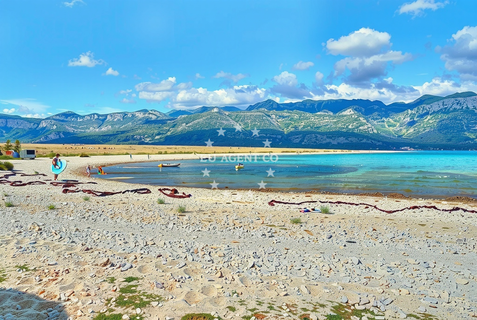
About this beach
Punta (Dragunica), Ražanac
Beach: Punta (Dragunica)
Location: Ražanac
Characteristics and facilities
Gravel
720 m
Beach character
The beach is characterized by its gravel composition, which contrasts with the more common sandy shores of the region. Gravel beaches are typically found in areas with stronger wave action or rocky substrates, though specific geological details about Ražanac's formation are not documented in official sources. The 720-meter length provides a linear shoreline that may offer views of the surrounding coast and sea.Swimming and shore
Swimming conditions at Ražanac Beach are not explicitly detailed in official records. Gravel shorelines can present challenges for swimmers due to the uneven surface, though the Adriatic Sea's generally mild temperatures make it a viable option for those accustomed to such environments. The beach's orientation relative to prevailing winds and currents would influence wave patterns, but specific data on water safety or accessibility is not available.Facilities and activities
Official records do not list specific facilities or activities associated with Ražanac Beach. The absence of structured amenities suggests it may function more as a natural shoreline than a developed recreational area. Nearby settlements in the Punta (Dragunica) region may offer broader services, but direct beachside infrastructure is not documented.Access and location
Ražanac Beach is situated within the Punta (Dragunica) settlement, a coastal area along Croatia's Adriatic coast. Its exact coordinates (44.292323, 15.32828) place it near the broader Dalmatian coast, which is known for its network of islands, traditional fishing communities, and maritime routes. Travelers arriving by sea may find connections to nearby marinas or anchorages in the region, though specific distances are not provided in official records.What to expect
Visitors to Ražanac Beach should expect a gravel shoreline spanning 720 meters, with no explicitly listed facilities or structured activities. The beach's character aligns with the natural coastal features of the Dalmatian coast, where gravel and rocky shorelines are common in certain areas. While no specific services are documented, the surrounding Punta (Dragunica) settlement may provide access to local amenities, restaurants, or cultural sites typical of the region.Practical tips
Given the gravel composition of the beach, visitors may wish to wear sturdy footwear for walking along the shoreline. The absence of detailed facility information suggests that provisions such as sun protection, water, and snacks should be brought from nearby settlements. As with any natural shoreline, caution is advised when entering the water, particularly near the gravel transition zone.Exploring the coast by yacht
For sailors and yacht charter guests, the Punta (Dragunica) region offers access to the broader Adriatic sailing routes. Nearby marinas and anchorages in the Dalmatian coast provide opportunities for yacht-based exploration of the area. While Ražanac Beach itself is not noted as a formal anchorage, its proximity to coastal settlements may make it a convenient reference point for navigation in the region.Regional Context and Coastal Features
The Punta (Dragunica) area is part of Croatia's Dalmatian coast, a region defined by its limestone cliffs, traditional fishing villages, and maritime heritage. The Adriatic Sea's clear waters and moderate climate make it a popular sailing destination, with routes extending to nearby islands such as Brač and Hvar. Gravel beaches like Ražanac are less common than sandy shores but reflect the diverse coastal geology of the area.Anchorages in the surrounding area
Anchorages in the surrounding area include rtina and ljubac, located near Punta (Dragunica).
- Anchorage — rtina — 1.4 NM from beach
- Anchorage — rtina — 1.5 NM from beach
- Anchorage — ljubac — 2.6 NM from beach
- Anchorage — ljubac — 2.8 NM from beach
- Anchorage — tribanj — 4.5 NM from beach
- Anchorage — vlasici — pag — 5.0 NM from beach
- Anchorage — vrsi — 5.1 NM from beach
- Anchorage — nin — 5.5 NM from beach
Distances are straight-line geographic distances, not sailing routes.
Mooring buoys in the surrounding area
Mooring buoys in the surrounding area include ljubac and sibuljina point, situated close to Punta (Dragunica).
- Jetty — ljubac — 2.5 NM from beach
- Šibuljina Point — sibuljina point — 2.7 NM from beach
- Punta Skala — petrcane — 9.9 NM from beach
- Vir — 10.5 NM from beach
- Jetty — zadar — 11.0 NM from beach
Distances are straight-line geographic distances, not sailing routes.
Marine fuel stations
- Ina — zadar — 11.3 NM from beach
- Ina — preko — ugljan — 14.2 NM from beach
- Fuel station — sukosan — 14.4 NM from beach
- Ina — biograd na moru — 21.8 NM from beach
Distances are straight-line geographic distances, not sailing routes.
Harbours in the surrounding area
- Ražanac — razanac — 0.9 NM from beach
- Starigrad Paklenica — 4.7 NM from beach
- Miškovići — miskovici — pag — 5.1 NM from beach
- Mulo — nin — 5.4 NM from beach
- Vinjerac — 6.1 NM from beach
- Seline — 6.4 NM from beach
Distances are straight-line geographic distances, not sailing routes.
Marinas in the surrounding area
- Marina Borik — zadar — 11.0 NM from beach
- Vitrenjak Zadar — 11.0 NM from beach
- Marina Zadar — 11.3 NM from beach
- Olive Island Marina — sutomiscica — ugljan — 13.6 NM from beach
- Marina Preko — ugljan — 14.0 NM from beach
Distances are straight-line geographic distances, not sailing routes.
Navigation guides for the surrounding area
Navigation guides for the surrounding area include the VELESITSKI KANAL and Starigrad-Paklenica, providing routes near Punta (Dragunica).
- VELESITSKI KANAL (S) — 1.9 NM from beach
- KrusCica and Uvala KrusCica Duboka — 3.4 NM from beach
- Starigrad-Paklenica {Velebitski Kanai) — 4.9 NM from beach
- Posedarje (Novigradsko More) — 8.2 NM from beach
- Privlaka — 9.0 NM from beach
Distances are straight-line geographic distances, not sailing routes.
Yachts from nearby departure bases
Yachts from nearby departure bases include motor boats and sailboats based in Zadar Diklo Port and Zadar Marina Borik, offering access to Punta (Dragunica).
Sailing yachts
- Bavaria Cruiser 46 (Tkon) — Zadar Marina Borik — 11.0 NM from departure base to beach
- Dufour 460 (Proizd) — Zadar Marina Borik — 11.0 NM from departure base to beach
Catamarans
- Leopard 50 (Solaia) — Zadar Marina Borik — 11.0 NM from departure base to beach
- Sunreef 60 (SINATA) — Zadar Marina Borik — 11.0 NM from departure base to beach
Motor yachts
- Prestige 460 (Adudu 2) — Zadar Marina Borik — 11.0 NM from departure base to beach
Motor boats
- Rancraft RS Cinque.5 — Zadar Diklo Port — 10.0 NM from departure base to beach
- Rancraft RM21 (Dugi otok) — Zadar Diklo Port — 10.0 NM from departure base to beach
- Rancraft RM19 (Daycruiser) — Zadar Diklo Port — 10.0 NM from departure base to beach
- Merry Fisher 895 — Povljana Marina — 10.2 NM from departure base to beach
- Merry Fisher 895 (Joy) — Zadar Marina Borik — 11.0 NM from departure base to beach
Distances are straight-line geographic distances, not sailing routes.