Primošten Burnji Beaches and Coves, Croatia
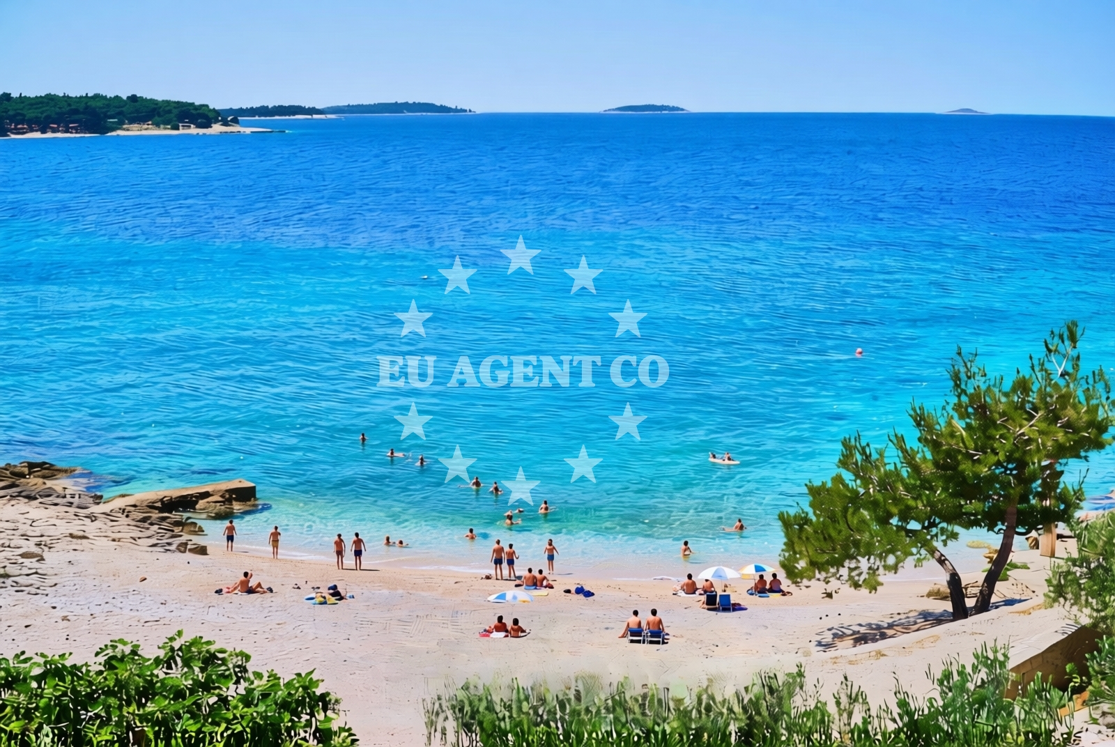
About this beach
Primošten Burnji: beaches and coves
Beach character
The beaches and coves of Primošten Burnji are defined by their rocky terrain and sheltered positions, formed by the interplay of sea currents and limestone cliffs. While not featuring sandy shores, the area offers several small pebble beaches and natural swimming spots tucked between the islands. The water clarity is typically high, revealing vibrant marine life that attracts snorkelers and divers. The coves provide natural protection from open-sea swells, making them suitable for swimming during calmer conditions. The surrounding landscape is characterized by dense vegetation on the cliffs, with olive groves and vineyards visible on the mainland side.Swimming and shore
Swimming conditions in the coves of Primošten Burnji are generally favorable during the summer months, with water temperatures reaching comfortable levels by late June. The sheltered nature of the inlets reduces wave action, though swimmers should be mindful of underwater rock formations. The rocky shores create natural pools in some areas, offering safer swimming options. Snorkeling is particularly rewarding here, with opportunities to observe fish species common to the Adriatic, including groupers and moray eels. The absence of large-scale tourism infrastructure means visitors can often enjoy these spots with minimal crowds.Facilities and activities
The area lacks formal beach facilities such as showers, restrooms, or umbrellas, reflecting its character as a more natural and secluded coastal environment. However, the proximity to the mainland town of Primošten (approximately 15 kilometers away) means visitors can access basic amenities in the nearby settlement. Activities centered around the area include kayaking between the islands, exploring the network of coves by boat, and hiking along the mainland's coastal trails. The rocky coastline also provides opportunities for rock climbing and photography, particularly during sunrise and sunset when the light enhances the dramatic landscape.Access and location
Primošten Burnji's coves are best accessed by boat, with no direct road connections to the mainland. The nearest marina is located in the town of Primošten, which serves as a common starting point for yacht charters exploring this part of the coast. The area's position within the Šibenik-Knin County places it along a popular sailing route that connects the Adriatic's northern and southern regions. The nearest major port cities include Šibenik (approximately 40 kilometers south) and Split (about 70 kilometers further south), both of which offer yacht charter services and provisioning facilities.What to expect
Visitors to Primošten Burnji should expect a rugged, undeveloped coastline that prioritizes natural beauty over modern amenities. The coves offer a sense of isolation that is rare along Croatia's more commercialized shores, though this also means limited infrastructure. The area is particularly appealing to yacht charter guests seeking to explore lesser-known parts of the Dalmatian coast. Those visiting should plan for self-sufficiency, as there are no on-site facilities for food, water, or shade. The best times to visit are during the late spring and early autumn when the weather is mild and the sea is calm, allowing for easy navigation between the islands.Practical tips
For those planning a visit, consider bringing snorkeling gear and a waterproof bag for personal items. The absence of formal parking areas means boats should anchor carefully to avoid damaging the seabed. Local regulations may restrict anchoring in certain coves during peak season, so it's advisable to consult with local marinas or charter agencies for the latest information. The area's isolation makes it an ideal destination for those seeking solitude, but visitors should be prepared for the lack of nearby services.Exploring the coast by yacht
The waters surrounding Primošten Burnji are part of a broader sailing region that includes the islands of Primošten, Šolta, and the mainland coast near Šibenik. This area is a favored route for yacht charters due to its combination of sheltered anchorages, scenic coastal routes, and proximity to cultural attractions. The nearby town of Primošten offers a base for exploring the region, with its historic Old Town and access to the Šibenik-Knin County's network of roads and trails. For charter guests, the area provides an opportunity to experience the Adriatic's natural beauty while connecting with the region's rich maritime history.Historical Context of the Primošten Archipelago
The Primošten archipelago has a long maritime history, with records dating back to the medieval period. The islands were strategically important for Venetian and Ottoman naval powers, and remnants of this history can still be seen in the region's fortifications and coastal settlements. The area's natural harbors made it a valuable location for shipbuilding and trade, a legacy that continues to influence the region's connection to the sea.Anchorages in the surrounding area
Anchorages in the surrounding area include grebastica and dolac, located near Primošten Burnji.
- Anchorage — grebastica — 1.3 NM from beach
- Anchorage — dolac — 2.2 NM from beach
- Anchorage — zaboric — 2.2 NM from beach
- Anchorage — grebastica — 2.4 NM from beach
- Anchorage — zaboric — 2.5 NM from beach
- Anchorage — zaboric — 2.8 NM from beach
- Anchorage — zaboric — 3.1 NM from beach
- Anchorage — zaboric — 3.2 NM from beach
Distances are straight-line geographic distances, not sailing routes.
Mooring buoys in the surrounding area
Mooring buoys in the surrounding area include grebastica jetty and primosten quay, close to Primošten Burnji.
- Jetty — grebastica — 1.3 NM from beach
- Quay — primosten — 2.4 NM from beach
- Buoy field — primosten — 2.6 NM from beach
- Hotel Spongiola jetty — krapanj — 4.6 NM from beach
- Zlatna ribica jetty — brodarica — 4.7 NM from beach
Distances are straight-line geographic distances, not sailing routes.
Marine fuel stations
- Petrol — primosten — 2.7 NM from beach
- Flash — rogoznica — 4.7 NM from beach
- Lukoil — sibenik — 7.4 NM from beach
- Ina — sibenik — 8.2 NM from beach
Distances are straight-line geographic distances, not sailing routes.
Harbours in the surrounding area
Harbours in the surrounding area include Primosten and Krapanj, situated near Primošten Burnji.
- Primošten — primosten — 2.6 NM from beach
- Krapanj — 4.4 NM from beach
- Brodarica — 4.5 NM from beach
- Rogoznica — 5.0 NM from beach
- Zablaće — zablace — 7.4 NM from beach
- Zlarin — 8.1 NM from beach
Distances are straight-line geographic distances, not sailing routes.
Marinas in the surrounding area
Marinas in the surrounding area include Marina Kremik in primosten and Marina Frapa in rogoznica, close to Primošten Burnji.
- Marina Kremik — primosten — 2.8 NM from beach
- Marina Frapa — rogoznica — 4.8 NM from beach
- Amadria Yacht Marines — sibenik — 6.8 NM from beach
- Marina Mandalina — sibenik — 7.3 NM from beach
- Marina Agana — 8.5 NM from beach
Distances are straight-line geographic distances, not sailing routes.
Restaurants near the beach
Restaurants near the beach include Saricevi dvori and Konoba Antonija in primosten, near Primošten Burnji.
- Pizzeria Niko — grebastica — 1.5 NM from beach
- Saricevi dvori — primosten — 2.2 NM from beach
- Konoba Antonija — primosten — 2.5 NM from beach
- Restaurant Galija — primosten — 2.5 NM from beach
- Torkul — primosten — 2.6 NM from beach
- Staro Selo — primosten — 2.6 NM from beach
- Kamenar — primosten — 2.6 NM from beach
Distances are straight-line geographic distances, not sailing routes.
Navigation guides for the surrounding area
Navigation guides for the surrounding area include Luka Grebastica and Primosten, located near Primošten Burnji.
- Luka Grebastica — 1.6 NM from beach
- Primosten — 2.4 NM from beach
- Luka Peles and Marina Kremik (Primosten) — 3.1 NM from beach
- Jadrtovac — 4.1 NM from beach
- Krapanj — 4.4 NM from beach
Distances are straight-line geographic distances, not sailing routes.
Yachts from nearby departure bases
Yachts from nearby departure bases include D&D Kufner 54 and Dufour Catamaran 48, based at Primošten Marina Kremik.
Sailing yachts
- D&D Kufner 54 (Ella I) — Primošten Marina Kremik — 2.8 NM from departure base to beach
- Dufour 56 (KABUKI) — Primošten Marina Kremik — 2.8 NM from departure base to beach
- Sun Odyssey 389 (sun elli) — Primošten Marina Kremik — 2.8 NM from departure base to beach
- Jeanneau 54 (Zut) — Primošten Marina Kremik — 2.8 NM from departure base to beach
- Sun Odyssey 379 (b'elli) — Primošten Marina Kremik — 2.8 NM from departure base to beach
Catamarans
- Dufour Catamaran 48 (Catamarino) — Primošten Marina Kremik — 2.8 NM from departure base to beach
- Lagoon 450 Flybridge (double elli) — Primošten Marina Kremik — 2.8 NM from departure base to beach
- Neel 47 (Hope ) — Primošten Marina Kremik — 2.8 NM from departure base to beach
- Lagoon 40 (wave elli) — Primošten Marina Kremik — 2.8 NM from departure base to beach
- Lucia 40 (PEARL) — Primošten Marina Kremik — 2.8 NM from departure base to beach
Distances are straight-line geographic distances, not sailing routes.