Potkop Paprenica, Dragove (Dugi otok) Beach, Croatia
Potkop Paprenica Beach lies on the northern coast of Dugi Otok, an island in the Adriatic Sea known for its rugged beauty and clear waters. The beach's gravel composition sets it apart from the island's more common pebble and sand shores, offering a unique texture for visitors. Located near the village of Dragove, the beach is part of a coastline that blends natural landscapes with the island's maritime heritage. While facilities are limited, the area's proximity to sailing routes makes it a point of interest for charter guests exploring the Dalmatian coast.
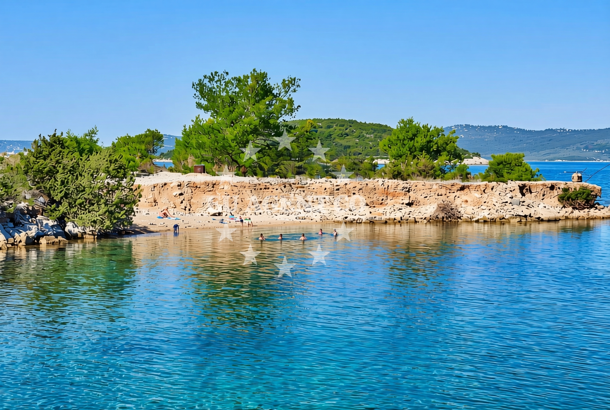
About this beach
Potkop Paprenica, Dragove (Dugi otok)
Beach: Potkop Paprenica
Location: Dragove (Dugi otok)
Characteristics and facilities
Gravel
Beach character
The beach's gravel substrate creates a distinct contrast with the smooth pebble beaches typical of Dugi Otok. This texture may appeal to visitors seeking a more rugged shoreline experience, though it may be less comfortable for those preferring softer sands. The beach's orientation along the island's northern shore means it faces open sea conditions, which can influence wave patterns and water temperature. The surrounding terrain includes low-lying coastal grasslands and rocky outcrops, reflecting the island's geological character.
Swimming and shore
Swimming conditions at Potkop Paprenica depend on wind and wave activity, which can be more pronounced due to the beach's exposed position. The gravel shore may make entry into the water less straightforward than at sandy beaches, though the sea floor typically slopes gently. Water clarity is generally good, with visibility often extending to depths of 10-15 meters. The beach's location offers unobstructed views of the open Adriatic, with passing boats occasionally visible from the shore.
Facilities and activities
There are no permanent facilities at Potkop Paprenica Beach, including showers, toilets, or umbrellas. Visitors should plan accordingly, bringing personal supplies for comfort. The immediate area lacks designated parking or roads, requiring visitors to approach by foot or vehicle from nearby Dragove. Recreational activities are limited to the beach itself, though the island's interior offers hiking trails and historical sites like the 14th-century church in Dragove. Nearby, the village of Dragove provides basic amenities for visitors.
Access and location
Reaching Potkop Paprenica requires traveling to Dragove on Dugi Otok, which is accessible by ferry from Zadar or Supetar on the mainland. The beach is approximately 3 kilometers northeast of Dragove, with no formal signage along the route. Coordinates (44.120286, 14.928942) place it within the broader Dalmatian coast region, where yacht charters frequently operate. The area's proximity to the Kornati National Park makes it a potential stop for sailors exploring the Adriatic's eastern islands.
What to expect
Visitors should expect a gravel shoreline with minimal infrastructure, suitable for those seeking a more natural coastal experience. The beach's position on Dugi Otok means it is part of a landscape shaped by maritime influences, with views of the open sea and passing vessels. While not ideal for sunbathing on soft sand, the beach offers a unique texture for those interested in exploring the island's varied coastlines. The surrounding area provides opportunities to explore Dugi Otok's interior, including its vineyards and historical landmarks.
Practical tips
Given the absence of facilities, visitors should bring water, sun protection, and beach towels. The gravel surface may be uncomfortable for prolonged sitting, so a mat or blanket is advisable. Parking options near Dragove should be confirmed in advance, as the beach lacks designated lots. Weather conditions can change rapidly along the northern Adriatic coast, so checking forecasts before visiting is recommended.
Exploring the coast by yacht
For yacht charter guests, Potkop Paprenica's location on Dugi Otok offers a strategic vantage point for exploring the Adriatic. The island's northern shore is part of a sailing route that connects Zadar, the Kornati Islands, and the coast of Slavonia. Charter yachts frequently anchor near Dragove to access the island's less-visited northern beaches. The surrounding waters are part of the Kornati National Park, a protected area with numerous bays and coves ideal for anchoring. Sailors should note that the open sea conditions near Potkop Paprenica may require careful navigation during strong winds.
Dugi Otok's Coastal Character
Dugi Otok's coastline is defined by a mix of pebble beaches, cliffs, and gravel shores like Potkop Paprenica. The island's geology, shaped by Pliocene-era deposits, creates a varied landscape that contrasts with the more tourist-developed shores of nearby islands. The northern coast, where Potkop Paprenica is located, is less frequented by visitors, preserving its natural character. This makes it an appealing destination for those seeking solitude or a different perspective on the Adriatic's coastline.
Anchorages in the surrounding area
Anchorages near Dragove on Dugi Otok offer convenient stops for mooring in the vicinity of Potkop Paprenica Beach.
- Anchorage — dragove — dugi otok — 0.1 NM from beach
- Anchorage — dragove — dugi otok — 0.9 NM from beach
- Anchorage — zverinac — 2.0 NM from beach
- Sakarun — soline — dugi otok — 2.3 NM from beach
- Anchorage — soline — dugi otok — 2.5 NM from beach
- Anchorage — dugi otok — 2.6 NM from beach
- Zverinac North — 2.8 NM from beach
- Lučica — soline — dugi otok — 3.0 NM from beach
Distances are straight-line geographic distances, not sailing routes.
Mooring buoys in the surrounding area
Mooring buoys at Sakarun and Verunic provide nearby options for securing vessels close to Potkop Paprenica Beach on Dugi Otok.
- Quay — dragove — dugi otok — 0.8 NM from beach
- Buoy field Sakarun — soline — dugi otok — 2.5 NM from beach
- Jetty — sestrunj — 3.1 NM from beach
- Jetty — verunic — dugi otok — 3.1 NM from beach
- Buoy field — verunic — dugi otok — 3.2 NM from beach
Distances are straight-line geographic distances, not sailing routes.
Marine fuel stations
- Ina — preko — ugljan — 11.7 NM from beach
- Ina — zadar — 12.9 NM from beach
- Ina — zaglav — dugi otok — 13.8 NM from beach
- Fuel station — sukosan — 16.4 NM from beach
Distances are straight-line geographic distances, not sailing routes.
Harbours in the surrounding area
- Božava — bozava — dugi otok — 1.5 NM from beach
- Zverinac — 2.5 NM from beach
- Kablin — sestrunj — 3.6 NM from beach
- Veli Rat — dugi otok — 3.6 NM from beach
- Hrvatin — sestrunj — 3.8 NM from beach
- Brbinj — dugi otok — 4.2 NM from beach
Distances are straight-line geographic distances, not sailing routes.
Marinas in the surrounding area
- Marina Veli Rat — dugi otok — 3.8 NM from beach
- Marina Veli Iž — iz veli — 8.9 NM from beach
- Olive Island Marina — sutomiscica — ugljan — 10.5 NM from beach
- Marina Preko — ugljan — 11.5 NM from beach
- Marina Borik — zadar — 12.1 NM from beach
Distances are straight-line geographic distances, not sailing routes.
Restaurants near the beach
Restaurants in Bozava and Zverinac are located within a short distance, offering dining options close to Potkop Paprenica Beach on Dugi Otok.
- Restaurant Konoba Kadulja — bozava — dugi otok — 1.5 NM from beach
- Boxavia — bozava — dugi otok — 1.5 NM from beach
- Veli Kamik — bozava — dugi otok — 1.5 NM from beach
- Restaurant — bozava — dugi otok — 1.5 NM from beach
- Gostionica Oleander — bozava — dugi otok — 1.6 NM from beach
- Ristorante Zverinac — 2.5 NM from beach
- Amarcord — soline — dugi otok — 2.6 NM from beach
Distances are straight-line geographic distances, not sailing routes.
Navigation guides for the surrounding area
Navigation guides for areas like Božava and Zverinac assist in planning routes around Potkop Paprenica Beach on Dugi Otok.
- Božava — 1.4 NM from beach
- Dugi Otok -Bozava — 2.3 NM from beach
- Zverinac — 2.4 NM from beach
- Luka Soliscica — 3.4 NM from beach
- Uvala Kablin — 3.8 NM from beach
Distances are straight-line geographic distances, not sailing routes.
Yachts from nearby departure bases
Sailing yachts
- Elan Impression 40 (Val) — Ugljan Sutomišćica Olive Island — 10.5 NM from departure base to beach
- Dufour 460 (Proizd) — Zadar Marina Borik — 12.1 NM from departure base to beach
Catamarans
- Sunreef 60 (SINATA) — Zadar Marina Borik — 12.1 NM from departure base to beach
Motor yachts
- Prestige 550 Fly (Floria) — Zadar Marina Borik — 12.1 NM from departure base to beach
Motor boats
- Adria 28 Luxus (Ana) — Brbinj Marina — 3.6 NM from departure base to beach
- Quicksilver Activ 905 (Galeb) — Ugljan Sutomišćica Olive — 10.5 NM from departure base to beach
- Rancraft RM21 (Dugi otok) — Zadar Diklo Port — 12.0 NM from departure base to beach
- Rancraft RS Cinque.5 — Zadar Diklo Port — 12.0 NM from departure base to beach
- Rancraft RM19 (Daycruiser) — Zadar Diklo Port — 12.0 NM from departure base to beach
- Merry Fisher 795 (Jura 3212ZD) — Zadar Marina Borik — 12.1 NM from departure base to beach
Distances are straight-line geographic distances, not sailing routes.