Porat (Krk): Beaches and Coves, Croatia
About this beach
Porat (Krk): beaches and coves
Beach character
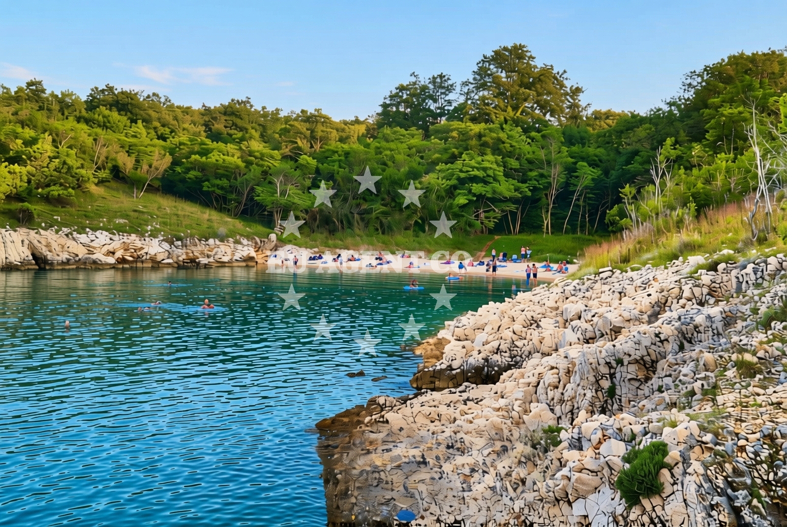
The Porat coastline features a series of interconnected coves and shallow inlets carved into limestone formations. These natural features create micro-environments with varying exposure to waves and sunlight. The rocky terrain supports sparse vegetation, with juniper and Mediterranean shrubs clinging to crevices. The intertidal zones reveal fossilized marine deposits, offering glimpses into the region's geological history.Swimming and shore
Shallow waters near the coves provide safe swimming conditions during low tide, though wave action increases in open areas. The shoreline's irregular topography creates natural pools in some sections, which may dry out during summer months. Visitors should note that the beach lacks formalized access points, requiring careful navigation of the rocky terrain.Facilities and activities
No permanent infrastructure exists along the Porat coastline. Nearby Krk town offers basic amenities including restaurants, shops, and a marina for yacht charter guests. The area's natural character makes it suitable for rock-hopping, snorkeling, and coastal hiking. Kayaking is possible from the island's western shore, with routes passing through the cove system.Access and location
The Porat coastline is accessible via Krk town (approx. 8km southeast) or Vrbnik village (approx. 12km northwest). Road access requires navigating narrow coastal roads with limited parking. The nearest official marina is in Krk town, with anchorage options available in the Kvarner Gulf. Coordinates (45.1215579, 14.4919911) place the area within the broader Krk Island protected landscape.What to expect
This coastline offers a raw, unspoiled experience of the northern Adriatic. Expect uneven terrain requiring careful footing, with no designated pathways or seating. The area's natural character means facilities are limited to what's available in nearby Krk town. The cove system provides opportunities for exploration but requires self-sufficiency in terms of equipment and provisions.Practical tips
Wear sturdy footwear for rocky terrain. Check tide times before visiting tidal pools. The nearest freshwater source is in Krk town. Marine life sightings are common but should be observed from a distance.Exploring the coast by yacht
For yacht charter guests, the Porat coastline serves as a waypoint within the Kvarner Gulf sailing routes. The area's sheltered coves offer potential anchorage points, though formal marinas are limited to Krk town. Sailors navigating the northern Adriatic may use this stretch as part of a circumnavigation of Krk Island, with connections to the Istrian Peninsula and mainland Croatia. Euro-Agent's yacht search platform can help identify vessels operating in this region.Regional Context and Cultural Connections
Krk Island's western coast has historical significance as a medieval maritime trade route. The nearby village of Vrbnik preserves 13th-century fortifications, while Krk town's Romanesque architecture reflects its Venetian heritage. Local cuisine features seafood from the Kvarner Gulf, with restaurants in Krk town offering fresh catches of the day.Anchorages in the surrounding area
Anchorages near Porat and Malinska on Krk offer convenient mooring options.
- Anchorage — porat — krk — 0.6 NM from beach
- Anchorage — malinska — krk — 0.6 NM from beach
- Anchorage — krk — 1.6 NM from beach
- Anchorage — krk — 2.3 NM from beach
- Anchorage — njivice — krk — 2.5 NM from beach
- Camp Glavotok — krk — 2.8 NM from beach
- Anchorage — krk — 4.1 NM from beach
- Anchorage — krk — 4.3 NM from beach
Distances are straight-line geographic distances, not sailing routes.
Mooring buoys in the surrounding area
- Camp Glavotok — krk — 2.7 NM from beach
- Jetty — pinezici — krk — 4.7 NM from beach
- Jetty — pinezici — krk — 4.7 NM from beach
- Buoy field — pinezici — krk — 5.0 NM from beach
- Jetty — pinezici — krk — 5.0 NM from beach
Distances are straight-line geographic distances, not sailing routes.
Marine fuel stations
Marine fuel stations in Krk and Crikvenica support refueling needs in the region.
- OMV — krk — 5.6 NM from beach
- Ina — krk — 6.7 NM from beach
- Flash — krk — 6.8 NM from beach
- Fuel station — crikvenica — 9.0 NM from beach
Distances are straight-line geographic distances, not sailing routes.
Harbours in the surrounding area
- Porat — krk — 0.2 NM from beach
- Vantačić — vantacic — vantacici — 0.6 NM from beach
- Haludovo — malinska — krk — 1.6 NM from beach
- Haludovo — malinska — krk — 1.6 NM from beach
- Glavotok — krk — 3.1 NM from beach
- Njivice — krk — 3.4 NM from beach
Distances are straight-line geographic distances, not sailing routes.
Marinas in the surrounding area
- Omišalj Docks — omisalj — krk — 5.8 NM from beach
- Šilo — silo — krk — 7.7 NM from beach
- Marina Punat — krk — 7.9 NM from beach
- ACI Marina Cres — 10.9 NM from beach
- Marina Novi — novi vinodolski — 12.5 NM from beach
Distances are straight-line geographic distances, not sailing routes.
Restaurants near the beach
Restaurants in Porat and Malinska offer dining choices close to the beach.
- Picolla Venezia — porat — krk — 0.1 NM from beach
- Gostiona Sidro — porat — krk — 0.1 NM from beach
- Porat — krk — 0.1 NM from beach
- Restaurant Obala — malinska — krk — 1.5 NM from beach
- Restaurant — malinska — krk — 1.7 NM from beach
- Restaurant — malinska — krk — 1.7 NM from beach
- Rivica — njivice — krk — 3.4 NM from beach
Distances are straight-line geographic distances, not sailing routes.
Navigation guides for the surrounding area
Navigation guides for Uvala Cavlena and Luka Kijac assist in route planning around Krk.
- Uvala Cavlena — 1.5 NM from beach
- Luka Kijac — 2.5 NM from beach
- Njivice — 3.5 NM from beach
- Uvala Vala Jana — 4.0 NM from beach
- Luka Torkul — 5.0 NM from beach
Distances are straight-line geographic distances, not sailing routes.
Yachts from nearby departure bases
Yachts departing from Malinska and Krk Marina Punat provide access to the Porat beach area.
Sailing yachts
- Sun Odyssey 29.2 (Mirabai) — Malinska Hotel Malin port — 1.2 NM from departure base to beach
- Dufour 460 Grand (WindyLife ) — Krk Marina Punat — 7.9 NM from departure base to beach
- Hanse 588 (FitzRoy) — Krk Marina Punat — 7.9 NM from departure base to beach
- Oceanis 38.1 (Diana) — Krk Marina Punat — 7.9 NM from departure base to beach
Catamarans
- Lavezzi 40 (Mrs. Brightside) — Krk Marina Punat — 7.9 NM from departure base to beach
- Lagoon 40 (Sunset) — Krk Marina Punat — 7.9 NM from departure base to beach
Motor yachts
- Sunseeker 64 (MARITA) — Krk Marina Punat — 7.9 NM from departure base to beach
- Elegance 60 Fly (LIFESTYLE 1) — Krk Marina Punat — 7.9 NM from departure base to beach
Motor boats
- Cranchi 43 Sport Top (Sunpower) — Krk Marina Punat — 7.9 NM from departure base to beach
- Cranchi M44 HT (Hakuna Matata) — Krk Marina Punat — 7.9 NM from departure base to beach
Distances are straight-line geographic distances, not sailing routes.