Porat, Brijesta Beach, Croatia
About this beach
Porat, Brijesta
Beach: Porat
Location: Brijesta
Characteristics and facilities
Gravel, concrete / stone slabs
130 m
Natural shade
Beach character
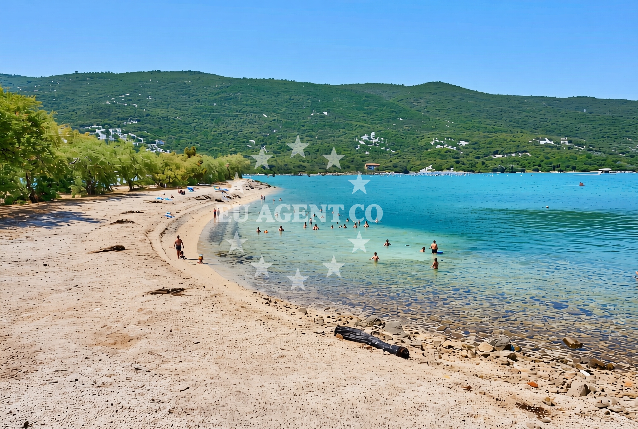
The beach's surface is predominantly gravel and concrete/stone slabs, a characteristic that defines its accessibility and use. Its 130-meter length offers a compact shoreline, suitable for those seeking a quiet stretch of coast. Natural shade is a notable feature, likely provided by surrounding vegetation or topography, which may offer respite from the sun for visitors.Swimming and shore
The beach's gravel and stone composition suggests it may not be ideal for swimming, though the exact water conditions are not specified. The natural shade could be a practical consideration for those seeking relief from direct sunlight along the shore.Facilities and activities
No specific facilities or activities are detailed in the beach's authoritative records. Visitors should assume standard coastal amenities may be limited, with no explicit mention of showers, restrooms, or other infrastructure.Access and location
Porat, Brijesta Beach is situated in the Porat area, a coastal settlement in Croatia. Its coordinates (42.907009, 17.531856) place it within a region known for its Adriatic coastline. Nearby, the settlement of Porat may offer additional context, though specific access routes or transportation links are not detailed in the beach's records.What to expect
Visitors to Porat, Brijesta Beach should expect a shoreline composed of gravel and stone slabs, with a length of 130 meters. Natural shade is available, which may be beneficial for those seeking shelter from the sun. The beach does not appear to have structured facilities or amenities, so visitors should plan accordingly. Its location in Porat connects it to the broader Adriatic coast, which may offer additional exploration opportunities beyond the beach itself.Practical tips
Given the beach's gravel and stone surface, visitors may want to consider footwear suitable for uneven terrain. The natural shade can be a practical feature for sun protection, though it is advisable to check the extent of coverage. As no facilities are explicitly listed, bringing personal items such as water or snacks may be necessary.Exploring the coast by yacht
Porat, Brijesta Beach is located in an area that connects to the broader Adriatic sailing routes. While the beach itself is not described as an anchorage or marina, the surrounding Porat region may offer access to nearby coastal waters. Yacht charter guests exploring the area could consider the proximity to other Adriatic destinations, though specific sailing distances or marina locations are not detailed here. For detailed yacht availability and sailing area information, visitors are encouraged to use the Euro-Agent Yacht Search page.Regional Context and Coastal Exploration
The Porat area is part of the Adriatic coast, known for its scenic landscapes and maritime connections. While Brijesta Beach itself is a modest shoreline, the surrounding region offers opportunities for coastal exploration. Nearby settlements may provide access to additional beaches, cultural sites, or maritime activities. Yacht charter guests in the area could explore the broader Adriatic coastline, though specific routes would require further planning.Anchorages in the surrounding area
Nearby anchorage in Brijesta offers convenient mooring options close to Porat, Brijesta Beach.
- Anchorage — brijesta — 0.1 NM from beach
- Anchorage — duboka — 2.3 NM from beach
- Anchorage — klek — 2.3 NM from beach
- Anchorage — klek — 2.5 NM from beach
- Anchorage — zuljana — 3.6 NM from beach
- Anchorage — zuljana — 3.8 NM from beach
- Anchorage — duba — 4.6 NM from beach
- Anchorage — trstenik — 5.2 NM from beach
Distances are straight-line geographic distances, not sailing routes.
Mooring buoys in the surrounding area
A mooring buoy in Brijesta is situated just 0.03 nautical miles from Porat, Brijesta Beach.
- Brijesta — 0.0 NM from beach
- Jetty — blace — 6.2 NM from beach
- Quay — prapratno — 8.3 NM from beach
- Buoy — mljet — 9.2 NM from beach
- Restaurant Dalmatinac quay — mljet — 9.2 NM from beach
Distances are straight-line geographic distances, not sailing routes.
Marine fuel stations
Marine fuel station in Ploce is approximately 9.69 nautical miles from Porat, Brijesta Beach.
- Fuel station — ploce — 9.7 NM from beach
- Fuel station — sobra — mljet — 10.9 NM from beach
- Fuel station — korcula — 17.1 NM from beach
- Ina — dubrovnik — 28.4 NM from beach
Distances are straight-line geographic distances, not sailing routes.
Harbours in the surrounding area
Harbor in Žuljana is located 3.6 nautical miles from Porat, Brijesta Beach.
- Žuljana — zuljana — 3.6 NM from beach
- Drače — drace — 3.9 NM from beach
- Sresar — rat — 4.6 NM from beach
- Trstenik — 5.9 NM from beach
- Opuzen — 6.9 NM from beach
- Hodilje — 7.5 NM from beach
Distances are straight-line geographic distances, not sailing routes.
Marinas in the surrounding area
Marina Lumbarda in Korcula is approximately 15.85 nautical miles from Porat, Brijesta Beach.
- Marina Lumbarda — korcula — 15.9 NM from beach
- ACI Marina Slano — 17.4 NM from beach
- ACI Marina Korčula — korcula — 17.6 NM from beach
- Marina Frapa Dubrovnik — 28.4 NM from beach
- ACI Marina Dubrovnik — 29.7 NM from beach
Distances are straight-line geographic distances, not sailing routes.
Restaurants near the beach
Bistro Ankora in Žuljana is about 3.56 nautical miles from Porat, Brijesta Beach.
- Bistro Ankora — zuljana — 3.6 NM from beach
- Konoba Riva — zuljana — 3.6 NM from beach
Distances are straight-line geographic distances, not sailing routes.
Navigation guides for the surrounding area
Navigation guide for Uvala Lopata is located 2.29 nautical miles from Porat, Brijesta Beach.
- Uvala Lopata — 2.3 NM from beach
- Uvala Kljemtine — 2.3 NM from beach
- Uvala Klek — 2.5 NM from beach
- Trstenik — 5.6 NM from beach
- Bl ace — 6.0 NM from beach
Distances are straight-line geographic distances, not sailing routes.
Yachts from nearby departure bases
Sailing yachts
- Elan 40 Impression (Karleta) — Ploče City Port — 9.7 NM from departure base to beach
- Sun Odyssey 419 (Luka Ploce) — Ploče City Port — 9.7 NM from departure base to beach
- More 55 (MRS. ROBINSON) — Ploče City Port — 9.7 NM from departure base to beach
- Elan 514 Impression (Cesarica III) — Ploče City Port — 9.7 NM from departure base to beach
- Sun Odyssey 349 (Porto Tolero) — Ploče City Port — 9.7 NM from departure base to beach
- Salona 44 (SAMOA) — Ploče City Port — 9.7 NM from departure base to beach
- Sun Odyssey 349 (Visnjica) — Ploče City Port — 9.7 NM from departure base to beach
- Oceanis 45 (Soul) — Slano ACI Marina — 17.4 NM from departure base to beach
Catamarans
- Lagoon 450 Fly (Alba Mouse) — Ploče City Port — 9.7 NM from departure base to beach
- Lagoon 50 (TWIN JOY) — Slano ACI Marina — 17.4 NM from departure base to beach
Distances are straight-line geographic distances, not sailing routes.