Pol Cimprijanovo, Komiža (Vis) Beach, Croatia
Pol Cimprijanovo Beach is a quiet stretch of coastline located in Komiža, a village on the island of Vis in Croatia’s Adriatic Sea. Nestled along the southern coast of Vis, the beach is part of a region renowned for its dramatic cliffs, crystal-clear waters, and rich maritime history. While the beach itself remains relatively unspoiled, its proximity to Komiža—a settlement steeped in cultural and historical significance—offers visitors a unique blend of natural beauty and local heritage.
About this beach
Pol Cimprijanovo, Komiža (Vis)
Beach: Pol Cimprijanovo
Location: Komiža (Vis)
Beach character
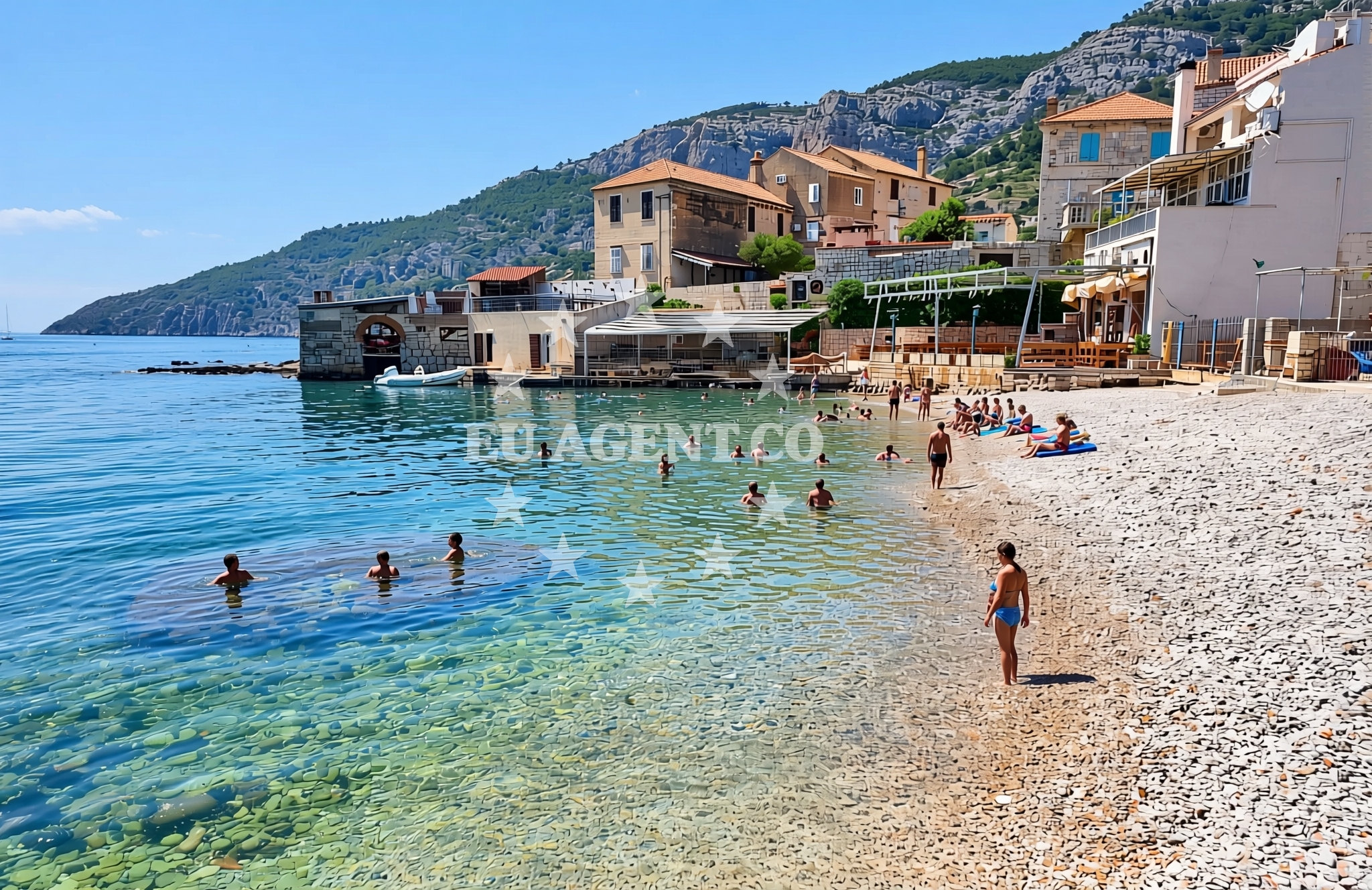
Pol Cimprijanovo Beach is a modest, undeveloped shoreline that reflects the raw, unaltered character of Vis’ coastal landscape. The beach is composed of fine sand and pebbles, with gentle slopes leading into the sea. The surrounding area is marked by low-lying terrain and scattered vegetation, typical of Vis’ rocky and arid interior. The absence of artificial structures or modern amenities preserves the beach’s natural ambiance, making it an ideal spot for those seeking solitude or a quiet interlude during a visit to the island.
Swimming and shore
The waters near Pol Cimprijanovo are typical of the Adriatic, with clear, temperate conditions that support swimming and water-based activities. The shoreline is accessible via a short walk from the nearest road, though the lack of formal pathways or infrastructure means visitors should exercise caution when navigating the terrain. The beach’s orientation and the absence of significant wave action contribute to a generally calm environment, though conditions may vary depending on wind patterns and seasonal weather.
Facilities and activities
No formal facilities or services are explicitly associated with Pol Cimprijanovo Beach itself. However, the nearby village of Komiža offers basic amenities, including small shops, cafes, and accommodations. Visitors may find limited parking options in the surrounding area, though the beach’s remote location means it is not a primary destination for large groups or organized tourism. The beach is best suited for independent travelers or those exploring the island’s less-traveled routes.
Access and location
Pol Cimprijanovo Beach is located on the southern coast of Vis, approximately 5 kilometers from the village of Komiža. The nearest road access is via the main route connecting Komiža to the rest of the island. Given Vis’ limited road network, visitors arriving by car should plan for a short but scenic drive from the island’s main ports or ferry landing points. For yacht charter guests, the beach’s proximity to Komiža and its position along the island’s southern coastline make it a potential stop for those exploring Vis’ western and southern shores.
What to expect
Visitors to Pol Cimprijanovo Beach should expect a tranquil, low-key experience with minimal infrastructure. The beach is not a hub for organized tourism, and its appeal lies in its natural setting rather than amenities. The surrounding area of Komiža offers a glimpse into Vis’ historical and cultural legacy, with landmarks such as the Blue Grotto and the village’s traditional architecture providing context for the island’s past. The beach is best visited during the shoulder seasons, when crowds are sparse and the landscape is at its most vivid.
Practical tips
Given the beach’s undeveloped nature, visitors should bring essentials such as water, sun protection, and appropriate footwear for uneven terrain. The lack of formal signage or pathways means navigation to the beach should be done with care. Those planning to visit by yacht may find anchoring opportunities in nearby bays or marinas in Komiža, though specific details should be confirmed through local maritime resources.
Exploring the coast by yacht
For yacht charter guests, the waters around Vis offer a range of sailing opportunities, from sheltered bays to open sea routes. The island’s position in the Adriatic makes it a gateway to exploring the broader Dalmatian coast, with nearby anchorages and marinas in Komiža providing convenient bases for excursions. The area’s relatively calm conditions and scenic coastline make it a popular destination for both short-term charters and longer voyages along the Croatian coast.
Historical and Cultural Context of Komiža
Komiža, the village near Pol Cimprijanovo Beach, has a history deeply tied to Vis’ role as a strategic maritime location. During the Yugoslav era, the island was largely isolated, preserving its traditional way of life. Today, Komiža serves as a cultural and administrative center for Vis, with its narrow streets and stone buildings reflecting centuries of habitation. The village is also home to the Blue Grotto, a sea cave accessible by boat, which has become a symbol of the island’s natural beauty.
Anchorages in the surrounding area
- Anchorage — komiza — vis — 0.2 NM from beach
- Uvala Knezice — komiza — vis — 1.1 NM from beach
- Anchorage — komiza — vis — 2.3 NM from beach
- Stiniva — vis — 4.0 NM from beach
- Anchorage — vis — 4.4 NM from beach
- Vis luka — 4.5 NM from beach
- Parja — vis — 4.5 NM from beach
- Anchorage — vis — 4.5 NM from beach
Distances are straight-line geographic distances, not sailing routes.
Mooring buoys in the surrounding area
- Komiza Buoy field — vis — 0.1 NM from beach
- Lucka Uprava buoys, Komiza — vis — 0.1 NM from beach
- Quay — vis — 1.4 NM from beach
- Jetty — vis — 4.6 NM from beach
- Buoy field — vis — 4.6 NM from beach
Distances are straight-line geographic distances, not sailing routes.
Marine fuel stations
- Petrol station Ina — vis — 4.4 NM from beach
- Fuel station — hvar — 17.2 NM from beach
- Ina — milna brac — 22.9 NM from beach
- Fuel station — rogac — solta — 23.0 NM from beach
Distances are straight-line geographic distances, not sailing routes.
Harbours in the surrounding area
- Komiža — komiza — vis — 0.1 NM from beach
- Luka — vis — 4.4 NM from beach
- Rogačić — vis — 4.6 NM from beach
- Kut — vis — 5.0 NM from beach
Distances are straight-line geographic distances, not sailing routes.
Marinas in the surrounding area
- ACI Marina Palmižana — aci marina palmizana — st klement — 15.1 NM from beach
- Marina Martinis Marchi — maslinica — solta — 21.7 NM from beach
- Marina Vlaška — milna brac — 23.0 NM from beach
- Marina Milna Kanarija — milna brac — 23.0 NM from beach
- ACI Marina Milna — milna brac — 23.1 NM from beach
Distances are straight-line geographic distances, not sailing routes.
Restaurants near the beach
- Bako — komiza — vis — 0.0 NM from beach
- Restaurant — komiza — vis — 0.0 NM from beach
- Barba — komiza — vis — 0.0 NM from beach
- Jastozera — komiza — vis — 0.0 NM from beach
- Pizzeria Hum — komiza — vis — 0.2 NM from beach
- Riblji Komiza — vis — 0.2 NM from beach
- Fabrika — komiza — vis — 0.2 NM from beach
Distances are straight-line geographic distances, not sailing routes.
Navigation guides for the surrounding area
- Komiža — 0.2 NM from beach
- Uvala Stoncica — 7.2 NM from beach
- Luka Soline — 14.1 NM from beach
- Uvala Tarsce — 14.5 NM from beach
- Uvala Stari Stani — 14.7 NM from beach
Distances are straight-line geographic distances, not sailing routes.
Yachts from nearby departure bases
Sailing yachts
- Sun Odyssey 449 (Port Royal) — Šolta Rogač — 22.9 NM from departure base to beach
- Sun Odyssey 490 (Izzy) — Šolta Rogač — 22.9 NM from departure base to beach
- Oceanis 46.1 (Everest) — Šolta Rogač — 22.9 NM from departure base to beach
- Cyclades 39.3 (Patagonia) — Šolta Rogač — 22.9 NM from departure base to beach
- Sun Odyssey 349 (Siberia) — Šolta Rogač — 22.9 NM from departure base to beach
Catamarans
- Lagoon 42 (Galapagos) — Šolta Rogač — 22.9 NM from departure base to beach
- Lagoon 40 (Solentia) — Šolta Rogač — 22.9 NM from departure base to beach
- Lagoon 400 (Greenland) — Šolta Rogač — 22.9 NM from departure base to beach
- Lagoon 450 (Madagascar) — Šolta Rogač — 22.9 NM from departure base to beach
- Lagoon 450 Flybridge (Samogon) — Šolta Rogač — 22.9 NM from departure base to beach
Distances are straight-line geographic distances, not sailing routes.