Podrope, Ropa (Mljet) Beach: A Natural Haven on the Croatian Coast, Croatia
About this beach
Podrope, Ropa (Mljet)
Beach: Podrope
Location: Ropa (Mljet)
Characteristics and facilities
Rocks
70 m
Beach character
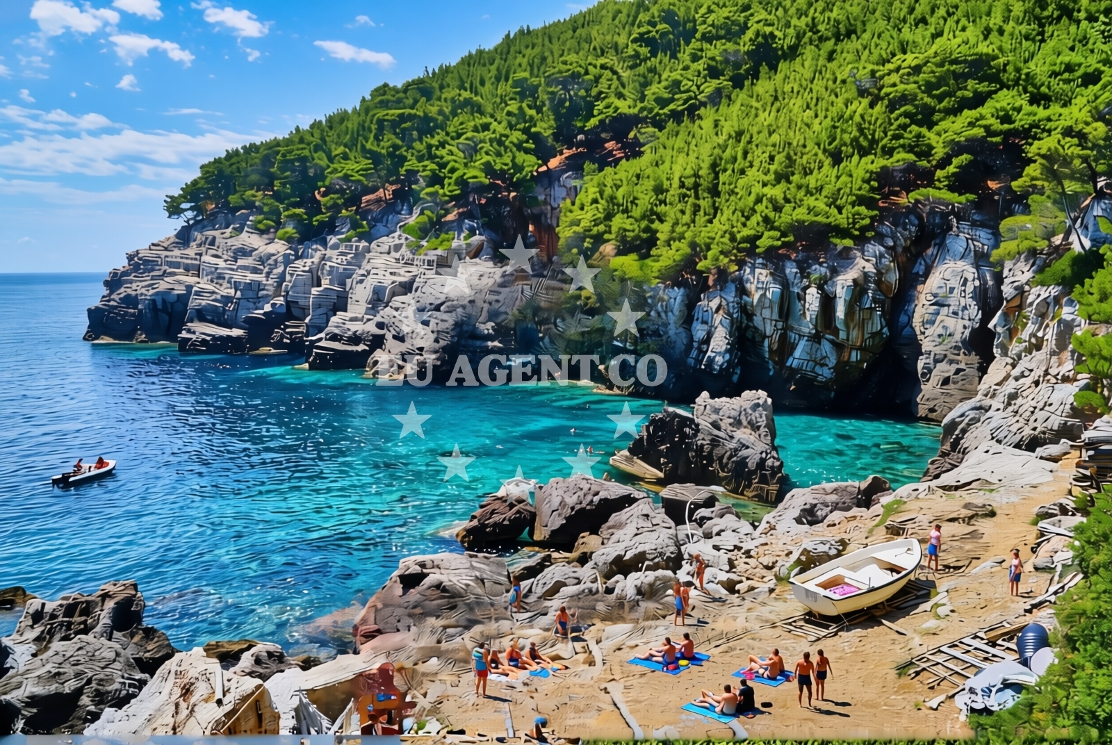
The beach is characterized by its rocky outcrops and sparse sand, creating a stark contrast to the more developed shores of the Dalmatian coast. The terrain is uneven, with scattered stones and limited flat areas, which may make it less ideal for sunbathing but offers unique opportunities for exploring the intertidal zone. The surrounding area is dominated by the Mljet National Park, which includes two saltwater lakes—St. Paul and St. Mary—surrounded by dense pine forests and dotted with ancient monasteries. The beach's proximity to these natural landmarks makes it a gateway to the island's protected ecosystems.Swimming and shore
Swimming conditions at Podrope, Ropa (Mljet) Beach are influenced by the rocky shoreline, which can create turbulent waters near the shore. However, the Adriatic Sea's generally clear waters offer visibility for snorkeling in calmer areas further from the rocks. The beach is not marked for swimming, but the nearby lakes of Mljet National Park provide safer, freshwater alternatives for those seeking a more tranquil aquatic experience. The rocky terrain also allows for easy access to the shoreline, though visitors should exercise caution when navigating the uneven surface.Facilities and activities
There are no official facilities or amenities directly at Podrope, Ropa (Mljet) Beach. The lack of infrastructure aligns with the beach's natural, unspoiled character. Activities are limited to walking along the rocky shore, exploring the nearby Mljet National Park, and enjoying the scenic vistas of the Adriatic. The surrounding area offers hiking trails through the pine forests and access to the saltwater lakes, which are popular for kayaking and birdwatching.Access and location
Podrope, Ropa (Mljet) Beach is located in the village of Podrope on Mljet Island, Croatia. The island is accessible by ferry from Dubrovnik, Korčula, and other nearby Dalmatian ports. Local roads provide access to the village, though the beach itself is best reached on foot due to its remote location. The coordinates (42.752667, 17.456576) place it near the southern tip of the island, close to the boundary of Mljet National Park. The area's isolation contributes to its tranquil atmosphere, making it a less crowded alternative to other beaches on the island.What to expect
Visitors to Podrope, Ropa (Mljet) Beach should expect a natural, undeveloped shoreline with rocky terrain and limited facilities. The beach is best suited for those seeking solitude and a connection to the island's protected landscapes. The surrounding Mljet National Park offers opportunities for hiking, cycling, and exploring the island's unique ecosystems. The Adriatic Sea's clear waters provide a scenic backdrop, though swimming may be limited to calmer areas further from the shore. The beach's location within a UNESCO Biosphere Reserve underscores its ecological significance, making it a destination for nature enthusiasts.Practical tips
Wear sturdy footwear to navigate the rocky terrain, and bring a waterproof bag to protect belongings from sea spray. The lack of facilities means visitors should bring their own refreshments and sunscreen. The beach's proximity to Mljet National Park makes it a good base for exploring the island's trails and lakes, but be prepared for limited signage and remote paths.Exploring the coast by yacht
For yacht charter guests, Podrope, Ropa (Mljet) Beach offers a secluded anchorage point on the southeastern coast of Mljet Island. The surrounding waters are part of a popular sailing route in the Adriatic, with nearby marinas in the village of Palanka and the town of Mljet providing convenient bases for exploring the island. Charter yachts can anchor near the beach to enjoy the unspoiled coastline, though the rocky shoreline may require careful navigation. The area's connection to Mljet National Park makes it an appealing stop for sailors seeking to combine sailing with land-based exploration of the island's natural wonders.Mljet National Park: A UNESCO Legacy
Podrope, Ropa (Mljet) Beach lies within Mljet National Park, a UNESCO Biosphere Reserve established in 1981. The park is renowned for its two saltwater lakes, St. Paul and St. Mary, which are surrounded by pine forests and dotted with historic monasteries. The area's ecological significance is underscored by its diverse flora and fauna, including rare bird species and endemic plant life. Visitors can explore the park's trails, which wind through the forests and along the lakeshores, offering panoramic views of the Adriatic.Anchorages in the surrounding area
Anchorages in the surrounding area include Kobrava, Polace, Pomena, and Zuljana near Podrope, Ropa (Mljet) Beach.
- Kobrava - Polace — mljet — 2.7 NM from beach
- Polače — polace — mljet — 4.1 NM from beach
- Anchorage — pomena — mljet — 5.5 NM from beach
- Lokve — pomena — mljet — 5.7 NM from beach
- Anchorage — zuljana — 8.0 NM from beach
- Anchorage — zuljana — 8.3 NM from beach
- Anchorage — prozura — mljet — 8.6 NM from beach
- Anchorage — prozura — mljet — 8.6 NM from beach
Distances are straight-line geographic distances, not sailing routes.
Mooring buoys in the surrounding area
Mooring buoys in the surrounding area feature Restaurant Dalmatinac quay, Konoba Joseph dock, and Restaurant Bourbon quay near Podrope, Ropa (Mljet) Beach.
- Restaurant Dalmatinac quay — mljet — 3.0 NM from beach
- Buoy — mljet — 3.0 NM from beach
- Konoba Joseph dock — polace — mljet — 3.9 NM from beach
- Restaurant Bourbon quay — polace — mljet — 3.9 NM from beach
- Quay from "Calypso Grill" — polace — mljet — 3.9 NM from beach
Distances are straight-line geographic distances, not sailing routes.
Marine fuel stations
Marine fuel stations in the vicinity include Sobra, Ploce, Korcula, and Ubli serving Podrope, Ropa (Mljet) Beach.
- Fuel station — sobra — mljet — 7.3 NM from beach
- Fuel station — ploce — 18.0 NM from beach
- Fuel station — korcula — 18.2 NM from beach
- Ina — ubli — lastovo — 27.9 NM from beach
Distances are straight-line geographic distances, not sailing routes.
Harbours in the surrounding area
Harbours in the surrounding area encompass Kozarica, Polace, Pomena, Sobra, and Žuljana near Podrope, Ropa (Mljet) Beach.
- Kozarica — mljet — 1.5 NM from beach
- Polače — polace — mljet — 4.0 NM from beach
- Pomena — mljet — 5.4 NM from beach
- Sobra — mljet — 6.4 NM from beach
- Žuljana — zuljana — 8.3 NM from beach
- Okuklje — mljet — 9.6 NM from beach
Distances are straight-line geographic distances, not sailing routes.
Marinas in the surrounding area
- Marina Lumbarda — korcula — 16.2 NM from beach
- ACI Marina Korčula — korcula — 18.7 NM from beach
- ACI Marina Slano — 19.1 NM from beach
- Marina Solitudo — lastovo — 27.9 NM from beach
- Marina Frapa Dubrovnik — 28.1 NM from beach
Distances are straight-line geographic distances, not sailing routes.
Restaurants near the beach
Restaurants near the beach include Dalmatinac, Joseph, Calypso Grill, and Konoba Sponga in Polace and Kozarica.
- Restaurant — kozarica — mljet — 1.5 NM from beach
- Dalmatinac — mljet — 3.0 NM from beach
- Joseph — polace — mljet — 3.9 NM from beach
- Resturant Bourbon jetty — polace — mljet — 3.9 NM from beach
- Calypso Grill — polace — mljet — 3.9 NM from beach
- Konoba Sponga — polace — mljet — 3.9 NM from beach
- Konoba Ogigija — polace — mljet — 3.9 NM from beach
Distances are straight-line geographic distances, not sailing routes.
Navigation guides for the surrounding area
Navigation guides for the surrounding area cover Kozarica, Luka Polace, Pomena, Luka Sobra, and Luka Prozura near Podrope, Ropa (Mljet) Beach.
- Kozarica — 1.5 NM from beach
- Luka Polace — 4.1 NM from beach
- Pomena — 5.2 NM from beach
- Luka Sobra — 6.6 NM from beach
- Luka Prozura — 8.8 NM from beach
Distances are straight-line geographic distances, not sailing routes.
Yachts from nearby departure bases
Yachts from nearby departure bases include Ploče City Port and Slano ACI Marina offering access to Podrope, Ropa (Mljet) Beach.
Sailing yachts
- Elan 40 Impression (Karleta) — Ploče City Port — 18.0 NM from departure base to beach
- Sun Odyssey 419 (Luka Ploce) — Ploče City Port — 18.0 NM from departure base to beach
- More 55 (MRS. ROBINSON) — Ploče City Port — 18.0 NM from departure base to beach
- Elan 514 Impression (Cesarica III) — Ploče City Port — 18.0 NM from departure base to beach
- Sun Odyssey 349 (Visnjica) — Ploče City Port — 18.0 NM from departure base to beach
- Salona 44 (SAMOA) — Ploče City Port — 18.0 NM from departure base to beach
- Sun Odyssey 349 (Porto Tolero) — Ploče City Port — 18.0 NM from departure base to beach
- Oceanis 45 (Cancan) — Slano ACI Marina — 19.1 NM from departure base to beach
Catamarans
- Lagoon 450 Fly (Alba Mouse) — Ploče City Port — 18.0 NM from departure base to beach
- Lagoon 50 (TWIN JOY) — Slano ACI Marina — 19.1 NM from departure base to beach
Distances are straight-line geographic distances, not sailing routes.