Planike Zapad, Mimice Beach, Croatia
About this beach
Planike zapad, Mimice
Beach: Planike zapad
Location: Mimice
Characteristics and facilities
Gravel, rocks
30 m
Beach character
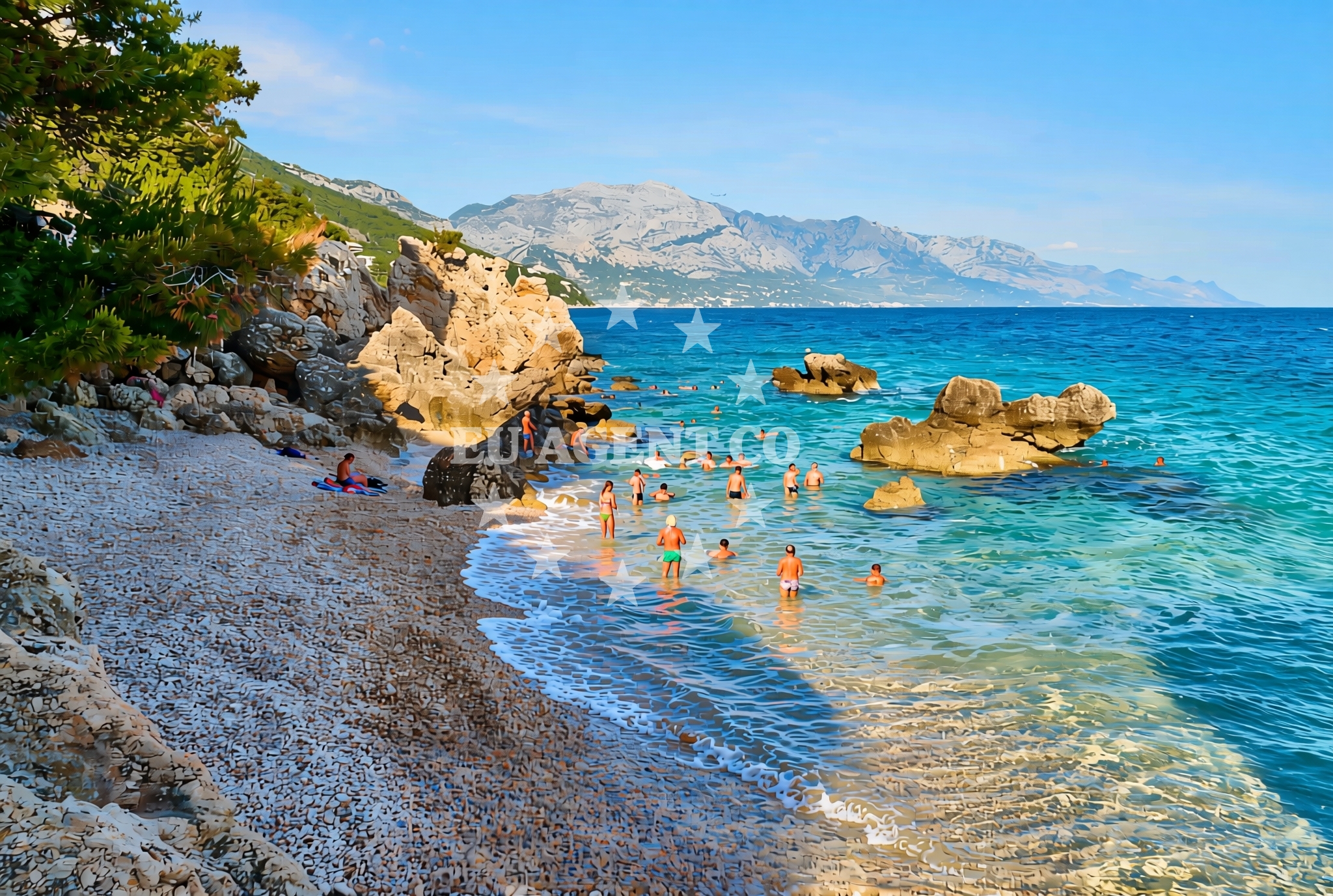
Mimice Beach at Planike Zapad is defined by its gravelly surface and exposed rock formations, which create a distinct contrast to the more common sandy beaches of the region. The beach's limited length and lack of developed amenities make it a quiet, low-traffic shoreline. The rocky sections may offer opportunities for exploring tidal pools or collecting natural stones, though visitors should be mindful of uneven surfaces. The beach's orientation and surrounding topography suggest it may be more accessible during lower tide conditions, though no official access details are documented in the beach catalog.Swimming and shore
Swimming conditions at Mimice Beach are not explicitly described in the beach catalog, but the gravel and rock composition suggests the shoreline may be more suitable for wading than for extended swimming. The beach's proximity to the open Adriatic Sea means water quality typically aligns with regional standards, though no specific testing data is available. The rocky terrain may create natural shelters from wind, though this is not confirmed in the catalog. Visitors should exercise caution when entering the water due to the potential for uneven seabed conditions.Facilities and activities
The beach catalog does not document any formal facilities, amenities, or structured activities at Mimice Beach. No showers, restrooms, parking areas, or lifeguard services are listed. The absence of developed infrastructure aligns with the beach's description as a short, gravel-and-rock shoreline. Visitors should plan accordingly, bringing personal items for comfort and safety. The beach's natural character may appeal to those seeking a minimalist coastal experience rather than a fully serviced resort environment.Access and location
Mimice Beach is situated in the Planike area, a coastal region in Croatia that connects to broader networks of Adriatic settlements. While specific road access details are not provided in the beach catalog, the settlement of Mimice is likely reachable via local roads that serve the surrounding fishing communities and coastal villages. The beach's coordinates (43.403377, 16.800957) place it near the central Dalmatian coast, within sailing distance of larger ports and marinas that cater to yacht charter travelers. The exact walking distance from nearby roads or settlements is not documented, but the beach's short length suggests it may be accessible via brief coastal walks.What to expect
Planike Zapad's Mimice Beach offers a straightforward coastal experience centered on its natural gravel and rock composition. Visitors should expect a short shoreline with no formal amenities, making it more suitable for brief exploration than extended stays. The beach's orientation and surrounding terrain suggest it may be best visited during calmer weather conditions, though no specific seasonal recommendations are documented. Its location in the Mimice area connects it to the broader Planike coast, which includes other beaches and traditional maritime settlements. The absence of developed infrastructure means visitors should prepare with essentials like water, sunscreen, and appropriate footwear for the rocky terrain.Practical tips
Given the beach's gravel and rock composition, wear sturdy footwear to navigate the shoreline safely. Carry drinking water and sun protection, as no facilities are available on-site. Check local weather conditions before visiting, as the beach's exposure to the open sea may affect comfort levels. The beach's proximity to Mimice and other coastal settlements suggests opportunities for exploring nearby villages or accessing larger maritime services.Exploring the coast by yacht
For yacht charter travelers, the Planike coast offers a range of sailing opportunities, with Mimice Beach situated near traditional maritime routes. The surrounding area includes marinas and harbors that serve both local fishing communities and international charter yachts. While Mimice Beach itself is not a docking location, the nearby settlements of Planike and Mimice provide access to coastal services and infrastructure. Yacht charter guests exploring this region may find the area's rugged coastline and sheltered bays appealing for anchoring or brief landings, though specific navigational details should be confirmed through Euro-Agent's sailing area resources.Regional Context and Coastal Networks
The Planike coast, including Mimice Beach, is part of a larger network of Adriatic settlements that historically relied on fishing and maritime trade. Nearby areas feature a mix of traditional villages and more developed coastal towns, offering opportunities to explore local culture and cuisine. The region's sailing routes connect to key ports in the central Dalmatian coast, making it a viable stop for yacht charter itineraries focused on less-visited coastal areas.Anchorages in the surrounding area
Anchorages in the surrounding area include options near povlja, brac.
- Tri luke — povlja — brac — 3.8 NM from beach
- Anchorage — povlja — brac — 4.1 NM from beach
- Anchorage — povlja — brac — 4.1 NM from beach
- Anchorage — povlja — brac — 4.1 NM from beach
- Anchorage — povlja — brac — 4.1 NM from beach
- Anchorage — povlja — brac — 4.2 NM from beach
- Anchorage — povlja — brac — 4.4 NM from beach
- Anchorage — povlja — brac — 4.5 NM from beach
Distances are straight-line geographic distances, not sailing routes.
Mooring buoys in the surrounding area
Mooring buoys in the surrounding area are located near povlja, brac, including Restaurant Pipo buoys.
- Restaurant Pipo buoys — povlja — brac — 3.8 NM from beach
- Restaurant Pipo jetty — povlja — brac — 3.9 NM from beach
- Konoba Rojen jetty — povlja — brac — 3.9 NM from beach
- Quay — postira — brac — 5.7 NM from beach
- Baško Polje — basko polje — baska voda — 7.6 NM from beach
Distances are straight-line geographic distances, not sailing routes.
Marine fuel stations
- Fuel station — sumartin — brac — 7.5 NM from beach
- Fuel station — bol — brac — 10.7 NM from beach
- Ina — makarska — 11.4 NM from beach
- Ina — vrboska — hvar — 14.5 NM from beach
Distances are straight-line geographic distances, not sailing routes.
Harbours in the surrounding area
Harbours in the surrounding area include Mimice, a short distance from the beach.
- Mimice — 0.3 NM from beach
- Pisak — 2.6 NM from beach
- Pučišća harbour — pucisca — brac — 4.4 NM from beach
- Stomarica — 5.1 NM from beach
- Omiš — omis — 5.2 NM from beach
- Brela — 6.2 NM from beach
Distances are straight-line geographic distances, not sailing routes.
Marinas in the surrounding area
Marinas in the surrounding area include Marina Baška Voda and others in baska-voda.
- Marina Baška Voda — marina baska voda — 6.9 NM from beach
- Marina Ramova — krvavica — 9.2 NM from beach
- Marina Lav — podstrana — 12.6 NM from beach
- Marina Tučepi — marina tucepi — 14.0 NM from beach
- ACI Marina Vrboska — hvar — 14.5 NM from beach
Distances are straight-line geographic distances, not sailing routes.
Restaurants near the beach
Restaurants near the beach include Hideaway Pipo and Konoba Rojen in povlja, brac.
- Hideaway Pipo — povlja — brac — 3.9 NM from beach
- Konoba Rojen — povlja — brac — 3.9 NM from beach
- Pizzeria Marin — pucisca — brac — 4.4 NM from beach
- Kala — povlja — brac — 4.5 NM from beach
- Stara Uljara — povlja — brac — 4.5 NM from beach
- Lado — pucisca — brac — 4.5 NM from beach
Distances are straight-line geographic distances, not sailing routes.
Navigation guides for the surrounding area
Navigation guides for the surrounding area include Mi mice and Pucisca, both within a few nautical miles.
- Mi mice — 0.5 NM from beach
- Uvala Luka — 3.8 NM from beach
- Pucisca — 4.2 NM from beach
- Omis — 4.9 NM from beach
- Dugi Rat (Uvala Orisac) — 7.2 NM from beach
Distances are straight-line geographic distances, not sailing routes.
Yachts from nearby departure bases
Sailing yachts
- Elan Impression 40 (KARLETA) — Baška Voda Port — 6.9 NM from departure base to beach
- Elan 45 Impression (" MONACO ") — Baška Voda — 7.0 NM from departure base to beach
- Bavaria Cruiser 37 (AURORA) — Baška Voda — 7.0 NM from departure base to beach
- Oceanis 45 (FORTUNE) — Baška Voda — 7.0 NM from departure base to beach
Catamarans
- Lagoon 450 (LAMANTIN) — Baška Voda — 7.0 NM from departure base to beach
Motor yachts
- Canados 86 (Karisma) — Baška Voda — 7.0 NM from departure base to beach
Gulets / Cruisers
- Gulet (Trebenna) — Omiš City Port — 5.2 NM from departure base to beach
- Gulet (Primorac) — Omiš City Port — 5.2 NM from departure base to beach
- Gulet (PATRONICE) — Omiš City Port — 5.3 NM from departure base to beach
Motor boats
- Pearl Sea 31 Hard Top (Aero) — Baška Voda Port — 6.9 NM from departure base to beach
Distances are straight-line geographic distances, not sailing routes.