Oskorušica, Žrnovo (Korčula) Beach, Croatia
About this beach
Oskorušica, Žrnovo (Korčula)
Beach: Oskorušica
Location: Žrnovo (Korčula)
Characteristics and facilities
Gravel, rocks
Beach character
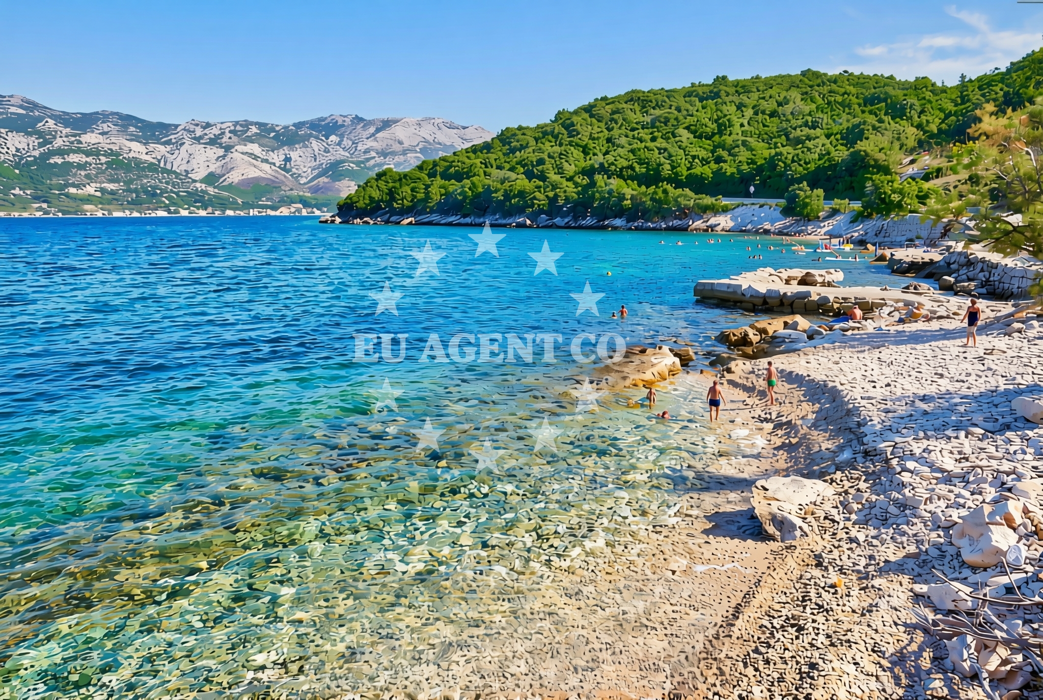
The beach’s primary feature is its gravel and rock composition, which creates a firm, uneven surface along the shore. This type of beach is less common in the Adriatic, making it a unique geological feature in the Korčula area. The rocky outcrops and gravelly substrate may limit traditional beach activities such as swimming or sunbathing, but they contribute to the area’s natural ruggedness. The absence of sand gives the beach a more primitive, untamed appearance, which could appeal to visitors interested in exploring the island’s diverse coastal environments.Swimming and shore
Swimming conditions at Oskorušica Beach are not explicitly documented in the catalog, but the gravel and rock composition suggest that the shoreline may not be suitable for wading or prolonged water activities. The beach’s rocky nature could create uneven entry points into the sea, which may pose challenges for swimmers. However, the surrounding waters of Korčula are generally known for their clarity and mild temperatures, typical of the Adriatic Sea. Visitors should exercise caution near the shoreline due to the uneven terrain.Facilities and activities
The beach lacks explicitly listed facilities or amenities, as indicated by the catalog. There are no references to parking, restrooms, showers, or other infrastructure. The absence of structured amenities aligns with the beach’s natural, unspoiled character. Activities associated with the beach are not specified, though the broader Korčula region offers opportunities for hiking, cycling, and exploring the island’s historic sites. The beach itself appears to be more of a natural feature than a destination for organized recreation.Access and location
Oskorušica Beach is located in Žrnovo, a village on the southern coast of Korčula Island. The island of Korčula is part of the Pelješac Peninsula in Croatia and is accessible by ferry from the mainland or via yacht charter routes that traverse the Adriatic. Žrnovo itself is a small settlement with a quiet, rural character, positioned between the island’s more developed areas and its rugged, less-visited coastal stretches. Visitors arriving by car would need to navigate local roads, though specific parking details are not provided in the catalog. The beach’s location makes it a potential stop for sailors exploring the Korčula coastline.What to expect
Visitors to Oskorušica Beach should expect a natural, gravelly shoreline with rocky formations rather than a traditional sandy beach. The area is likely to be quieter and less developed than other parts of Korčula, offering a more secluded experience. The beach’s character may appeal to those interested in geological features or seeking a break from more crowded coastal areas. While there are no documented amenities, the surrounding region of Korčula provides opportunities for cultural exploration, including visits to the island’s medieval town, vineyards, and historic sites.Practical tips
Due to the gravel and rock composition, visitors should wear sturdy footwear to navigate the shoreline comfortably. The beach’s lack of amenities means visitors should bring their own supplies, such as water, snacks, and sun protection. The area’s natural setting may offer scenic views of the Adriatic Sea, making it a suitable spot for photography or quiet reflection.Exploring the coast by yacht
The waters around Korčula, including the area near Žrnovo, are part of a popular sailing route in the Adriatic. Yacht charter guests exploring the region may find the coastline between Korčula and the Pelješac Peninsula to be particularly scenic, with opportunities to anchor near lesser-known beaches and villages. While Oskorušica Beach itself is not an anchorage, the broader Korčula area is well-connected to major Adriatic ports and sailing routes, making it accessible for those traveling by yacht.Korčula’s Coastal Character
Korčula’s coastline is a mix of sandy beaches, rocky coves, and rugged cliffs, reflecting the island’s diverse geological history. The presence of gravel and rock at Oskorušica Beach is consistent with the island’s southern shore, which is less developed than the western and northern coasts. This part of Korčula is known for its tranquility, making it a preferred destination for those seeking a slower pace compared to the island’s more tourist-oriented areas.Anchorages in the surrounding area
Anchorages near Korčula and Racisce offer nearby mooring options.
- Anchorage — korcula — 1.0 NM from beach
- Anchorage — korcula — 1.3 NM from beach
- Anchorage — racisce — korcula — 1.4 NM from beach
- Anchorage — korcula — 1.7 NM from beach
- Anchorage — korcula — 1.9 NM from beach
- Anchorage — racisce — korcula — 2.4 NM from beach
- Anchorage — korcula — 3.0 NM from beach
- Anchorage — korcula — 3.1 NM from beach
Distances are straight-line geographic distances, not sailing routes.
Mooring buoys in the surrounding area
Mooring buoys and jetties in Korčula and Lovište provide nearby anchoring points.
- Jetty — korcula — 1.6 NM from beach
- Konoba Estravaganca buoys - Duba — konoba estravaganca buoys duba — loviste — 2.6 NM from beach
- Fuel jetty — korcula — 3.3 NM from beach
- Jetty — loviste — 3.4 NM from beach
- Jetty — loviste — 3.8 NM from beach
Distances are straight-line geographic distances, not sailing routes.
Marine fuel stations
Fuel stations in Korčula, Vela Luka, and Ploče serve the surrounding maritime areas.
- Fuel station — korcula — 3.3 NM from beach
- Ina — vela luka — korcula — 15.8 NM from beach
- Fuel station — ploce — 16.6 NM from beach
- Ina — ubli — lastovo — 17.4 NM from beach
Distances are straight-line geographic distances, not sailing routes.
Harbours in the surrounding area
Harbors in Viganj, Kučišće, and Račišće are located near Korčula and Lovište.
- Viganj — 1.4 NM from beach
- Kučišće — kucisce — 1.9 NM from beach
- Račišće — racisce — korcula — 2.5 NM from beach
- Korčula W harbour — korcula — 2.6 NM from beach
- Korčula E harbour — korcula — 2.8 NM from beach
- Lovište — loviste — 4.1 NM from beach
Distances are straight-line geographic distances, not sailing routes.
Marinas in the surrounding area
- ACI Marina Korčula — korcula — 2.8 NM from beach
- Marina Lumbarda — korcula — 5.0 NM from beach
- Marina Korkyra — vela luka — korcula — 15.9 NM from beach
- Marina Solitudo — lastovo — 16.5 NM from beach
- Marina Tučepi — marina tucepi — 17.8 NM from beach
Distances are straight-line geographic distances, not sailing routes.
Restaurants near the beach
Restaurants in Racisce and Korčula are situated close to the beach area.
- Stane — racisce — korcula — 1.5 NM from beach
- Restaurant — korcula — 1.6 NM from beach
- Mimi's Bistro at Tara's Lodge — korcula — 1.6 NM from beach
- Mimi's Bistro at Tara's Lodge — korcula — 1.6 NM from beach
- Vala — racisce — korcula — 2.5 NM from beach
- Konoba Estravaganca — loviste — 2.6 NM from beach
- Restaurant&Bar Fish'N'Go — korcula — 2.7 NM from beach
Distances are straight-line geographic distances, not sailing routes.
Navigation guides for the surrounding area
Navigation guides for Uvala Vrbovica and nearby areas assist with local sailing routes.
- Uvala Kneza — 1.2 NM from beach
- Uvala Vrbovica — 1.4 NM from beach
- Uvala Banja — 2.0 NM from beach
- Luka Racisce — 2.2 NM from beach
- Otocic Badija — 4.2 NM from beach
Distances are straight-line geographic distances, not sailing routes.
Yachts from nearby departure bases
Sailing yachts
- Elan 40 Impression (Karleta) — Ploče City Port — 16.5 NM from departure base to beach
- Elan 514 Impression (Cesarica III) — Ploče City Port — 16.5 NM from departure base to beach
- More 55 (MRS. ROBINSON) — Ploče City Port — 16.5 NM from departure base to beach
- Salona 44 (SAMOA) — Ploče City Port — 16.5 NM from departure base to beach
- Sun Odyssey 349 (Visnjica) — Ploče City Port — 16.5 NM from departure base to beach
- Sun Odyssey 419 (Luka Ploce) — Ploče City Port — 16.5 NM from departure base to beach
- Sun Odyssey 349 (Porto Tolero) — Ploče City Port — 16.5 NM from departure base to beach
- Bavaria 40 Cruiser (LADY BUTTERFLY) — Tučepi Port — 17.8 NM from departure base to beach
Catamarans
- Lagoon 450 Fly (Alba Mouse) — Ploče City Port — 16.5 NM from departure base to beach
Motor yachts
- Princess V53 (Chablis) — Makarska Port — 19.6 NM from departure base to beach
Distances are straight-line geographic distances, not sailing routes.