Orebić Zapad Beach, Croatia
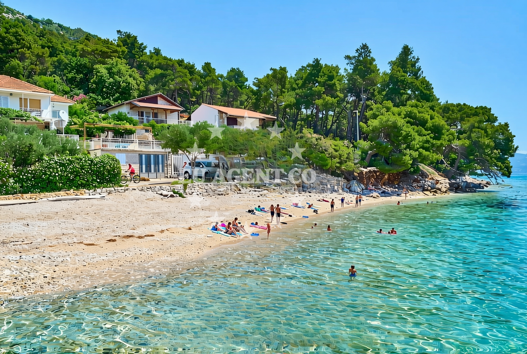
Orebić Zapad Beach lies along the Adriatic coast in the town of Orebić, a historic settlement in Croatia’s Split-Dalmatia County. This 70-meter stretch of gravel and concrete/stone slabs offers a straightforward shoreline with natural shade from surrounding terrain. While no formal facilities are listed, the beach’s proximity to Orebić’s harbor and cultural sites makes it a practical stop for visitors exploring the region’s coastal routes.
About this beach
Orebić zapad, Orebić
Beach: Orebić zapad
Location: Orebić
Characteristics and facilities
Gravel, concrete / stone slabs
70 m
Natural shade
Beach character
The beach’s surface consists of gravel and concrete/stone slabs, a common feature along Croatia’s rocky coastlines. Its 70-meter length provides a compact shoreline, ideal for brief stops or casual walks. Natural shade is available from nearby vegetation or topography, offering respite from the sun. The beach does not appear to have structured amenities, reflecting its character as a more utilitarian coastal stretch compared to developed resorts in the area.
Swimming and shore
Swimming conditions at Orebić Zapad are typical of the Adriatic, with clear waters and moderate wave action depending on weather. The gravelly seabed may make it less suitable for young children but offers a stable surface for confident swimmers. The shore’s composition suggests it is more suited to walking or short recreational use than sunbathing, though the natural shade provides a practical advantage for those seeking relief from direct sunlight.
Facilities and activities
No formal facilities are explicitly listed for Orebić Zapad Beach itself. However, the nearby town of Orebić offers amenities such as restaurants, shops, and a harbor that serves as a hub for local maritime activity. The beach’s immediate surroundings do not indicate structured activities, but its location along the Adriatic makes it a potential waypoint for yacht charter guests exploring the region’s coastal routes.
Access and location
Access to Orebić Zapad Beach is via the town of Orebić, which sits on the eastern coast of the island of Brač, approximately 25 kilometers northeast of Split. The beach is likely reachable by road from Orebić’s main thoroughfares, with no specific parking details provided. Its position near the harbor suggests it may be used by local residents for casual recreation, though it does not appear to be a primary tourist destination compared to other beaches in the area.
What to expect
Orebić Zapad Beach is a short, gravelly shoreline with natural shade, suitable for brief stops or walks. No formal amenities are listed, so visitors should expect a more rustic setting compared to developed beaches. The beach’s proximity to Orebić’s harbor and cultural sites makes it a practical location for those combining maritime exploration with land-based activities in the region. Its character reflects the rocky coastline typical of Croatia’s Adriatic shores.
Practical tips
Visitors should consider the gravelly surface when planning activities, as it may be less comfortable for prolonged sunbathing. The natural shade is a practical feature for those seeking relief from the sun. As with any Adriatic beach, checking local conditions for water clarity and weather is advisable, particularly during peak season.
Exploring the coast by yacht
The Adriatic Sea, with its calm waters and scenic islands, is a popular sailing destination, and Orebić’s harbor serves as a gateway to this region. Yacht charter guests using Euro-Agent may find the surrounding area ideal for exploring Brač, Hvar, and the broader Split-Dalmatia coastline. While Orebić Zapad Beach itself is not a primary anchorage, its proximity to the harbor makes it a convenient reference point for sailors navigating the area. For availability and booking, visit Euro-Agent’s Yacht Search to explore options in this sailing region.
Orebić: A Coastal Town with Maritime History
The town of Orebić, located on the island of Brač, has a long maritime tradition tied to its harbor and proximity to the Adriatic’s shipping lanes. Historic landmarks include the 16th-century fortress of Fortica, which offers panoramic views of the coast. Local cuisine features fresh seafood, reflecting the town’s reliance on the sea. Visitors may also explore Brač’s famous white stone quarries, which supplied material for the Venetian city of Venice.
Sailing in the Split-Dalmatia Region
The Split-Dalmatia County, encompassing Orebić and neighboring islands, is a focal point for Adriatic sailing. Charter yachts often navigate from Split to Hvar, Vis, and Brač, with Orebić’s harbor serving as a secondary port. The region’s clear waters and protected bays make it suitable for both motor and sail boats, though specific marina details are best confirmed through Euro-Agent’s booking platform.
Anchorages in the surrounding area
Anchorages near Orebić Beach include Korcula and Badija, offering nearby mooring options.
- Anchorage — korcula — 1.3 NM from beach
- Anchorage — korcula — 1.6 NM from beach
- Anchorage — badija — 1.6 NM from beach
- Anchorage — korcula — 1.8 NM from beach
- Anchorage — korcula — 2.1 NM from beach
- Anchorage — korcula — 2.2 NM from beach
- Anchorage — lumbarda — korcula — 2.8 NM from beach
- Anchorage — duba peljeska — 3.6 NM from beach
Distances are straight-line geographic distances, not sailing routes.
Mooring buoys in the surrounding area
Mooring buoys in the surrounding area include Korcula fuel jetty and Stupe restaurant buoys.
- Fuel jetty — korcula — 1.2 NM from beach
- Jetty — korcula — 1.8 NM from beach
- Restaurant Moro buoys — stupe — 2.1 NM from beach
- Vrnik Arts Club buoys — 2.3 NM from beach
- Quay — vrnik — 2.4 NM from beach
Distances are straight-line geographic distances, not sailing routes.
Marine fuel stations
- Fuel station — korcula — 1.2 NM from beach
- Fuel station — ploce — 13.5 NM from beach
- Ina — vela luka — korcula — 19.0 NM from beach
- Ina — ubli — lastovo — 19.8 NM from beach
Distances are straight-line geographic distances, not sailing routes.
Harbours in the surrounding area
- Korčula W harbour — korcula — 0.9 NM from beach
- Korčula E harbour — korcula — 1.0 NM from beach
- Orebić — orebic — 1.3 NM from beach
- Kučišće — kucisce — 1.4 NM from beach
- Viganj — 2.0 NM from beach
- Duba — duba peljeska — 3.2 NM from beach
Distances are straight-line geographic distances, not sailing routes.
Marinas in the surrounding area
Marinas in the surrounding area include ACI Marina Korcula and Marina Lumbarda, located on Korcula.
- ACI Marina Korčula — korcula — 1.1 NM from beach
- Marina Lumbarda — korcula — 3.2 NM from beach
- Marina Tučepi — marina tucepi — 17.8 NM from beach
- Marina Solitudo — lastovo — 19.0 NM from beach
- Marina Korkyra — vela luka — korcula — 19.1 NM from beach
Distances are straight-line geographic distances, not sailing routes.
Restaurants near the beach
Restaurants near Orebić Beach are clustered in Korcula, offering dining options within a short distance.
- Restaurant — korcula — 0.8 NM from beach
- Adio Mare — korcula — 0.9 NM from beach
- Restaurant Lesic Dimitri — korcula — 0.9 NM from beach
- Restaurant Filippi — korcula — 0.9 NM from beach
- Restaurant — korcula — 0.9 NM from beach
- Aterina — korcula — 0.9 NM from beach
- Restaurant — korcula — 1.0 NM from beach
Distances are straight-line geographic distances, not sailing routes.
Navigation guides for the surrounding area
Navigation guides for the surrounding area include Uvala Banja and Otocic Badija, useful for route planning near the beach.
- Uvala Banja — 1.4 NM from beach
- Orebic — 1.5 NM from beach
- Otocic Badija — 1.7 NM from beach
- Uvala Vrbovica — 1.9 NM from beach
- Uvala Racisce — 2.9 NM from beach
Distances are straight-line geographic distances, not sailing routes.
Yachts from nearby departure bases
Sailing yachts
- Elan 40 Impression (Karleta) — Ploče City Port — 13.4 NM from departure base to beach
- More 55 (MRS. ROBINSON) — Ploče City Port — 13.4 NM from departure base to beach
- Salona 44 (SAMOA) — Ploče City Port — 13.4 NM from departure base to beach
- Sun Odyssey 349 (Porto Tolero) — Ploče City Port — 13.4 NM from departure base to beach
- Elan 514 Impression (Cesarica III) — Ploče City Port — 13.4 NM from departure base to beach
- Sun Odyssey 419 (Luka Ploce) — Ploče City Port — 13.4 NM from departure base to beach
- Sun Odyssey 349 (Visnjica) — Ploče City Port — 13.4 NM from departure base to beach
- Bavaria 40 Cruiser (LADY BUTTERFLY) — Tučepi Port — 17.8 NM from departure base to beach
Catamarans
- Lagoon 450 Fly (Alba Mouse) — Ploče City Port — 13.4 NM from departure base to beach
Motor yachts
- Princess V53 (Chablis) — Makarska Port — 19.9 NM from departure base to beach
Distances are straight-line geographic distances, not sailing routes.