Oglavci: Beaches and Coves, Croatia
About this beach
Oglavci: beaches and coves
Beach character
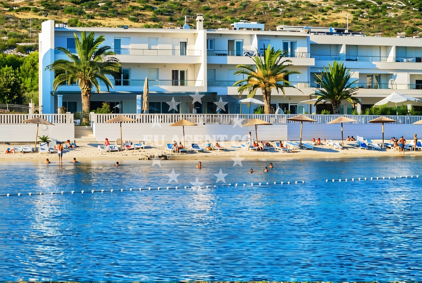
The beaches of Oglavci are defined by their rocky outcrops and scattered pebbles, typical of the Dalmatian Coast's geological profile. Sheltered coves carve into the shoreline, offering brief respite from the open sea. The water clarity here aligns with the Adriatic's reputation for transparency, though depth variations are influenced by the rugged seabed. These natural formations create a dynamic interplay between land and sea, with tidal patterns shaping the accessible shoreline.Swimming and shore
Swimming conditions vary across the coastline due to the uneven seabed. In the more sheltered coves, the water remains relatively calm, making them suitable for brief dips. However, the open stretches between rocky formations can experience stronger currents, particularly during midday hours. The shore itself is composed of a mix of pebbles and small stones, requiring sturdy footwear for exploration. Snorkeling is feasible in shallower areas, where marine life often thrives in the crevices between rocks.Facilities and activities
There are no formal facilities or infrastructure at Oglavci's beaches. The absence of permanent amenities means visitors should plan accordingly, bringing essentials like water, snacks, and sun protection. The natural terrain supports low-impact activities such as hiking along the coastline, rock scrambling, and exploring the coves by foot. Kayaking is possible from nearby launch points, though the rocky shoreline may limit direct access to the water.Access and location
Oglavci's beaches are accessible via local roads that wind through the surrounding hills. The nearest major settlements include the historic town of Split to the north and the coastal village of Bol to the south. These towns serve as gateways to the region, offering transport links and basic services. The coastline's proximity to the Adriatic's main sailing lanes makes it a strategic point for yachts navigating between the northern and southern Dalmatian Coast.What to expect
Visitors should anticipate a landscape shaped by nature rather than formal development. The beaches of Oglavci are best experienced as part of a broader exploration of the Dalmatian Coast's natural features. The lack of amenities means this is not a destination for those seeking convenience, but rather for those drawn to the region's unfiltered coastal character. The interplay of land and sea creates a constantly shifting environment, with tidal movements and weather conditions influencing the accessible shoreline.Practical tips
Given the absence of formal facilities, visitors are advised to carry sufficient water and sun protection. The rocky terrain requires sturdy footwear for safe exploration. Parking options near the coastline are limited, with access typically restricted to local residents. For those arriving by yacht, the nearby marinas in Split and Bol provide docking facilities with connections to the region's sailing routes.Exploring the coast by yacht
For yacht charter guests, Oglavci's coastline offers a strategic vantage point along the Adriatic's eastern corridor. The area's proximity to Split and Bol provides easy access to marinas with fueling and provisioning services. Sailors navigating the Dalmatian Coast often use this stretch as a reference point, with the rocky outcrops serving as natural landmarks. The sheltered coves may offer brief anchoring opportunities, though formal mooring facilities are limited to the nearby settlements.Regional Context and Coastal Patterns
The Dalmatian Coast's geological history has shaped Oglavci's coastline into a series of rugged inlets and headlands. This pattern is consistent with other parts of the region, where tectonic activity and erosion have created the distinctive rocky shorelines. The area's maritime traditions are reflected in the nearby settlements, which have long served as waystations for sailors navigating the Adriatic.Anchorages in the surrounding area
Anchorages in the surrounding area include options near Rogoznica and Razanj, providing nearby mooring spots.
- Anchorage — rogoznica — 1.7 NM from beach
- Ankerplatz vor Rogoznica — 2.2 NM from beach
- Anchorage — razanj — 3.1 NM from beach
- Borovica — razanj — 3.4 NM from beach
- Anchorage — razanj — 3.6 NM from beach
- Anchorage — dolac — 3.6 NM from beach
- Anchorage — grebastica — 4.1 NM from beach
- Anchorage — zaboric — 4.9 NM from beach
Distances are straight-line geographic distances, not sailing routes.
Mooring buoys in the surrounding area
- Buoy field — rogoznica — 2.2 NM from beach
- Quay — primosten — 2.3 NM from beach
- Buoy field — primosten — 2.5 NM from beach
- Quay — razanj — 3.1 NM from beach
- Jetty — grebastica — 4.1 NM from beach
Distances are straight-line geographic distances, not sailing routes.
Marine fuel stations
Marine fuel stations are located in Primosten and Rogoznica, ensuring refueling options close to the beach.
- Petrol — primosten — 1.4 NM from beach
- Flash — rogoznica — 1.8 NM from beach
- Lukoil — sibenik — 10.0 NM from beach
- Ina — sibenik — 10.8 NM from beach
Distances are straight-line geographic distances, not sailing routes.
Harbours in the surrounding area
Harbours in the surrounding area include Rogoznica and Primosten, situated at short distances from the beach.
- Rogoznica — 2.2 NM from beach
- Primošten — primosten — 2.5 NM from beach
- Marina — 6.7 NM from beach
- Krapanj — 7.0 NM from beach
- Brodarica — 7.2 NM from beach
- Borak — drvenik mali — 8.5 NM from beach
Distances are straight-line geographic distances, not sailing routes.
Marinas in the surrounding area
Marinas in the surrounding area, such as Marina Kremik in Primosten, are located near the beach.
- Marina Kremik — primosten — 1.5 NM from beach
- Marina Frapa — rogoznica — 2.0 NM from beach
- Marina Agana — 6.9 NM from beach
- Amadria Yacht Marines — sibenik — 9.3 NM from beach
- Marina Mandalina — sibenik — 9.9 NM from beach
Distances are straight-line geographic distances, not sailing routes.
Restaurants near the beach
Restaurants near the beach include options in Primosten and Rogoznica, offering dining close to the shore.
- Saricevi dvori — primosten — 0.8 NM from beach
- Kremik — primosten — 1.5 NM from beach
- Hotel Restaurant Life — rogoznica — 1.6 NM from beach
- Siesta — rogoznica — 1.7 NM from beach
- Atrium — rogoznica — 1.8 NM from beach
- Konoba — rogoznica — 1.9 NM from beach
- Ancora — rogoznica — 1.9 NM from beach
Distances are straight-line geographic distances, not sailing routes.
Navigation guides for the surrounding area
Navigation guides for the surrounding area include Luka Peles and Uvala Stupin, providing route information near the beach.
- Luka Peles and Marina Kremik (Primosten) — 1.3 NM from beach
- Uvala Stupin — 1.7 NM from beach
- Rogoznica — 2.1 NM from beach
- Primosten — 2.3 NM from beach
- Uvala Borovica — 3.6 NM from beach
Distances are straight-line geographic distances, not sailing routes.
Yachts from nearby departure bases
Sailing yachts
- Jeanneau 54 (Postira) — Primošten Marina Kremik — 1.5 NM from departure base to beach
- Dufour 56 (Barmaley) — Primošten Marina Kremik — 1.5 NM from departure base to beach
- Dufour 460 Grand (Sulaco) — Primošten Marina Kremik — 1.5 NM from departure base to beach
- Dufour 56 (KABUKI) — Primošten Marina Kremik — 1.5 NM from departure base to beach
- Sun Odyssey 389 (sun elli) — Primošten Marina Kremik — 1.5 NM from departure base to beach
Catamarans
- Lucia 40 (PEARL) — Primošten Marina Kremik — 1.5 NM from departure base to beach
- Lagoon 40 (Bahia Real) — Primošten Marina Kremik — 1.5 NM from departure base to beach
- Dufour Catamaran 48 (BRO) — Primošten Marina Kremik — 1.5 NM from departure base to beach
- Neel 47 (Hope ) — Primošten Marina Kremik — 1.5 NM from departure base to beach
- Lagoon 450 Flybridge (double elli) — Primošten Marina Kremik — 1.5 NM from departure base to beach
Distances are straight-line geographic distances, not sailing routes.