Obriž istok, Lokva Rogoznica Beach, Croatia
Obriž istok, Lokva Rogoznica Beach is a gravel shoreline located in the Lokva Rogoznica area of Croatia. Stretching 110 meters along the coast, the beach features natural shade and a shower facility, making it a straightforward option for visitors seeking basic coastal access. Situated in a region known for its rugged Adriatic coastline, the beach offers a glimpse into the natural landscapes of the area, though it lacks the amenities of more developed shorelines.
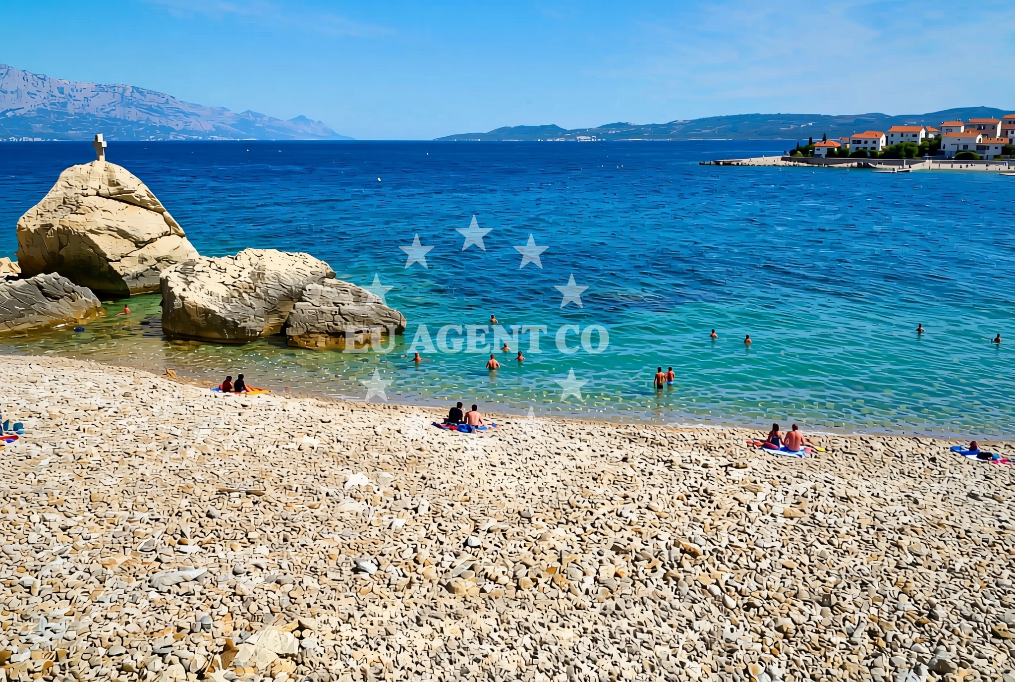
About this beach
Obriž istok, Lokva Rogoznica
Beach: Obriž istok
Location: Lokva Rogoznica
Characteristics and facilities
Gravel
110 m
Natural shade
shower
Beach character
The beach is composed primarily of gravel, which defines its texture and accessibility. Its 110-meter length provides a modest stretch of shoreline, suitable for casual walks or brief stops. Natural shade is available, likely from overhanging vegetation or topographical features, though the exact source is not specified. A shower facility is present, indicating basic infrastructure for visitors. The gravel composition suggests that the beach may be less ideal for swimming compared to sandy alternatives, but it remains a functional spot for those prioritizing accessibility over leisurely water activities.
Swimming and shore
Swimming conditions at Obriž istok are not explicitly detailed in the beach's documentation, but the gravel substrate implies that the shoreline may not be optimal for water-based recreation. The beach’s primary appeal lies in its simplicity and the presence of a shower facility, which caters to visitors requiring basic hygiene amenities. The shore itself is characterized by its natural, unaltered state, reflecting the rugged coastal terrain typical of this part of Croatia. While not a destination for sunbathing or extended relaxation, the beach serves as a practical point of access for those exploring the surrounding area.
Facilities and activities
The beach includes a single shower facility, which is a key feature for visitors needing to rinse off after water activities or before returning to their accommodations. No other amenities are listed, and there is no indication of additional services such as parking, food vendors, or recreational equipment rentals. Activities associated with the beach are not specified, but its location in Croatia’s Adriatic region suggests potential for nearby sailing, hiking, or cultural exploration. However, the beach itself does not appear to host organized events or structured recreational programs.
Access and location
Obriž istok, Lokva Rogoznica Beach is located in the Lokva Rogoznica area, a coastal region in Croatia. Its coordinates (43.407586, 16.754334) place it along the Adriatic Sea, near the broader Dalmatian coast. The area is part of a landscape defined by rocky inlets, small settlements, and maritime routes. While specific road access details are not provided, the beach’s proximity to Lokva Rogoznica suggests it may be reachable via local roads or trails. Visitors should consider regional transportation options, as the beach does not appear to be a major tourist hub with dedicated infrastructure.
What to expect
Visitors to Obriž istok, Lokva Rogoznica Beach should expect a straightforward, minimally developed shoreline. The gravel composition and lack of extensive amenities make it a utilitarian option rather than a destination for luxury or leisure. The shower facility is a notable feature, but no other services are indicated. The beach’s natural state reflects its role as a functional coastal access point, with little emphasis on comfort or convenience. Those planning to visit should prioritize practicality, as the beach does not offer the amenities typical of more tourist-oriented locations.
Practical tips
Given the beach’s gravel composition, visitors may wish to wear appropriate footwear for walking along the shore. The shower facility is available, but there are no details about its operating hours or maintenance schedule. As the beach lacks additional infrastructure, visitors should bring their own supplies and plan for a visit that aligns with its basic offerings.
Exploring the coast by yacht
For yacht charter travelers, Obriž istok’s location along the Adriatic Sea places it within a region rich in sailing opportunities. The nearby coastline features a network of anchorages, marinas, and scenic routes that cater to motor yachts and sailboats. While the beach itself is not a designated marina or anchorage, its proximity to Lokva Rogoznica and the broader Dalmatian coast suggests it could serve as a reference point for sailors exploring the area. Yacht charter guests may find value in combining visits to this beach with stops at more developed ports or natural harbors in the region.
Regional Context and Coastal Features
The Lokva Rogoznica area is part of Croatia’s Adriatic coastline, characterized by its rugged terrain and sparse development. The region is known for its natural beauty, with cliffs, caves, and secluded coves that attract sailors and hikers. Nearby settlements may offer limited services, but the focus of the area remains on its unspoiled landscapes. Yacht charter travelers navigating these waters may encounter similar shorelines, with Obriž istok serving as one of many accessible points along the coast.
Anchorages in the surrounding area
- Konopjikova — postira — brac — 4.0 NM from beach
- Anchorage — postira — brac — 4.4 NM from beach
- Tri luke — povlja — brac — 4.5 NM from beach
- Anchorage — povlja — brac — 5.0 NM from beach
- Anchorage — povlja — brac — 5.1 NM from beach
- Anchorage — povlja — brac — 5.2 NM from beach
- Anchorage — povlja — brac — 5.5 NM from beach
- Anchorage — povlja — brac — 5.5 NM from beach
Distances are straight-line geographic distances, not sailing routes.
Mooring buoys in the surrounding area
Mooring buoys and jetties in Postira, Povlja, and Podstrana offer nearby options for anchoring.
- Quay — postira — brac — 4.0 NM from beach
- Restaurant Pipo buoys — povlja — brac — 4.4 NM from beach
- Restaurant Pipo jetty — povlja — brac — 4.5 NM from beach
- Konoba Rojen jetty — povlja — brac — 4.6 NM from beach
- Jetty — podstrana — 9.0 NM from beach
Distances are straight-line geographic distances, not sailing routes.
Marine fuel stations
Marine fuel stations in Sumartin, Bol, Makarska, and Vrboska provide refueling options in the surrounding regions.
- Fuel station — sumartin — brac — 8.6 NM from beach
- Fuel station — bol — brac — 9.8 NM from beach
- Ina — makarska — 13.3 NM from beach
- Ina — vrboska — hvar — 14.1 NM from beach
Distances are straight-line geographic distances, not sailing routes.
Harbours in the surrounding area
Harbors in Mimice, Omiš, Pučišća, Pisak, Dugi Rat, and Postira are situated in the vicinity.
- Mimice — 2.4 NM from beach
- Omiš — omis — 3.4 NM from beach
- Pučišća harbour — pucisca — brac — 3.7 NM from beach
- Pisak — 4.7 NM from beach
- Dugi Rat — 5.4 NM from beach
- Postira — brac — 5.8 NM from beach
Distances are straight-line geographic distances, not sailing routes.
Marinas in the surrounding area
- Marina Baška Voda — marina baska voda — 8.9 NM from beach
- Marina Lav — podstrana — 10.7 NM from beach
- Marina Ramova — krvavica — 11.1 NM from beach
- ACI Marina Vrboska — hvar — 14.1 NM from beach
- ACI Marina Milna — milna brac — 14.2 NM from beach
Distances are straight-line geographic distances, not sailing routes.
Restaurants near the beach
Restaurants in Omiš, Pučišća, Postira, and Povlja offer nearby dining options.
- Konoba Milo — omis — 3.5 NM from beach
- Lado — pucisca — brac — 3.7 NM from beach
- Pizzeria Marin — pucisca — brac — 3.7 NM from beach
- Restaurant — postira — brac — 4.4 NM from beach
- Hideaway Pipo — povlja — brac — 4.5 NM from beach
- Konoba Rojen — povlja — brac — 4.6 NM from beach
Distances are straight-line geographic distances, not sailing routes.
Navigation guides for the surrounding area
Navigation guides for Mi mice, Omis, Pucisca, Uvala Luka, and Dugi Rat assist in local sailing.
- Mi mice — 2.5 NM from beach
- Omis — 3.1 NM from beach
- Pucisca — 3.6 NM from beach
- Uvala Luka — 4.6 NM from beach
- Dugi Rat (Uvala Orisac) — 5.3 NM from beach
Distances are straight-line geographic distances, not sailing routes.
Yachts from nearby departure bases
Sailing yachts
- Elan Impression 40 (KARLETA) — Baška Voda Port — 8.8 NM from departure base to beach
- Bavaria 44 (TARISA ) — Baška Voda — 9.0 NM from departure base to beach
Catamarans
- Lagoon 450 Fly (Falco) — Sumpetar Port — 6.2 NM from departure base to beach
Gulets / Cruisers
- Gulet (Trebenna) — Omiš City Port — 3.3 NM from departure base to beach
- Gulet (Primorac) — Omiš City Port — 3.3 NM from departure base to beach
- Gulet (PATRONICE) — Omiš City Port — 3.5 NM from departure base to beach
- Gulet (Altair) — Sumpetar Port — 6.2 NM from departure base to beach
- Gulet (Cataleya) — Sumpetar Port — 6.2 NM from departure base to beach
- Gulet cruiser (AGORA) — Dugi Rat Luka Krilo — 7.5 NM from departure base to beach
Motor boats
- Pearl Sea 31 Hard Top (Aero) — Baška Voda Port — 8.8 NM from departure base to beach
Distances are straight-line geographic distances, not sailing routes.