Naburje jug, Zastražišće (Hvar) Beach, Croatia
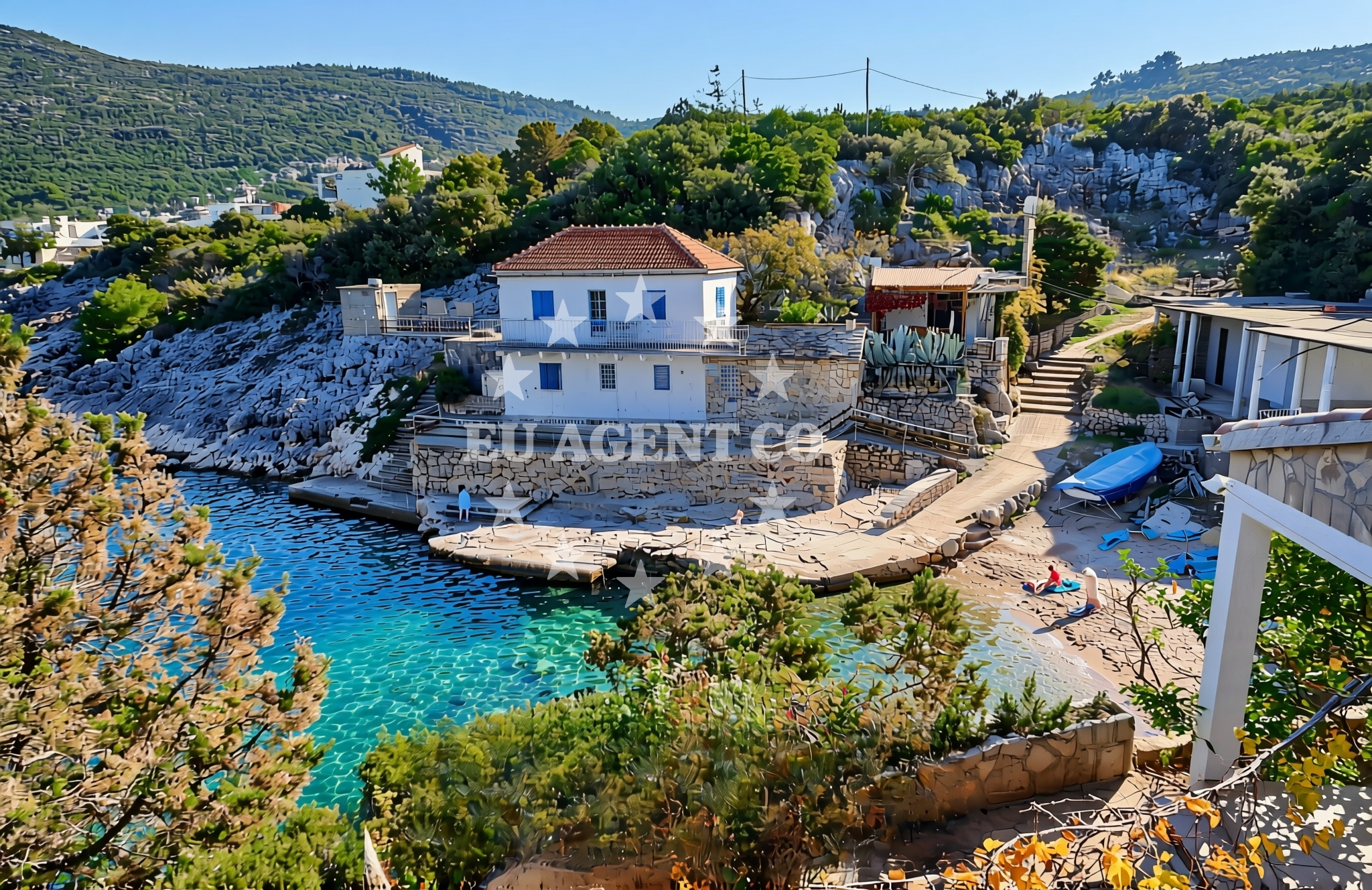
About this beach
Naburje jug, Zastražišće (Hvar)
Beach: Naburje jug
Location: Zastražišće (Hvar)
Characteristics and facilities
Gravel, concrete / stone slabs
Natural shade
Beach character
The beach's surface is primarily composed of gravel and concrete/stone slabs, a characteristic that distinguishes it from the more common sandy beaches found along the Dalmatian coast. This texture may appeal to visitors seeking a unique coastal experience, though it is less suited for prolonged sunbathing. Natural shade is available along parts of the shoreline, offering respite from the sun. The beach's orientation and surrounding topography contribute to its integration within the broader Hvar coastline, which is known for its dramatic cliffs and clear waters.Swimming and shore
Swimming conditions at Naburje jug, Zastražišće (Hvar) Beach are influenced by its proximity to the open sea and the local tidal patterns. The gravel and stone slab shoreline may make direct entry into the water less comfortable for some visitors, though the beach's location near the coast allows access to calmer waters further offshore. The Adriatic Sea's generally clear waters and moderate temperatures during the summer months make it a viable swimming destination, though the beach's specific conditions should be considered in relation to broader coastal trends.Facilities and activities
The beach does not feature structured amenities such as showers, restrooms, or designated seating areas. Visitors should plan accordingly, as the lack of formal facilities means that any provisions will need to be brought from nearby settlements. The beach's immediate surroundings do not include commercial concessions, but the nearby town of Hvar offers a range of services, including dining options, accommodations, and retail stores. Activities associated with the beach are limited to passive recreation, with no structured programs or rentals available on-site.Access and location
Naburje jug, Zastražišće (Hvar) Beach is situated within the municipality of Hvar, on the island's southern coast. Access to the beach is via local roads that connect to Hvar's main settlement and other coastal points. The beach's location places it within reach of Hvar's cultural and historical landmarks, as well as the island's network of smaller villages and coastal trails. For those arriving by sea, the beach is positioned along a stretch of coastline that is part of the broader Adriatic sailing routes, though it is not marked as an anchorage or marina in maritime charts.What to expect
Visitors to Naburje jug, Zastražišće (Hvar) Beach should expect a shoreline defined by gravel and stone slabs, with natural shade available along parts of the beach. The absence of formal amenities means that visitors will need to rely on nearby settlements for services such as food, water, and shelter. The beach's position on the Hvar coast provides access to the island's cultural and natural attractions, though its specific features make it more suited to those seeking a less conventional coastal experience. The surrounding waters offer opportunities for swimming and maritime exploration, though the beach itself is not a primary hub for water-based activities.Practical tips
Given the beach's gravel and stone slab composition, visitors may wish to bring footwear suitable for uneven surfaces. Sun protection is recommended, as natural shade is limited to specific areas. Those planning extended stays should consider nearby accommodations in Hvar Town, which offers a range of lodging options. The beach's location near Hvar's main settlement means that visitors can easily access local services, though the beach itself does not have on-site facilities.Exploring the coast by yacht
For visitors arriving by yacht or considering charter options in the region, Naburje jug, Zastražišće (Hvar) Beach is positioned along a section of the Hvar coastline that is popular with sailors. The broader Hvar area is a well-established sailing destination, with routes extending to nearby islands such as Vis, Brac, and Korcula. Charter guests exploring the Adriatic may find the beach's location useful as a reference point for navigating the Hvar coast, though it is not marked as a formal anchorage. The surrounding waters are generally suitable for motor yachts and sailing vessels, with access to marinas and harbors in Hvar Town and other coastal settlements.Regional Context and Cultural Significance
The beach's location on the island of Hvar places it within a region rich in history and cultural heritage. Hvar itself is known for its medieval architecture, vineyards, and connection to the arts. The island's coastal areas, including Naburje jug, are part of a landscape shaped by centuries of maritime activity and agricultural traditions. Visitors interested in the region's history may explore Hvar Town, which features landmarks such as the Hvar Fortress and the Cathedral of St. Nicholas. The beach's proximity to these sites offers a blend of natural and cultural experiences for those exploring the area.Anchorages in the surrounding area
Anchorages near Pokrivenik on Hvar offer nearby mooring options.
- Anchorage — pokrivenik — hvar — 0.2 NM from beach
- Anchorage — pokrivenik — hvar — 0.3 NM from beach
- Anchorage — pokrivenik — hvar — 0.5 NM from beach
- Anchorage — hvar — 2.2 NM from beach
- Anchorage — dugi dolac — hvar — 2.2 NM from beach
- Anchorage — dugi dolac — hvar — 2.3 NM from beach
- Anchorage — dugi dolac — hvar — 2.5 NM from beach
- Anchorage — dugi dolac — hvar — 2.6 NM from beach
Distances are straight-line geographic distances, not sailing routes.
Mooring buoys in the surrounding area
- Restaurant Preza quay — pokrivenik — hvar — 0.2 NM from beach
- Quay — hvar — 2.8 NM from beach
- Jetty — velika stiniva — hvar — 3.1 NM from beach
- Quay — bogomolje — hvar — 5.8 NM from beach
- Jetty — zavala — hvar — 8.3 NM from beach
Distances are straight-line geographic distances, not sailing routes.
Marine fuel stations
Marine fuel stations in Sumartin, Vrboska, and Makarska serve boats traveling near the beach.
- Fuel station — sumartin — brac — 8.1 NM from beach
- Ina — vrboska — hvar — 9.3 NM from beach
- Ina — makarska — 10.3 NM from beach
- Fuel station — bol — brac — 11.9 NM from beach
Distances are straight-line geographic distances, not sailing routes.
Harbours in the surrounding area
- Sumartin — brac — 8.0 NM from beach
- Port Jelsa — hvar — 8.3 NM from beach
- Vrboska — hvar — 9.4 NM from beach
- Lovište — loviste — 9.8 NM from beach
- Podgora — 9.9 NM from beach
- Čaklje — caklje — podgora — 10.1 NM from beach
Distances are straight-line geographic distances, not sailing routes.
Marinas in the surrounding area
- ACI Marina Vrboska — hvar — 9.3 NM from beach
- Marina Tučepi — marina tucepi — 10.1 NM from beach
- Marina Ramova — krvavica — 11.2 NM from beach
- Marina Baška Voda — marina baska voda — 12.6 NM from beach
- Marina Korkyra — vela luka — korcula — 13.8 NM from beach
Distances are straight-line geographic distances, not sailing routes.
Restaurants near the beach
Restaurants in Pokrivenik and Pakomina offer dining choices near the beach.
- Restaurant Timun — pokrivenik — hvar — 0.2 NM from beach
- Pakomina — hvar — 2.8 NM from beach
Distances are straight-line geographic distances, not sailing routes.
Navigation guides for the surrounding area
Navigation guides for Uvala Pokrivenik and nearby bays assist in local sailing routes.
- Uvala Pokrivenik — 0.3 NM from beach
- Uvala Studena — 7.3 NM from beach
- Uvala Duboka — 7.5 NM from beach
- Uvala Kozja — 7.7 NM from beach
- Su martin — 8.0 NM from beach
Distances are straight-line geographic distances, not sailing routes.
Yachts from nearby departure bases
Sailing yachts
- Bavaria 40 Cruiser (LADY BUTTERFLY) — Tučepi Port — 10.1 NM from departure base to beach
- Bavaria Cruiser 37 (AURORA) — Baška Voda — 12.6 NM from departure base to beach
- Elan 50 Impression (FINES DE CLAIRES) — Baška Voda — 12.6 NM from departure base to beach
Catamarans
- Lagoon 450 (LAMANTIN) — Baška Voda — 12.6 NM from departure base to beach
Motor yachts
- Princess V53 (Chablis) — Makarska Port — 10.3 NM from departure base to beach
- Canados 86 (Karisma) — Baška Voda — 12.6 NM from departure base to beach
Motor boats
- Jeanneau NC 37 (Black Pearl) — Makarska Port — 10.3 NM from departure base to beach
- Galeon 430 Skydeck (Bellagio) — Makarska Port — 10.3 NM from departure base to beach
- Galeon 430 Skydeck (BELLAGIO) — Makarska Port — 10.3 NM from departure base to beach
- Jeanneau NC 37 (Black Pearl) — Makarska Port — 10.3 NM from departure base to beach
Distances are straight-line geographic distances, not sailing routes.