Mutogras 2, Podstrana - Mutogras Beach, Croatia
Mutogras 2 is a coastal stretch located in Podstrana, a village on the Dalmatian coast of Croatia. This beach is characterized by its gravel and concrete/stone slabs, extending approximately 250 meters along the shoreline. While it lacks traditional sandy expanses, its unique surface and proximity to the Adriatic Sea make it a distinctive spot for visitors exploring the region.
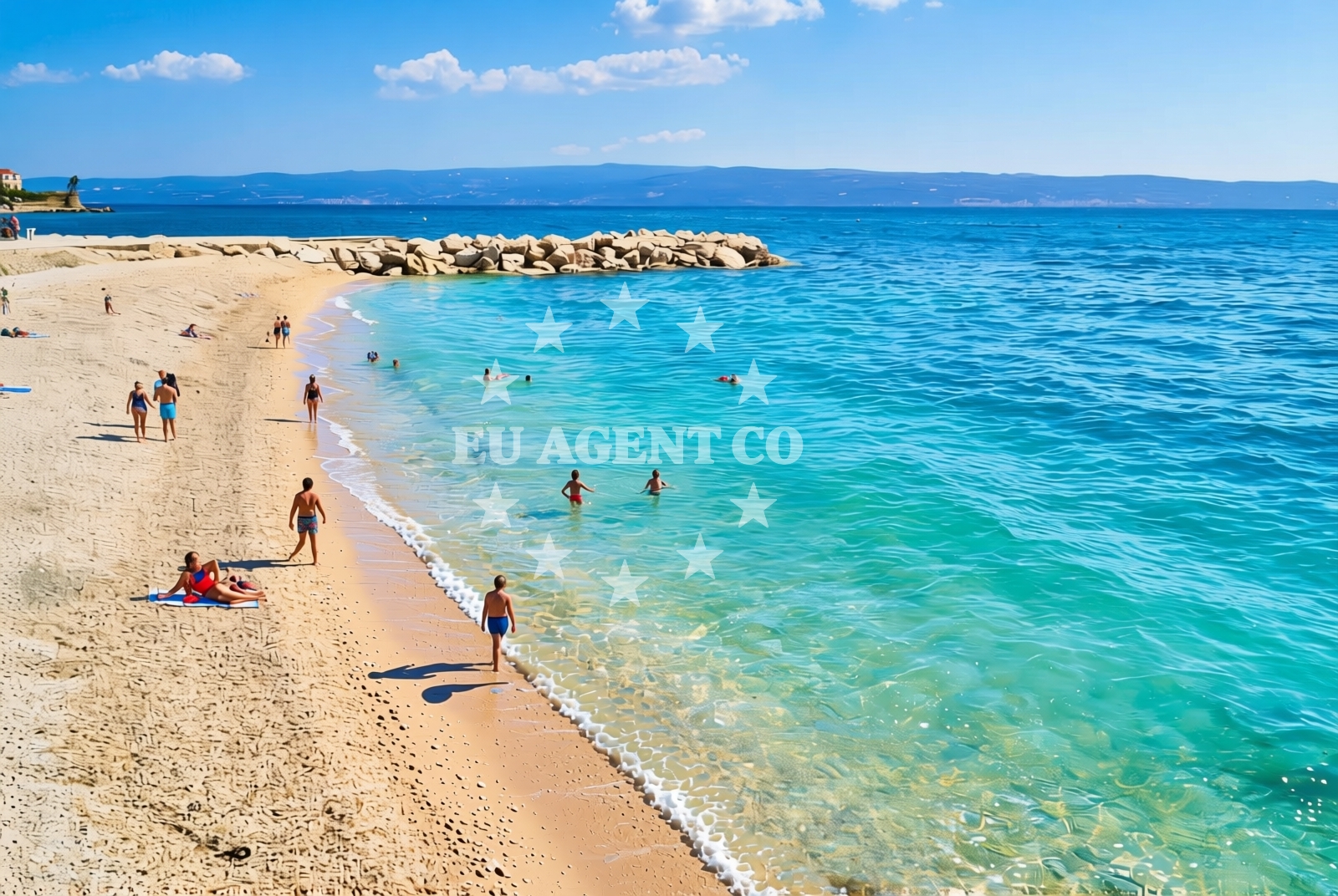
About this beach
Mutogras 2, Podstrana - Mutogras
Beach: Mutogras 2
Location: Podstrana - Mutogras
Characteristics and facilities
Gravel, concrete / stone slabs
250 m
Beach character
The beach's surface consists primarily of gravel and concrete/stone slabs, which may appeal to those seeking a more rugged coastal experience. Its 250-meter length offers a modest but defined shoreline. The absence of detailed natural features in official records suggests a relatively unmodified coastline, potentially influenced by local geological formations or historical land use patterns.
Swimming and shore
Swimming conditions at Mutogras 2 are not explicitly documented in available records. The beach's rocky and gravelly nature may affect water access, with potential variations in wave exposure depending on tides and weather. Visitors should consider the shoreline's composition when planning aquatic activities, as it may differ from typical sandy beaches in the region.
Facilities and activities
No specific facilities or amenities are listed for Mutogras 2 in official records. The beach appears to be a more natural, low-maintenance coastal area without reported infrastructure such as showers, toilets, or parking. Activities associated with the beach are not detailed in available data, suggesting it may be primarily used for passive enjoyment of the shoreline.
Access and location
Mutogras 2 is situated in Podstrana, a coastal village in Split-Dalmatia County, Croatia. The area is part of a broader network of Adriatic coastlines known for their historical significance and scenic value. While specific access routes are not documented, the beach's location near Podstrana implies proximity to local roads and potential connections to nearby settlements or tourist hubs along the Dalmatian coast.
What to expect
Visitors to Mutogras 2 should expect a beach with a gravel and stone-slab surface, offering a unique contrast to the sandy shores typical of the Adriatic. The 250-meter length provides a modest shoreline, with no reported facilities or structured amenities. The beach's character appears to be shaped by its geological composition and minimal development, making it a location for those seeking a more rustic coastal experience.
Practical tips
Given the beach's gravel and stone-slab surface, visitors may wish to wear appropriate footwear for comfort. As no facilities are documented, it is advisable to bring personal items such as water or snacks. The beach's characteristics suggest it may be best suited for short visits or as part of a broader exploration of Podstrana and its surroundings.
Exploring the coast by yacht
Mutogras 2 lies within a region of the Adriatic Sea that is frequented by sailors and yacht charter guests. The Dalmatian coast, including areas near Podstrana, offers a network of marinas, anchorages, and sailing routes that cater to both experienced and casual sailors. While specific nautical details for this beach are not provided, its location suggests potential connections to nearby sailing infrastructure, making it a possible point of interest for those exploring the Croatian coastline by sea.
Local Context: Podstrana and the Dalmatian Coast
Podstrana, where Mutogras 2 is located, is a village on the island of Hvar, though the exact administrative classification of the area may require further verification. The Dalmatian coast is renowned for its historical sites, vineyards, and scenic landscapes, with Podstrana itself likely offering connections to local attractions such as the Pakleni Islands or the town of Hvar. The region's maritime heritage and proximity to the Adriatic make it a popular destination for both land-based tourism and nautical exploration.
Anchorages in the surrounding area
Anchorages near Brac and Split offer nearby mooring options.
- Anchorage — supetar — brac — 5.3 NM from beach
- Anchorage — splitska — brac — 5.5 NM from beach
- Anchorage — postira — brac — 5.8 NM from beach
- Anchorage — split — 6.6 NM from beach
- Uvala Likva — sutivan — brac — 6.9 NM from beach
- Anchorage — postira — brac — 7.0 NM from beach
- Konopjikova — postira — brac — 7.6 NM from beach
- Stipanska — brac — 8.1 NM from beach
Distances are straight-line geographic distances, not sailing routes.
Mooring buoys in the surrounding area
- Jetty — podstrana — 0.5 NM from beach
- Promenade — split — 6.7 NM from beach
- Quay — postira — brac — 7.7 NM from beach
- Nautical Anchorage Bobovišća — bobovisce — brac — 8.5 NM from beach
- Nautical Anchorage Bobovišća — bobovisce — brac — 8.7 NM from beach
Distances are straight-line geographic distances, not sailing routes.
Marine fuel stations
Marine fuel stations in Split and surrounding areas ensure refueling convenience.
- Ina — split — 6.7 NM from beach
- Ina — split — 7.0 NM from beach
- Flash — kastel gomilica — 8.7 NM from beach
- Ina — milna brac — 10.3 NM from beach
Distances are straight-line geographic distances, not sailing routes.
Harbours in the surrounding area
- Krilo — jesenice — 1.1 NM from beach
- Sumpetar — dugi rat — 2.4 NM from beach
- Clubharbour Podstrana — 2.7 NM from beach
- Stobreč — stobrec — 3.0 NM from beach
- Dugi Rat — 3.2 NM from beach
- Supetar — brac — 5.1 NM from beach
Distances are straight-line geographic distances, not sailing routes.
Marinas in the surrounding area
- Marina Lav — podstrana — 2.2 NM from beach
- ACI Marina Split — 6.7 NM from beach
- Marina Kaštela — marina kastela — kastel gomilica — 8.9 NM from beach
- ACI Marina Milna — milna brac — 10.2 NM from beach
- Marina Vlaška — milna brac — 10.2 NM from beach
Distances are straight-line geographic distances, not sailing routes.
Restaurants near the beach
Restaurants in Podstrana offer dining options near the beach.
- Leonis — podstrana — 2.2 NM from beach
- Skampino — podstrana — 2.2 NM from beach
- Fabio — podstrana — 2.3 NM from beach
Distances are straight-line geographic distances, not sailing routes.
Navigation guides for the surrounding area
Navigation guides for Dugi Rat and surrounding areas assist in route planning.
- Kairos — 2.1 NM from beach
- Dugi Rat (Uvala Orisac) — 3.3 NM from beach
- Pomorsko Sportsko Drustvo (PSD) Zenta (Uvala Zenta) — 5.3 NM from beach
- Omis — 5.7 NM from beach
- Uvala Spliska (Splitska) — 5.7 NM from beach
Distances are straight-line geographic distances, not sailing routes.
Yachts from nearby departure bases
Yachts departing from Podstrana Marina Lav and Dugi Rat provide access to the area.
Sailing yachts
- Jeanneau 53 (Win Win) — Podstrana Marina Lav — 2.2 NM from departure base to beach
Motor yachts
- Ferretti 450 (Lady Esmeralda) — Podstrana Marina Lav — 2.2 NM from departure base to beach
- Ferretti 500 (Anna) — Podstrana Marina Lav — 2.2 NM from departure base to beach
- Princess 62 (Sassy) — Podstrana Marina Lav — 2.2 NM from departure base to beach
- Azimut Magellano 60 (Amparito XIII) — Podstrana Marina Lav — 2.2 NM from departure base to beach
Gulets / Cruisers
- Gulet cruiser (AGORA) — Dugi Rat Luka Krilo — 1.1 NM from departure base to beach
Motor boats
- Princess 42 (Touche) — Podstrana Marina Lav — 2.2 NM from departure base to beach
- Scanner 710 (Nerezine) — Podstrana Marina Lav — 2.2 NM from departure base to beach
- Catcruiser 45 (Lav Boat) — Podstrana Marina Lav — 2.2 NM from departure base to beach
- Sessa C35 (Jupika) — Podstrana Marina Lav — 2.2 NM from departure base to beach
Distances are straight-line geographic distances, not sailing routes.