Montun sredina, Viganj Beach, Croatia
Montun sredina, Viganj Beach lies along the rugged coastline of Croatia's central Dalmatian region. This gravel beach stretches 40 meters along the shore, offering a quiet alternative to the more developed resorts nearby. The beach's natural shade, provided by coastal rock formations and sparse vegetation, creates a unique microclimate that differs from the typically sunbaked Adriatic shores. While the beach lacks formal amenities, its simplicity aligns with the character of the surrounding rural landscape.
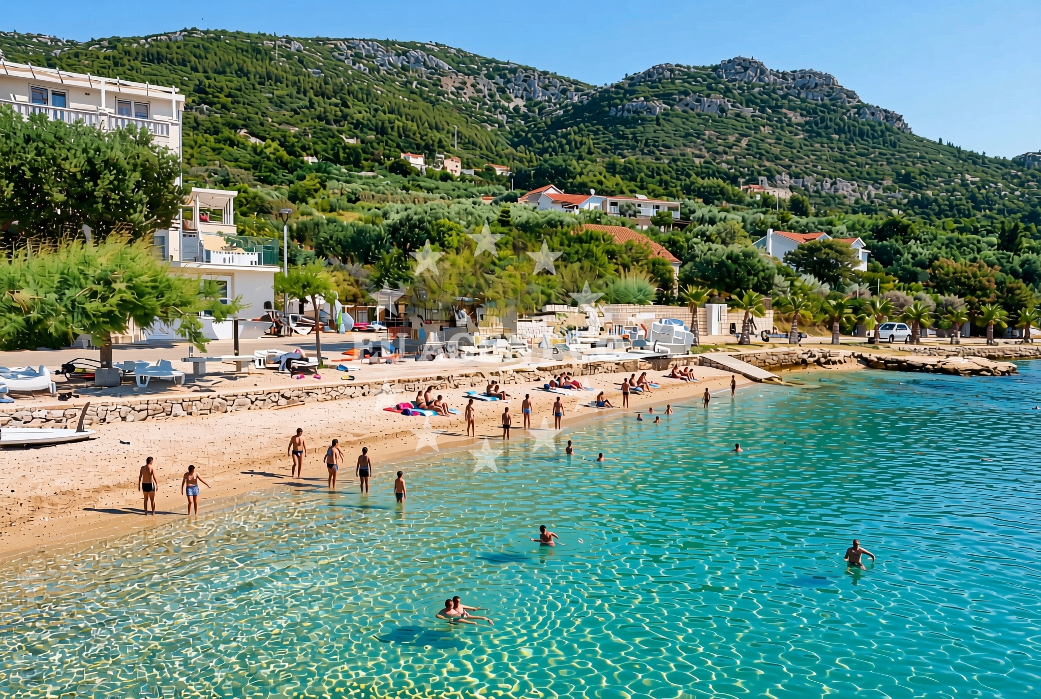
About this beach
Montun sredina, Viganj
Beach: Montun sredina
Location: Viganj
Characteristics and facilities
Gravel
40 m
Natural shade
Beach character
The beach consists of coarse gravel, which provides a firm surface for walking but may require sturdy footwear. The 40-meter shoreline is flanked by rocky outcrops that offer natural shade during midday hours. This characteristic makes the beach particularly appealing during the hottest parts of the day, though the gravel substrate may not be ideal for swimming. The beach's orientation and topography suggest it is likely exposed to prevailing winds, which could influence water conditions and comfort levels for visitors.
Swimming and shore
Swimming conditions at Montun sredina are not explicitly documented in official records. The gravel substrate suggests the beach is not suited for wading or prolonged water contact, though the adjacent shoreline may feature more suitable areas for swimming. The beach's exposure to wind and waves implies that water movement could be more pronounced than in sheltered coves. Visitors should assess conditions carefully before entering the water, as the lack of formal lifeguard services means safety depends on personal judgment.
Facilities and activities
No formal facilities are listed for Montun sredina, Viganj Beach. The absence of amenities such as restrooms, showers, or changing rooms aligns with its classification as a natural beach rather than a tourist destination. Activities associated with the beach are not explicitly documented, though the surrounding area's rural character suggests limited organized recreation. The beach's gravel composition may make it unsuitable for sunbathing or beach games typically played on sand.
Access and location
Access to Montun sredina is likely via local roads connecting to the broader Viganj area. The beach's proximity to Viganj, a small settlement in the Split-Dalmatia County, places it within reach of regional infrastructure. However, the lack of specific access details in official records suggests the beach may be reached via informal paths or require local knowledge. The beach's coordinates (42.984898° N, 17.093924° E) place it in a region characterized by scattered coastal settlements and rugged terrain.
What to expect
Visitors should expect a raw, unembellished coastal experience at Montun sredina. The beach's gravel surface and limited shade suggest it is best suited for those seeking solitude rather than relaxation. The absence of formal facilities means visitors must bring their own provisions and equipment. The beach's orientation and exposure to wind may create challenging conditions for water activities, though the surrounding landscape offers opportunities for exploration beyond the shoreline.
Practical tips
Consider wearing sturdy footwear to navigate the gravel beach safely. Bring sun protection despite the natural shade, as wind exposure can increase UV risk. Check tide times if planning to explore the shoreline, as conditions may change with the sea level. The beach's remote character means visitors should be self-sufficient, with no guarantee of emergency services beyond standard coastal response protocols.
Exploring the coast by yacht
The beach's location in the central Dalmatian coast places it within reach of several popular sailing areas. Yacht charter guests exploring the Split to Dubrovnik route may find the surrounding waters suitable for anchoring, though specific marina options are not documented for this exact location. The region's rugged coastline and scattered islands create a dynamic sailing environment, with opportunities for exploring nearby settlements like Viganj and the broader Split-Dalmatia County. Charter operators based in nearby ports may include this area in multi-day itineraries focusing on less-visited coastal segments.
Regional Context and Coastal Character
The Viganj area is part of a broader coastal landscape marked by limestone cliffs, olive groves, and small fishing villages. This beach's gravel composition contrasts with the more common sandy beaches found in tourist hubs like Bol or Supetar. The region's maritime history is evident in the nearby settlements, which have long relied on fishing and limited coastal trade. While not a major sailing destination, the area's proximity to the main Split-Dalmatia shipping routes makes it a potential stop for charter vessels exploring the region's less-developed shores.
Anchorages in the surrounding area
Anchorages in Korcula and Loviste are located near the Viganj Beach in Montun sredina.
- Anchorage — korcula — 1.3 NM from beach
- Anchorage — korcula — 1.4 NM from beach
- Anchorage — korcula — 1.7 NM from beach
- Anchorage — korcula — 1.7 NM from beach
- Anchorage — racisce — korcula — 2.2 NM from beach
- Anchorage — loviste — 2.5 NM from beach
- Anchorage — korcula — 2.8 NM from beach
- Anchorage — racisce — korcula — 3.3 NM from beach
Distances are straight-line geographic distances, not sailing routes.
Mooring buoys in the surrounding area
Mooring buoys and jetties in Korcula and Loviste are situated close to the Viganj Beach in Montun sredina.
- Jetty — korcula — 1.7 NM from beach
- Konoba Estravaganca buoys - Duba — konoba estravaganca buoys duba — loviste — 2.7 NM from beach
- Fuel jetty — korcula — 3.0 NM from beach
- Jetty — loviste — 3.6 NM from beach
- Jetty — loviste — 3.6 NM from beach
Distances are straight-line geographic distances, not sailing routes.
Marine fuel stations
- Fuel station — korcula — 3.0 NM from beach
- Fuel station — ploce — 15.5 NM from beach
- Ina — vela luka — korcula — 16.7 NM from beach
- Ina — ubli — lastovo — 18.7 NM from beach
Distances are straight-line geographic distances, not sailing routes.
Harbours in the surrounding area
Harbours in Viganj, Korcula, and Orebic are located near the Viganj Beach in Montun sredina.
- Viganj — 0.3 NM from beach
- Kučišće — kucisce — 0.9 NM from beach
- Korčula W harbour — korcula — 2.2 NM from beach
- Korčula E harbour — korcula — 2.4 NM from beach
- Račišće — racisce — korcula — 3.3 NM from beach
- Orebić — orebic — 3.6 NM from beach
Distances are straight-line geographic distances, not sailing routes.
Marinas in the surrounding area
Marinas in Korcula, Lumbarda, and Tučepi are situated in the surrounding area of the Viganj Beach in Montun sredina.
- ACI Marina Korčula — korcula — 2.5 NM from beach
- Marina Lumbarda — korcula — 5.0 NM from beach
- Marina Tučepi — marina tucepi — 16.8 NM from beach
- Marina Korkyra — vela luka — korcula — 16.8 NM from beach
- Marina Solitudo — lastovo — 17.8 NM from beach
Distances are straight-line geographic distances, not sailing routes.
Restaurants near the beach
Restaurants in Korcula are located near the Viganj Beach in Montun sredina.
- Restaurant — korcula — 1.6 NM from beach
- Mimi's Bistro at Tara's Lodge — korcula — 1.7 NM from beach
- Mimi's Bistro at Tara's Lodge — korcula — 1.7 NM from beach
- Aterina — korcula — 2.3 NM from beach
- Restaurant — korcula — 2.3 NM from beach
- Restaurant — korcula — 2.3 NM from beach
- Adio Mare — korcula — 2.3 NM from beach
Distances are straight-line geographic distances, not sailing routes.
Navigation guides for the surrounding area
Navigation guides for Uvala Vrbovica, Luka Racisce, and Otocic Badija are relevant to the area around the Viganj Beach in Montun sredina.
- Uvala Vrbovica — 1.4 NM from beach
- Uvala Banja — 1.9 NM from beach
- Uvala Kneza — 2.0 NM from beach
- Luka Racisce — 3.1 NM from beach
- Otocic Badija — 3.8 NM from beach
Distances are straight-line geographic distances, not sailing routes.
Yachts from nearby departure bases
Sailing yachts
- Elan 40 Impression (Karleta) — Ploče City Port — 15.4 NM from departure base to beach
- More 55 (MRS. ROBINSON) — Ploče City Port — 15.4 NM from departure base to beach
- Sun Odyssey 349 (Porto Tolero) — Ploče City Port — 15.4 NM from departure base to beach
- Elan 514 Impression (Cesarica III) — Ploče City Port — 15.4 NM from departure base to beach
- Sun Odyssey 419 (Luka Ploce) — Ploče City Port — 15.4 NM from departure base to beach
- Salona 44 (SAMOA) — Ploče City Port — 15.4 NM from departure base to beach
- Sun Odyssey 349 (Visnjica) — Ploče City Port — 15.4 NM from departure base to beach
- Bavaria 40 Cruiser (LADY BUTTERFLY) — Tučepi Port — 16.8 NM from departure base to beach
Catamarans
- Lagoon 450 Fly (Alba Mouse) — Ploče City Port — 15.4 NM from departure base to beach
Motor yachts
- Princess V53 (Chablis) — Makarska Port — 18.7 NM from departure base to beach
Distances are straight-line geographic distances, not sailing routes.