Modrič, Rovanjska Beach, Croatia
Modrič, Rovanjska Beach lies along the rugged coastline of Croatia's central Dalmatian coast, near the town of Modrič. This stretch of shoreline is part of a region known for its dramatic cliffs, secluded coves, and clear waters that draw both locals and visitors. While the beach itself remains relatively unmarked in official records, its proximity to established coastal settlements and sailing routes makes it a point of interest for those exploring the area by land or sea.
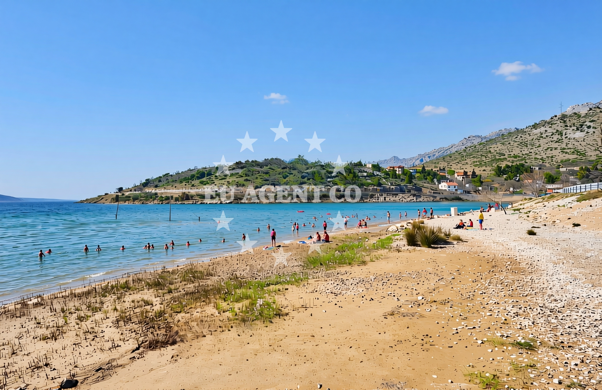
About this beach
Modrič, Rovanjska
Beach: Modrič
Location: Rovanjska
Beach character
The beach's character is shaped by its position along the Rovanjska coast, a part of Croatia's coastline that transitions between open sea and sheltered inlets. The surrounding landscape features limestone cliffs and dense vegetation, typical of the region's karst topography. While specific details about the beach's sand quality or water depth are not documented, the general character of the area suggests a mix of pebbles and fine sand, with waters that are typically clear and cool. The absence of formal amenities means visitors should expect a more natural, undeveloped setting.
Swimming and shore
Swimming conditions at Modrič, Rovanjska Beach are influenced by the nearby coastal currents and seasonal weather patterns. The Adriatic Sea in this region is known for its generally mild temperatures, with summer waters reaching comfortable levels for swimming. However, the beach's exposure to open sea means swells can occasionally make swimming less ideal. The shore itself appears to be a mix of natural terrain, with no formal lifeguard services or marked swimming zones reported in available records.
Facilities and activities
No formal facilities such as restrooms, showers, or changing rooms are documented for Modrič, Rovanjska Beach. The lack of structured amenities aligns with the beach's undeveloped nature. Activities associated with the area are likely limited to passive recreation such as sunbathing, walking along the shore, and photography. The surrounding region offers opportunities for hiking and exploring nearby villages, though these would require traveling beyond the immediate beach area.
Access and location
Access to Modrič, Rovanjska Beach is likely via local roads connecting to the town of Modrič, a small settlement known for its traditional architecture and proximity to the sea. The beach's coordinates (44.259178, 15.537936) place it within a region that is accessible by car or public transport from larger coastal cities like Split and Dubrovnik. For visitors arriving by sea, the nearest established marinas are located in nearby towns, with sailing routes passing through the broader Adriatic region.
What to expect
Visitors to Modrič, Rovanjska Beach should expect a natural, undeveloped shoreline with minimal infrastructure. The beach's setting is defined by its proximity to limestone cliffs and the broader Adriatic landscape. While no formal services are documented, the area's appeal lies in its isolation and unspoiled character. Those seeking amenities should plan to access nearby towns for dining, accommodations, or additional facilities. The beach is best suited for visitors looking to enjoy a quiet, scenic coastline away from crowded tourist hubs.
Practical tips
Given the beach's undeveloped nature, visitors are advised to bring all necessary supplies, including water, sunscreen, and picnic equipment. Parking options near the beach are not documented, so arriving by car may require careful navigation of local roads. For those exploring the area by sea, nearby marinas in Modrič and surrounding towns offer docking options and access to local sailing routes.
Exploring the coast by yacht
The waters near Modrič, Rovanjska Beach are part of a larger sailing region that extends along Croatia's central coast. This area is popular with charter yachts due to its combination of open sea sailing and sheltered bays. Nearby marinas in Modrič and other coastal towns provide docking facilities for motor yachts and sailboats. The Adriatic's generally favorable sailing conditions make this region a common route for those exploring the Dalmatian coast, with opportunities to anchor in nearby coves or visit cultural landmarks along the way.
Regional Context and Nearby Settlements
The beach lies within a region that includes the town of Modrič, a small coastal community known for its traditional architecture and proximity to the sea. The broader area is part of the Split-Dalmatia County, which includes numerous islands and coastal towns that are popular with tourists and sailors. Nearby settlements offer a range of services, from local restaurants to cultural sites, making them useful bases for exploring the region.
Anchorages in the surrounding area
Anchorages in the surrounding area include Vinjerac, Maslenica, and Novigrad, offering nearby mooring options.
- Anchorage — vinjerac — 3.3 NM from beach
- Anchorage — maslenica — 3.4 NM from beach
- Anchorage — novigrad — 5.3 NM from beach
- Anchorage — karin — 8.0 NM from beach
- Karin dock — 8.3 NM from beach
- Anchorage — ljubac — 10.4 NM from beach
- Anchorage — ljubac — 10.4 NM from beach
- Anchorage — rtina — 10.5 NM from beach
Distances are straight-line geographic distances, not sailing routes.
Mooring buoys in the surrounding area
Mooring buoys in the surrounding area include Šibuljina Point and Ljubac Jetty, situated near the beach.
- Šibuljina Point — sibuljina point — 9.7 NM from beach
- Jetty — ljubac — 10.5 NM from beach
Distances are straight-line geographic distances, not sailing routes.
Marine fuel stations
- Ina — zadar — 15.8 NM from beach
- Fuel station — sukosan — 16.1 NM from beach
- Ina — preko — ugljan — 18.4 NM from beach
- Ina — biograd na moru — 19.7 NM from beach
Distances are straight-line geographic distances, not sailing routes.
Harbours in the surrounding area
- Maslenica — 2.3 NM from beach
- Seline — 2.9 NM from beach
- Vinjerac — 3.3 NM from beach
- Starigrad Paklenica — 4.8 NM from beach
- Obrovac — 7.1 NM from beach
- Ražanac — razanac — 8.3 NM from beach
Distances are straight-line geographic distances, not sailing routes.
Marinas in the surrounding area
- Marina Zadar — 15.8 NM from beach
- Vitrenjak Zadar — 16.0 NM from beach
- Marina Dalmacija — sukosan — 16.0 NM from beach
- Marina Borik — zadar — 16.1 NM from beach
- Kukljica — ugljan — 18.3 NM from beach
Distances are straight-line geographic distances, not sailing routes.
Restaurants near the beach
Restaurants near the beach include Gostionica Ivan in Seline and Buffet Paklenica in Starigrad Paklenica, offering nearby dining options.
- Gostionica Ivan — seline — 2.6 NM from beach
- Restaurant — seline — 2.8 NM from beach
- Buffet Paklenica — starigrad paklenica — 4.0 NM from beach
- Restaurant — starigrad paklenica — 4.2 NM from beach
Distances are straight-line geographic distances, not sailing routes.
Navigation guides for the surrounding area
Navigation guides for the surrounding area include Posedarje and Starigrad-Paklenica, providing route information near Modrič Beach.
- Posedarje (Novigradsko More) — 3.9 NM from beach
- Starigrad-Paklenica {Velebitski Kanai) — 4.6 NM from beach
- VELESITSKI KANAL (S) — 8.3 NM from beach
- KrusCica and Uvala KrusCica Duboka — 10.7 NM from beach
Distances are straight-line geographic distances, not sailing routes.
Yachts from nearby departure bases
Yachts from nearby departure bases include those based in Novigrad Dalmatia and Zadar Marina, offering access to the area.
Sailing yachts
- Sun Odyssey 39i (Prizba) — Zadar Marina — 15.8 NM from departure base to beach
- Bavaria Cruiser 37 (Sunseeker) — Zadar Marina — 15.8 NM from departure base to beach
- Oceanis 40 (Omis) — Zadar Marina — 15.8 NM from departure base to beach
- Dufour 380 (Mljet) — Zadar Marina — 15.8 NM from departure base to beach
Catamarans
- Bali 4.6 (Jako 2) — Zadar Marina — 15.8 NM from departure base to beach
- Delta F40-XT (Veronchie) — Zadar Marina — 15.8 NM from departure base to beach
Motor boats
- Merry Fisher 795 () — Novigrad Dalmatia — 4.7 NM from departure base to beach
- Tempest 650 (CAPELLI) — Zadar Marina — 15.8 NM from departure base to beach
- Balt 918 Titanium (Wanderer) — Zadar Marina — 15.8 NM from departure base to beach
- Shark BF 23 Sport (Hrvoje) — Zadar Marina — 15.8 NM from departure base to beach
Distances are straight-line geographic distances, not sailing routes.