Mirine sjever 2, Barbat na Rabu (Rab) Beach, Croatia
Mirine sjever 2 is a stretch of coastline located in Barbat na Rabu, a settlement on the island of Rab in Croatia's northern Adriatic. This beach combines sandy, gravelly, and rocky terrain, creating a varied shoreline that reflects the island's rugged coastal character. Positioned on the eastern coast of Rab, the beach offers a vantage point over the open sea and proximity to the island's historic core, where medieval architecture and traditional stone houses still define the landscape.
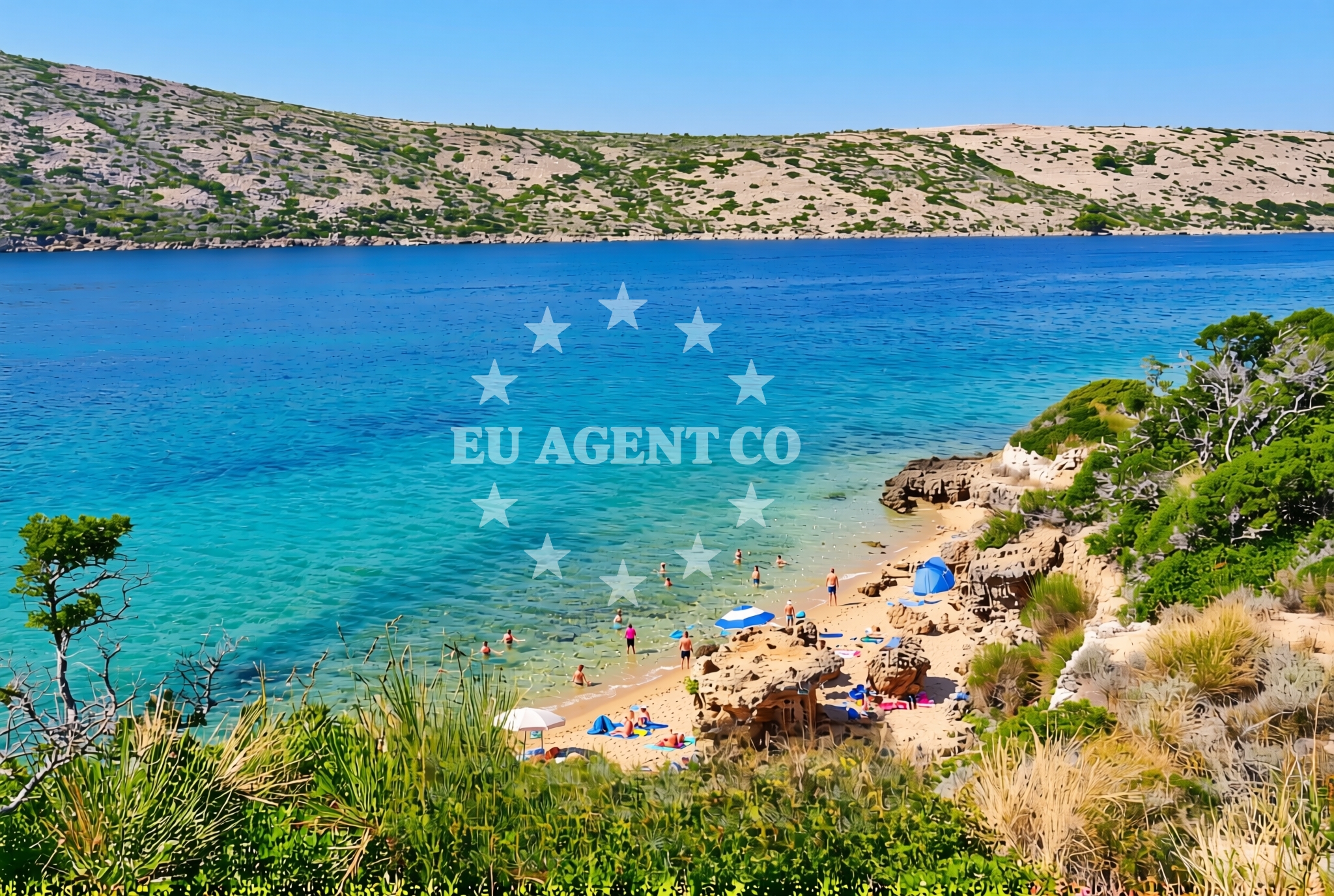
About this beach
Mirine sjever 2, Barbat na Rabu (Rab)
Beach: Mirine sjever 2
Location: Barbat na Rabu (Rab)
Characteristics and facilities
Sand, gravel, rocks
Beach character
The beach's composition of sand, gravel, and rock creates a dynamic shoreline that shifts with tides and weather. The sand is interspersed with pebbles and larger stones, forming a textured surface that contrasts with the smoother stretches of sand. This mix of materials influences the beach's usability: the sandy areas are suitable for casual walking, while the gravel and rock sections are more suited to exploration or as anchoring points for boats. The beach's natural features are typical of Rab's eastern coastline, which is characterized by low-lying cliffs, scattered rock formations, and clear waters that extend toward the open Adriatic.
Swimming and shore
The beach's varied terrain affects swimming conditions. The sandy sections offer gentle entry into the sea, while the gravel and rocky areas may present challenges for swimmers. The water clarity is generally good, reflecting the Adriatic's reputation for transparency, though visibility can vary with weather and tide. The shore's rocky sections may provide shelter from direct wind exposure, making them a potential option for resting during stronger breezes. However, swimmers should exercise caution near the rock formations, as currents can be unpredictable in areas with uneven seabeds.
Facilities and activities
No formal facilities are listed for Mirine sjever 2, consistent with the character of many beaches on Rab's less-developed eastern coast. The absence of amenities such as showers, restrooms, or seating aligns with the island's focus on preserving natural landscapes. Activities associated with the beach are likely limited to passive recreation, such as walking along the shore, exploring rock formations, or enjoying the view of the open sea. The beach's composition may also support low-impact pursuits like collecting shells or stones, though visitors should respect local environmental guidelines.
Access and location
Mirine sjever 2 is situated in Barbat na Rabu, a small settlement on the island of Rab, which lies approximately 25 kilometers northeast of the town of Rab. The beach is accessible via local roads that connect to the island's main thoroughfares. Visitors arriving by car would navigate through Rab's coastal villages, where traditional architecture and narrow streets reflect the island's historical development. The beach's location on the island's eastern coast places it near the boundary between Rab's more developed western areas and its quieter, more rugged eastern shores.
What to expect
Visitors to Mirine sjever 2 should expect a shoreline that combines sand, gravel, and rock, creating a varied walking surface. The beach's natural character is consistent with Rab's eastern coast, which prioritizes preservation over development. The absence of formal facilities means the beach is best suited for those seeking solitude or a connection to the island's unspoiled landscapes. The open sea view from the beach offers a sense of isolation, though the proximity to Barbat na Rabu ensures access to the island's cultural and historical sites, including its medieval fortifications and traditional stone houses.
Practical tips
Wear sturdy footwear for navigating the gravel and rocky sections of the beach. Sun protection is advisable, as the open coastal position may increase exposure to sunlight. The beach's natural terrain may make it less ideal for families with young children, though the sandy areas offer a more forgiving surface. Visitors should be mindful of tide changes, as the rocky sections may become submerged during high water.
Exploring the coast by yacht
The beach's location on the island of Rab places it within a region popular with sailors exploring the northern Adriatic. Rab's coastline offers a mix of sheltered bays and exposed stretches, making it a strategic point for yacht charters navigating between the Croatian mainland and the islands of the Kvarner Gulf. Nearby anchorages and marinas, such as those in the town of Rab or the nearby islands of Šolta and Hvar, provide options for docking or refueling. The open sea perspective from Mirine sjever 2 reflects the broader sailing context of the area, where the Adriatic's deep blue waters meet the island's rugged coast.
Cultural and Historical Context
The settlement of Barbat na Rabu is part of Rab's historic fabric, with its stone houses and medieval fortifications reflecting the island's long history as a defensive stronghold. The beach's proximity to these sites offers visitors a chance to combine natural exploration with cultural discovery. Rab's eastern coast, including Mirine sjever 2, has historically been less populated than the western areas, preserving a sense of tranquility that contrasts with the island's more developed tourist centers.
Anchorages in the surrounding area
Anchorages in the surrounding area include Rab and Misnjak, offering nearby options for mooring near Mirine sjever 2, Barbat na Rabu (Rab) Beach.
- Anchorage — rab — 0.5 NM from beach
- Anchorage — rab — 0.6 NM from beach
- Mag — misnjak — rab — 1.5 NM from beach
- Anchorage — stinica — 3.3 NM from beach
- Zavratnica — jablanac — 3.3 NM from beach
- Anchorage — veli vranjak — 4.1 NM from beach
- Anchorage — rab — 4.3 NM from beach
- Anchorage — rab — 4.5 NM from beach
Distances are straight-line geographic distances, not sailing routes.
Mooring buoys in the surrounding area
Mooring buoys in the surrounding area feature Jetty — Rab and Kaštel — Barbat — Rab, situated close to the beach.
- Jetty — rab — 0.4 NM from beach
- Kaštel — barbat — rab — 1.2 NM from beach
- Jetty — barbat — rab — 1.4 NM from beach
- Sveti Stjepan — barbat — rab — 1.8 NM from beach
- Banjol — rab — 2.7 NM from beach
Distances are straight-line geographic distances, not sailing routes.
Marine fuel stations
Marine fuel stations in Rab and Losinj provide refueling options for boats near Mirine sjever 2, Barbat na Rabu (Rab) Beach.
- Ina — rab — 3.8 NM from beach
- Tifon — nerezine — losinj — 18.5 NM from beach
- Adria Oil — mali losinj — 18.8 NM from beach
- Ina — mali losinj — 18.9 NM from beach
Distances are straight-line geographic distances, not sailing routes.
Harbours in the surrounding area
Harbours in the surrounding area include Mišnjak — Misnjak — Rab and Pičuljan dock — Barbat — Rab, located near the beach.
- Mišnjak — misnjak — rab — 1.6 NM from beach
- Pičuljan dock — barbat — rab — 2.0 NM from beach
- Mala Stinica — 2.8 NM from beach
- Jablanac — 3.1 NM from beach
- Hafen Rab — 3.7 NM from beach
- Tovarnele — pag — 4.1 NM from beach
Distances are straight-line geographic distances, not sailing routes.
Marinas in the surrounding area
Marinas in the surrounding area include ACI Marina Rab and ACI Marina Supetarska Draga — Rab, situated in proximity to the beach.
- ACI Marina Rab — 3.8 NM from beach
- ACI Marina Supetarska Draga — rab — 6.9 NM from beach
- ACI Marina Šimuni — simuni — pag — 15.6 NM from beach
- Marina Nerezine — losinj — 18.6 NM from beach
- Y/C Marina Mali Lošinj — mali losinj — 18.6 NM from beach
Distances are straight-line geographic distances, not sailing routes.
Restaurants near the beach
Restaurants near the beach include Leut — Barbat — Rab and Konoba Stina — Jablanac, offering dining options in Barbat and Jablanac.
- Leut — barbat — rab — 1.5 NM from beach
- Mama — barbat — rab — 1.5 NM from beach
- Barbat — rab — 1.8 NM from beach
- Konoba Stina — jablanac — 3.6 NM from beach
- Santa Maria — rab — 3.7 NM from beach
- Tapas Bar Kampanel — rab — 3.7 NM from beach
- Paradiso — rab — 3.8 NM from beach
Distances are straight-line geographic distances, not sailing routes.
Navigation guides for the surrounding area
Navigation guides for the surrounding area cover Uvala Misnjak, Jablanac, and Rab, providing route information near the beach.
- Uvala Misnjak — 1.8 NM from beach
- Uvala Stinica — 3.1 NM from beach
- Jablanac — 3.2 NM from beach
- Uvala Zavratnica — 3.4 NM from beach
- Rab — 3.7 NM from beach
Distances are straight-line geographic distances, not sailing routes.
Yachts from nearby departure bases
Yachts from nearby departure bases include Absolute 50 Fly (Acrobat) from Rab ACI Marina and Balt 818 Titanium (Valentina 2) from Novalja.
Sailing yachts
- First 45 (Egeria) — Šimuni Kolan ACI Marina — 15.5 NM from departure base to beach
- Elan 35 Impression (Essi) — Mali Lošinj — 18.6 NM from departure base to beach
- Elan 50 Impression (Vuschi) — Mali Lošinj — 18.6 NM from departure base to beach
- Dufour 412 Grand large (Eva) — Mali Lošinj — 18.6 NM from departure base to beach
Motor yachts
- Absolute 50 Fly (Acrobat) — Rab ACI Marina — 3.8 NM from departure base to beach
Motor boats
- Balt 818 Titanium (Valentina 2) — Novalja — 9.7 NM from departure base to beach
- Balt 818 Titanium (Valentina) — Novalja — 9.7 NM from departure base to beach
- Antares 36 (JOIA) — Mali Lošinj — 18.6 NM from departure base to beach
- Galeon Galia 630 (Kali) — Mali Lošinj — 18.6 NM from departure base to beach
- Galeon Galia 700 — Mali Lošinj — 18.6 NM from departure base to beach
Distances are straight-line geographic distances, not sailing routes.