Miletići istok, Rtina Beach, Croatia
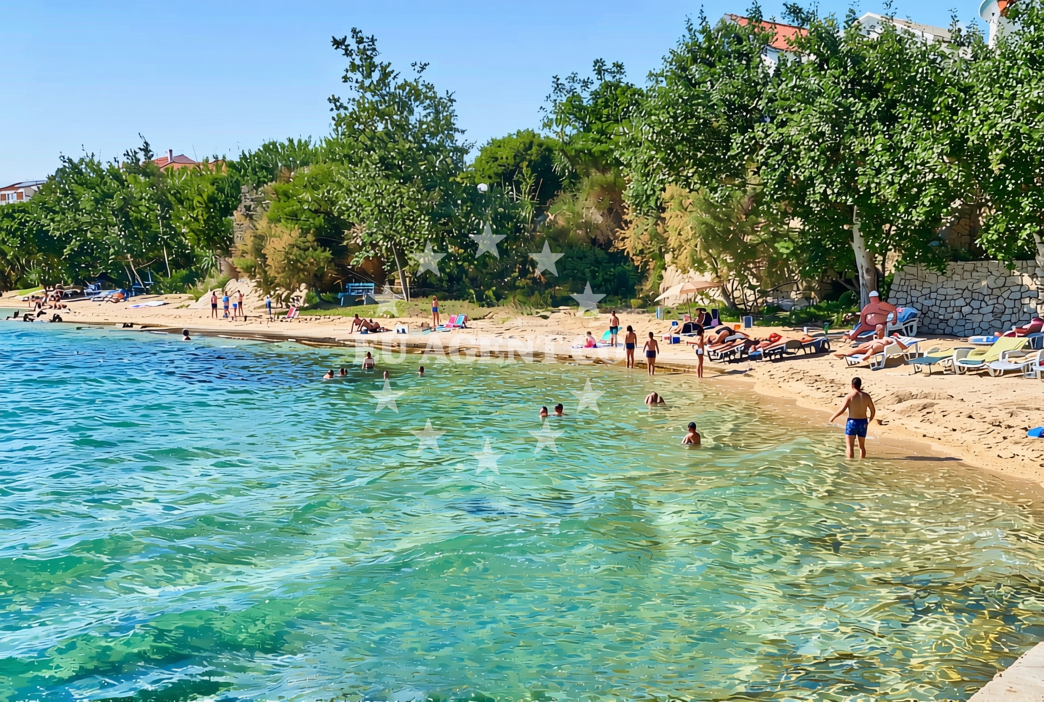
About this beach
Miletići istok, Rtina
Beach: Miletići istok
Location: Rtina
Characteristics and facilities
Gravel, concrete / stone slabs
80 m
Natural shade
Beach character
The beach's surface consists primarily of gravel and concrete/stone slabs, creating a terrain that is more suited for walking or standing than for sunbathing. The 80-meter length offers a modest stretch of shoreline, with natural shade provided by the surrounding topography. This configuration suggests the beach may be more accessible to those seeking a brief stop along the coast rather than an extended day at the water's edge. The lack of formal facilities means visitors should plan accordingly, focusing on the raw coastal character rather than structured beach amenities.Swimming and shore
The gravel and stone slab composition of the shore may present challenges for swimming, as the transition from land to water could be abrupt. However, the beach's natural shade offers a practical advantage for those seeking respite from direct sunlight. The shoreline's texture and length suggest it may be more suitable for short walks or as a vantage point to observe the surrounding coastal landscape rather than for extended aquatic activities.Facilities and activities
No formal facilities are documented for Miletići istok, Rtina Beach. The absence of structured amenities means visitors should not expect services such as showers, restrooms, or seating. Activities appear limited to the natural features of the beach itself, with the gravel and stone slabs defining the primary interaction with the shoreline. The beach's characteristics make it a candidate for brief exploration rather than prolonged use, particularly for those prioritizing accessibility over traditional beach comforts.Access and location
Located in Miletići istok, the beach is part of the broader Dalmatian coast, a region known for its dramatic cliffs and historic settlements. Access is likely via local roads connecting to the area, though specific transportation details are not outlined in the catalog. The beach's position within this coastal stretch places it near other points of interest along the Adriatic, potentially linking it to nearby towns, cultural sites, or sailing routes that define the region's appeal.What to expect
Visitors to Miletići istok, Rtina Beach should anticipate a shoreline defined by gravel and stone slabs, with limited formal amenities. The beach's 80-meter length and natural shade provide a basic framework for coastal engagement. Those planning a visit should consider the terrain's characteristics, as the surface may not be ideal for sunbathing or swimming. The beach's location within the Dalmatian coast suggests it may serve as a brief stop along a larger coastal exploration, rather than a primary destination for extended beach activities.Practical tips
Given the beach's gravel and stone slab surface, visitors are advised to wear appropriate footwear for comfort. The natural shade available can be a useful feature for those seeking sun protection. As no formal facilities are documented, visitors should bring necessary supplies for a self-sufficient visit. The beach's positioning along the Dalmatian coast may offer opportunities to combine the visit with nearby coastal excursions or yacht charter itineraries.Exploring the coast by yacht
For yacht charter guests exploring the Dalmatian coast, Miletići istok, Rtina Beach represents one of many natural shorelines along this popular sailing region. The area's rugged coastline and historic settlements make it a compelling destination for those seeking to combine maritime travel with coastal exploration. While the beach itself may not serve as a primary anchorage point, its location could be incorporated into a broader itinerary that includes nearby bays, marinas, and cultural landmarks along the Adriatic.Regional Context and Coastal Exploration
The Dalmatian coast, where Miletići istok is located, is renowned for its dramatic landscapes and historic towns. Yacht charter guests often navigate this region to access hidden coves, medieval villages, and vibrant maritime culture. While Rtina Beach itself may not be a primary stop for sailors, its proximity to other coastal attractions could make it a useful reference point during a voyage along this part of the Adriatic.Anchorages in the surrounding area
Anchorages in the surrounding area of Rtina, including nearby locations like Vlasici and Tribanj.
- Anchorage — rtina — 1.5 NM from beach
- Anchorage — rtina — 1.9 NM from beach
- Anchorage — vlasici — pag — 2.6 NM from beach
- Anchorage — vrsi — 3.2 NM from beach
- Anchorage — tribanj — 3.2 NM from beach
- Anchorage — ljubac — 3.4 NM from beach
- Anchorage — smokvica — 3.7 NM from beach
- Anchorage — ljubac — 3.7 NM from beach
Distances are straight-line geographic distances, not sailing routes.
Mooring buoys in the surrounding area
Mooring buoys in the surrounding area, such as Ljubac Jetty and Sibuljina Point.
- Jetty — ljubac — 3.1 NM from beach
- Šibuljina Point — sibuljina point — 3.3 NM from beach
- Vir — 8.2 NM from beach
- Punta Skala — petrcane — 9.0 NM from beach
- Jetty — zadar — 11.2 NM from beach
Distances are straight-line geographic distances, not sailing routes.
Marine fuel stations
Marine fuel stations in Zadar and nearby regions like Ugljan and Dugi Otok.
- Ina — zadar — 11.7 NM from beach
- Ina — preko — ugljan — 14.4 NM from beach
- Fuel station — sukosan — 15.5 NM from beach
- Ina — zaglav — dugi otok — 22.4 NM from beach
Distances are straight-line geographic distances, not sailing routes.
Harbours in the surrounding area
Harbours in the surrounding area, including Miškovići on Pag and Nin further east.
- Miškovići — miskovici — pag — 2.6 NM from beach
- Ražanac — razanac — 3.5 NM from beach
- Mulo — nin — 4.1 NM from beach
- Nin — 5.6 NM from beach
- Starigrad Paklenica — 7.1 NM from beach
- Privlaka — 7.3 NM from beach
Distances are straight-line geographic distances, not sailing routes.
Marinas in the surrounding area
Marinas in Zadar and Ugljan, such as Marina Borik and Marina Preko.
- Marina Borik — zadar — 11.2 NM from beach
- Vitrenjak Zadar — 11.3 NM from beach
- Marina Zadar — 11.6 NM from beach
- Olive Island Marina — sutomiscica — ugljan — 13.6 NM from beach
- Marina Preko — ugljan — 14.2 NM from beach
Distances are straight-line geographic distances, not sailing routes.
Navigation guides for the surrounding area
Navigation guides for nearby areas including Otok Pag and Starigrad-Paklenica.
- KrusCica and Uvala KrusCica Duboka — 3.1 NM from beach
- VELESITSKI KANAL (S) — 3.7 NM from beach
- OTOK PAG — 6.8 NM from beach
- Privlaka — 7.1 NM from beach
- Starigrad-Paklenica {Velebitski Kanai) — 7.3 NM from beach
Distances are straight-line geographic distances, not sailing routes.
Yachts from nearby departure bases
Yachts departing from bases like Povljana Marina and Zadar Diklo Port.
Sailing yachts
- Dufour 560 (Anatoli) — Zadar Marina Borik — 11.2 NM from departure base to beach
- Bavaria 44 (Tummy fish) — Zadar Marina Borik — 11.2 NM from departure base to beach
Catamarans
- Sunreef 60 (SINATA) — Zadar Marina Borik — 11.2 NM from departure base to beach
- Leopard 50 (Solaia) — Zadar Marina Borik — 11.2 NM from departure base to beach
Motor yachts
- Prestige 460 (Adudu 2) — Zadar Marina Borik — 11.2 NM from departure base to beach
Motor boats
- Merry Fisher 895 — Povljana Marina — 7.7 NM from departure base to beach
- Rancraft RS Cinque.5 — Zadar Diklo Port — 10.0 NM from departure base to beach
- Rancraft RM21 (Dugi otok) — Zadar Diklo Port — 10.0 NM from departure base to beach
- Rancraft RM19 (Daycruiser) — Zadar Diklo Port — 10.0 NM from departure base to beach
- Merry Fisher 795 (KlaPa) — Zadar Marina Borik — 11.2 NM from departure base to beach
Distances are straight-line geographic distances, not sailing routes.