Maslinčica Zapad, Veli Iž (Iž) Beach, Croatia
Maslinčica Zapad, located on the island of Iž in Croatia’s Adriatic Sea, is a secluded stretch of coastline that offers a quiet alternative to more crowded shores. Nestled within the broader Dalmatian coast, this beach benefits from the region’s reputation for clear waters, rugged cliffs, and a network of nearby islands that make it a natural hub for sailing enthusiasts. While the beach itself remains understated in its details, its location within the Iž archipelago places it near a range of maritime routes, marinas, and cultural landmarks that define the area’s character.
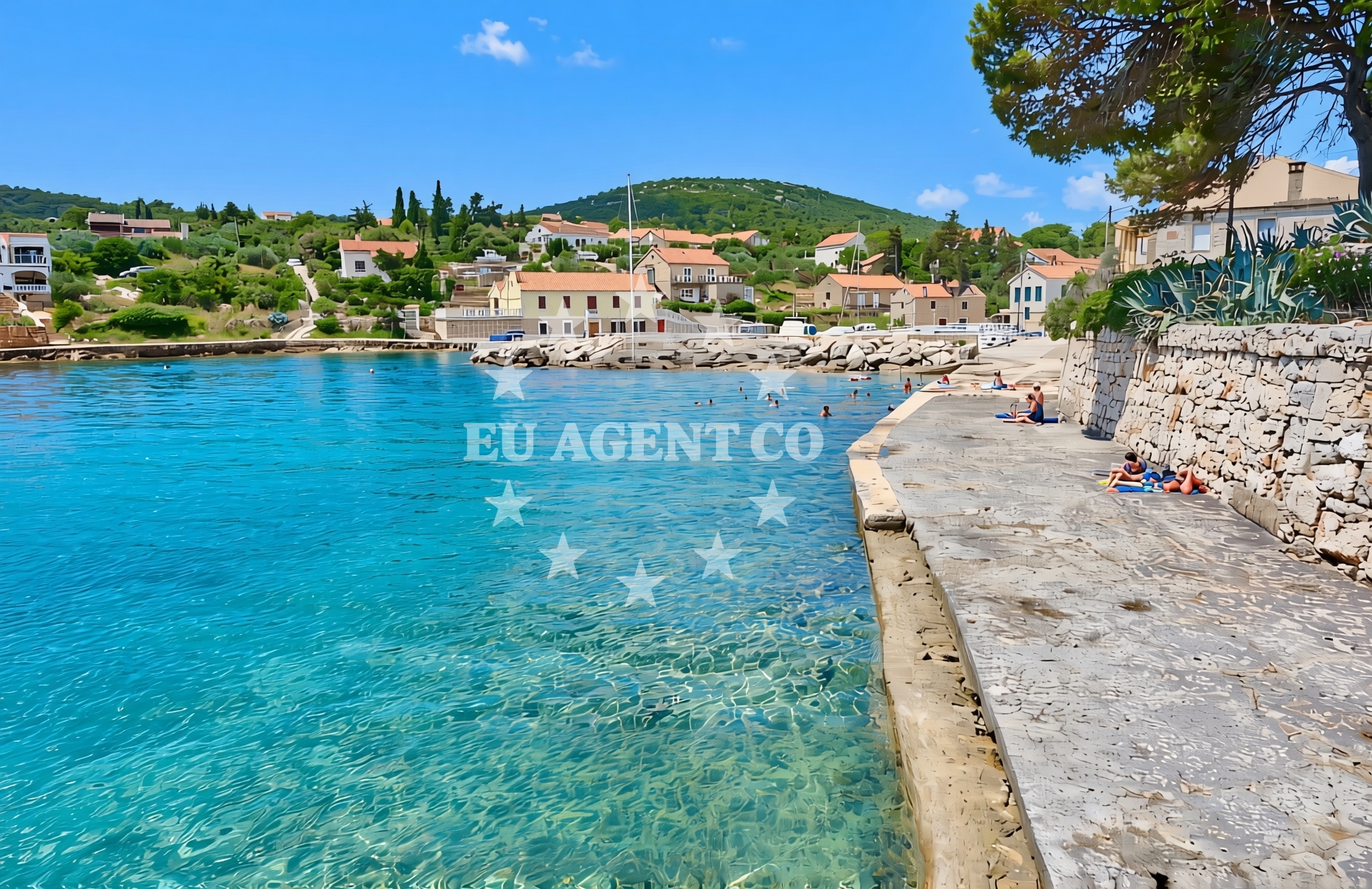
About this beach
Maslinčica zapad, Veli Iž (Iž)
Beach: Maslinčica zapad
Location: Veli Iž (Iž)
Beach character
The beach’s name—Maslinčica Zapad—translates to ‘West Maslinčica,’ indicating its position relative to another nearby shore. The area’s geography is shaped by the broader Iž island, which is part of a chain of small islands and islets along the coast of Croatia’s central Dalmatia. These islands are known for their limestone cliffs, olive groves, and traditional stone houses, creating a landscape that blends natural beauty with historical presence. While specific details about the beach’s sand or rock composition are not documented, the general character of the region suggests a mix of pebbles and fine sand, typical of the Adriatic’s coastal profile.
Swimming and shore
The Adriatic Sea’s waters in this region are generally calm and transparent, making swimming a practical activity. The absence of documented natural features such as caves or rock formations means the shore is likely a straightforward stretch of coastline, suitable for sunbathing and light water activities. The beach’s orientation toward the open sea may mean it experiences moderate wave action, though local conditions would depend on seasonal winds and tides. For those seeking sheltered waters, nearby bays and inlets on Iž may offer more protected environments.
Facilities and activities
No specific facilities or structured activities are listed for Maslinčica Zapad. However, the broader Iž island and its surrounding waters are part of a network of coastal settlements that support a range of amenities, including small harbors, local taverns, and seasonal boat rentals. Visitors may find opportunities for snorkeling, kayaking, or simply exploring the nearby islets by boat. The lack of formal amenities at the beach itself suggests a focus on natural immersion rather than commercialized recreation.
Access and location
Reaching Maslinčica Zapad requires navigating to the island of Iž, which is part of the Šibenik-Knin County. The nearest major settlement is Šibenik, a town known for its medieval fortresses and proximity to the Krka National Park. Travelers may arrive by ferry from Šibenik or via road connections to the island’s main landing points. The beach’s remote character means it is less likely to be a primary stop for organized tours, making it a destination for those seeking solitude or independent exploration of the area’s lesser-known shores.
What to expect
Visitors to Maslinčica Zapad can anticipate a beach experience defined by its isolation and integration with the natural landscape of Iž. The absence of formal facilities means the focus is on the raw coastal environment, with opportunities to enjoy the Adriatic’s waters and the island’s traditional architecture. The beach’s location near Šibenik and its surrounding islands positions it within a region known for its sailing routes, historical sites, and cultural heritage. Those planning a visit should consider the island’s seasonal accessibility and the practicalities of reaching the shore, as the beach is not served by direct transport links.
Practical tips
Given the beach’s remote nature, visitors should plan transportation in advance, as there are no direct services to Maslinčica Zapad. Bringing supplies such as water, sunscreen, and a picnic is advisable, as local amenities may be limited. The area’s maritime character means that weather conditions can influence access and comfort, particularly during the sailing season when winds and waves are more pronounced.
Exploring the coast by yacht
The waters around Iž are part of a broader sailing region that includes the Šibenik archipelago and the Krka River estuary. Yacht charter guests exploring this area may find Maslinčica Zapad as a potential stopover, particularly for those seeking a quiet anchorage away from more crowded marinas. The nearby port of Šibenik offers a range of charter services, and the surrounding islands provide opportunities for day trips, cultural visits, and exploration of the region’s natural beauty. For those interested in booking a yacht, Euro-Agent’s Yacht Search page provides access to available vessels and sailing options in the area.
Cultural and Historical Context
The island of Iž, like many in the Šibenik archipelago, has a history tied to the medieval Kingdom of Croatia and the Venetian Republic. Traditional stone houses and olive groves reflect centuries of agricultural and maritime life. Nearby Šibenik, a UNESCO World Heritage site, is home to the St. Nicholas Fortress and the Šibenik Cathedral, both of which highlight the region’s historical significance. These cultural elements provide context for the area’s enduring connection to the sea and its role in shaping local traditions.
Anchorages in the surrounding area
Anchorages in the surrounding area include Anchorage — iz, Anchorage — rava, and Anchorage — ugljan near Maslinčica zapad, Veli Iž (Iž) Beach.
- Anchorage — iz — 1.4 NM from beach
- Anchorage — rava — 2.6 NM from beach
- Anchorage — iz mali — 2.6 NM from beach
- Anchorage — rava — 2.7 NM from beach
- Anchorage — ugljan — 3.0 NM from beach
- Anchorage — ugljan — 3.0 NM from beach
- Anchorage — rava — 3.1 NM from beach
- Anchorage — ugljan — 3.6 NM from beach
Distances are straight-line geographic distances, not sailing routes.
Mooring buoys in the surrounding area
Mooring buoys in the surrounding area include Jetty — iz veli, Buoy field — iz, and Konoba Baroni buoys — iz near Maslinčica zapad, Veli Iž (Iž) Beach.
- Jetty — iz veli — 0.0 NM from beach
- Buoy field — iz — 1.7 NM from beach
- Konoba Baroni buoys — iz — 1.7 NM from beach
- Restaurant Knez jetty — iz — 1.8 NM from beach
- Jetty — iz mali — 2.2 NM from beach
Distances are straight-line geographic distances, not sailing routes.
Marine fuel stations
Marine fuel stations include Ina — preko — ugljan and Ina — zadar near Maslinčica zapad, Veli Iž (Iž) Beach.
- Ina — preko — ugljan — 3.8 NM from beach
- Ina — zadar — 6.3 NM from beach
- Ina — zaglav — dugi otok — 6.6 NM from beach
- Fuel station — sukosan — 8.1 NM from beach
Distances are straight-line geographic distances, not sailing routes.
Harbours in the surrounding area
Harbours in the surrounding area include Iž Veli — iz veli and Mala Rava near Maslinčica zapad, Veli Iž (Iž) Beach.
- Iž Veli — iz veli — 0.3 NM from beach
- Mala Rava — 2.5 NM from beach
- Bršanj — iz mali — 2.6 NM from beach
- Bršanj — iz mali — 2.6 NM from beach
- Vela Rava — 3.0 NM from beach
- Lukoran — ugljan — 3.4 NM from beach
Distances are straight-line geographic distances, not sailing routes.
Marinas in the surrounding area
- Marina Veli Iž — iz veli — 0.4 NM from beach
- Olive Island Marina — sutomiscica — ugljan — 3.5 NM from beach
- Marina Preko — ugljan — 3.7 NM from beach
- Marina Borik — zadar — 6.2 NM from beach
- Kukljica — ugljan — 6.2 NM from beach
Distances are straight-line geographic distances, not sailing routes.
Restaurants near the beach
Restaurants near the beach include Lanterna — iz veli, Mandrac — iz veli, and Konoba Kod Barbe — iz veli near Maslinčica zapad, Veli Iž (Iž) Beach.
- Lanterna — iz veli — 0.3 NM from beach
- Mandrac — iz veli — 0.4 NM from beach
- Konoba Kod Barbe — iz veli — 0.4 NM from beach
- Konoba Luzarija — iz veli — 0.4 NM from beach
- Baroni — iz — 1.7 NM from beach
- Knez — iz — 1.8 NM from beach
- Konoba Gajeta — iz mali — 2.1 NM from beach
Distances are straight-line geographic distances, not sailing routes.
Navigation guides for the surrounding area
Navigation guides for the surrounding area include Uvala Saline and Uvala Knez near Maslinčica zapad, Veli Iž (Iž) Beach.
- Uvala Saline — 1.2 NM from beach
- Uvala Knez — 1.9 NM from beach
- Uvala Lokvino (Mala Rava) — 2.4 NM from beach
- Uvala Brsanj — 2.7 NM from beach
- Lukoran Veli — 3.5 NM from beach
Distances are straight-line geographic distances, not sailing routes.
Yachts from nearby departure bases
Sailing yachts
- Elan Impression 40 (Val) — Ugljan Sutomišćica Olive Island — 3.5 NM from departure base to beach
- Dufour 560 (Tara) — Zadar Marina Borik — 6.2 NM from departure base to beach
- Oceanis 40.1 (Stobrec) — Zadar Marina Borik — 6.2 NM from departure base to beach
Catamarans
- Sunreef 60 (SINATA) — Zadar Marina Borik — 6.2 NM from departure base to beach
- Leopard 50 (Solaia) — Zadar Marina Borik — 6.2 NM from departure base to beach
Motor yachts
- Ferretti 780 (TESORO) — Zadar Marina Borik — 6.2 NM from departure base to beach
- Prestige 460 (ADUDU 2) — Zadar Marina Borik — 6.2 NM from departure base to beach
Motor boats
- Quicksilver Activ 905 (Galeb) — Ugljan Sutomišćica Olive — 3.5 NM from departure base to beach
- Adria 28 Luxus (Ana) — Brbinj Marina — 5.1 NM from departure base to beach
- Antares 36 (Setemana) — Zadar Marina Borik — 6.2 NM from departure base to beach
Distances are straight-line geographic distances, not sailing routes.