Mali raj, Baška (Krk) Beach, Croatia
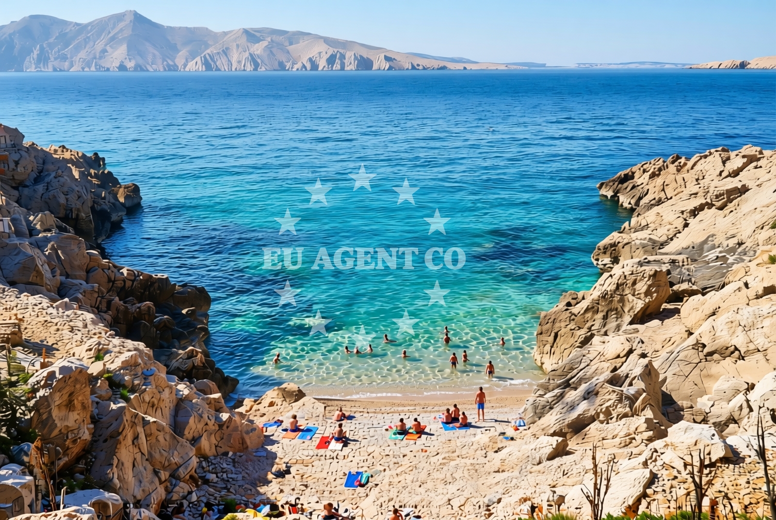
Mali raj Beach lies along the eastern shore of Baška, a coastal town on Krk Island in Croatia's Kvarner Gulf. This stretch of coastline features a rocky shoreline composed of pebbles, gravel, and exposed bedrock, with natural shade provided by coastal vegetation. The beach's proximity to Baška's harbor and the broader Krk archipelago makes it a point of interest for visitors exploring the island's northern coast.
About this beach
Mali raj, Baška (Krk)
Beach: Mali raj
Location: Baška (Krk)
Characteristics and facilities
Pebbles, gravel, rocks
10 m
Natural shade
Beach character
The beach's rocky terrain creates a unique setting for sunbathing and coastal exploration. The 10-meter-wide shoreline is characterized by uneven surfaces, requiring sturdy footwear for safe navigation. Natural shade from low-lying shrubs and trees offers limited relief from direct sunlight, particularly in the afternoon. The absence of artificial structures or amenities means visitors should prepare for a more rustic, nature-focused experience.
Swimming and shore
Swimming conditions at Mali raj are influenced by the rocky seabed and variable wave action. The shoreline's composition makes it unsuitable for recreational swimming, with deeper water zones forming immediately offshore. The beach's orientation toward the open sea means it is exposed to prevailing winds from the northeast, which can create choppy conditions during stronger breezes. The rocky substrate provides opportunities for exploring tidal pools and marine life along the shore.
Facilities and activities
No permanent facilities are present at Mali raj Beach. The lack of infrastructure means there are no lifeguard services, parking areas, or recreational amenities. The beach's natural character makes it unsuitable for organized activities, though it offers a quiet vantage point for observing maritime traffic passing through the Baška harbor. The rocky terrain limits the practicality of water sports or beach games.
Access and location
Access to Mali raj Beach is via a short walk from the main road running along Baška's eastern coast. The beach is located approximately 3 kilometers northeast of Baška's central area, with the nearest significant settlement being the town of Baška itself. The beach's position on Krk Island places it within reach of the island's main road network, though there are no dedicated parking areas or access roads leading directly to the shore.
What to expect
Visitors should expect a rugged, undeveloped shoreline with no amenities or services. The beach's rocky nature requires careful navigation, particularly during low tide when exposed bedrock becomes more pronounced. The natural shade provided by coastal vegetation offers limited respite from sunlight, making it most suitable for visitors seeking a remote, low-impact coastal experience. The beach's proximity to Baška's harbor means it is occasionally used by local fishing boats and leisure craft.
Practical tips
Visitors are advised to wear sturdy footwear to navigate the rocky shoreline safely. Sun protection is essential due to the limited shade available. The beach's exposure to maritime traffic means visitors should remain vigilant when near the water's edge. There are no designated entry points or signage, so navigation should be done with care.
Exploring the coast by yacht
For yacht charter guests, Mali raj Beach offers a vantage point for observing the Baška harbor and the broader Krk archipelago. The beach's location on the northern coast of Krk places it within sailing distance of the island's main marina in Baška, as well as the nearby islands of Cres and Lošinj. The Kvarner Gulf's sheltered waters make this region a popular sailing destination, with routes extending to the Istrian Peninsula and the northern Dalmatian coast. Yacht charter guests may use the Baška harbor as a base for exploring the surrounding coastline and anchorages.
Regional Context and Coastal Features
Krk Island, where Mali raj Beach is located, is the largest island in the Kvarner Gulf and a key waypoint for maritime traffic between the Istrian Peninsula and the mainland. The island's northern coast, including Baška, features a series of rocky inlets and shallow bays that create a complex navigational environment. The surrounding waters are known for their clear visibility and moderate currents, making them suitable for sailing excursions. The island's historical significance as a Roman settlement adds cultural context to the region's coastal landscape.
Anchorages in the surrounding area
Anchorages near Vela Luka and Mala Luka provide nearby options for mooring in the Krk area.
- Anchorage — baska — krk — 1.2 NM from beach
- Vela Luka — krk — 1.4 NM from beach
- Mala Luka — krk — 1.7 NM from beach
- Anchorage — krk — 2.4 NM from beach
- Bracol — krk — 2.6 NM from beach
- Anchorage — prvic istria — 2.7 NM from beach
- Anchorage — krk — 3.6 NM from beach
- Anchorage — krk — 3.8 NM from beach
Distances are straight-line geographic distances, not sailing routes.
Mooring buoys in the surrounding area
- Jetty — krk — 1.3 NM from beach
- Jetty — krk — 1.4 NM from beach
- Buoy field — krk — 2.6 NM from beach
- Jetty — stara baska — krk — 3.9 NM from beach
- Jetty — stara baska — krk — 4.0 NM from beach
Distances are straight-line geographic distances, not sailing routes.
Marine fuel stations
Fuel stations in Krk and nearby locations ensure easy refueling for vessels in the region.
- Flash — krk — 9.4 NM from beach
- Ina — krk — 9.5 NM from beach
- INA — novi vinodolski — 9.6 NM from beach
- Ina — rab — 12.5 NM from beach
Distances are straight-line geographic distances, not sailing routes.
Harbours in the surrounding area
Harbors such as Baška and Senj are situated in close proximity, offering convenient access points for yachts and boats.
- Baška — baska — krk — 0.9 NM from beach
- Senj — 5.3 NM from beach
- St. Juraj — st juraj — 6.3 NM from beach
- Punat — krk — 7.3 NM from beach
- Melna — goli otok — 7.3 NM from beach
- Lukovo — 8.1 NM from beach
Distances are straight-line geographic distances, not sailing routes.
Marinas in the surrounding area
- Marina Punat — krk — 7.6 NM from beach
- Mitan Marina — novi vinodolski — 9.4 NM from beach
- Marina Novi — novi vinodolski — 9.6 NM from beach
- ACI Marina Supetarska Draga — rab — 10.1 NM from beach
- Šilo — silo — krk — 12.0 NM from beach
Distances are straight-line geographic distances, not sailing routes.
Restaurants near the beach
Restaurants in Baska and surrounding areas offer dining options for visitors to the Mali raj beach.
- Restaurant — baska — krk — 0.9 NM from beach
- Restaurant — baska — krk — 0.9 NM from beach
- Vela Luka — krk — 1.3 NM from beach
- Mala Luka — krk — 1.8 NM from beach
- Restaurant — krk — 2.6 NM from beach
- Restaurant — stara baska — krk — 3.9 NM from beach
- Mariana Restaurant — stara baska — krk — 4.0 NM from beach
Distances are straight-line geographic distances, not sailing routes.
Navigation guides for the surrounding area
- Baška — 0.6 NM from beach
- Uvala Vela Luka — 1.6 NM from beach
- Senj — 5.4 NM from beach
- Uvala Sv. Jelena — 5.6 NM from beach
- Jurjevo (Luka Sv. Juraj) — 6.4 NM from beach
Distances are straight-line geographic distances, not sailing routes.
Yachts from nearby departure bases
Yachts departing from Krk Punat port and Marina Punat offer sailing opportunities in the Krk region.
Sailing yachts
- First 25.7 (Petra) — Krk Punat port — 7.3 NM from departure base to beach
- Salona 45 (Nati) — Krk Punat port — 7.3 NM from departure base to beach
- Oceanis 34 (Star Elisabeth) — Krk Marina Punat — 7.6 NM from departure base to beach
- Bavaria 44 (Plavac mali) — Krk Marina Punat — 7.6 NM from departure base to beach
Catamarans
- Lagoon 380 (Xenia) — Krk Punat port — 7.3 NM from departure base to beach
- Lagoon 440 (OCEANUS) — Krk Marina Punat — 7.6 NM from departure base to beach
- Lavezzi 40 (Mrs. Brightside) — Krk Marina Punat — 7.6 NM from departure base to beach
Motor yachts
- Elegance 60 Fly (LIFESTYLE 1) — Krk Marina Punat — 7.6 NM from departure base to beach
- Galeon 500 Fly (Barbara) — Krk Marina Punat — 7.6 NM from departure base to beach
Motor boats
- Beneteau Flyer 9 (Beneteau 9) — Krk Marina Punat — 7.6 NM from departure base to beach
Distances are straight-line geographic distances, not sailing routes.