Mala voda, Dragove (Dugi otok) Beach, Croatia
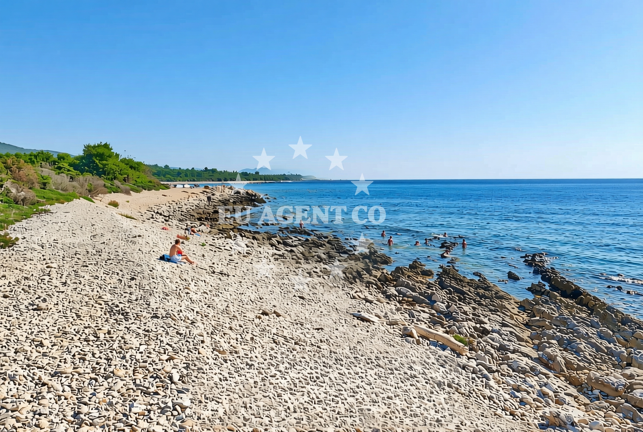
Mala voda, Dragove (Dugi otok) Beach lies on the eastern shore of Dugi Otok, one of the largest islands in the Adriatic Sea. This gravel and rock coastline offers a stark contrast to the island’s more sheltered coves, presenting a rugged yet inviting landscape for those seeking a different kind of coastal experience. Its position on Dugi Otok, a destination known for its dramatic cliffs and clear waters, situates it within a region that draws sailors, hikers, and nature enthusiasts.
About this beach
Mala voda, Dragove (Dugi otok)
Beach: Mala voda
Location: Dragove (Dugi otok)
Characteristics and facilities
Gravel, rocks
Beach character
The beach’s defining feature is its gravel and rocky terrain, which extends along the shoreline in uneven patterns. This composition makes it unsuitable for swimming but creates a unique environment for exploring tidal pools and observing marine life. The lack of sand gives the beach a distinct, almost lunar quality, particularly during low tide. The rocks are generally stable, though visitors should exercise caution during high waves or slippery conditions.
Swimming and shore
Swimming is not recommended here due to the rocky seabed and unpredictable wave action. However, the shore offers opportunities for rock pooling, where intertidal creatures such as crabs, sea urchins, and anemones can be observed. The beach’s exposure to the open sea means it is subject to stronger currents than more sheltered parts of Dugi Otok, making it a less common stop for families with young children.
Facilities and activities
No formal facilities are present at Mala voda, Dragove Beach. There are no lifeguard services, restrooms, or shaded seating areas. The absence of infrastructure aligns with its character as a more remote and natural site. Activities are limited to walking along the shore, photography, and casual exploration of the rocky terrain. The beach’s location on Dugi Otok means it is accessible to hikers and cyclists traveling along the island’s trails.
Access and location
Reaching Mala voda requires a journey to Dugi Otok, which is accessible by ferry from the mainland town of Supetar on Brac Island. The beach is located near the Dragove settlement, a small hamlet on the island’s northeastern coast. Visitors arriving by car will need to park in Dragove or nearby Supetar and walk to the beach, which is approximately 2 kilometers from the village. The route involves a mix of gravel paths and coastal roads.
What to expect
Visitors should prepare for a beach experience that prioritizes natural beauty over comfort. The gravel and rock surface requires sturdy footwear, and the lack of amenities means self-sufficiency is essential. The beach is best suited for those interested in geological features, coastal ecology, or photography. Its position on Dugi Otok also makes it a potential stop for sailors exploring the island’s western coast, though it is not a typical anchorage due to its exposed location.
Practical tips
Bring sturdy shoes to navigate the rocky terrain and consider visiting during low tide for easier access to the shore. Sun protection is advisable, as the open exposure to the Adriatic can lead to strong sunlight even in cooler months. Those interested in Dugi Otok’s sailing routes may want to consult local charts for safe navigation around the island’s northern reaches.
Exploring the coast by yacht
For sailors, Mala voda’s position on Dugi Otok places it within a key section of the Adriatic’s eastern coast, known for its challenging but rewarding passages. The beach is near the island’s westernmost points, which are often used as reference points for navigating the channels between Brac and Hvar. While not a marina or anchorage itself, its proximity to Dragove and Supetar means it is within reach of the island’s more developed sailing infrastructure, including fuel stations and charter bases.
Dugi Otok’s Coastal Geography
Dugi Otok’s coastline is marked by a mix of cliffs, caves, and rocky beaches, with Mala voda representing one of the more rugged sections. The island’s geology, shaped by limestone formations, contributes to the beach’s gravelly composition. This terrain is typical of the island’s northern and western coasts, which are less sheltered than the southern shores.
Sailing Routes Near Dugi Otok
The waters around Dugi Otok are part of a broader network of Adriatic sailing routes, with the island acting as a natural waypoint between Brac, Hvar, and the mainland. Sailors navigating these waters should be aware of shifting currents and the need for careful route planning, particularly near the island’s northern tip.
Anchorages in the surrounding area
Anchorages in the surrounding area include Dragove, Soline, and Zverinac on Dugi Otok, as well as other nearby locations.
- Anchorage — dragove — dugi otok — 1.5 NM from beach
- Anchorage — dragove — dugi otok — 1.5 NM from beach
- Sakarun — soline — dugi otok — 3.1 NM from beach
- Anchorage — soline — dugi otok — 3.5 NM from beach
- Anchorage — zverinac — 3.5 NM from beach
- Anchorage — dugi otok — 3.6 NM from beach
- Anchorage — dugi otok — 3.9 NM from beach
- Lučica — soline — dugi otok — 4.0 NM from beach
Distances are straight-line geographic distances, not sailing routes.
Mooring buoys in the surrounding area
- Quay — dragove — dugi otok — 1.0 NM from beach
- Buoy field — brbinj — dugi otok — 2.7 NM from beach
- Jetty — brbinj — dugi otok — 3.0 NM from beach
- Buoy field Sakarun — soline — dugi otok — 3.3 NM from beach
- Buoy field — brbinj — dugi otok — 3.5 NM from beach
Distances are straight-line geographic distances, not sailing routes.
Marine fuel stations
Marine fuel stations are located in Preko on Ugljan, Zaglav on Dugi Otok, Zadar, and Sukosan.
- Ina — preko — ugljan — 11.5 NM from beach
- Ina — zaglav — dugi otok — 12.7 NM from beach
- Ina — zadar — 13.0 NM from beach
- Fuel station — sukosan — 16.1 NM from beach
Distances are straight-line geographic distances, not sailing routes.
Harbours in the surrounding area
Harbours in the surrounding area include Božava and Brbinj on Dugi Otok, as well as Zverinac and other nearby ports.
- Božava — bozava — dugi otok — 2.9 NM from beach
- Brbinj — dugi otok — 3.4 NM from beach
- Zverinac — 4.0 NM from beach
- Kablin — sestrunj — 4.3 NM from beach
- Veli Rat — dugi otok — 4.4 NM from beach
- Hrvatin — sestrunj — 4.9 NM from beach
Distances are straight-line geographic distances, not sailing routes.
Marinas in the surrounding area
- Marina Veli Rat — dugi otok — 4.6 NM from beach
- Marina Veli Iž — iz veli — 8.2 NM from beach
- Olive Island Marina — sutomiscica — ugljan — 10.4 NM from beach
- Marina Preko — ugljan — 11.2 NM from beach
- Marina Borik — zadar — 12.3 NM from beach
Distances are straight-line geographic distances, not sailing routes.
Restaurants near the beach
Restaurants near the beach are clustered in Bozava and Brbinj on Dugi Otok, offering local cuisine and dining options.
- Restaurant Konoba Kadulja — bozava — dugi otok — 2.8 NM from beach
- Boxavia — bozava — dugi otok — 2.8 NM from beach
- Veli Kamik — bozava — dugi otok — 2.8 NM from beach
- Restaurant — bozava — dugi otok — 2.9 NM from beach
- Gostionica Oleander — bozava — dugi otok — 2.9 NM from beach
- Antonio — brbinj — dugi otok — 3.4 NM from beach
- Amarcord — soline — dugi otok — 3.4 NM from beach
Distances are straight-line geographic distances, not sailing routes.
Navigation guides for the surrounding area
- Božava — 2.8 NM from beach
- Dugi Otok -Bozava — 3.3 NM from beach
- Zverinac — 3.9 NM from beach
- Uvala Kablin — 4.5 NM from beach
- Luka Soliscica — 4.5 NM from beach
Distances are straight-line geographic distances, not sailing routes.
Yachts from nearby departure bases
Yachts from nearby departure bases include motor boats and sail boats based in Brbinj, Ugljan, and Zadar, offering charters to the area.
Sailing yachts
- Elan Impression 40 (Val) — Ugljan Sutomišćica Olive Island — 10.4 NM from departure base to beach
- Bavaria Cruiser 37 (Lupe) — Zadar Marina Borik — 12.3 NM from departure base to beach
- Bavaria 44 (Medena) — Zadar Marina Borik — 12.3 NM from departure base to beach
Catamarans
- Sunreef 60 (SINATA) — Zadar Marina Borik — 12.3 NM from departure base to beach
- Leopard 50 (Solaia) — Zadar Marina Borik — 12.3 NM from departure base to beach
Motor yachts
- Prestige 460 (ADUDU 2) — Zadar Marina Borik — 12.3 NM from departure base to beach
- Ferretti 780 (TESORO) — Zadar Marina Borik — 12.3 NM from departure base to beach
Motor boats
- Adria 28 Luxus (Ana) — Brbinj Marina — 3.0 NM from departure base to beach
- Quicksilver Activ 905 (Galeb) — Ugljan Sutomišćica Olive — 10.4 NM from departure base to beach
- Merry Fisher 895 — Zadar Marina Borik — 12.3 NM from departure base to beach
Distances are straight-line geographic distances, not sailing routes.