Majerovica Beach, Hvar, Croatia
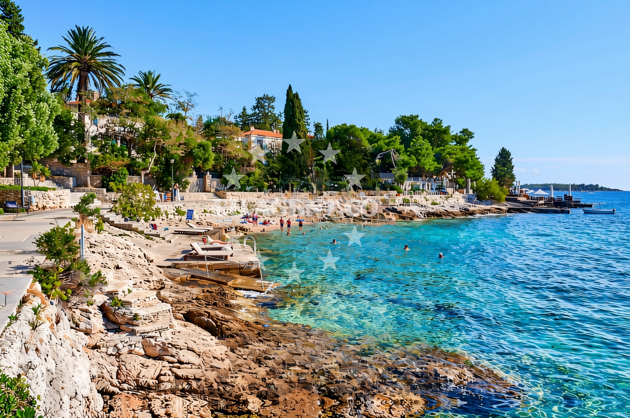
Majerovica Beach is a distinctive shoreline located on the island of Hvar, part of Croatia's Dalmatian Coast. This beach is characterized by its gravelly and rocky terrain, offering a unique contrast to the more typical sandy beaches found in the region. Situated on the southern coast of Hvar, it provides a glimpse into the island's rugged natural landscape. While the beach does not feature traditional amenities, its location makes it a point of interest for those exploring the Hvar coastline.
About this beach
Majerovica, Hvar (Hvar)
Beach: Majerovica
Location: Hvar (Hvar)
Characteristics and facilities
Gravel, concrete / stone slabs, rocks
Beach character
The beach's surface is composed primarily of gravel, concrete slabs, and rocky outcrops, creating a terrain that is more suited to walking than sunbathing. This composition reflects the natural geological features of the Hvar coast, where limestone formations and coastal erosion have shaped the shoreline. The lack of fine sand means that visitors should consider appropriate footwear for comfort. The beach does not extend into a large cove or bay, instead forming a narrow strip along the coastline. Its proximity to Hvar Town, the island's main settlement, makes it a convenient stop for those exploring the area by foot or vehicle.
Swimming and shore
Swimming conditions at Majerovica Beach are influenced by its rocky and gravelly nature. The shoreline is not ideal for wading, and the water's edge is marked by uneven surfaces. While the Adriatic Sea is generally known for its clear waters, specific details about water quality or depth at this location are not documented in the beach's records. Visitors should be mindful of the terrain when entering the water, as the rocky bottom may make swimming less comfortable than at more sheltered beaches. The beach's orientation along the coast means it is exposed to open sea conditions, which can affect wave patterns and safety during certain weather conditions.
Facilities and activities
No formal facilities or structured activities are listed for Majerovica Beach. The absence of amenities such as showers, restrooms, or seating reflects its status as a more natural, undeveloped shoreline. The beach does not appear to host organized events or seasonal activities, and there is no indication of rental services for equipment such as snorkeling gear or kayaks. Its primary appeal lies in its location and the opportunity to observe the raw coastal landscape of Hvar. Visitors are advised to bring their own supplies for comfort, as there are no on-site services or retail offerings.
Access and location
Access to Majerovica Beach is via the coastal road on Hvar, which connects to the island's main settlements and tourist infrastructure. The beach is located near the southern part of the island, within reach of Hvar Town, which serves as a hub for transportation, dining, and accommodations. For those arriving by boat, the nearby marinas in Hvar Town provide access points to the surrounding coastline. The beach's exact coordinates (43.172251, 16.431468) place it in a region that is part of the broader Adriatic sailing routes, making it a potential stop for yacht charter guests exploring the area.
What to expect
Visitors to Majerovica Beach should expect a natural, undeveloped shoreline with a gravelly and rocky composition. The beach is not equipped with traditional amenities such as sunbeds, umbrellas, or refreshment stands. Its location on the Hvar coast offers proximity to the island's cultural and historical sites, including Hvar Town and the nearby vineyards that are a hallmark of the region. The beach's terrain may be challenging for those seeking a relaxed, sandy environment, but it provides an opportunity to experience the unaltered coastal landscape of the Adriatic. The area is best suited for visitors interested in exploring the natural geography of Hvar rather than seeking a conventional beach day.
Practical tips
Due to the beach's rocky and gravelly surface, visitors are advised to wear sturdy footwear for comfort. Sun protection is essential, as there are no shaded areas or umbrellas available. Those planning to visit should bring their own supplies, as there are no on-site facilities for food, drinks, or personal care. The beach's proximity to Hvar Town means that visitors can easily access restaurants, shops, and other amenities in the nearby settlement.
Exploring the coast by yacht
The location of Majerovica Beach on the island of Hvar places it within a region that is popular among yacht charter guests. The Adriatic Sea's calm waters and the island's scenic coastline make it a favored destination for sailing excursions. Yacht charter guests exploring the Hvar area may find this beach to be a convenient stop, particularly for those seeking to observe the island's natural landscapes. The nearby marinas in Hvar Town provide docking options for motor yachts and sailing boats, allowing visitors to easily access the surrounding coast. While Majerovica Beach itself is not a traditional anchorage, its proximity to the island's main settlements and sailing routes makes it a potentially interesting point of interest for charter guests.
Cultural and Historical Context of Hvar
The island of Hvar, where Majerovica Beach is located, is known for its rich history, medieval architecture, and vibrant cultural scene. Hvar Town, the island's main settlement, is a UNESCO-protected site with a well-preserved old town, Venetian fortifications, and a bustling harbor. The island is also renowned for its production of high-quality wines, particularly white varieties such as Plavac Mali. Visitors to Majerovica Beach may find it rewarding to explore these cultural elements, which are accessible via the nearby coastal road and marinas.
Anchorages in the surrounding area
Anchorages near Hvar provide mooring options within a short distance of Majerovica Beach.
- Anchorage — hvar — 0.4 NM from beach
- Anchorage — hvar — 0.5 NM from beach
- Stipanska — marinkovac — 0.9 NM from beach
- Ždrilca Bay — zdrilca bay — marinkovac — 0.9 NM from beach
- Ždrilca Bay — zdrilca bay — marinkovac — 1.0 NM from beach
- Anchorage — hvar — 1.2 NM from beach
- Anchorage — hvar — 1.2 NM from beach
- Anchorage — hvar — 1.2 NM from beach
Distances are straight-line geographic distances, not sailing routes.
Mooring buoys in the surrounding area
Mooring buoys in Hvar and Marinkovac are located near Majerovica Beach.
- Jetty — hvar — 0.2 NM from beach
- Buoy field — hvar — 0.3 NM from beach
- Single Buoys Hvar — 0.4 NM from beach
- Quay — marinkovac — 1.0 NM from beach
- Antonio Patak Restaurant buoys — marinkovac — 1.0 NM from beach
Distances are straight-line geographic distances, not sailing routes.
Marine fuel stations
Fuel stations in Hvar and nearby areas serve boats traveling to Majerovica Beach.
- Fuel station — hvar — 0.6 NM from beach
- Ina — milna brac — 9.3 NM from beach
- Ina — vrboska — hvar — 10.6 NM from beach
- Fuel station — bol — brac — 11.1 NM from beach
Distances are straight-line geographic distances, not sailing routes.
Harbours in the surrounding area
- Hvar — 0.4 NM from beach
- Vira — hvar — 1.1 NM from beach
- Stari Grad — hvar — 7.1 NM from beach
- Marina Bilo Idro — sveta nedjelja — hvar — 7.2 NM from beach
- Milna — milna brac — 9.4 NM from beach
- Vrboska — hvar — 10.6 NM from beach
Distances are straight-line geographic distances, not sailing routes.
Marinas in the surrounding area
- ACI Marina Palmižana — aci marina palmizana — st klement — 1.7 NM from beach
- ACI Marina Milna — milna brac — 9.3 NM from beach
- Marina Milna Kanarija — milna brac — 9.3 NM from beach
- Marina Vlaška — milna brac — 9.5 NM from beach
- ACI Marina Vrboska — hvar — 10.7 NM from beach
Distances are straight-line geographic distances, not sailing routes.
Restaurants near the beach
- Restaurant — hvar — 0.3 NM from beach
- Restaurant — hvar — 0.3 NM from beach
- Dva Ribara — hvar — 0.3 NM from beach
- Dalmatino — hvar — 0.4 NM from beach
- Junior — hvar — 0.4 NM from beach
- Gariful — hvar — 0.5 NM from beach
- Macondo — hvar — 0.5 NM from beach
Distances are straight-line geographic distances, not sailing routes.
Navigation guides for the surrounding area
Navigation guides for Hvar and nearby bays assist in planning routes to Majerovica Beach.
- Luka Mala Garska — 0.4 NM from beach
- Uvala Vira (Uvala Pribinja) — 1.4 NM from beach
- Uvala Vinogradisce — 1.9 NM from beach
- Uvala Duboka Vela — 2.0 NM from beach
- Uvala Stari Stani — 2.2 NM from beach
Distances are straight-line geographic distances, not sailing routes.
Yachts from nearby departure bases
Sailing yachts
- Hanse 388 (BANJO) — Milna Marina Vlaška — 9.5 NM from departure base to beach
- Hanse 505 (AVALON) — Milna Marina Vlaška — 9.5 NM from departure base to beach
- Hanse 455 (AURUM 1) — Milna Marina Vlaška — 9.5 NM from departure base to beach
- Bavaria 46 Cruiser (MO) — Milna Marina Vlaška — 9.5 NM from departure base to beach
- Cyclades 39.3 (Patagonia) — Šolta Rogač — 14.6 NM from departure base to beach
- Sun Odyssey 490 (Izzy) — Šolta Rogač — 14.6 NM from departure base to beach
- Sun Odyssey 449 (Port Royal) — Šolta Rogač — 14.6 NM from departure base to beach
Catamarans
- Lagoon 400 (Greenland) — Šolta Rogač — 14.6 NM from departure base to beach
- Lagoon 40 (Solentia) — Šolta Rogač — 14.6 NM from departure base to beach
- Lagoon 450 Flybridge (Samogon) — Šolta Rogač — 14.6 NM from departure base to beach
Distances are straight-line geographic distances, not sailing routes.