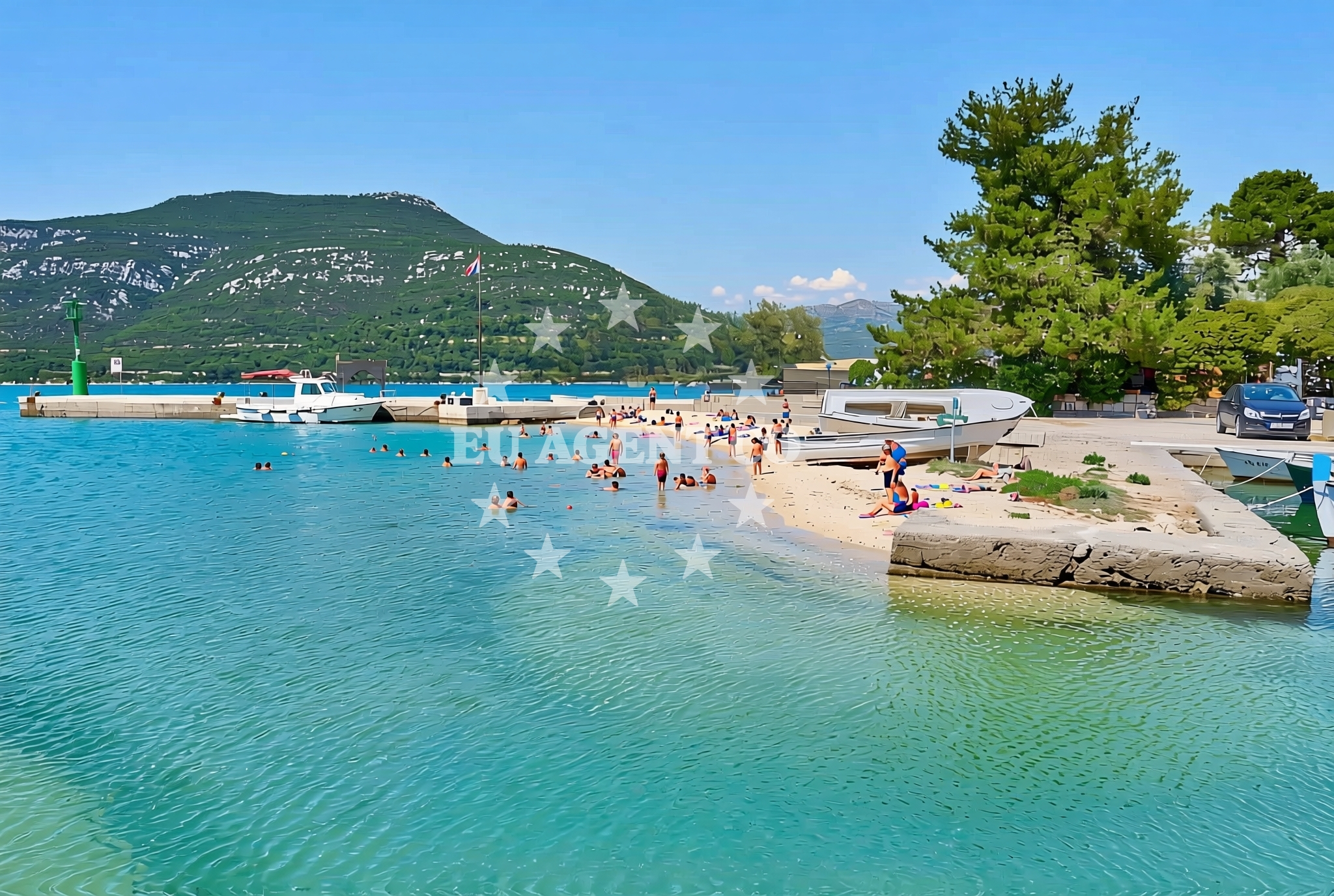
Lukobran jug, Hodilje Beach, Croatia
About this beach
Lukobran jug, Hodilje
Beach: Lukobran jug
Location: Hodilje
Characteristics and facilities
Gravel, concrete / stone slabs
15 m
Restaurant / snack bar
Caffe bar / Drinks stand
Football pitch
sports_basketball
Basketball / handball court
Beach character
The beach's surface consists of gravel and concrete/stone slabs, creating a distinct texture compared to typical sandy shores. This configuration may appeal to those seeking a more rugged or utilitarian coastal experience. The area is marked by its 15-meter stretch, which accommodates a range of activities despite its limited length. Notably, the beach is not described as having natural features like sand, rock formations, or aquatic vegetation, focusing instead on constructed and recreational elements.Swimming and shore
There is no explicit mention of swimming facilities, water depth, or shoreline conditions in the beach's authoritative data. The absence of structured natural features suggests that the primary appeal of this location lies outside aquatic activities, with the shore serving more as a transitional space between land-based amenities and the sea.Facilities and activities
The beach is associated with several land-based facilities, including a restaurant/snack bar and a caffe bar/drinks stand, which provide refreshments for visitors. Sports infrastructure is a key feature, with a football pitch and courts for basketball and handball. These facilities indicate the area's focus on community and recreational activities, though there is no indication of equipment rental or organized sports programs.Access and location
Located in Hodilje, Lukobran jug is part of Croatia's coastal network, though specific details about road access, parking, or nearby towns are not provided in the catalog. Its position along the Adriatic coast places it within reach of yacht charter routes that traverse the region, making it a potential stop for sailors exploring the area. The beach's proximity to the sea and existing infrastructure suggest it could serve as a convenient access point for those combining land and maritime activities.What to expect
Visitors to Lukobran jug, Hodilje Beach should expect a shoreline defined by gravel and concrete surfaces rather than sand. The area is equipped with sports facilities, including a football pitch and basketball/handball courts, which are likely maintained for local use. Dining options are available through a nearby restaurant/snack bar and caffe bar, though specific operating hours or seasonal availability are not detailed. The beach does not appear to have dedicated swimming areas or natural features that would attract water-based recreation.Practical tips
Given the presence of sports facilities, visitors interested in playing football, basketball, or handball may want to check the condition of the courts and pitch in advance. The dining options available on-site suggest that light meals and beverages can be accessed without needing to travel far, though it's advisable to confirm the hours of operation for the restaurant and caffe bar.Exploring the coast by yacht
As part of Croatia's Adriatic coastline, Lukobran jug lies within a region that is accessible to yacht charter travelers. While the beach itself is not described as an anchorage or marina, its location along the coast could be of interest to sailors exploring the area. Euro-Agent's yacht charter services operate in this general region, offering opportunities to experience the surrounding waters and coastal settlements.Regional Context
Hodilje is a village in Croatia that benefits from its coastal position, which connects it to broader Adriatic sailing routes. The area's infrastructure, including the facilities at Lukobran jug, reflects a blend of recreational and community-focused development typical of many coastal towns in the region.Anchorages in the surrounding area
Anchorages in the surrounding area include Broce, Prapratno, and Mali Ston, offering nearby options for mooring.
- Anchorage — mali ston — 0.9 NM from beach
- Anchorage — prapratno — 2.7 NM from beach
- Anchorage — broce — 3.5 NM from beach
- Ribnja — broce — 3.7 NM from beach
- Anchorage — broce — 4.1 NM from beach
- Anchorage — broce — 4.5 NM from beach
- Anchorage — broce — 5.8 NM from beach
- Anchorage — olipa — 6.7 NM from beach
Distances are straight-line geographic distances, not sailing routes.
Mooring buoys in the surrounding area
- Quay — prapratno — 2.6 NM from beach
- Quay — kobas — 4.0 NM from beach
- Lukas Taverna jetty — kobas — 4.1 NM from beach
- Konoba Nico jetty — kobas — 4.1 NM from beach
- Brijesta — 7.5 NM from beach
Distances are straight-line geographic distances, not sailing routes.
Marine fuel stations
- Fuel station — sobra — mljet — 7.8 NM from beach
- Fuel station — ploce — 16.1 NM from beach
- Ina — dubrovnik — 21.0 NM from beach
- Ina — dubrovnik — 22.3 NM from beach
Distances are straight-line geographic distances, not sailing routes.
Harbours in the surrounding area
Harbours in the surrounding area include Hodilje, Mali Ston, and Okuklje — mljet, with Hodilje being the closest to the beach.
- Hodilje — 0.0 NM from beach
- Mali Ston — 0.9 NM from beach
- Ston — 1.5 NM from beach
- Prapranto Ferry Harbour — prapratno — 2.9 NM from beach
- Doli — 5.6 NM from beach
- Okuklje — mljet — 8.0 NM from beach
Distances are straight-line geographic distances, not sailing routes.
Marinas in the surrounding area
Marinas in the surrounding area include ACI Marina Slano and Marina Frapa Dubrovnik, with Slano being the nearest to the beach.
- ACI Marina Slano — 9.9 NM from beach
- Marina Frapa Dubrovnik — 21.0 NM from beach
- ACI Marina Dubrovnik — 22.3 NM from beach
- Marina Lumbarda — korcula — 23.1 NM from beach
- ACI Marina Korčula — korcula — 25.0 NM from beach
Distances are straight-line geographic distances, not sailing routes.
Restaurants near the beach
Restaurants near the beach include Bota Sare in Mali Ston and Lukas Taverna in Kobas, offering dining options in nearby areas.
- Bota Sare — mali ston — 1.0 NM from beach
- Restaurant — prapratno — 2.5 NM from beach
- Gastro Mare — kobas — 4.0 NM from beach
- Luka's Taverna — lukas taverna — kobas — 4.1 NM from beach
- Nico — kobas — 4.1 NM from beach
Distances are straight-line geographic distances, not sailing routes.
Navigation guides for the surrounding area
Navigation guides for the surrounding area cover Hodilje, Luka, and Mali Ston, providing context for nearby waters.
- Hodilje — 0.2 NM from beach
- Luka — 0.3 NM from beach
- Uvala Bjejvica — 1.1 NM from beach
- Uvala Bistrina — 1.1 NM from beach
- Mali Ston — 1.2 NM from beach
Distances are straight-line geographic distances, not sailing routes.
Yachts from nearby departure bases
Yachts depart from Slano ACI Marina, a short distance away, offering access to the beach from this nearby base.
Sailing yachts
- Oceanis 45 (Soul) — Slano ACI Marina — 9.9 NM from departure base to beach
- Elan 45 Impression (Skyfall) — Slano ACI Marina — 9.9 NM from departure base to beach
- Elan 50 Impression (Timeless) — Slano ACI Marina — 9.9 NM from departure base to beach
- Oceanis 45 (Cancan) — Slano ACI Marina — 9.9 NM from departure base to beach
- Oceanis 45 (Mambo 1) — Slano ACI Marina — 9.9 NM from departure base to beach
Catamarans
- MY 44 (Fusion) — Slano ACI Marina — 9.9 NM from departure base to beach
- Lagoon 50 (TWIN JOY) — Slano ACI Marina — 9.9 NM from departure base to beach
- Lagoon 40 (MARINERO) — Slano ACI Marina — 9.9 NM from departure base to beach
- Lagoon 450 Flybridge (MALA MARE) — Slano ACI Marina — 9.9 NM from departure base to beach
- Lagoon 42 (HAPPY KEY) — Slano ACI Marina — 9.9 NM from departure base to beach
Distances are straight-line geographic distances, not sailing routes.