Luka zapad, Kučište Beach, Croatia
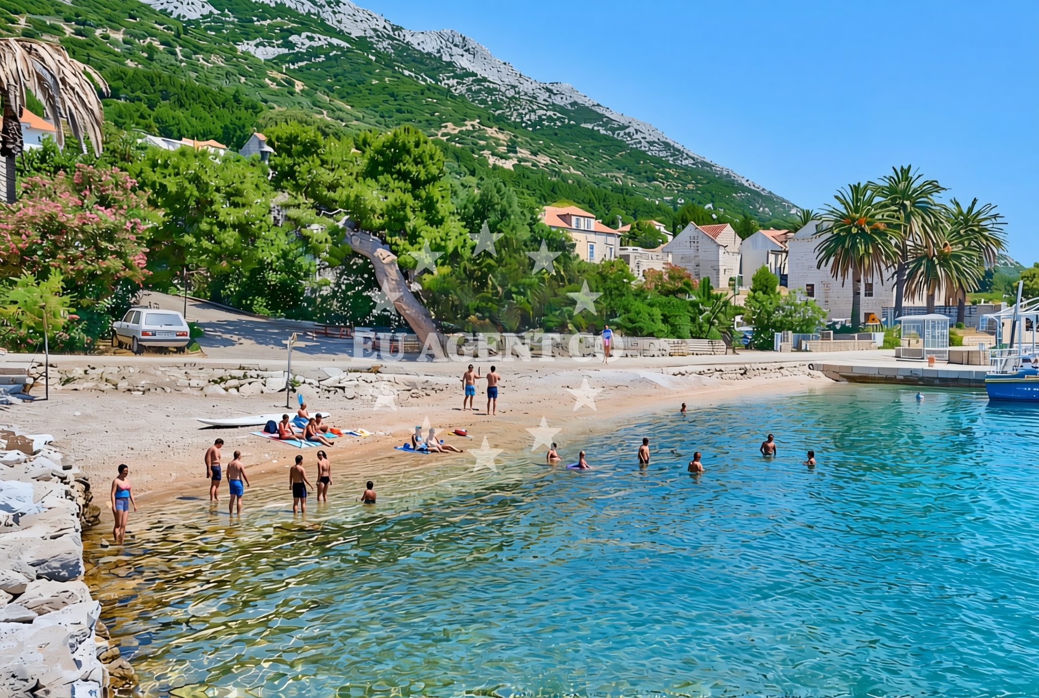
Luka zapad, Kučište Beach is a gravelly shoreline located in the Luka zapad area of Croatia. Stretching approximately 40 meters, this beach is characterized by its rocky and pebbly surface, offering a unique contrast to the region’s more typical sandy shores. Situated in a coastal setting, it provides a quiet vantage point for observing the surrounding landscape and maritime activity. While no formal facilities are listed, its proximity to the broader Luka zapad settlement may offer opportunities for local exploration.
About this beach
Luka zapad, Kučište
Beach: Luka zapad
Location: Kučište
Characteristics and facilities
Gravel
40 m
Beach character
The beach’s primary feature is its gravel composition, which dominates the shoreline. This texture creates a distinct walking surface, ideal for those seeking a more rugged coastal experience. The 40-meter length provides a modest stretch for visitors to traverse, though it is not suited for extended sunbathing or water-based activities. The gravel likely results from natural erosion processes typical of the Adriatic coastline, where rocky substrates are common. The beach’s character aligns with the geological patterns of the region, which includes a mix of rocky inlets and more sheltered coves.
Swimming and shore
Due to the gravelly nature of the beach, swimming conditions are not explicitly documented. The shoreline’s composition may make it challenging for direct water access, though the beach’s position within the Luka zapad area suggests it could be part of a larger coastal network. Visitors should note that the gravel may affect the ease of entering the water, and the absence of formal amenities means preparation for a basic beach experience is advisable.
Facilities and activities
No specific facilities or activities are listed for Luka zapad, Kučište Beach. The beach appears to be a natural, undeveloped shoreline, which may appeal to visitors seeking solitude or those interested in geological features. While no structured amenities are mentioned, the broader Luka zapad area likely offers nearby services, though these are not detailed in the beach’s catalog.
Access and location
Luka zapad, Kučište Beach is located in the Luka zapad region, a coastal area in Croatia. Its coordinates (42.980377, 17.115547) place it within a part of the Adriatic coastline known for its rugged terrain and maritime connectivity. The beach is positioned near the settlement of Kučište, which may provide access to local roads or pathways. However, the lack of formal access details means visitors should consider the area’s natural topography when planning their visit.
What to expect
Visitors to Luka zapad, Kučište Beach should expect a gravelly shoreline that stretches approximately 40 meters. The beach’s natural composition offers a stark contrast to more conventional sandy beaches, making it a distinctive location for those interested in coastal geology. While no formal facilities are listed, the area’s proximity to the Luka zapad settlement may provide opportunities for nearby exploration. The beach’s position within the Adriatic coastline suggests it could be part of a larger network of coastal sites, though specific details about water conditions or accessibility are not provided.
Practical tips
Given the beach’s gravelly surface, visitors may wish to wear sturdy footwear for comfort. The absence of formal amenities means bringing personal items such as water, snacks, and sun protection is advisable. The beach’s location within the Luka zapad area may offer opportunities for local exploration, though specific routes or services are not detailed in the catalog.
Exploring the coast by yacht
The Luka zapad region, where Kučište Beach is located, lies within a part of the Adriatic Sea that is popular among sailors and yacht charter enthusiasts. The area’s rugged coastline and proximity to other coastal settlements make it a potential starting point for exploring the broader Adriatic region. For those interested in yacht charters, Euro-Agent offers access to a range of motor and sailing yachts operating in nearby sailing areas. Visitors considering a yacht charter may find the surrounding waters suitable for short cruises, though specific marina or anchorage details for this exact location are not provided in the catalog.
Regional Context and Coastal Connectivity
The Luka zapad area is part of a coastal region in Croatia that features a mix of rocky inlets, sheltered bays, and open sea vistas. This part of the Adriatic is known for its maritime traditions and scenic routes, which may appeal to both casual visitors and experienced sailors. While Kučište Beach itself is a modest shoreline, the broader area offers opportunities for exploring nearby islands, coastal towns, and maritime trails. For those interested in yacht charters, the region’s sailing routes can provide access to a variety of destinations, though specific details about local marinas or anchorages are not included in this beach’s catalog.
Anchorages in the surrounding area
Anchorages near Korcula, including locations like Badija and Racisce.
- Anchorage — korcula — 1.2 NM from beach
- Anchorage — korcula — 1.3 NM from beach
- Anchorage — korcula — 1.3 NM from beach
- Anchorage — korcula — 1.3 NM from beach
- Anchorage — korcula — 2.0 NM from beach
- Anchorage — badija — 2.7 NM from beach
- Anchorage — racisce — korcula — 3.1 NM from beach
- Anchorage — loviste — 3.3 NM from beach
Distances are straight-line geographic distances, not sailing routes.
Mooring buoys in the surrounding area
Mooring buoys in Korcula and Vrnik, such as the Jetty in Korcula and Restaurant Moro buoys in Stupe.
- Jetty — korcula — 1.3 NM from beach
- Fuel jetty — korcula — 2.1 NM from beach
- Vrnik Arts Club buoys — 3.4 NM from beach
- Quay — vrnik — 3.4 NM from beach
- Restaurant Moro buoys — stupe — 3.4 NM from beach
Distances are straight-line geographic distances, not sailing routes.
Marine fuel stations
Marine fuel stations in Korcula and Ploce, including Ina in Vela Luka and Fuel station in Ploce.
- Fuel station — korcula — 2.1 NM from beach
- Fuel station — ploce — 14.7 NM from beach
- Ina — vela luka — korcula — 17.6 NM from beach
- Ina — ubli — lastovo — 19.1 NM from beach
Distances are straight-line geographic distances, not sailing routes.
Harbours in the surrounding area
Harbours near the beach, including Kučišće and Viganj in Korcula.
- Kučišće — kucisce — 0.0 NM from beach
- Viganj — 0.7 NM from beach
- Korčula W harbour — korcula — 1.3 NM from beach
- Korčula E harbour — korcula — 1.5 NM from beach
- Orebić — orebic — 2.7 NM from beach
- Duba — duba peljeska — 3.6 NM from beach
Distances are straight-line geographic distances, not sailing routes.
Marinas in the surrounding area
Marinas in Korcula, such as ACI Marina Korčula and Marina Lumbarda.
- ACI Marina Korčula — korcula — 1.6 NM from beach
- Marina Lumbarda — korcula — 4.2 NM from beach
- Marina Tučepi — marina tucepi — 17.2 NM from beach
- Marina Korkyra — vela luka — korcula — 17.8 NM from beach
- Marina Solitudo — lastovo — 18.2 NM from beach
Distances are straight-line geographic distances, not sailing routes.
Restaurants near the beach
Restaurants in Korcula, including Mimi's Bistro at Tara's Lodge and Aterina.
- Restaurant — korcula — 1.3 NM from beach
- Mimi's Bistro at Tara's Lodge — korcula — 1.3 NM from beach
- Mimi's Bistro at Tara's Lodge — korcula — 1.3 NM from beach
- Restaurant — korcula — 1.4 NM from beach
- Restaurant — korcula — 1.4 NM from beach
- Aterina — korcula — 1.4 NM from beach
- Adio Mare — korcula — 1.4 NM from beach
Distances are straight-line geographic distances, not sailing routes.
Navigation guides for the surrounding area
Navigation guides for areas like Uvala Vrbovica and Otocic Badija near Korcula.
- Uvala Vrbovica — 1.1 NM from beach
- Uvala Banja — 1.2 NM from beach
- Otocic Badija — 2.8 NM from beach
- Orebic — 2.9 NM from beach
- Uvala Kneza — 2.9 NM from beach
Distances are straight-line geographic distances, not sailing routes.
Yachts from nearby departure bases
Yachts departing from Ploče City Port and Tučepi Port, offering sail and motor yacht options.
Sailing yachts
- Elan 40 Impression (Karleta) — Ploče City Port — 14.6 NM from departure base to beach
- Sun Odyssey 419 (Luka Ploce) — Ploče City Port — 14.6 NM from departure base to beach
- Sun Odyssey 349 (Visnjica) — Ploče City Port — 14.6 NM from departure base to beach
- Elan 514 Impression (Cesarica III) — Ploče City Port — 14.6 NM from departure base to beach
- Salona 44 (SAMOA) — Ploče City Port — 14.6 NM from departure base to beach
- More 55 (MRS. ROBINSON) — Ploče City Port — 14.6 NM from departure base to beach
- Sun Odyssey 349 (Porto Tolero) — Ploče City Port — 14.6 NM from departure base to beach
- Bavaria 40 Cruiser (LADY BUTTERFLY) — Tučepi Port — 17.2 NM from departure base to beach
Catamarans
- Lagoon 450 Fly (Alba Mouse) — Ploče City Port — 14.6 NM from departure base to beach
Motor yachts
- Princess V53 (Chablis) — Makarska Port — 19.2 NM from departure base to beach
Distances are straight-line geographic distances, not sailing routes.