Luka, Povljana (Pag) Beach, Croatia
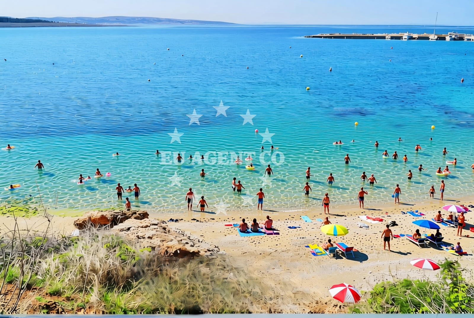
About this beach
Luka, Povljana (Pag)
Beach: Luka
Location: Povljana (Pag)
Characteristics and facilities
Sand, rocks
60 m
Beach character
The beach's terrain is a mix of coarse sand and jagged limestone rocks, creating a landscape that feels more like a coastal cliff face than a traditional Mediterranean shore. The sand is sparse, concentrated in narrow strips between the rocks, while the majority of the beach is composed of uneven stone formations. These rocks, some of which are covered in marine vegetation, create natural pools during high tide. The beach's short length (60 meters) means it is best suited for brief visits rather than extended sunbathing sessions.Swimming and shore
Swimming conditions are variable due to the rocky terrain. The sand patches provide calm, shallow waters ideal for wading, while the rock formations create turbulent currents and unpredictable depths. The beach lacks designated swimming areas or lifeguards, so caution is advised near the shoreline. The rocks themselves are often rough and uneven, making them unsuitable for prolonged soaking but offering opportunities for exploring tidal pools and marine life.Facilities and activities
No permanent facilities are listed for this beach, including showers, toilets, or parking. The absence of infrastructure aligns with Pag's reputation as a destination for those seeking unspoiled coastal experiences. Activities are limited to sunbathing on the sand patches and exploring the rocky shoreline. The beach's proximity to Povljana village means visitors can combine their visit with trips to local shops, restaurants, or the island's salt production heritage.Access and location
The beach is accessible via a short walk from the village of Povljana, which lies on the northern coast of Pag Island. Pag itself is a car-free island, with access limited to boat or ferry from the mainland town of Zadar. The nearest major port is Zadar, approximately 45 kilometers southeast, with regular ferry services connecting to the mainland. For yacht charter guests, the beach's location on Pag's eastern coast places it within reach of sailing routes that extend to Vis, Brac, and the islands of Hvar and Korcula.What to expect
Expect a beach that prioritizes natural character over modern amenities. The 60-meter stretch of sand and rock is best suited for visitors seeking solitude and a connection to Pag's rugged coastline. The lack of facilities means this is not a beach for those requiring conveniences like showers or parking. The rocky terrain offers opportunities for exploration but may not be ideal for families with young children. The beach's position near Povljana village allows for easy access to local culture, including Pag's famed salt production and traditional Dalmatian cuisine.Practical tips
Wear sturdy footwear for navigating the rocky sections, as the terrain can be uneven and sharp. Visit during low tide to access the beach's full extent and explore tidal pools. Combine your visit with a trip to Povljana village for dining options and insights into Pag's salt-making traditions.Exploring the coast by yacht
For yacht charter guests, Pag Island serves as a strategic base for exploring the Adriatic's eastern coast. The island's sheltered bays and proximity to Zadar make it a popular stop for sailors navigating between the mainland and the central Dalmatian islands. While Luka, Povljana Beach itself is not a marina or anchorage, its location on Pag's eastern shore places it within reach of sailing routes that extend to the islands of Vis and Brac. Charter yachts may use nearby harbors in Zadar or the island's western coast for mooring.Pag Island's Cultural Heritage
Pag Island's history is deeply tied to salt production, a tradition dating back to Roman times. The island's salt pans, visible near Povljana, are a UNESCO-protected site and a testament to Croatia's maritime heritage. This cultural context adds depth to visits to Luka, Povljana Beach, where the landscape reflects the same rugged, utilitarian character that defined Pag's historical economy.Sailing Routes from Pag
Pag's position on the Adriatic makes it a gateway for yacht charters exploring the eastern Dalmatian coast. From the island, routes extend north to Zadar, south to Vis, and west toward the islands of Hvar and Brac. The lack of marinas on Pag's eastern shore means yachts typically anchor in Zadar or use western harbors, but the island's natural beauty and strategic location make it a favored stop for sailors.Anchorages in the surrounding area
Anchorages in Povljana and nearby areas include Anchorage — povljana — pag, located near the beach.
- Anchorage — povljana — pag — 0.5 NM from beach
- Anchorage — povljana — pag — 1.7 NM from beach
- Mlinica — kosljun pag — 1.7 NM from beach
- Anchorage — vir — 2.3 NM from beach
- Anchorage — lozice — vir — 2.6 NM from beach
- Anchorage — kosljun pag — 3.1 NM from beach
- Anchorage — vir — 3.2 NM from beach
- Anchorage — lozice — vir — 3.2 NM from beach
Distances are straight-line geographic distances, not sailing routes.
Mooring buoys in the surrounding area
- Vir — 3.1 NM from beach
- Jetty — simuni — pag — 9.1 NM from beach
- Punta Skala — petrcane — 9.5 NM from beach
- Jetty — ljubac — 9.6 NM from beach
- Šibuljina Point — sibuljina point — 10.0 NM from beach
Distances are straight-line geographic distances, not sailing routes.
Marine fuel stations
- Ina — zadar — 14.7 NM from beach
- Ina — preko — ugljan — 16.7 NM from beach
- Fuel station — sukosan — 19.5 NM from beach
- Ina — zaglav — dugi otok — 23.9 NM from beach
Distances are straight-line geographic distances, not sailing routes.
Harbours in the surrounding area
- Povljana — pag — 0.3 NM from beach
- Košljun — kosljun pag — 3.1 NM from beach
- Privlaka — 5.0 NM from beach
- Miškovići — miskovici — pag — 5.2 NM from beach
- Pag — 6.3 NM from beach
- Lukovo Šugarje — lukovo sugarje — rudelici — 6.8 NM from beach
Distances are straight-line geographic distances, not sailing routes.
Marinas in the surrounding area
Marinas in Šimuni, Zadar, and Ugljan provide berthing facilities, with ACI Marina Šimuni being a notable option.
- ACI Marina Šimuni — simuni — pag — 9.9 NM from beach
- Marina Borik — zadar — 13.8 NM from beach
- Vitrenjak Zadar — 14.0 NM from beach
- Marina Zadar — 14.7 NM from beach
- Olive Island Marina — sutomiscica — ugljan — 15.3 NM from beach
Distances are straight-line geographic distances, not sailing routes.
Restaurants near the beach
Restaurants near the beach include Nirvana, Mornar, and Lanterna, all located in Povljana.
- Nirvana — povljana — pag — 0.1 NM from beach
- Mornar — povljana — pag — 0.3 NM from beach
- Lanterna — povljana — pag — 0.4 NM from beach
- Villa Kaštel — povljana — pag — 0.4 NM from beach
- Restaurant — vir — 2.9 NM from beach
- Viranka — 2.9 NM from beach
- Restaurant — vir — 3.0 NM from beach
Distances are straight-line geographic distances, not sailing routes.
Navigation guides for the surrounding area
Navigation guides cover Otok Pag, Privlaka, and Uvala Bliznica, aiding in local maritime travel.
- OTOK PAG — 1.9 NM from beach
- Privlaka — 5.0 NM from beach
- Uvala Bliznica — 7.8 NM from beach
- KrusCica and Uvala KrusCica Duboka — 9.2 NM from beach
- VELESITSKI KANAL (S) — 11.1 NM from beach
Distances are straight-line geographic distances, not sailing routes.
Yachts from nearby departure bases
Sailing yachts
- First 45 (Egeria) — Šimuni Kolan ACI Marina — 9.9 NM from departure base to beach
- Dufour 460 (Proizd) — Zadar Marina Borik — 13.8 NM from departure base to beach
Catamarans
- Sunreef 60 (SINATA) — Zadar Marina Borik — 13.8 NM from departure base to beach
Motor yachts
- Prestige 550 Fly (Floria) — Zadar Marina Borik — 13.8 NM from departure base to beach
Motor boats
- Merry Fisher 895 — Povljana Marina — 0.1 NM from departure base to beach
- BWA Sport 22GT (BWA ) — Pag City Port — 6.3 NM from departure base to beach
- Rancraft RM19 (Daycruiser) — Zadar Diklo Port — 12.4 NM from departure base to beach
- Rancraft RM21 (Dugi otok) — Zadar Diklo Port — 12.4 NM from departure base to beach
- Rancraft RS Cinque.5 — Zadar Diklo Port — 12.4 NM from departure base to beach
- Merry Fisher 895 (Joy) — Zadar Marina Borik — 13.8 NM from departure base to beach
Distances are straight-line geographic distances, not sailing routes.