Lučica, Verunić (Dugi otok) Beach, Croatia
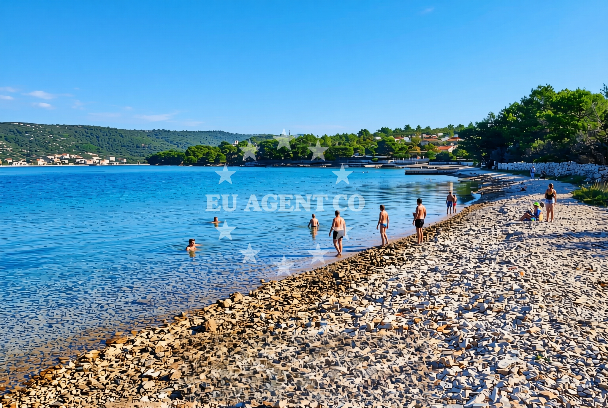
About this beach
Lučica, Verunić (Dugi otok)
Beach: Lučica
Location: Verunić (Dugi otok)
Characteristics and facilities
Rocks
Beach character
The beach is characterized by its exposed rocky formations, which extend along the shoreline and into the shallows. These features create a dynamic landscape that changes with the tide, offering opportunities for exploration during lower water levels. The absence of artificial structures or amenities means the beach retains its natural state, making it a destination for those interested in unspoiled coastal environments. The rocky terrain also influences the beach's accessibility, requiring visitors to navigate uneven surfaces when approaching the water's edge.Swimming and shore
Swimming conditions at Lučica depend on tidal patterns and wave activity. The rocky seabed creates variable depths near the shore, with deeper water forming beyond the immediate shoreline. The beach's character makes it more suitable for experienced swimmers or those comfortable with natural, unstructured coastlines. The shore itself is composed of uneven rock formations, which may limit the availability of flat areas for sunbathing or relaxation.Facilities and activities
There are no formal facilities or services directly associated with Lučica Beach. The lack of infrastructure aligns with its natural, unmodified state. Activities are limited to passive recreation such as walking along the shoreline or observing the coastal landscape. The beach's rocky nature makes it less suitable for water sports or beach games typically associated with sandy shores.Access and location
Lučica Beach is situated on the northern end of Verunić (Dugi Otok), one of the larger islands in the central Adriatic. The island is part of the Šibenik-Knin County, located between the islands of Šolta and Brač. Access to the beach requires reaching Dugi Otok via boat or ferry from mainland Croatia or nearby islands. The nearest major settlement is Šibenik, which serves as a gateway to the area with ferry connections to the islands of the Adriatic.What to expect
Visitors to Lučica Beach should expect a natural, unmodified coastline defined by rocky formations. The beach lacks infrastructure such as parking, restrooms, or changing facilities, making it more suited for those seeking a remote, undeveloped environment. The terrain requires careful navigation due to uneven surfaces, and the absence of lifeguards or emergency services means visitors should exercise caution when entering the water. The beach's character is best appreciated during calm weather conditions when the rocky shoreline is more accessible.Practical tips
Wear sturdy footwear to navigate the rocky shoreline safely. Be mindful of tide changes, as the beach's accessibility varies with water levels. Carry water and sun protection, as there are no shaded areas or facilities for visitors.Exploring the coast by yacht
For yacht charter guests exploring the Adriatic, Lučica Beach offers a glimpse into the natural coastlines of Dugi Otok, a popular sailing destination. The island's position in the central Adriatic makes it a strategic stop for those traveling between the Dalmatian Coast and the islands of Brač, Šolta, and Hvar. While the beach itself is not a designated anchorage, the surrounding waters provide opportunities for sailing excursions and exploration of the island's rugged coastline.Regional Context of Dugi Otok
Dugi Otok, meaning 'Long Island,' is known for its dramatic cliffs, pine forests, and unspoiled natural beauty. The island's coastline is characterized by alternating stretches of sandy beaches and rocky inlets, with Lučica representing one of the more rugged sections. The island's interior features hiking trails that offer panoramic views of the Adriatic, connecting land-based exploration with coastal experiences.Anchorages in the surrounding area
Anchorages in the surrounding area include options near Lučica and Soline on Dugi Otok.
- Lučica — soline — dugi otok — 0.1 NM from beach
- Anchorage — dugi otok — 0.7 NM from beach
- Anchorage — soline — dugi otok — 0.7 NM from beach
- Sakarun — soline — dugi otok — 0.9 NM from beach
- Anchorage — dugi otok — 1.3 NM from beach
- Anchorage — dugi otok — 1.4 NM from beach
- Zverinac North — 2.2 NM from beach
- Anchorage — zverinac — 2.9 NM from beach
Distances are straight-line geographic distances, not sailing routes.
Mooring buoys in the surrounding area
- Buoy field — verunic — dugi otok — 0.2 NM from beach
- Jetty — verunic — dugi otok — 0.3 NM from beach
- Jetty — verunic — dugi otok — 0.4 NM from beach
- Buoy field Sakarun — soline — dugi otok — 0.7 NM from beach
- Slatine cove — dugi otok — 1.2 NM from beach
Distances are straight-line geographic distances, not sailing routes.
Marine fuel stations
Marine fuel stations are located in Preko, Zadar, and other areas further from the beach.
- Ina — preko — ugljan — 14.8 NM from beach
- Ina — zadar — 15.8 NM from beach
- Ina — zaglav — dugi otok — 16.8 NM from beach
- Fuel station — sukosan — 19.5 NM from beach
Distances are straight-line geographic distances, not sailing routes.
Harbours in the surrounding area
Harbors such as Veli Rat and Božava are situated on Dugi Otok and nearby islands.
- Veli Rat — dugi otok — 0.6 NM from beach
- Božava — bozava — dugi otok — 1.9 NM from beach
- Zverinac — 2.5 NM from beach
- Harbour Marina Molat — 4.2 NM from beach
- Brgulje — molat — 5.1 NM from beach
- Hrvatin — sestrunj — 5.8 NM from beach
Distances are straight-line geographic distances, not sailing routes.
Marinas in the surrounding area
- Marina Veli Rat — dugi otok — 0.7 NM from beach
- Marina Veli Iž — iz veli — 12.0 NM from beach
- Olive Island Marina — sutomiscica — ugljan — 13.5 NM from beach
- Marina Preko — ugljan — 14.5 NM from beach
- Marina Borik — zadar — 14.9 NM from beach
Distances are straight-line geographic distances, not sailing routes.
Restaurants near the beach
Restaurants at Verunić and Veli Rat provide dining options close to the beach.
- DiM — verunic — dugi otok — 0.3 NM from beach
- Verunic — veli rat — dugi otok — 0.5 NM from beach
- Pizzeria Galeb — veli rat — dugi otok — 0.5 NM from beach
- Lanterna — veli rat — dugi otok — 0.6 NM from beach
- Amarcord — soline — dugi otok — 0.6 NM from beach
- Gostionica Oleander — bozava — dugi otok — 1.8 NM from beach
- Restaurant Konoba Kadulja — bozava — dugi otok — 1.8 NM from beach
Distances are straight-line geographic distances, not sailing routes.
Navigation guides for the surrounding area
Navigation guides cover areas such as Luka Soliscica and Božava, aiding route planning around the beach.
- Luka Soliscica — 0.8 NM from beach
- Dugi Otok -Bozava — 0.8 NM from beach
- Božava — 2.1 NM from beach
- Zverinac — 2.6 NM from beach
- Uvala Lucina (Molat) Fl.R.3s6m4M — 4.5 NM from beach
Distances are straight-line geographic distances, not sailing routes.
Yachts from nearby departure bases
Yachts depart from nearby bases including Brbinj Marina and Zadar, offering access to the beach area.
Sailing yachts
- Elan Impression 40 (Val) — Ugljan Sutomišćica Olive Island — 13.5 NM from departure base to beach
- Bavaria C42 (Dna) — Zadar Marina Borik — 14.9 NM from departure base to beach
Catamarans
- Leopard 50 (Solaia) — Zadar Marina Borik — 14.9 NM from departure base to beach
Motor yachts
- Prestige 550 Fly (Floria) — Zadar Marina Borik — 14.9 NM from departure base to beach
Motor boats
- Adria 28 Luxus (Ana) — Brbinj Marina — 6.7 NM from departure base to beach
- Quicksilver Activ 905 (Galeb) — Ugljan Sutomišćica Olive — 13.5 NM from departure base to beach
- Rancraft RM21 (Dugi otok) — Zadar Diklo Port — 14.6 NM from departure base to beach
- Rancraft RM19 (Daycruiser) — Zadar Diklo Port — 14.6 NM from departure base to beach
- Rancraft RS Cinque.5 — Zadar Diklo Port — 14.6 NM from departure base to beach
- Merry Fisher 895 — Zadar Marina Borik — 14.9 NM from departure base to beach
Distances are straight-line geographic distances, not sailing routes.