Lučica sredina, Podaca Beach - Natural Rocky Shores in Croatia
About this beach
Lučica sredina, Podaca
Beach: Lučica sredina
Location: Podaca
Characteristics and facilities
Gravel, rocks
150 m
Beach character
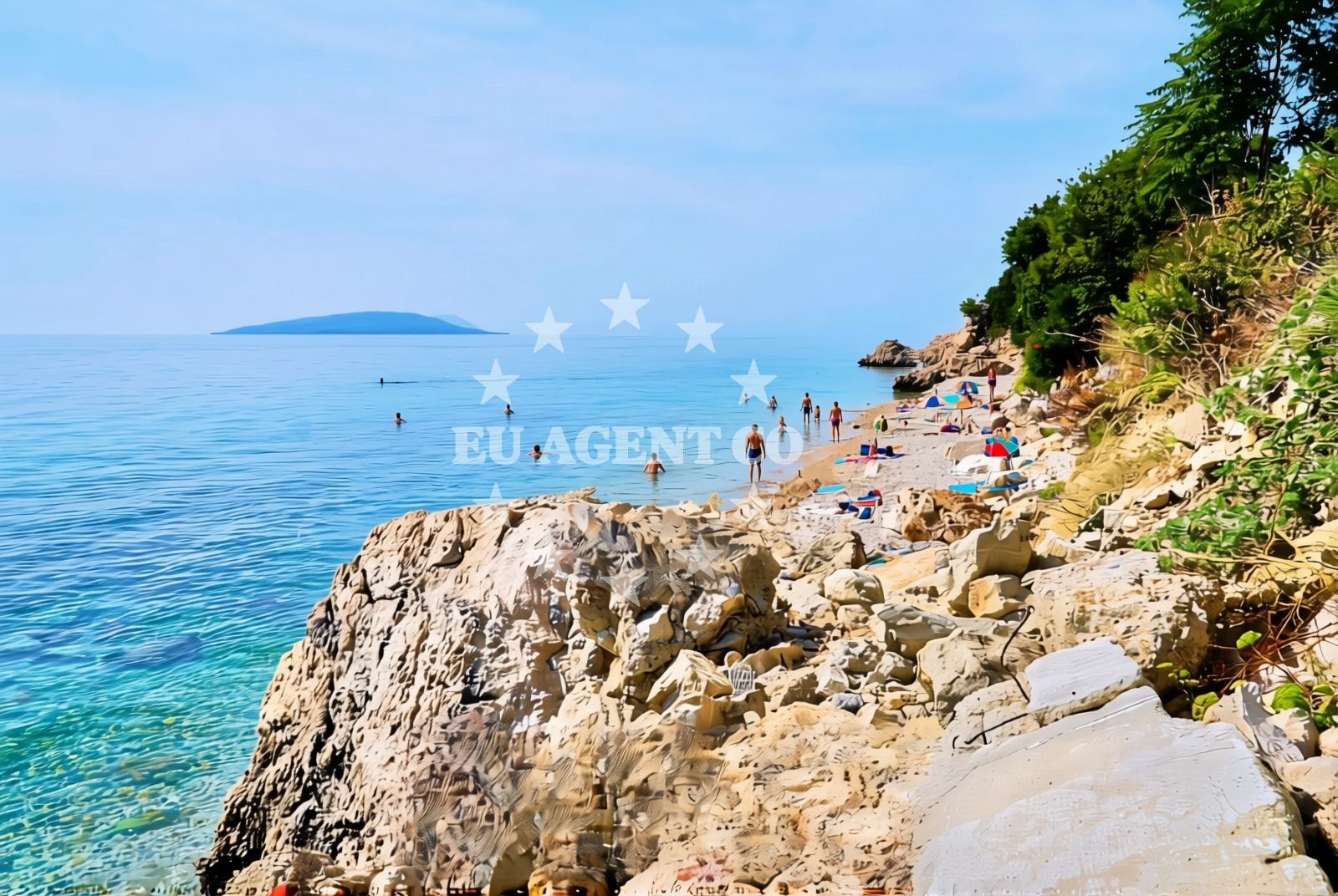
The beach's defining feature is its composition of gravel and rocks, which creates a rugged and uneven shoreline. This natural terrain suggests the beach is more suited to casual exploration than swimming or sunbathing. The 150-meter length is relatively short, making it a modest stretch of coast. The absence of structured facilities or amenities indicates a focus on the beach's natural state, with no evidence of artificial modifications or developments. The surrounding area likely retains its undeveloped character, typical of smaller coastal settlements in Croatia's rural Adriatic regions.Swimming and shore
Swimming conditions at Lučica sredina are not explicitly documented, but the gravel and rocky shoreline suggest limited suitability for swimming. The beach's natural composition may create uneven entry points into the water, making it less accessible for swimmers. The shore itself is composed of loose gravel and exposed rocks, which could make walking along the beach challenging without appropriate footwear. No lifeguard services, water access points, or safety infrastructure are mentioned in the beach's authoritative records.Facilities and activities
There is no evidence of permanent facilities such as restrooms, showers, or changing rooms at Lučica sredina. The beach appears to be an undeveloped coastal site with no commercial infrastructure. Activities associated with the beach are not formally listed, but the natural terrain may allow for limited exploration, such as rock-hopping or coastal walking. The absence of structured amenities suggests visitors should prepare for a self-sufficient visit, with no expectation of services typically found at more developed beaches.Access and location
Lučica sredina is located within the settlement of Podaca, a small coastal community on Croatia's Adriatic coast. The beach's exact coordinates (43.127543° N, 17.29037° E) place it in a region characterized by rugged coastlines and traditional maritime settlements. Proximity to nearby towns or roads is not specified in the beach's records, but its inclusion in Euro-Agent's catalog suggests it is accessible to visitors exploring the area. The beach's undeveloped nature implies it may be reached via local roads or footpaths typical of rural coastal regions.What to expect
Visitors to Lučica sredina should expect a short, gravel-and-rock shoreline with no formal amenities or services. The beach's natural state is its defining characteristic, offering a raw coastal experience rather than a polished tourist destination. The 150-meter length provides limited space for activities, and the uneven terrain may require sturdy footwear for safe navigation. The area likely retains its natural character, with no signs of commercial development or infrastructure.Practical tips
Given the beach's gravel and rocky composition, visitors are advised to wear sturdy footwear for safe access. There is no indication of parking, restrooms, or other services, so self-sufficiency is essential. The beach's short length and natural terrain make it more suitable for brief exploration than extended stays.Exploring the coast by yacht
Lučica sredina's location on Croatia's Adriatic coast places it within a region popular with yacht charter guests. The nearby waters offer opportunities for sailing, anchoring, and exploring the rugged coastline. Euro-Agent's yacht charter services can connect visitors with motor yachts and sailboats operating in this area, providing access to both the beach and the surrounding maritime landscape. However, the beach itself is not marked as an anchorage or docking point in the catalog.Regional Context and Coastal Character
Podaca is a small settlement in Croatia's Dalmatian region, known for its traditional fishing heritage and unspoiled coastline. The area around Lučica sredina likely reflects the broader character of the region, where natural shorelines and small fishing villages coexist with modern yacht charter activity. The Adriatic Sea's clear waters and rugged cliffs in this area make it a destination for sailors seeking both scenic beauty and challenging coastal routes.Anchorages in the surrounding area
Anchorages in the surrounding area include Drvenik, Sucuraj, and Ploce.
- Anchorage — drvenik — 2.5 NM from beach
- Anchorage — sucuraj — hvar — 4.7 NM from beach
- Anchorage — ploce — 5.5 NM from beach
- Anchorage — sucuraj — hvar — 5.6 NM from beach
- Anchorage — sucuraj — hvar — 6.2 NM from beach
- Anchorage — selca kod bogomolja — hvar — 6.5 NM from beach
- Anchorage — selca kod bogomolja — hvar — 6.6 NM from beach
- Anchorage — sucuraj — hvar — 6.6 NM from beach
Distances are straight-line geographic distances, not sailing routes.
Mooring buoys in the surrounding area
Mooring buoys in the surrounding area include Brist, Drvenik Ferry Dock, and Sucuraj Jetty.
- Brist — 1.5 NM from beach
- Drvenik - Ferry dock — drvenik ferry dock — 2.4 NM from beach
- Jetty — sucuraj — hvar — 4.5 NM from beach
- Konoba Gambo buoys — selca kod bogomolja — hvar — 8.4 NM from beach
- Kraj - Soline — kraj soline — drasnice — 9.7 NM from beach
Distances are straight-line geographic distances, not sailing routes.
Marine fuel stations
Marine fuel stations are in Ploce, Korcula, Makarska, and Sumartin.
- Fuel station — ploce — 7.8 NM from beach
- Fuel station — korcula — 12.1 NM from beach
- Ina — makarska — 15.7 NM from beach
- Fuel station — sumartin — brac — 21.1 NM from beach
Distances are straight-line geographic distances, not sailing routes.
Harbours in the surrounding area
Harbours in the surrounding area include Zaostrog, Drvenik, Gradac, Sucuraj, Živogošće, and Trpanj.
- Zaostrog — 0.9 NM from beach
- Drvenik — 2.6 NM from beach
- Gradac — 2.6 NM from beach
- Sućuraj — sucuraj — hvar — 4.5 NM from beach
- Živogošće — zivogosce — 6.8 NM from beach
- Trpanj — 7.1 NM from beach
Distances are straight-line geographic distances, not sailing routes.
Marinas in the surrounding area
Marinas in the surrounding area include ACI Marina Korčula, Marina Tučepi, Marina Lumbarda, Marina Ramova, and Marina Baška Voda.
- ACI Marina Korčula — korcula — 12.2 NM from beach
- Marina Tučepi — marina tucepi — 13.0 NM from beach
- Marina Lumbarda — korcula — 13.3 NM from beach
- Marina Ramova — krvavica — 17.9 NM from beach
- Marina Baška Voda — marina baska voda — 20.4 NM from beach
Distances are straight-line geographic distances, not sailing routes.
Restaurants near the beach
Restaurants near the beach include Riblji Restoran and Restaurant in Sucuraj.
- Riblji Restoran — sucuraj — hvar — 4.5 NM from beach
- Restaurant — sucuraj — hvar — 4.5 NM from beach
Distances are straight-line geographic distances, not sailing routes.
Navigation guides for the surrounding area
Navigation guides for the surrounding area include Uvala Drvenik, Gradac, Otok Hvar, Trpanj, and Uvala Divna.
- Uvala Drvenik (Donja Vala) — 2.2 NM from beach
- Gradac — 2.9 NM from beach
- OTOK HVAR — 3.8 NM from beach
- Trpanj — 7.0 NM from beach
- Uvala Divna — 7.5 NM from beach
Distances are straight-line geographic distances, not sailing routes.
Yachts from nearby departure bases
Yachts from nearby departure bases include those based in Ploče City Port and Tučepi Port, offering sail boats and catamarans.
Sailing yachts
- Elan 40 Impression (Karleta) — Ploče City Port — 7.7 NM from departure base to beach
- Elan 514 Impression (Cesarica III) — Ploče City Port — 7.7 NM from departure base to beach
- Sun Odyssey 349 (Porto Tolero) — Ploče City Port — 7.7 NM from departure base to beach
- Salona 44 (SAMOA) — Ploče City Port — 7.7 NM from departure base to beach
- Sun Odyssey 419 (Luka Ploce) — Ploče City Port — 7.7 NM from departure base to beach
- More 55 (MRS. ROBINSON) — Ploče City Port — 7.7 NM from departure base to beach
- Sun Odyssey 349 (Visnjica) — Ploče City Port — 7.7 NM from departure base to beach
- Bavaria 40 Cruiser (LADY BUTTERFLY) — Tučepi Port — 13.1 NM from departure base to beach
Catamarans
- Lagoon 450 Fly (Alba Mouse) — Ploče City Port — 7.7 NM from departure base to beach
Motor yachts
- Princess V53 (Chablis) — Makarska Port — 15.5 NM from departure base to beach
Distances are straight-line geographic distances, not sailing routes.