Lučica jug, Rtina Beach, Croatia
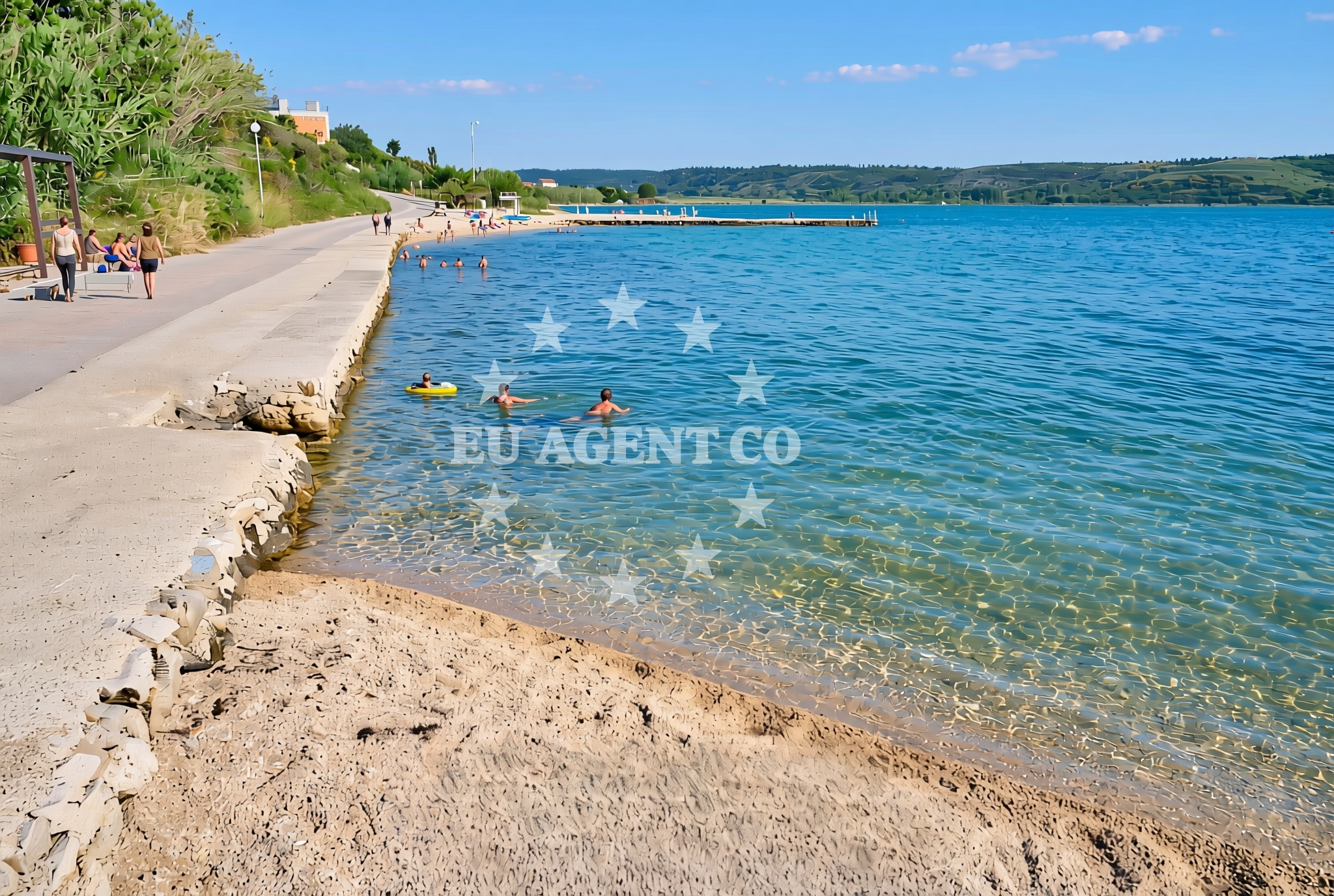
Lučica jug, Rtina Beach is a compact coastal stretch located in the village of Rtina, along Croatia's eastern Adriatic coast. This 15-meter-long gravel beach offers a straightforward shoreline experience, complemented by nearby amenities that cater to casual visitors. Its proximity to the mainland and limited infrastructure suggest it serves more as a local access point than a major tourist destination, with its character defined by natural materials and minimal development.
About this beach
Lučica jug, Rtina
Beach: Lučica jug
Location: Rtina
Characteristics and facilities
Gravel
15 m
Restaurant / snack bar
Caffe bar / Drinks stand
Beach character
The beach consists of gravel, a composition that influences its usability for swimming and sunbathing. While the short length (15 meters) limits recreational space, the shoreline's texture provides a tactile contrast to more typical sandy beaches. No official facilities are listed in the beach's authoritative records, though nearby infrastructure includes a restaurant, snack bar, and caffe bar, which may serve the immediate area. The absence of detailed natural features or amenities in the catalog suggests a focus on basic coastal access rather than specialized beach activities.
Swimming and shore
Given the gravel composition and limited shoreline length, swimming is unlikely to be a primary activity at Lučica jug, Rtina Beach. The beach's character appears more suited to walking along the shore or as a brief stop during coastal travel. No specific water depth, wave conditions, or safety information is documented in the beach's records, aligning with the catalog's focus on basic geographic and infrastructural details rather than recreational water use.
Facilities and activities
The beach is associated with three nearby facilities: a restaurant, a snack bar, and a caffe bar. These establishments likely serve the broader Rtina area rather than the beach specifically, given the absence of direct linkage in the catalog. No structured activities are listed, and the beach's short length and gravel surface suggest it is not designed for organized recreation. The facilities may provide basic refreshments for visitors passing through the area.
Access and location
Lučica jug, Rtina Beach is situated in the village of Rtina, a coastal settlement on the Pelješac Peninsula in Croatia. Coordinates (44.291367°N, 15.302659°E) place it near the mouth of the Cetina River, with views of the islands of Šipan and Hvar on the horizon. The beach's location suggests it may be used by locals for brief coastal access, though its limited size and lack of detailed infrastructure imply it is not a primary destination for extended stays or organized tourism.
What to expect
Expect a short, gravelly shoreline at Lučica jug, Rtina Beach, with no official facilities directly on the beach itself. Nearby amenities include a restaurant, snack bar, and caffe bar, which may serve the broader Rtina area. The beach's character is defined by its natural materials and minimal development, making it more suitable for passing visitors than extended stays. Its location on the Pelješac Peninsula offers views of the Adriatic Sea and proximity to other coastal settlements, though the beach itself lacks detailed recreational infrastructure.
Practical tips
Visitors should note the beach's gravel surface and limited size, which may affect comfort for prolonged stays. While no specific hours or regulations are documented, the nearby restaurant and caffe bar could provide refreshments. The beach's location near the Cetina River mouth may offer scenic views, though its primary function appears to be as a local access point rather than a tourist attraction.
Exploring the coast by yacht
For yacht charter guests, Lučica jug's location on the Pelješac Peninsula places it within reach of the broader Adriatic sailing routes. The nearby village of Rtina is a known stop for yachts exploring the Dalmatian coast, with access to the Cetina River and proximity to islands like Šipan and Hvar. While the beach itself is not marked as an anchorage or marina, its coastal position offers a vantage point for sailors navigating the area. Yacht charter guests may use nearby ports such as Dubrovnik or Korčula as bases for exploring this region.
Regional Context and Coastal Orientation
The Pelješac Peninsula, where Lučica jug is located, is a strategic coastal area connecting the Adriatic Sea to the Cetina River. This geography historically influenced trade routes and continues to shape modern maritime activity. The peninsula's southern tip near the village of Cavtat is a popular yacht anchorage, while the northern areas include the town of Čilipi, a hub for fishing and coastal tourism. Lučica jug's position along this coastline suggests it may be used by yachts passing through the region, though its specific utility for anchoring or docking is not documented.
Anchorages in the surrounding area
- Anchorage — rtina — 0.3 NM from beach
- Anchorage — rtina — 0.6 NM from beach
- Anchorage — ljubac — 2.1 NM from beach
- Anchorage — ljubac — 2.5 NM from beach
- Anchorage — vrsi — 4.0 NM from beach
- Anchorage — vlasici — pag — 4.0 NM from beach
- Anchorage — tribanj — 4.3 NM from beach
- Anchorage — nin — 4.5 NM from beach
Distances are straight-line geographic distances, not sailing routes.
Mooring buoys in the surrounding area
- Jetty — ljubac — 1.9 NM from beach
- Šibuljina Point — sibuljina point — 3.2 NM from beach
- Punta Skala — petrcane — 9.0 NM from beach
- Vir — 9.4 NM from beach
- Jetty — zadar — 10.5 NM from beach
Distances are straight-line geographic distances, not sailing routes.
Marine fuel stations
- Ina — zadar — 10.9 NM from beach
- Ina — preko — ugljan — 13.7 NM from beach
- Fuel station — sukosan — 14.3 NM from beach
- Ina — zaglav — dugi otok — 21.6 NM from beach
Distances are straight-line geographic distances, not sailing routes.
Harbours in the surrounding area
- Ražanac — razanac — 2.0 NM from beach
- Miškovići — miskovici — pag — 4.2 NM from beach
- Mulo — nin — 4.4 NM from beach
- Starigrad Paklenica — 5.8 NM from beach
- Nin — 5.9 NM from beach
- Vinjerac — 7.2 NM from beach
Distances are straight-line geographic distances, not sailing routes.
Marinas in the surrounding area
- Marina Borik — zadar — 10.5 NM from beach
- Vitrenjak Zadar — 10.5 NM from beach
- Marina Zadar — 10.8 NM from beach
- Olive Island Marina — sutomiscica — ugljan — 13.0 NM from beach
- Marina Preko — ugljan — 13.6 NM from beach
Distances are straight-line geographic distances, not sailing routes.
Navigation guides for the surrounding area
- VELESITSKI KANAL (S) — 2.8 NM from beach
- KrusCica and Uvala KrusCica Duboka — 3.5 NM from beach
- Starigrad-Paklenica {Velebitski Kanai) — 6.0 NM from beach
- Privlaka — 7.9 NM from beach
- OTOK PAG — 8.1 NM from beach
Distances are straight-line geographic distances, not sailing routes.
Yachts from nearby departure bases
Sailing yachts
- Oceanis 46.1 (Antonela M.) — Zadar Marina Borik — 10.5 NM from departure base to beach
- Bavaria Cruiser 37 (JULIA) — Zadar Marina Borik — 10.5 NM from departure base to beach
Catamarans
- Leopard 50 (Solaia) — Zadar Marina Borik — 10.5 NM from departure base to beach
- Sunreef 60 (SINATA) — Zadar Marina Borik — 10.5 NM from departure base to beach
Motor yachts
- Prestige 460 (ADUDU 2) — Zadar Marina Borik — 10.5 NM from departure base to beach
Motor boats
- Merry Fisher 895 — Povljana Marina — 9.2 NM from departure base to beach
- Rancraft RS Cinque.5 — Zadar Diklo Port — 9.4 NM from departure base to beach
- Rancraft RM19 (Daycruiser) — Zadar Diklo Port — 9.4 NM from departure base to beach
- Rancraft RM21 (Dugi otok) — Zadar Diklo Port — 9.4 NM from departure base to beach
- Merry Fisher 895 (VIP 3029ZD) — Zadar Marina Borik — 10.5 NM from departure base to beach
Distances are straight-line geographic distances, not sailing routes.