Lučica istok, Podaca Beach, Croatia
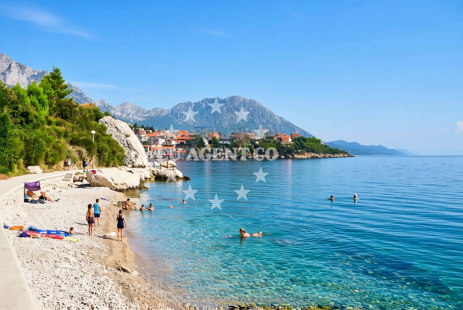
About this beach
Lučica istok, Podaca
Beach: Lučica istok
Location: Podaca
Characteristics and facilities
Gravel
70 m
Beach character
The beach is composed primarily of gravel, a feature that distinguishes it from the pebbled or sandy shores found elsewhere in the region. This composition creates a firm, stable surface ideal for walking or casual recreation. The beach's relatively short length means it remains less crowded than larger resorts, offering a more tranquil experience. The surrounding landscape includes low-lying coastal terrain and sparse vegetation, typical of the rocky Dalmatian coastline. While the beach itself lacks formal facilities, its proximity to Podaca ensures access to basic services in the nearby village.Swimming and shore
Swimming conditions at Lučica istok are influenced by the gravelly shore and the open sea beyond. The beach's firm surface may make wading less comfortable compared to sandy alternatives, though the clear waters of the Adriatic provide good visibility for those entering the sea. The shoreline is relatively flat, with no significant elevation changes, allowing for easy access to the water. The beach's orientation faces east, meaning it receives morning sunlight and is exposed to prevailing winds from the north, which can affect sea conditions during certain times of the year.Facilities and activities
The beach does not have built infrastructure such as showers, restrooms, or umbrellas. Visitors relying on amenities will need to use facilities in the nearby village of Podaca. Activities are limited to passive recreation such as sunbathing, walking along the shore, and photography. The gravel surface may make it less suitable for children's play or water sports, though the area's natural setting offers opportunities for birdwatching and exploring the coastal landscape.Access and location
Lučica istok is accessible via local roads connecting to the village of Podaca, which lies approximately 15 kilometers northeast of the town of Supetar on the island of Brac. The beach is marked on Euro-Agent's beaches map, providing a reference point for visitors navigating the Dalmatian coast. Its location near the mainland and proximity to Brac make it a potential waypoint for yacht charters exploring the southern Adriatic, with nearby marinas in Supetar and Bol offering docking options.What to expect
Visitors should expect a secluded, gravelly beach with minimal infrastructure. The 70-meter stretch offers a peaceful setting for those seeking solitude, though the lack of facilities means preparation for basic needs is necessary. The beach's orientation and gravel composition create a distinct character compared to other Adriatic shores. Those arriving by land will find the village of Podaca nearby, while sailors may use it as a reference point during coastal passages.Practical tips
Wear sturdy footwear to navigate the gravel shoreline comfortably. Bring water and sun protection, as shade is limited. Check local conditions for any temporary access restrictions. For amenities, plan to use services in Podaca or nearby marinas.Exploring the coast by yacht
For yacht charter guests, Lučica istok's location near Brac and the mainland offers strategic positioning for exploring the Adriatic. Sailors passing through the area may use it as a reference point when navigating between Supetar and the broader Dalmatian coast. Nearby marinas in Supetar and Bol provide docking options, while the open waters around Podaca offer opportunities for anchoring in sheltered bays. Euro-Agent's yacht search page can help identify vessels available for trips along this coastline.Regional Context and Coastal Exploration
The beach lies within a region known for its rugged coastline and historic villages. The nearby village of Podaca, though small, retains traditional architecture and offers a glimpse into rural Dalmatian life. The surrounding waters are part of a sailing route connecting Brac to the mainland, with opportunities to explore nearby islands such as Hvar and Vis. The area's maritime history is reflected in local landmarks, including ancient Roman ruins and medieval fortifications along the coast.Anchorages in the surrounding area
Nearby anchorages include Drvenik and Sućuraj-Hvar, offering convenient mooring options within a few nautical miles.
- Anchorage — drvenik — 2.6 NM from beach
- Anchorage — sucuraj — hvar — 4.8 NM from beach
- Anchorage — ploce — 5.4 NM from beach
- Anchorage — sucuraj — hvar — 5.7 NM from beach
- Anchorage — sucuraj — hvar — 6.3 NM from beach
- Anchorage — selca kod bogomolja — hvar — 6.6 NM from beach
- Anchorage — selca kod bogomolja — hvar — 6.7 NM from beach
- Anchorage — sucuraj — hvar — 6.7 NM from beach
Distances are straight-line geographic distances, not sailing routes.
Mooring buoys in the surrounding area
- Brist — 1.3 NM from beach
- Drvenik - Ferry dock — drvenik ferry dock — 2.5 NM from beach
- Jetty — sucuraj — hvar — 4.6 NM from beach
- Konoba Gambo buoys — selca kod bogomolja — hvar — 8.5 NM from beach
- Kraj - Soline — kraj soline — drasnice — 9.8 NM from beach
Distances are straight-line geographic distances, not sailing routes.
Marine fuel stations
Fuel stations are situated in Ploce and extend to Korcula and Makarska, providing refueling options across the region.
- Fuel station — ploce — 7.7 NM from beach
- Fuel station — korcula — 12.2 NM from beach
- Ina — makarska — 15.8 NM from beach
- Fuel station — sumartin — brac — 21.2 NM from beach
Distances are straight-line geographic distances, not sailing routes.
Harbours in the surrounding area
Harbors such as Zaostrog and Drvenik are within a short distance, offering shelter and facilities for vessels.
- Zaostrog — 1.0 NM from beach
- Gradac — 2.5 NM from beach
- Drvenik — 2.7 NM from beach
- Sućuraj — sucuraj — hvar — 4.6 NM from beach
- Živogošće — zivogosce — 7.0 NM from beach
- Trpanj — 7.1 NM from beach
Distances are straight-line geographic distances, not sailing routes.
Marinas in the surrounding area
- ACI Marina Korčula — korcula — 12.2 NM from beach
- Marina Tučepi — marina tucepi — 13.2 NM from beach
- Marina Lumbarda — korcula — 13.3 NM from beach
- Marina Ramova — krvavica — 18.0 NM from beach
- Marina Baška Voda — marina baska voda — 20.5 NM from beach
Distances are straight-line geographic distances, not sailing routes.
Restaurants near the beach
- Riblji Restoran — sucuraj — hvar — 4.6 NM from beach
- Restaurant — sucuraj — hvar — 4.7 NM from beach
Distances are straight-line geographic distances, not sailing routes.
Navigation guides for the surrounding area
Navigation guides for Uvala Drvenik and surrounding areas like Gradac and Hvar assist in planning routes.
- Uvala Drvenik (Donja Vala) — 2.3 NM from beach
- Gradac — 2.7 NM from beach
- OTOK HVAR — 3.9 NM from beach
- Trpanj — 7.0 NM from beach
- Uvala Divna — 7.6 NM from beach
Distances are straight-line geographic distances, not sailing routes.
Yachts from nearby departure bases
Yachts depart from Ploče City Port and other nearby bases such as Tučepi and Makarska, catering to various sailing preferences.
Sailing yachts
- Elan 40 Impression (Karleta) — Ploče City Port — 7.6 NM from departure base to beach
- Sun Odyssey 349 (Visnjica) — Ploče City Port — 7.6 NM from departure base to beach
- More 55 (MRS. ROBINSON) — Ploče City Port — 7.6 NM from departure base to beach
- Salona 44 (SAMOA) — Ploče City Port — 7.6 NM from departure base to beach
- Elan 514 Impression (Cesarica III) — Ploče City Port — 7.6 NM from departure base to beach
- Sun Odyssey 419 (Luka Ploce) — Ploče City Port — 7.6 NM from departure base to beach
- Sun Odyssey 349 (Porto Tolero) — Ploče City Port — 7.6 NM from departure base to beach
- Bavaria 40 Cruiser (LADY BUTTERFLY) — Tučepi Port — 13.2 NM from departure base to beach
Catamarans
- Lagoon 450 Fly (Alba Mouse) — Ploče City Port — 7.6 NM from departure base to beach
Motor yachts
- Princess V53 (Chablis) — Makarska Port — 15.6 NM from departure base to beach
Distances are straight-line geographic distances, not sailing routes.