Lavanda (FKK), Stanković Beach, Croatia
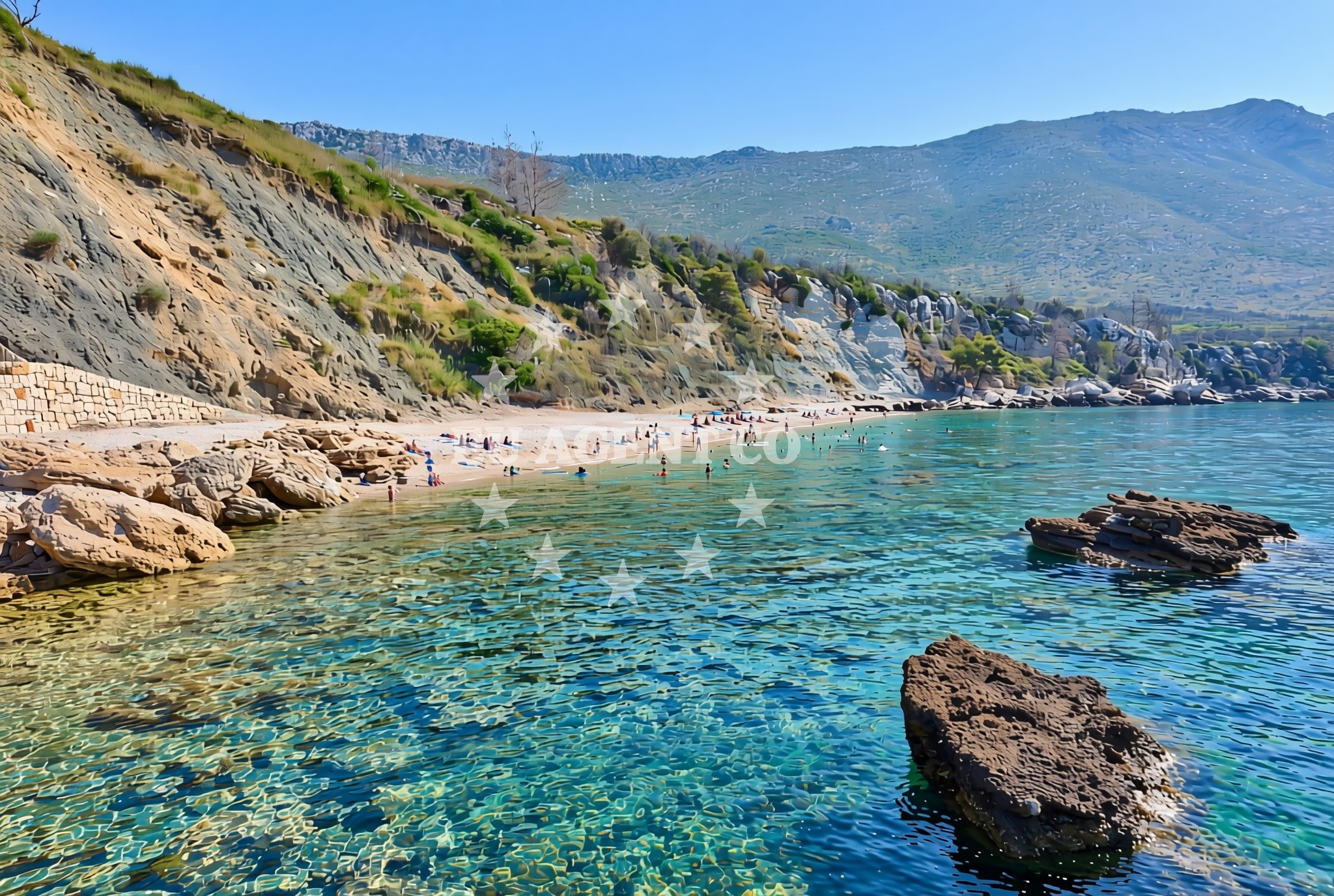
Lavanda (FKK), Stanković Beach is a distinctive coastal feature located in the village of Stanković on Croatia’s Adriatic coast. This gravel beach extends 155 meters along the shoreline, offering a textured alternative to the region’s more common sandy beaches. While no formal facilities are listed, its location within a broader coastal network makes it a point of interest for those exploring the area’s natural and maritime landscapes.
About this beach
Lavanda (FKK), Stanković
Beach: Lavanda (FKK)
Location: Stanković
Characteristics and facilities
Gravel
155 m
Beach character
The beach’s defining characteristic is its gravel composition, which contrasts with the smooth sands typical of many Adriatic shores. This texture may influence its use for swimming or sunbathing, though visitors are encouraged to experience it directly. The beach’s length provides a modest stretch for exploration, and its placement within Stanković suggests proximity to local settlements and potential connections to nearby coastal routes.
Swimming and shore
Swimming conditions at Lavanda (FKK) are not explicitly detailed in available records, but the gravel substrate may affect water access and comfort. The shoreline itself is marked by its rocky and pebbly nature, which could offer unique opportunities for coastal walks or photography. As with many Adriatic beaches, the interplay between land and sea here is shaped by the region’s geological formations and maritime climate.
Facilities and activities
No specific facilities or structured activities are documented for Lavanda (FKK) Beach. Its appeal likely stems from its natural character rather than curated amenities. Visitors may find it a place for quiet reflection, informal gatherings, or as a stop along broader coastal excursions. The absence of formal infrastructure underscores its role as a raw, unembellished stretch of coastline.
Access and location
Located in Stanković, this beach is part of a coastal area that connects to broader Adriatic networks. While no specific access routes or parking details are provided, its position within a known settlement suggests proximity to local roads and potential links to nearby towns. For those arriving by sea, the beach’s placement along the coast may align with regional sailing patterns, though formal marina or anchorage information is not available for this exact location.
What to expect
Visitors to Lavanda (FKK) should anticipate a gravel beach experience that diverges from the region’s more common sandy shores. The 155-meter stretch offers a unique texture for walking or sitting, though its suitability for swimming is uncertain. The beach’s character is likely shaped by its geological context, and its placement in Stanković may provide opportunities to engage with local coastal life or broader Adriatic scenery.
Practical tips
Those visiting should consider footwear suitable for gravel surfaces and be mindful of potential variations in beach conditions. As with many natural shorelines, the best times to visit may depend on tidal patterns and weather, though specific guidance is not available in records.
Exploring the coast by yacht
The Adriatic coast near Stanković is part of a sailing region known for its scenic routes and diverse coastal landscapes. While Lavanda (FKK) Beach itself is not marked as a formal anchorage or marina, the broader area may interest yacht charter guests exploring the Croatian coast. For those seeking to combine beach visits with maritime travel, Euro-Agent’s yacht search tool can help identify vessels operating in this region.
Regional Context and Coastal Connections
The area around Stanković is part of Croatia’s Dalmatian coast, a region characterized by its rugged cliffs, clear waters, and historic settlements. While Lavanda (FKK) is a modest beach, the broader coastline offers opportunities for sailing, hiking, and cultural exploration. Nearby towns may provide access to restaurants, markets, and other amenities, though specific details for Stanković are not detailed in available records.
Anchorages in the surrounding area
Anchorages in the surrounding area include Duba Peljeska, Badija, and Korcula, offering nearby mooring options.
- Anchorage — duba peljeska — 2.3 NM from beach
- Anchorage — badija — 2.7 NM from beach
- Anchorage — korcula — 3.4 NM from beach
- Anchorage — trpanj — 3.7 NM from beach
- Anchorage — lumbarda — korcula — 3.7 NM from beach
- Anchorage — korcula — 3.9 NM from beach
- Anchorage — lumbarda — korcula — 4.1 NM from beach
- Anchorage — podobuce — 4.1 NM from beach
Distances are straight-line geographic distances, not sailing routes.
Mooring buoys in the surrounding area
- Restaurant Moro buoys — stupe — 1.4 NM from beach
- Fuel jetty — korcula — 3.1 NM from beach
- Vrnik Arts Club buoys — 3.2 NM from beach
- Quay — vrnik — 3.2 NM from beach
- Jetty — korcula — 4.5 NM from beach
Distances are straight-line geographic distances, not sailing routes.
Marine fuel stations
- Fuel station — korcula — 3.1 NM from beach
- Fuel station — ploce — 10.8 NM from beach
- Ina — makarska — 20.6 NM from beach
- Ina — vela luka — korcula — 21.7 NM from beach
Distances are straight-line geographic distances, not sailing routes.
Harbours in the surrounding area
- Orebić — orebic — 1.5 NM from beach
- Duba — duba peljeska — 3.0 NM from beach
- Trpanj — 3.1 NM from beach
- Korčula E harbour — korcula — 3.4 NM from beach
- Korčula W harbour — korcula — 3.4 NM from beach
- Tatinja — lumbarda — korcula — 3.7 NM from beach
Distances are straight-line geographic distances, not sailing routes.
Marinas in the surrounding area
- ACI Marina Korčula — korcula — 3.4 NM from beach
- Marina Lumbarda — korcula — 3.8 NM from beach
- Marina Tučepi — marina tucepi — 18.1 NM from beach
- Marina Solitudo — lastovo — 21.4 NM from beach
- Marina Korkyra — vela luka — korcula — 21.8 NM from beach
Distances are straight-line geographic distances, not sailing routes.
Restaurants near the beach
Restaurants near the beach include Moro in Stupe and Vrnik Arts Club, offering dining options in the vicinity.
- Moro — stupe — 1.4 NM from beach
- Vrnik Arts Club — 3.2 NM from beach
- Restaurant Lesic Dimitri — korcula — 3.3 NM from beach
- Restaurant Filippi — korcula — 3.3 NM from beach
- Restaurant — korcula — 3.3 NM from beach
- Adio Mare — korcula — 3.4 NM from beach
- Restaurant — korcula — 3.4 NM from beach
Distances are straight-line geographic distances, not sailing routes.
Navigation guides for the surrounding area
Navigation guides for the surrounding area include Orebic and Uvala Divna, aiding in local route planning.
- Orebic — 1.3 NM from beach
- Uvala Divna — 2.2 NM from beach
- Otocic Badija — 2.6 NM from beach
- Trpanj — 3.3 NM from beach
- Uvala Racisce — 3.7 NM from beach
Distances are straight-line geographic distances, not sailing routes.
Yachts from nearby departure bases
Yachts from nearby departure bases include those based in Ploče City Port and Tučepi Port, offering charter options.
Sailing yachts
- Elan 40 Impression (Karleta) — Ploče City Port — 10.7 NM from departure base to beach
- Sun Odyssey 349 (Porto Tolero) — Ploče City Port — 10.7 NM from departure base to beach
- Elan 514 Impression (Cesarica III) — Ploče City Port — 10.7 NM from departure base to beach
- Sun Odyssey 419 (Luka Ploce) — Ploče City Port — 10.7 NM from departure base to beach
- Salona 44 (SAMOA) — Ploče City Port — 10.7 NM from departure base to beach
- More 55 (MRS. ROBINSON) — Ploče City Port — 10.7 NM from departure base to beach
- Sun Odyssey 349 (Visnjica) — Ploče City Port — 10.7 NM from departure base to beach
- Bavaria 40 Cruiser (LADY BUTTERFLY) — Tučepi Port — 18.1 NM from departure base to beach
Catamarans
- Lagoon 450 Fly (Alba Mouse) — Ploče City Port — 10.7 NM from departure base to beach
Motor yachts
- Princess V53 (Chablis) — Makarska Port — 20.4 NM from departure base to beach
Distances are straight-line geographic distances, not sailing routes.