Kupalište Reš, Rijeka Beach, Croatia
About this beach
Kupalište Reš, Rijeka
Beach: Kupalište Reš
Location: Rijeka
Characteristics and facilities
Concrete / stone slabs
50 m
Beach character
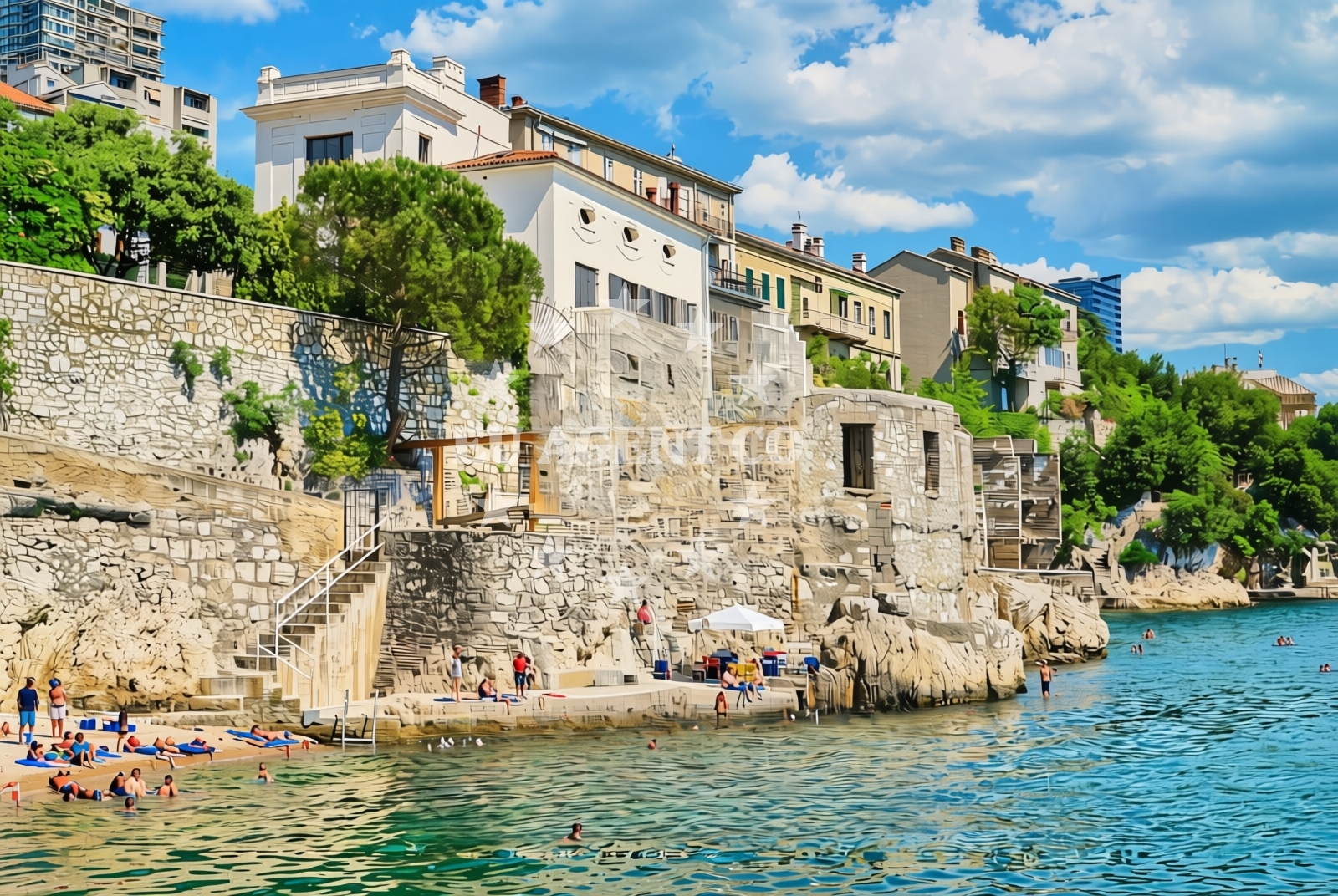
The beach consists of concrete and stone slabs, a feature common in urban coastal areas where natural sand is scarce. At 50 meters in length, it is a short but accessible shoreline, ideal for brief sunbathing sessions or casual strolls. The hard surface may make it less suitable for children’s play compared to sandy beaches, but it provides a stable base for visitors walking along the shore. The beach’s character reflects Rijeka’s role as a port city, where urban development often prioritizes functionality over natural landscapes.Swimming and shore
Swimming conditions at Kupalište Reš are not explicitly detailed in available records, but the concrete and stone shoreline suggests the water’s edge is firm and unobstructed. The beach’s proximity to Rijeka’s harbor means it is likely exposed to maritime traffic, which may influence water clarity and safety. Visitors should exercise caution near the shoreline, as the hard surface could be slippery when wet. The beach does not appear to have designated swimming zones or lifeguard services, so it is advisable to assess conditions before entering the water.Facilities and activities
There are no listed facilities or activities specific to Kupalište Reš itself. The beach does not appear to have amenities such as showers, changing rooms, or seating. However, its location in Rijeka means visitors may access nearby city services, including cafes, restaurants, and cultural attractions. The beach’s primary function seems to be as a public shoreline for walking and viewing the harbor, rather than a destination for water-based activities.Access and location
Kupalište Reš is located in Rijeka, a major port city on the Adriatic Sea in northern Croatia. The beach lies along the coastline near the city’s harbor, which has historically been a hub for maritime trade and shipbuilding. Rijeka’s coastal position, at the mouth of the Kvarner Gulf, makes it a gateway to the Adriatic’s northern routes. The beach’s exact coordinates (45.319612° N, 14.46249° E) place it within walking distance of Rijeka’s historic Old Town and modern port facilities.What to expect
Visitors to Kupalište Reš should expect a short, urban-style beach composed of concrete and stone slabs. The 50-meter shoreline is best suited for casual use, such as walking along the shore or enjoying views of the harbor. The beach lacks traditional amenities like sunbeds or umbrellas, so visitors may need to bring their own equipment. Its location in Rijeka means it is well-connected to the city’s infrastructure, though it is not a primary destination for water sports or relaxation compared to other beaches in the region.Practical tips
Due to the concrete and stone surface, visitors may want to wear comfortable footwear to avoid discomfort. The beach’s proximity to Rijeka’s harbor means it is accessible by foot, bike, or public transport. Those interested in maritime activities may find nearby marinas and yacht charter services in the city more useful than the beach itself.Exploring the coast by yacht
Rijeka’s strategic position as a port city makes it a common stop for yacht charters exploring the northern Adriatic. The Kvarner Gulf, which lies just offshore from Kupalište Reš, offers sailing routes to nearby islands such as Krk and Cres. While the beach itself is not a marina or anchorage, its location near the harbor means it is within easy reach of yacht facilities. Charter guests may find the beach useful for a quick walk or photo opportunity, though more extensive nautical activities would require access to Rijeka’s dedicated marinas.Rijeka’s Maritime Heritage
Rijeka’s history as a port city dates back to ancient times, with its harbor serving as a critical link between the Adriatic and the mainland. The city’s maritime legacy is evident in its architecture, museums, and ongoing role as a shipping and cruise ship destination. Visitors to Kupalište Reš may appreciate the opportunity to observe this heritage firsthand, with the beach offering views of ships docking at the nearby port.Anchorages in the surrounding area
Anchorages in the surrounding area of Rijeka include locations such as Anchorage — voz — krk and Anchorage — jadranovo.
- Anchorage — voz — krk — 7.0 NM from beach
- Anchorage — voz — krk — 7.7 NM from beach
- Anchorage — jadranovo — 8.5 NM from beach
- Anchorage — medveja — 8.6 NM from beach
- Anchorage — klostar — 8.9 NM from beach
- Anchorage — moscenicka draga — 10.0 NM from beach
- Anchorage — njivice — krk — 10.4 NM from beach
- Anchorage — kacjak — 10.5 NM from beach
Distances are straight-line geographic distances, not sailing routes.
Mooring buoys in the surrounding area
Mooring buoys and jetties near Rijeka include Jetty — crisnjeva and Jetty — voz — krk.
- Jetty — crisnjeva — 6.2 NM from beach
- Jetty — voz — krk — 7.1 NM from beach
- Buoy field — omisalj — krk — 7.6 NM from beach
- Ika — 7.7 NM from beach
- Jetty — kacjak — 10.8 NM from beach
Distances are straight-line geographic distances, not sailing routes.
Marine fuel stations
Marine fuel stations in the vicinity of Rijeka include Fuel station — opatija and OMV — krk.
- Fuel station — opatija — 6.5 NM from beach
- Fuel station — crikvenica — 13.2 NM from beach
- OMV — krk — 17.5 NM from beach
- INA — novi vinodolski — 18.0 NM from beach
Distances are straight-line geographic distances, not sailing routes.
Harbours in the surrounding area
Harbours in the immediate area of Rijeka include Rijeka and Kostrena — paveki.
- Rijeka — 1.5 NM from beach
- Kostrena — paveki — 2.4 NM from beach
- Bakar — 3.2 NM from beach
- Brgud — rijeka — 3.3 NM from beach
- Podurinj — 3.4 NM from beach
- Kantrida — rijeka — 3.7 NM from beach
Distances are straight-line geographic distances, not sailing routes.
Marinas in the surrounding area
Marinas in the surrounding area of Rijeka include Marina Admiral — opatija and Omišalj Docks — omisalj — krk.
- Marina Admiral — opatija — 6.8 NM from beach
- ACI Marina Opatija — 7.3 NM from beach
- Omišalj Docks — omisalj — krk — 7.6 NM from beach
- Šilo — silo — krk — 13.4 NM from beach
- Marina Novi — novi vinodolski — 18.0 NM from beach
Distances are straight-line geographic distances, not sailing routes.
Restaurants near the beach
Restaurants near Kupalište Reš, Rijeka Beach include Na Kantunu — rijeka and Spagho — rijeka.
- Na Kantunu — rijeka — 0.8 NM from beach
- Restaurant — rijeka — 0.9 NM from beach
- Spagho — rijeka — 0.9 NM from beach
- Fork — rijeka — 1.1 NM from beach
- Restaurant — glavani — 1.4 NM from beach
- Restaurant — glavani — 1.4 NM from beach
Distances are straight-line geographic distances, not sailing routes.
Navigation guides for the surrounding area
Navigation guides for the surrounding area of Rijeka include Luka Martinscica and Rijeka (Fiume).
- Luka Martinscica — 1.0 NM from beach
- Rijeka (Fiume) — 1.7 NM from beach
- Opatija (and lciCi) — 6.2 NM from beach
- Omisaljski Zaljev — 7.2 NM from beach
- Uvala Sapan — 7.8 NM from beach
Distances are straight-line geographic distances, not sailing routes.
Yachts from nearby departure bases
Yachts departing from nearby bases in Rijeka include Motoryacht (Korab) and Bavaria 44 (Scorpion) from Rijeka Port.
Sailing yachts
- Bavaria 44 (Scorpion) — Rijeka Port — 3.3 NM from departure base to beach
- Sun Odyssey 45 (My Lady) — Rijeka Port — 3.3 NM from departure base to beach
- Bavaria 32 (Andromeda) — Kraljevica Port Porto — 5.0 NM from departure base to beach
- Bavaria 36 (Tamra) — Kraljevica Port Porto — 5.0 NM from departure base to beach
- Sun Odyssey 415 (Stariel) — Opatija Marina Admiral — 6.8 NM from departure base to beach
Catamarans
- Eleuthera 60 (Calima) — Rijeka Port — 3.3 NM from departure base to beach
Motor yachts
- Motoryacht (Korab) — Rijeka Port — 0.9 NM from departure base to beach
- Fleur de Lys (Cadabra) — Rijeka Port — 3.3 NM from departure base to beach
Motor boats
- Atlantic Sun Cruiser 730 (Lady Blue) — Opatija Marina Admiral — 6.8 NM from departure base to beach
- Merry Fisher 795 (Classic) — Opatija Marina Admiral — 6.8 NM from departure base to beach
Distances are straight-line geographic distances, not sailing routes.