Križ, Vrboska (Hvar) Beach, Croatia
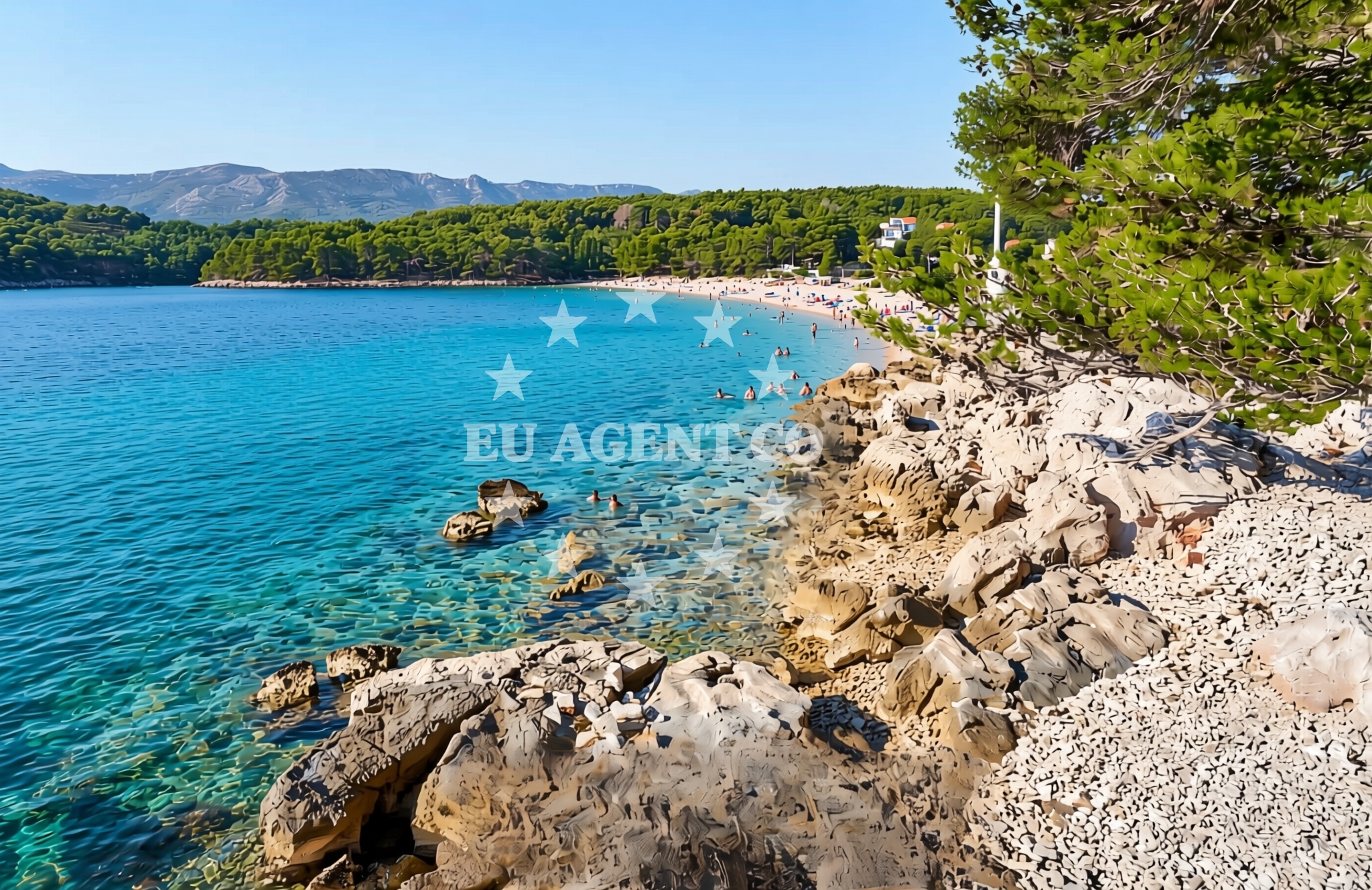
About this beach
Križ, Vrboska (Hvar)
Beach: Križ
Location: Vrboska (Hvar)
Characteristics and facilities
Gravel, rocks
Beach character
The beach's defining feature is its gravel and rock composition, which creates a rugged and uneven shoreline. This natural landscape is typical of certain parts of Hvar's coast, where erosion and geological formations shape the coastline. The lack of soft sand means the beach is more suitable for exploration, photography, or short walks along the shore rather than sunbathing or extended water activities. The terrain may require sturdy footwear for safe navigation.Swimming and shore
Due to the gravel and rock composition, Križ Beach is not ideal for swimming or water-based recreation. The shoreline is uneven and potentially hazardous for wading, though the area may appeal to those interested in coastal geology or rock formations. The surrounding waters are part of the Adriatic Sea, known for its clear waters and mild temperatures during the summer months.Facilities and activities
There are no formal facilities or structured activities listed for Križ Beach. The area appears to be a natural, undeveloped shoreline with no amenities such as restrooms, showers, or parking. Visitors should plan accordingly, as the beach does not cater to large groups or extended stays. The focus here is on the raw, unaltered coastal environment.Access and location
Križ Beach is located in the village of Vrboska on the island of Hvar, Croatia. The village of Vrboska is a historic settlement with a medieval fortress and a harbor that serves as a starting point for yacht charters in the area. The beach is accessible via local roads leading to the village, though specific parking details are not available in the catalog. Its proximity to Vrboska's harbor makes it a potential stop for sailors exploring the Hvar coast.What to expect
Visitors to Križ Beach should expect a rugged, gravelly shoreline with rocky outcrops. The beach is not designed for traditional beach activities but offers a unique opportunity to experience Hvar's natural coastal formations. The area is likely to be quiet and less crowded compared to other beaches in the region. Its location near Vrboska's harbor means it could be of interest to yacht charter guests passing through the area, though it is not a designated anchorage or docking point.Practical tips
Bring sturdy footwear for navigating the gravel and rocks. The beach is best suited for short visits or photography. Due to the lack of facilities, visitors should bring their own supplies. The area is remote, so it is advisable to check local conditions before visiting.Exploring the coast by yacht
Križ Beach lies near Vrboska, a well-known harbor on Hvar Island that is a popular base for yacht charters in the Adriatic. The surrounding waters are part of a sailing region that includes the Hvar Channel, a route connecting the islands of Hvar, Brac, and the mainland. Yacht charter guests exploring this area may pass by Križ Beach as part of a coastal cruise, though it is not a primary anchorage. For those interested in sailing, the nearby Vrboska harbor offers access to the broader Adriatic sailing network, with connections to other islands and coastal towns.Historical and Cultural Context of Vrboska
Vrboska, the village near Križ Beach, is one of the oldest settlements on Hvar Island. Its medieval fortress, built in the 13th century, is a notable landmark. The village has a rich history tied to the Knights of St. John and later Venetian rule. Today, Vrboska retains much of its traditional character, with narrow streets, stone buildings, and a harbor that has been a hub for maritime activity for centuries.Anchorages in the surrounding area
Anchorages in the surrounding area include Vrboska and Hvar, offering nearby mooring options.
- Anchorage — vrboska — hvar — 0.3 NM from beach
- Anchorage — hvar — 0.8 NM from beach
- Anchorage — vrboska — hvar — 0.9 NM from beach
- Uvala Basina — vrbanj — hvar — 1.7 NM from beach
- Anchorage — hvar — 2.5 NM from beach
- Anchorage — hvar — 2.6 NM from beach
- Anchorage — hvar — 2.9 NM from beach
- Anchorage — hvar — 3.0 NM from beach
Distances are straight-line geographic distances, not sailing routes.
Mooring buoys in the surrounding area
- Quay — hvar — 0.8 NM from beach
- Jetty — vrbanj — hvar — 1.7 NM from beach
- Jetty — vrbanj — hvar — 1.8 NM from beach
- Jetty — zavala — hvar — 3.3 NM from beach
- Buoy field — stari grad — hvar — 4.1 NM from beach
Distances are straight-line geographic distances, not sailing routes.
Marine fuel stations
- Ina — vrboska — hvar — 0.6 NM from beach
- Fuel station — bol — brac — 5.2 NM from beach
- Fuel station — sumartin — brac — 10.1 NM from beach
- Fuel station — hvar — 10.6 NM from beach
Distances are straight-line geographic distances, not sailing routes.
Harbours in the surrounding area
- Vrboska — hvar — 0.6 NM from beach
- Port Jelsa — hvar — 1.0 NM from beach
- Stari Grad — hvar — 4.2 NM from beach
- Marina Bilo Idro — sveta nedjelja — hvar — 5.1 NM from beach
- Bol — brac — 5.2 NM from beach
- Sumartin — brac — 10.4 NM from beach
Distances are straight-line geographic distances, not sailing routes.
Marinas in the surrounding area
Marinas in the surrounding area range from ACI Marina Vrboska to facilities on Korcula and Brac.
- ACI Marina Vrboska — hvar — 0.5 NM from beach
- ACI Marina Palmižana — aci marina palmizana — st klement — 12.8 NM from beach
- Marina Korkyra — vela luka — korcula — 13.1 NM from beach
- ACI Marina Milna — milna brac — 13.7 NM from beach
- Marina Milna Kanarija — milna brac — 13.9 NM from beach
Distances are straight-line geographic distances, not sailing routes.
Restaurants near the beach
Restaurants near the beach are clustered in Vrboska and Jelsa, offering local dining options.
- Restoran Luka — vrboska — hvar — 0.4 NM from beach
- Bonaca — vrboska — hvar — 0.5 NM from beach
- Trica Gardelin — vrboska — hvar — 0.7 NM from beach
- Restaurant Pizzeria Skojic — vrboska — hvar — 0.7 NM from beach
- Konoba Lem — vrboska — hvar — 0.7 NM from beach
- Tavern Lavcevic — vrboska — hvar — 0.8 NM from beach
- Me and Mrs Jones — jelsa — hvar — 0.9 NM from beach
Distances are straight-line geographic distances, not sailing routes.
Navigation guides for the surrounding area
Navigation guides for the surrounding area cover Vrboska, Zavala, and nearby coastal points.
- Vrboska — 0.3 NM from beach
- Otocic Zecevo — 0.9 NM from beach
- Jelsa — 1.0 NM from beach
- Uvala Basina — 1.4 NM from beach
- Zavala (Pitavska Plaza) — 3.4 NM from beach
Distances are straight-line geographic distances, not sailing routes.
Yachts from nearby departure bases
Yachts from nearby departure bases in Milna and Baška Voda provide access to the beach area.
Sailing yachts
- Hanse 505 (AVALON) — Milna Marina Vlaška — 14.1 NM from departure base to beach
- Bavaria 46 Cruiser (MO) — Milna Marina Vlaška — 14.1 NM from departure base to beach
- Hanse 388 (BANJO) — Milna Marina Vlaška — 14.1 NM from departure base to beach
- Hanse 455 (AURUM 1) — Milna Marina Vlaška — 14.1 NM from departure base to beach
- Elan Impression 40 (KARLETA) — Baška Voda Port — 15.7 NM from departure base to beach
- Bavaria 41 (Seagoll) — Baška Voda — 15.7 NM from departure base to beach
- Bavaria 44 (TARISA ) — Baška Voda — 15.7 NM from departure base to beach
Catamarans
- Lagoon 450 (LAMANTIN) — Baška Voda — 15.7 NM from departure base to beach
Motor yachts
- Canados 86 (Karisma) — Baška Voda — 15.7 NM from departure base to beach
Motor boats
- Pearl Sea 31 Hard Top (Aero) — Baška Voda Port — 15.7 NM from departure base to beach
Distances are straight-line geographic distances, not sailing routes.