Kralj Zvonimir istok, Orebić Beach, Croatia
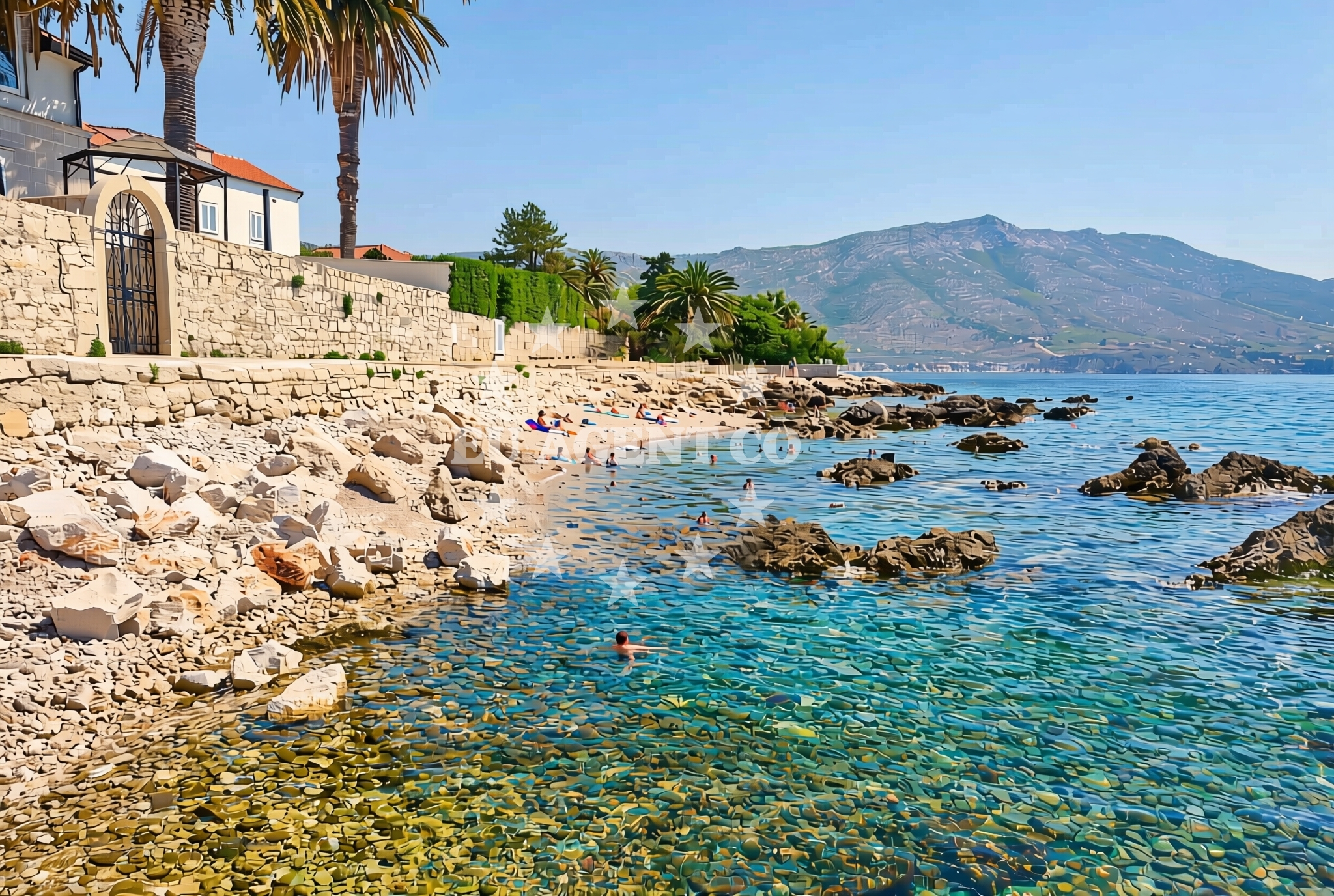
About this beach
Kralj Zvonimir istok, Orebić
Beach: Kralj Zvonimir istok
Location: Orebić
Characteristics and facilities
Gravel, concrete / stone slabs, rocks
50 m
Beach character
The beach's terrain consists primarily of gravel, concrete slabs, and exposed rock formations, creating a rugged shoreline that contrasts with the more conventional sandy beaches found elsewhere in Croatia. The 50-meter stretch is relatively narrow, making it a modest spot for those seeking a quiet, low-traffic coastal experience. The rocky sections may pose challenges for barefoot walking, though they provide stable footing for those navigating the shoreline. The beach's character is shaped by its geological composition and its position within the broader coastal topography of the Orebić area.Swimming and shore
Swimming conditions at Kralj Zvonimir istok are influenced by the nearby rocky terrain and the general dynamics of the Adriatic coastline. The beach's shallow, gravelly bottom may offer gentle entry points for swimmers, though the rocky sections could create uneven water depths. The shore itself is marked by a mix of natural rock formations and artificial concrete slabs, which may affect the overall swimming experience. Visitors should be mindful of the beach's limited size and the potential for waves to interact with the rocky outcrops, particularly during stronger winds.Facilities and activities
There are no formal facilities or structures directly associated with Kralj Zvonimir istok, Orebić Beach. The beach does not feature amenities such as showers, restrooms, or sunbeds, reflecting its modest scale and natural character. However, its proximity to Orebić means visitors can access local services, including restaurants, shops, and accommodations. The beach itself does not support organized activities, but the surrounding area offers opportunities for coastal exploration, hiking, and sightseeing along the Dalmatian coast.Access and location
Kralj Zvonimir istok is located within the town of Orebić, a coastal municipality on the island of Brač. The beach is accessible via local roads that connect to Orebić's main thoroughfares, making it reachable by car or public transportation. Orebić itself is a gateway to Brač Island and the wider Adriatic coastline, with ferry services and road links to nearby towns such as Bol and Supetar. The beach's position near the town center means it benefits from the infrastructure and services available in Orebić, though its own facilities remain limited to the natural shoreline.What to expect
Visitors to Kralj Zvonimir istok, Orebić Beach should expect a compact, gravelly shoreline with rocky sections that define its character. The beach is not suited for those seeking extensive sandy areas or extensive facilities, but it offers a quiet, low-traffic environment for those looking to enjoy the coastline's natural features. Its proximity to Orebić provides access to local amenities, though the beach itself remains a modest, unassuming spot. The area is best appreciated for its geological diversity and its role as a minor but accessible coastal point within the Orebić region.Practical tips
Due to the beach's gravelly and rocky terrain, visitors may want to wear sturdy footwear for comfort. The limited size of the beach means it is best suited for short visits or as a stopover during broader explorations of the Orebić area. Those planning to swim should be cautious of the uneven seabed and potential wave activity near the rocky outcrops. The beach's location near Orebić allows for easy access to local services, which can be useful for meals, accommodations, or further coastal excursions.Exploring the coast by yacht
For visitors interested in yacht charter or sailing, the area around Orebić offers access to the broader Adriatic sailing routes. The Dalmatian coast, including Brač Island and the nearby islands of Hvar and Šolta, is a popular region for charter yachts, with marinas and anchorages available in towns such as Bol, Supetar, and Split. While Kralj Zvonimir istok itself is not a designated anchorage or marina, its proximity to Orebić means it can serve as a reference point for sailors navigating the region. Charter guests exploring the area may find the surrounding coastline to be rich in natural beauty and sailing opportunities, with access to both sheltered bays and open waters.Regional Context and Coastal Exploration
The Orebić area is part of the larger Brač Island landscape, known for its limestone cliffs, vineyards, and coastal villages. The region's geography includes a mix of rugged coastlines, sheltered coves, and fertile inland areas. Visitors to Kralj Zvonimir istok may find it useful to explore nearby points of interest, such as the village of Orebić itself, which offers a blend of traditional architecture and modern amenities. The surrounding coastline also includes other beaches and bays that may be more suitable for different activities, depending on visitor preferences.Anchorages in the surrounding area
Anchorages in the surrounding area include options near Badija and Korcula, offering convenient mooring points for vessels.
- Anchorage — badija — 1.8 NM from beach
- Anchorage — korcula — 2.5 NM from beach
- Anchorage — duba peljeska — 2.7 NM from beach
- Anchorage — lumbarda — korcula — 3.0 NM from beach
- Anchorage — korcula — 3.3 NM from beach
- Anchorage — korcula — 3.5 NM from beach
- Anchorage — korcula — 3.5 NM from beach
- Anchorage — lumbarda — korcula — 3.6 NM from beach
Distances are straight-line geographic distances, not sailing routes.
Mooring buoys in the surrounding area
- Restaurant Moro buoys — stupe — 0.8 NM from beach
- Fuel jetty — korcula — 2.2 NM from beach
- Vrnik Arts Club buoys — 2.4 NM from beach
- Quay — vrnik — 2.5 NM from beach
- Jetty — korcula — 3.6 NM from beach
Distances are straight-line geographic distances, not sailing routes.
Marine fuel stations
- Fuel station — korcula — 2.1 NM from beach
- Fuel station — ploce — 11.8 NM from beach
- Ina — makarska — 20.6 NM from beach
- Ina — vela luka — korcula — 20.8 NM from beach
Distances are straight-line geographic distances, not sailing routes.
Harbours in the surrounding area
Harbours in the surrounding area include the nearby Orebić harbor, along with options in Korcula and Duba Peljeska.
- Orebić — orebic — 0.6 NM from beach
- Korčula E harbour — korcula — 2.4 NM from beach
- Korčula W harbour — korcula — 2.5 NM from beach
- Duba — duba peljeska — 3.1 NM from beach
- Tatinja — lumbarda — korcula — 3.1 NM from beach
- Kučišće — kucisce — 3.2 NM from beach
Distances are straight-line geographic distances, not sailing routes.
Marinas in the surrounding area
Marinas in the surrounding area feature ACI Marina Korcula and other facilities in Korcula and Tučepi.
- ACI Marina Korčula — korcula — 2.5 NM from beach
- Marina Lumbarda — korcula — 3.1 NM from beach
- Marina Tučepi — marina tucepi — 18.2 NM from beach
- Marina Solitudo — lastovo — 20.4 NM from beach
- Marina Korkyra — vela luka — korcula — 20.9 NM from beach
Distances are straight-line geographic distances, not sailing routes.
Restaurants near the beach
Restaurants near the beach feature options in Stupe and Korcula, offering dining experiences close to the shore.
- Moro — stupe — 0.7 NM from beach
- Restaurant Lesic Dimitri — korcula — 2.4 NM from beach
- Restaurant Filippi — korcula — 2.4 NM from beach
- Restaurant — korcula — 2.4 NM from beach
- Adio Mare — korcula — 2.4 NM from beach
- Vrnik Arts Club — 2.4 NM from beach
- Restaurant — korcula — 2.4 NM from beach
Distances are straight-line geographic distances, not sailing routes.
Navigation guides for the surrounding area
Navigation guides for the surrounding area include nearby points such as Orebic and Otocic Badija, aiding in route planning.
- Orebic — 0.4 NM from beach
- Otocic Badija — 1.7 NM from beach
- Uvala Divna — 2.7 NM from beach
- Uvala Racisce — 3.0 NM from beach
- Uvala Banja — 3.1 NM from beach
Distances are straight-line geographic distances, not sailing routes.
Yachts from nearby departure bases
Sailing yachts
- Elan 40 Impression (Karleta) — Ploče City Port — 11.7 NM from departure base to beach
- Elan 514 Impression (Cesarica III) — Ploče City Port — 11.7 NM from departure base to beach
- More 55 (MRS. ROBINSON) — Ploče City Port — 11.7 NM from departure base to beach
- Sun Odyssey 419 (Luka Ploce) — Ploče City Port — 11.7 NM from departure base to beach
- Sun Odyssey 349 (Visnjica) — Ploče City Port — 11.7 NM from departure base to beach
- Salona 44 (SAMOA) — Ploče City Port — 11.7 NM from departure base to beach
- Sun Odyssey 349 (Porto Tolero) — Ploče City Port — 11.7 NM from departure base to beach
- Bavaria 40 Cruiser (LADY BUTTERFLY) — Tučepi Port — 18.2 NM from departure base to beach
Catamarans
- Lagoon 450 Fly (Alba Mouse) — Ploče City Port — 11.7 NM from departure base to beach
Motor yachts
- Princess V53 (Chablis) — Makarska Port — 20.4 NM from departure base to beach
Distances are straight-line geographic distances, not sailing routes.