Keki istok, Barbat na Rabu (Rab) Beach, Croatia
About this beach
Keki istok, Barbat na Rabu (Rab)
Beach: Keki istok
Location: Barbat na Rabu (Rab)
Characteristics and facilities
Sand, gravel, concrete / stone slabs
Restaurant / snack bar
Caffe bar / Drinks stand
Beach character
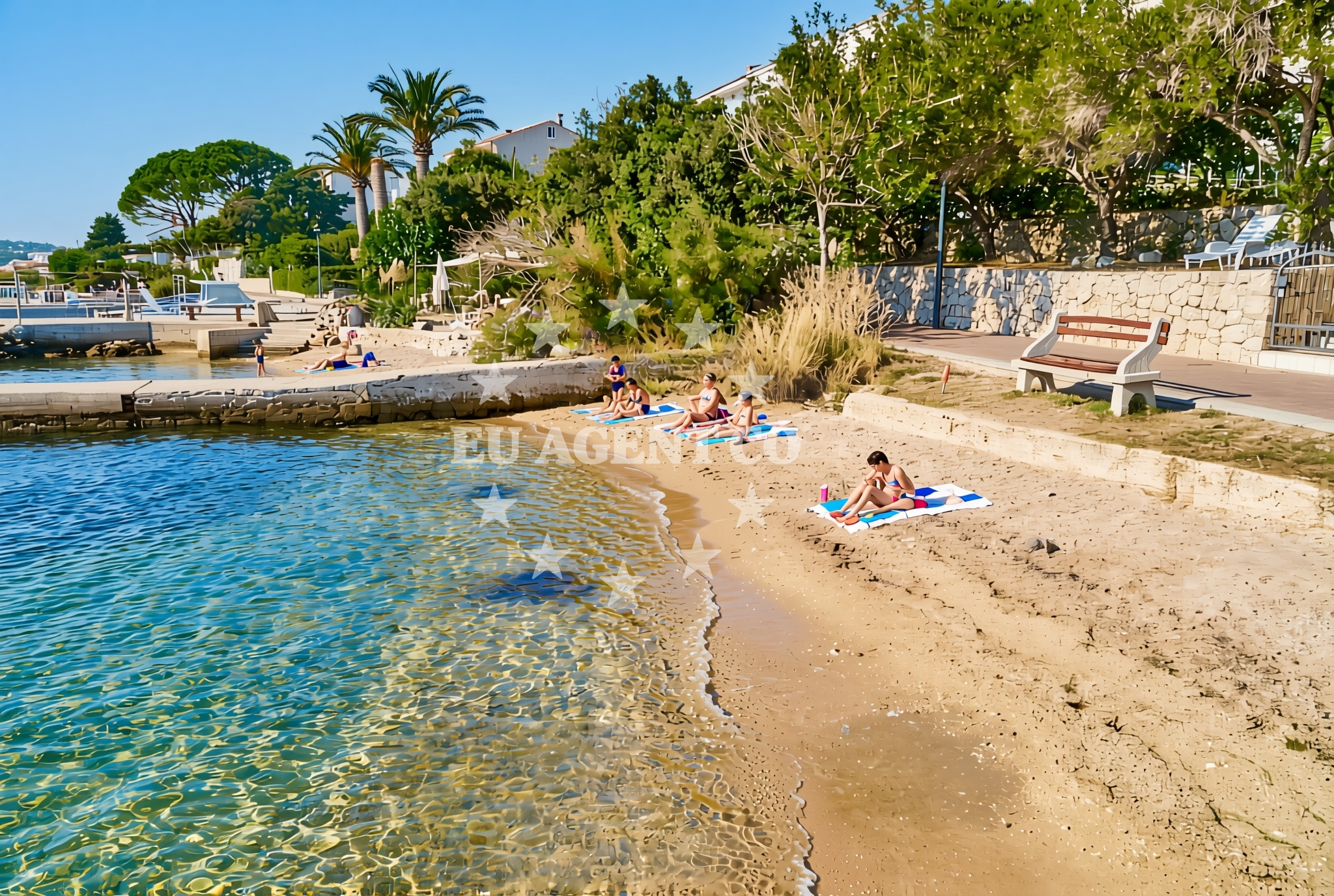
The beach's surface is a mix of sand, gravel, and concrete/stone slabs, a combination typical of Rab's coastal terrain. The sand and gravel sections provide a natural setting for sunbathing and casual recreation, while the concrete and stone areas may indicate structured access points or remnants of historical infrastructure. The shoreline's composition suggests a balance between natural erosion and human-modified features, common in coastal areas with significant maritime activity.Swimming and shore
While specific swimming conditions are not detailed in the beach's records, the Adriatic Sea's reputation for clear waters and moderate currents makes this area a logical candidate for safe swimming. The gravelly sections of the beach may offer firmer footing for entering and exiting the water, while the sandier areas could provide softer access. The presence of concrete slabs along the shore might indicate designated entry points or structural elements related to coastal management.Facilities and activities
The beach is equipped with a restaurant, snack bar, and caffe bar, catering to visitors seeking refreshments during their time at the shore. These facilities suggest a focus on convenience for day-trippers and casual visitors. No structured activities are listed, but the proximity to Rab's cultural and historical sites—such as the medieval town of Rab and its UNESCO-listed landmarks—offers opportunities for exploration beyond the beach itself.Access and location
Located on the island of Rab, this beach benefits from the island's well-connected transport network. Rab is accessible via ferry services from nearby mainland cities like Zadar and Split, as well as by air to Zadar Airport. The beach's position on the island's eastern coast places it within reach of other notable Adriatic destinations, including the islands of Hvar, Brac, and Vis. Its proximity to Rab's historic town center means visitors can easily combine beach time with cultural sightseeing.What to expect
Visitors to Keki istok, Barbat na Rabu (Rab) Beach can expect a shoreline that blends natural and modified elements, with sandy and gravelly sections adjacent to concrete and stone slabs. The beach is served by on-site dining options, making it a practical choice for those seeking meals and drinks without leaving the area. While no specific recreational activities are documented, the beach's location on Rab provides access to the island's rich heritage, including its medieval architecture and scenic coastal trails.Practical tips
Given the beach's exposure to the Adriatic, sunscreen and a hat are advisable for extended sun exposure. The on-site restaurant and bar make it a good spot for a casual meal, though visitors should be prepared for a straightforward, unadorned beach experience without additional amenities.Exploring the coast by yacht
For yacht charter guests exploring the northern Adriatic, Rab's coastline offers a mix of sheltered bays and open waters, with Keki istok situated along a stretch that connects to the island's marinas and anchorages. While the beach itself is not marked as a formal docking point, its proximity to Rab's maritime infrastructure makes it a logical stop for sailors seeking a break from cruising. The Adriatic's calm waters and favorable sailing conditions during spring and autumn make this region a popular choice for charter vacations.Historical Context of Rab
The island of Rab has a long history dating back to ancient times, with evidence of Roman settlements and medieval fortifications. The town of Rab, a UNESCO World Heritage Site, features well-preserved architecture and a vibrant cultural scene. Visitors to the beach may find it rewarding to explore these historical elements, which are within easy reach of the shoreline.Anchorages in the surrounding area
- Anchorage — rab — 1.8 NM from beach
- Anchorage — rab — 2.1 NM from beach
- Anchorage — rab — 2.3 NM from beach
- Anchorage — rab — 2.6 NM from beach
- Anchorage — suha punta — rab — 2.7 NM from beach
- Anchorage — rab — 2.9 NM from beach
- Anchorage — suha punta — rab — 2.9 NM from beach
- Anchorage — suha punta — rab — 3.2 NM from beach
Distances are straight-line geographic distances, not sailing routes.
Mooring buoys in the surrounding area
- Banjol — rab — 0.5 NM from beach
- Sveti Stjepan — barbat — rab — 0.5 NM from beach
- Jetty — barbat — rab — 0.8 NM from beach
- Kaštel — barbat — rab — 1.1 NM from beach
- Buoy field — rab — 1.7 NM from beach
Distances are straight-line geographic distances, not sailing routes.
Marine fuel stations
- Ina — rab — 1.6 NM from beach
- Tifon — nerezine — losinj — 17.4 NM from beach
- Adria Oil — mali losinj — 18.6 NM from beach
- Ina — mali losinj — 18.8 NM from beach
Distances are straight-line geographic distances, not sailing routes.
Harbours in the surrounding area
- Pičuljan dock — barbat — rab — 0.3 NM from beach
- Hafen Rab — 1.5 NM from beach
- Veli Žal — suha punta — rab — 3.1 NM from beach
- Mišnjak — misnjak — rab — 3.7 NM from beach
- Tovarnele — pag — 3.9 NM from beach
- Mala Stinica — 4.4 NM from beach
Distances are straight-line geographic distances, not sailing routes.
Marinas in the surrounding area
- ACI Marina Rab — 1.5 NM from beach
- ACI Marina Supetarska Draga — rab — 4.6 NM from beach
- Marina Nerezine — losinj — 17.5 NM from beach
- ACI Marina Šimuni — simuni — pag — 17.7 NM from beach
- Y/C Marina Mali Lošinj — mali losinj — 18.5 NM from beach
Distances are straight-line geographic distances, not sailing routes.
Restaurants near the beach
- Barbat — rab — 0.5 NM from beach
- Mama — barbat — rab — 0.8 NM from beach
- Leut — barbat — rab — 0.8 NM from beach
- Santa Maria — rab — 1.5 NM from beach
- Tapas Bar Kampanel — rab — 1.5 NM from beach
- Paradiso — rab — 1.5 NM from beach
- Labirint — rab — 1.6 NM from beach
Distances are straight-line geographic distances, not sailing routes.
Navigation guides for the surrounding area
- Rab — 1.4 NM from beach
- Uvala Sv. Fumija — 2.1 NM from beach
- Uvala Misnjak — 3.9 NM from beach
- Uvala Sv. Kristofor and the nearby inlets — 3.9 NM from beach
- Uvala Stinica — 4.7 NM from beach
Distances are straight-line geographic distances, not sailing routes.
Yachts from nearby departure bases
Sailing yachts
- First 45 (Egeria) — Šimuni Kolan ACI Marina — 17.6 NM from departure base to beach
- Salona 45 (Nati) — Krk Punat port — 18.2 NM from departure base to beach
- First 25.7 (Petra) — Krk Punat port — 18.2 NM from departure base to beach
- Bavaria 46 Cruiser (DEA) — Mali Lošinj — 18.5 NM from departure base to beach
- Sunsail 38 (Islanders) — Mali Lošinj — 18.5 NM from departure base to beach
Catamarans
- Lagoon 380 (Xenia) — Krk Punat port — 18.2 NM from departure base to beach
Motor yachts
- Absolute 50 Fly (Acrobat) — Rab ACI Marina — 1.5 NM from departure base to beach
Motor boats
- Balt 818 Titanium (Valentina 2) — Novalja — 11.8 NM from departure base to beach
- Balt 818 Titanium (Valentina) — Novalja — 11.8 NM from departure base to beach
- Merry Fisher 895 (Zablace) — Mali Lošinj — 18.5 NM from departure base to beach
Distances are straight-line geographic distances, not sailing routes.