Karaka, Neum Beach, Croatia
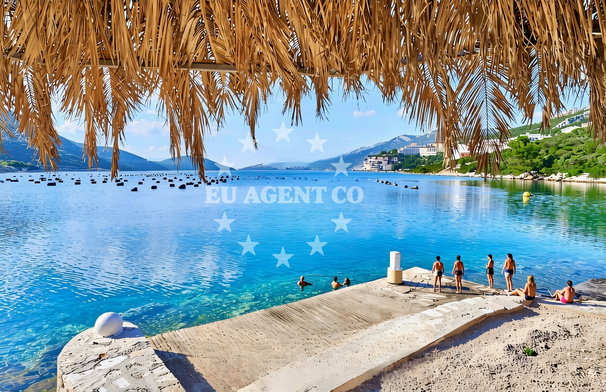
About this beach
Karaka, Neum
Beach: Karaka
Location: Neum
Characteristics and facilities
Gravel, concrete / stone slabs
Beach character
Karaka, Neum Beach is defined by its gravelly and rocky terrain, with surfaces composed of concrete and stone slabs. This creates a starkly different experience compared to the soft sands of other Adriatic beaches. The absence of traditional facilities such as showers, toilets, or umbrellas means visitors should prepare for a more rustic environment. The beach's simplicity aligns with its location in Neum, a town historically shaped by its strategic position between the Adriatic and the Neretva River. This terrain may appeal to those who prefer a less developed shoreline, though it may not be ideal for families seeking comfort or leisurely relaxation.Swimming and shore
The beach's gravel and stone slabs extend into the water, creating a shallow, uneven shoreline. While the Adriatic Sea is generally known for its clear waters, specific details about water quality or swimming conditions at Karaka are not documented in the beach's profile. Visitors should exercise caution when entering the sea, as the rocky terrain may pose challenges for swimmers. The lack of marked swimming areas or lifeguard services suggests that this beach is not optimized for recreational swimming, though it remains accessible for those willing to navigate its natural features.Facilities and activities
No formal facilities or activities are listed for Karaka, Neum Beach. The absence of amenities such as parking, restrooms, or shaded areas means visitors must rely on nearby infrastructure in Neum for basic needs. The beach does not appear to host organized activities, though its proximity to the Neretva River and the Adriatic coastline may offer opportunities for kayaking, fishing, or exploring the surrounding natural landscapes. Any recreational use would depend on the visitor's own equipment and preparation.Access and location
Karaka, Neum Beach is located in the town of Neum, which lies on the southernmost tip of the Croatian coast, bordering Bosnia and Herzegovina. The beach is accessible via local roads leading to Neum, a town known for its historical significance as a former Ottoman stronghold. Visitors arriving by car may find limited parking options near the beach, as the area's infrastructure is modest. Neum itself is a gateway to the Adriatic's quieter shores, with the beach serving as a reminder of the region's rugged coastline and maritime heritage.What to expect
Visitors to Karaka, Neum Beach should expect a raw, unpolished shoreline composed of gravel and stone slabs. The beach lacks traditional facilities, making it more suitable for those seeking a secluded, natural environment rather than a fully developed tourist destination. The area's proximity to Neum offers access to the town's historical sites and the Neretva River, which may provide alternative recreational opportunities. The beach's character is best appreciated by those who value simplicity and a connection to the Adriatic's untamed coastal landscapes.Practical tips
Due to the beach's gravelly terrain, visitors should wear sturdy footwear to avoid discomfort. Sun protection is essential, as there are no shaded areas or umbrellas available. Those planning to spend time at the beach should bring their own refreshments and supplies, as no on-site vendors are listed. The lack of formal facilities means visitors should prioritize safety and self-sufficiency during their visit.Exploring the coast by yacht
Karaka, Neum Beach lies within a region of the Adriatic that is popular with sailors and yacht charter guests. The surrounding waters offer opportunities for exploration, with Neum serving as a reference point for navigation along the Croatian coast. While the beach itself is not a designated anchorage, the broader area includes marinas and harbors that cater to yachting enthusiasts. Charter guests may find the proximity to Neum useful for accessing local attractions or planning routes along the Adriatic's southern reaches.Historical and Cultural Context of Neum
Neum, the town near Karaka, has a rich history influenced by its location at the crossroads of the Adriatic and the Neretva River. Historically, it was an important Ottoman outpost, and remnants of its past can still be seen in the area. The town's modern identity blends this heritage with its role as a coastal gateway, offering a quiet alternative to the more tourist-heavy regions of Croatia. Visitors may find interest in exploring Neum's historical sites, which provide context for the beach's unique position along the Adriatic.Anchorages in the surrounding area
Anchorages in the surrounding area include Klek, Duboka, and Mali Ston, offering nearby mooring options.
- Anchorage — klek — 3.2 NM from beach
- Anchorage — klek — 3.5 NM from beach
- Anchorage — duboka — 4.0 NM from beach
- Anchorage — brijesta — 4.2 NM from beach
- Anchorage — mali ston — 5.3 NM from beach
- Anchorage — prapratno — 6.3 NM from beach
- Anchorage — duba — 7.0 NM from beach
- Anchorage — broce — 7.6 NM from beach
Distances are straight-line geographic distances, not sailing routes.
Mooring buoys in the surrounding area
- Brijesta — 4.1 NM from beach
- Quay — prapratno — 6.3 NM from beach
- Jetty — blace — 8.3 NM from beach
- Quay — kobas — 8.4 NM from beach
- Lukas Taverna jetty — kobas — 8.4 NM from beach
Distances are straight-line geographic distances, not sailing routes.
Marine fuel stations
- Fuel station — sobra — mljet — 10.5 NM from beach
- Fuel station — ploce — 11.7 NM from beach
- Fuel station — korcula — 21.1 NM from beach
- Ina — dubrovnik — 25.2 NM from beach
Distances are straight-line geographic distances, not sailing routes.
Harbours in the surrounding area
- Hodilje — 4.4 NM from beach
- Mali Ston — 5.3 NM from beach
- Ston — 5.8 NM from beach
- Prapranto Ferry Harbour — prapratno — 6.6 NM from beach
- Opuzen — 6.8 NM from beach
- Žuljana — zuljana — 7.7 NM from beach
Distances are straight-line geographic distances, not sailing routes.
Marinas in the surrounding area
Marinas in the surrounding area include ACI Marina Slano, Marina Lumbarda, and ACI Marina Dubrovnik, providing nearby mooring options.
- ACI Marina Slano — 14.0 NM from beach
- Marina Lumbarda — korcula — 19.9 NM from beach
- ACI Marina Korčula — korcula — 21.6 NM from beach
- Marina Frapa Dubrovnik — 25.3 NM from beach
- ACI Marina Dubrovnik — 26.4 NM from beach
Distances are straight-line geographic distances, not sailing routes.
Navigation guides for the surrounding area
Navigation guides for the surrounding area include Uvala Lopata, Klek, and Kljemtine, offering route information.
- Uvala Lopata — 2.5 NM from beach
- Uvala Klek — 3.1 NM from beach
- Uvala Kljemtine — 3.2 NM from beach
- Uvala Bjejvica — 3.3 NM from beach
- Luka — 4.1 NM from beach
Distances are straight-line geographic distances, not sailing routes.
Yachts from nearby departure bases
Yachts from nearby departure bases include those departing from Ploče City Port and Slano ACI Marina, offering sail boat and catamaran options.
Sailing yachts
- Elan 40 Impression (Karleta) — Ploče City Port — 11.8 NM from departure base to beach
- More 55 (MRS. ROBINSON) — Ploče City Port — 11.8 NM from departure base to beach
- Sun Odyssey 349 (Visnjica) — Ploče City Port — 11.8 NM from departure base to beach
- Elan 514 Impression (Cesarica III) — Ploče City Port — 11.8 NM from departure base to beach
- Sun Odyssey 419 (Luka Ploce) — Ploče City Port — 11.8 NM from departure base to beach
- Salona 44 (SAMOA) — Ploče City Port — 11.8 NM from departure base to beach
- Sun Odyssey 349 (Porto Tolero) — Ploče City Port — 11.8 NM from departure base to beach
- Elan 50 Impression (Timeless) — Slano ACI Marina — 14.0 NM from departure base to beach
Catamarans
- Lagoon 450 Fly (Alba Mouse) — Ploče City Port — 11.8 NM from departure base to beach
- Lagoon 40 (MARINERO) — Slano ACI Marina — 14.0 NM from departure base to beach
Distances are straight-line geographic distances, not sailing routes.