Jorja, Grohote (Šolta) Beach, Croatia
Jorja, Grohote (Šolta) Beach is a coastal spot located on the island of Šolta, part of the Split-Dalmatia County in Croatia. The beach is accessible via gravel paths and concrete slabs, offering a straightforward approach for visitors. Nearby, a restaurant and café bar provide opportunities for refreshments, making it a convenient stop for those exploring the area.
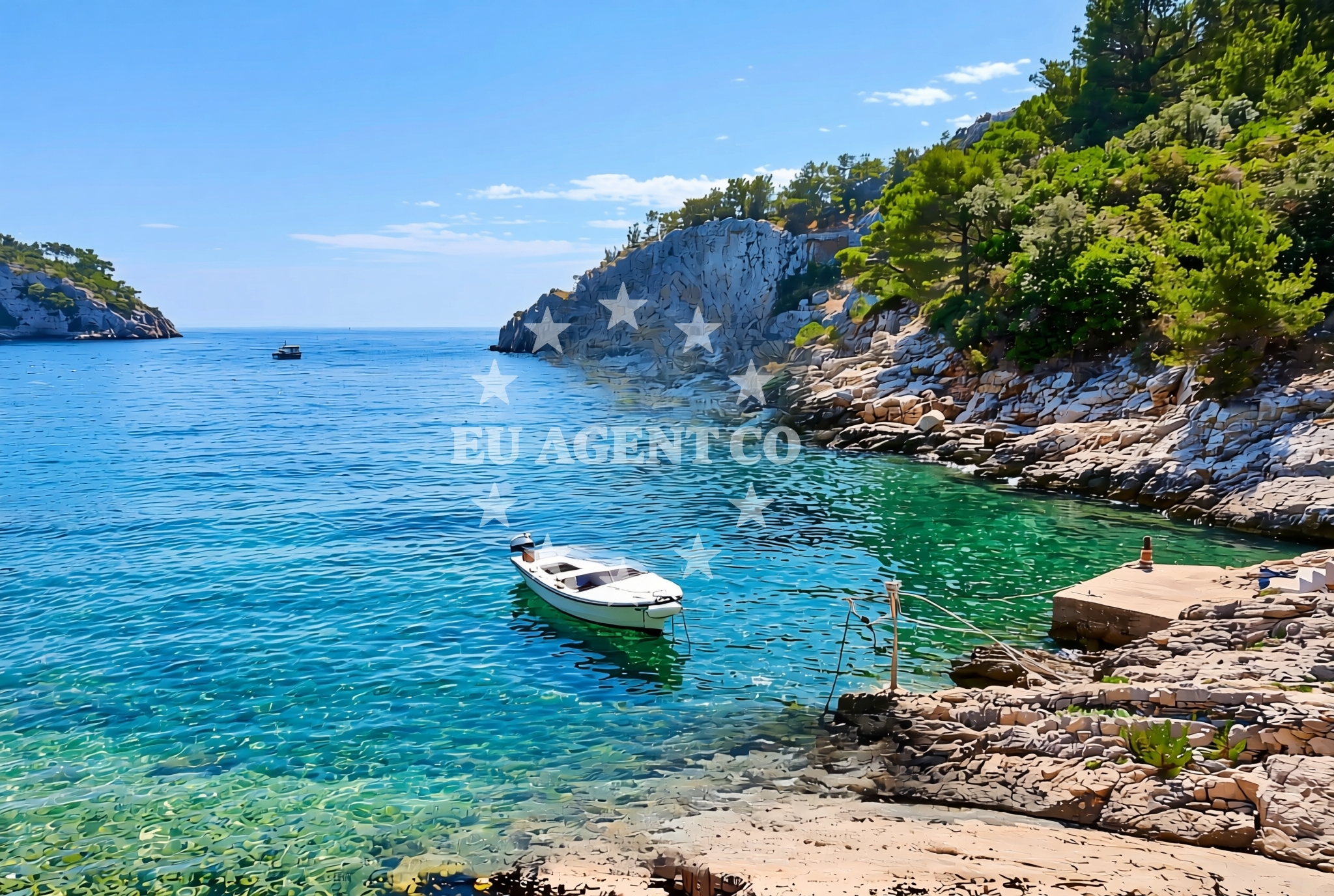
About this beach
Jorja, Grohote (Šolta)
Beach: Jorja
Location: Grohote (Šolta)
Characteristics and facilities
Gravel, concrete / stone slabs
Restaurant / snack bar
Caffe bar / Drinks stand
Beach character
The beach's surface consists of gravel and concrete/stone slabs, which may influence the type of footwear recommended for visitors. While the beach itself does not have explicit details on water conditions or sand quality, its proximity to Šolta's natural landscape suggests a setting typical of the Adriatic coast.
Swimming and shore
Although specific details about swimming conditions are not provided in the catalog, the beach's location on Šolta—a known sailing destination—implies access to clear waters. The shore's characteristics, defined by gravel and concrete, may indicate a more utilitarian approach to the beach rather than a traditional sandy shoreline.
Facilities and activities
Visitors to Jorja, Grohote (Šolta) Beach can take advantage of a nearby restaurant and café bar, which are listed in the beach's authoritative features. These amenities suggest that the area is equipped to cater to basic needs, though no specific activities beyond dining are detailed in the catalog.
Access and location
Jorja, Grohote (Šolta) Beach is situated in the village of Jorja on Šolta, an island in the Adriatic Sea. The beach's coordinates (43.367841, 16.293166) place it near the southern coast of Šolta, close to the broader sailing routes of the Adriatic. Access is via gravel and concrete paths, which may be suitable for vehicles or pedestrians depending on their condition.
What to expect
Visitors should expect a beach with gravel and concrete/stone slabs as the primary access points. The nearby restaurant and café bar are available for meals and drinks, though no further facilities or activities are explicitly listed. The beach's location on Šolta offers a backdrop of the Adriatic's natural scenery, typical of the region's coastal areas.
Practical tips
Given the beach's gravel and concrete access, visitors may want to consider appropriate footwear. The availability of a restaurant and café bar suggests that basic amenities are present, though it is advisable to confirm operating hours if planning to dine there.
Exploring the coast by yacht
For those interested in yacht charter, Jorja, Grohote (Šolta) Beach is situated in an area known for its sailing opportunities. Šolta is part of the Adriatic's popular sailing routes, and nearby marinas and anchorages may be accessible to charter guests. The Euro-Agent Yacht Charter platform can provide further details on available yachts and sailing itineraries in the region.
Regional Context and Šolta's Appeal
The island of Šolta, where Jorja, Grohote (Šolta) Beach is located, is part of the Šolta-Brac archipelago, known for its natural beauty and tranquil waters. The island's proximity to Split and the broader Dalmatian coast makes it a convenient base for exploring the Adriatic. Visitors may find opportunities for hiking, snorkeling, and other water-based activities in the surrounding area.
Anchorages in the surrounding area
- Anchorage — solta — 0.5 NM from beach
- Anchorage — solta — 0.5 NM from beach
- Anchorage — solta — 0.8 NM from beach
- Anchorage — necujam — solta — 1.2 NM from beach
- Anchorage — necujam — solta — 1.2 NM from beach
- Anchorage — solta — 1.2 NM from beach
- Anchorage — solta — 1.2 NM from beach
- Anchorage — necujam — solta — 1.4 NM from beach
Distances are straight-line geographic distances, not sailing routes.
Mooring buoys in the surrounding area
Mooring buoys in the surrounding area, such as those near Solta and Necujam, are located near Jorja, Grohote (Šolta) Beach.
- Buoy field — solta — 0.0 NM from beach
- Lonely Paradise restaurant buoys — solta — 0.3 NM from beach
- Pasarela restaurant jetty — rogac — solta — 1.6 NM from beach
- Jetty — necujam — solta — 1.7 NM from beach
- Resturant Sveti Petar bouy — necujam — solta — 2.0 NM from beach
Distances are straight-line geographic distances, not sailing routes.
Marine fuel stations
Marine fuel stations in Solta, Brac, and Trogir are situated near Jorja, Grohote (Šolta) Beach.
- Fuel station — rogac — solta — 1.7 NM from beach
- Ina — milna brac — 7.0 NM from beach
- Ina — trogir — 9.0 NM from beach
- B-Max — b max — trogir — 9.2 NM from beach
Distances are straight-line geographic distances, not sailing routes.
Harbours in the surrounding area
- Rogač — rogac — solta — 1.7 NM from beach
- Stomorska — solta — 2.6 NM from beach
- Milna — milna brac — 7.1 NM from beach
- Bobovišće — bobovisce — brac — 7.5 NM from beach
- Toče — okrug gornji — ciovo — 7.8 NM from beach
- Slatine — ciovo — 8.2 NM from beach
Distances are straight-line geographic distances, not sailing routes.
Marinas in the surrounding area
Marinas in the surrounding area, such as those in Solta and Brac, are located near Jorja, Grohote (Šolta) Beach.
- Marina Martinis Marchi — maslinica — solta — 4.2 NM from beach
- Marina Vlaška — milna brac — 6.8 NM from beach
- Marina Milna Kanarija — milna brac — 7.0 NM from beach
- ACI Marina Milna — milna brac — 7.2 NM from beach
- Marina Trogir — 9.0 NM from beach
Distances are straight-line geographic distances, not sailing routes.
Restaurants near the beach
Restaurants near the beach, including those in Solta and Necujam, are situated in the vicinity of Jorja, Grohote (Šolta) Beach.
- Lero — solta — 0.0 NM from beach
- Lonely Paradise — solta — 0.2 NM from beach
- Konoba Mareta — necujam — solta — 1.3 NM from beach
- Stara Kuća — rogac — solta — 1.5 NM from beach
- Villa Solta — rogac — 1.6 NM from beach
- Pasarela — rogac — solta — 1.6 NM from beach
- Restaurant Punta — necujam — solta — 1.6 NM from beach
Distances are straight-line geographic distances, not sailing routes.
Navigation guides for the surrounding area
- Uvala Tatinja — 0.2 NM from beach
- Rogac — 1.7 NM from beach
- Uvala Necujam — 1.7 NM from beach
- Uvala Donja Krusica — 2.7 NM from beach
- Stomorska — 2.7 NM from beach
Distances are straight-line geographic distances, not sailing routes.
Yachts from nearby departure bases
Yachts departing from nearby bases, such as Šolta Rogač, are located near Jorja, Grohote (Šolta) Beach.
Sailing yachts
- Cyclades 39.3 (Pharos) — Šolta Rogač — 1.7 NM from departure base to beach
- Sun Odyssey 449 (Port Royal) — Šolta Rogač — 1.7 NM from departure base to beach
- Cyclades 43.4 (Niagara) — Šolta Rogač — 1.7 NM from departure base to beach
- Oceanis 41.1 (Goa) — Šolta Rogač — 1.7 NM from departure base to beach
- Oceanis 46.1 (Everest) — Šolta Rogač — 1.7 NM from departure base to beach
Catamarans
- Lagoon 40 (Solentia) — Šolta Rogač — 1.7 NM from departure base to beach
- Lagoon 42 (Galapagos) — Šolta Rogač — 1.7 NM from departure base to beach
- Lagoon 450 Flybridge (Samogon) — Šolta Rogač — 1.7 NM from departure base to beach
- Lagoon 400 (Greenland) — Šolta Rogač — 1.7 NM from departure base to beach
- Lagoon 450 (Madagascar) — Šolta Rogač — 1.7 NM from departure base to beach
Distances are straight-line geographic distances, not sailing routes.