Igrane istok, Igrane Beach, Croatia
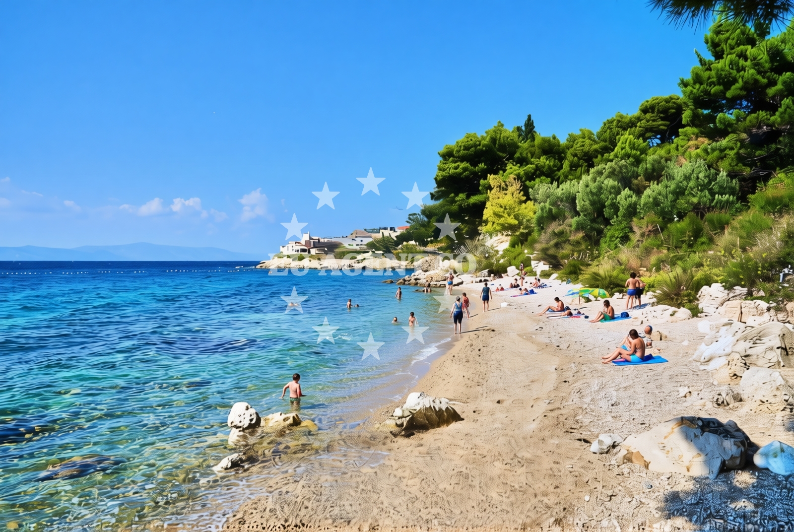
About this beach
Igrane istok, Igrane
Beach: Igrane istok
Location: Igrane
Characteristics and facilities
Gravel
170 m
Natural shade
Changing cabin
Beach character
The beach consists of gravel, stretching approximately 170 meters along the shore. Natural shade is available in certain areas, providing limited relief from direct sunlight. A single changing cabin is present, offering basic facilities for beachgoers. The gravel substrate influences swimming conditions, making it more suitable for those accustomed to rocky or uneven seabeds.Swimming and shore
Swimming from Igrane istok is possible but requires caution due to the gravelly shoreline. The beach's natural topography creates varying water depths near the shore, with deeper waters extending beyond the gravel zone. The absence of artificial structures means the shoreline remains in its natural state, with no designated swimming areas or lifeguard services.Facilities and activities
Facilities are limited to a single changing cabin, which serves as the primary amenity. There are no additional structures such as showers, restrooms, or seating areas. The beach does not host organized activities or events, maintaining its character as a simple, unembellished coastal access point.Access and location
Igrane istok is situated within the settlement of Igrane, a coastal community in Croatia's Dalmatian region. The beach lies along the same coastline as the nearby village of Igrane, which offers basic accommodation and local services. The Adriatic Sea's proximity creates opportunities for maritime exploration in the surrounding area.What to expect
Visitors should anticipate a beach with minimal infrastructure, defined by its gravel composition and natural features. The changing cabin provides basic facilities, while the shoreline remains in its natural state without artificial modifications. The beach's character is best suited for those seeking direct access to the sea with minimal amenities.Practical tips
Wear appropriate footwear for walking on gravel. The beach's natural conditions mean there are no designated swimming zones or safety services. Arrive early to secure a spot, as the beach's simplicity may attract visitors seeking unobstructed coastal access.Exploring the coast by yacht
For visitors interested in yacht charter experiences, the surrounding Adriatic coastline offers opportunities for exploration. Euro-Agent's yacht search platform provides access to vessels operating in this region, with options available for charters departing from nearby marinas along the Dalmatian coast. The area's maritime character supports both sailing and motorboat excursions, with anchorages and harbors accessible via the Euro-Agent POI maps.Regional Context
Igrane is part of the municipality of Supetar on the island of Brac, a region known for its rugged coastline and maritime traditions. The nearby village of Igrane offers simple accommodations, while the broader Brac island context provides opportunities for cultural exploration and island-hopping.Anchorages in the surrounding area
Anchorages in the surrounding Hvar area, including Sucuraj and Selca kod Bogomolja.
- Anchorage — sucuraj — hvar — 3.4 NM from beach
- Anchorage — selca kod bogomolja — hvar — 4.0 NM from beach
- Anchorage — sucuraj — hvar — 4.5 NM from beach
- Anchorage — sucuraj — hvar — 4.5 NM from beach
- Anchorage — selca kod bogomolja — hvar — 4.6 NM from beach
- Anchorage — selca kod bogomolja — hvar — 4.6 NM from beach
- Anchorage — sucuraj — hvar — 4.6 NM from beach
- Anchorage — drvenik — 5.0 NM from beach
Distances are straight-line geographic distances, not sailing routes.
Mooring buoys in the surrounding area
Mooring buoys near Sucuraj, Drasnice, and Selca kod Bogomolja in the Hvar region.
- Kraj - Soline — kraj soline — drasnice — 2.2 NM from beach
- Jetty — sucuraj — hvar — 4.6 NM from beach
- Konoba Gambo buoys — selca kod bogomolja — hvar — 5.1 NM from beach
- Drvenik - Ferry dock — drvenik ferry dock — 5.1 NM from beach
- Quay — bogomolje — hvar — 6.6 NM from beach
Distances are straight-line geographic distances, not sailing routes.
Marine fuel stations
Marine fuel stations in Makarska, Brac, Korcula, and Ploce.
- Ina — makarska — 8.3 NM from beach
- Fuel station — sumartin — brac — 13.6 NM from beach
- Fuel station — korcula — 14.4 NM from beach
- Fuel station — ploce — 15.3 NM from beach
Distances are straight-line geographic distances, not sailing routes.
Harbours in the surrounding area
Harbours in Igrane, Zivogosce, and nearby Drasnice and Podgora.
- Igrane — 0.3 NM from beach
- Živogošće — zivogosce — 0.6 NM from beach
- Drašnice — drasnice — 2.1 NM from beach
- Čaklje — caklje — podgora — 3.4 NM from beach
- Podgora — 4.4 NM from beach
- Sućuraj — sucuraj — hvar — 4.5 NM from beach
Distances are straight-line geographic distances, not sailing routes.
Marinas in the surrounding area
Marinas in Tučepi, Ramova, Baška Voda, and Korcula.
- Marina Tučepi — marina tucepi — 5.7 NM from beach
- Marina Ramova — krvavica — 10.6 NM from beach
- Marina Baška Voda — marina baska voda — 13.1 NM from beach
- ACI Marina Korčula — korcula — 14.2 NM from beach
- Marina Lumbarda — korcula — 16.3 NM from beach
Distances are straight-line geographic distances, not sailing routes.
Restaurants near the beach
Restaurants in Sucuraj, Hvar, near the beach.
- Mlaska — sucuraj — hvar — 3.5 NM from beach
- Restaurant — sucuraj — hvar — 4.5 NM from beach
- Riblji Restoran — sucuraj — hvar — 4.6 NM from beach
Distances are straight-line geographic distances, not sailing routes.
Navigation guides for the surrounding area
Navigation guides for Podgora, Hvar, and surrounding areas like Drvenik and Kozja.
- Podgora — 4.0 NM from beach
- OTOK HVAR — 4.9 NM from beach
- Uvala Drvenik (Donja Vala) — 5.3 NM from beach
- Uvala Kozja — 6.3 NM from beach
- Uvala Duboka — 6.4 NM from beach
Distances are straight-line geographic distances, not sailing routes.
Yachts from nearby departure bases
Yachts departing from Tučepi Port, Makarska Port, and Baška Voda.
Sailing yachts
- Bavaria 40 Cruiser (LADY BUTTERFLY) — Tučepi Port — 5.7 NM from departure base to beach
- Bavaria Cruiser 37 (AURORA) — Baška Voda — 13.1 NM from departure base to beach
- Oceanis 43 (BLACK SHEEP) — Baška Voda — 13.1 NM from departure base to beach
Catamarans
- Lagoon 450 (LAMANTIN) — Baška Voda — 13.1 NM from departure base to beach
Motor yachts
- Princess V53 (Chablis) — Makarska Port — 8.1 NM from departure base to beach
- Canados 86 (Karisma) — Baška Voda — 13.1 NM from departure base to beach
Motor boats
- Jeanneau NC 37 (Black Pearl) — Makarska Port — 8.1 NM from departure base to beach
- Galeon 430 Skydeck (BELLAGIO) — Makarska Port — 8.1 NM from departure base to beach
- Jeanneau NC 37 (Black Pearl) — Makarska Port — 8.1 NM from departure base to beach
- Galeon 430 Skydeck (Bellagio) — Makarska Port — 8.1 NM from departure base to beach
Distances are straight-line geographic distances, not sailing routes.