Grlić, Grebaštica Beach, Croatia
About this beach
Grlić, Grebaštica
Beach: Grlić
Location: Grebaštica
Beach character
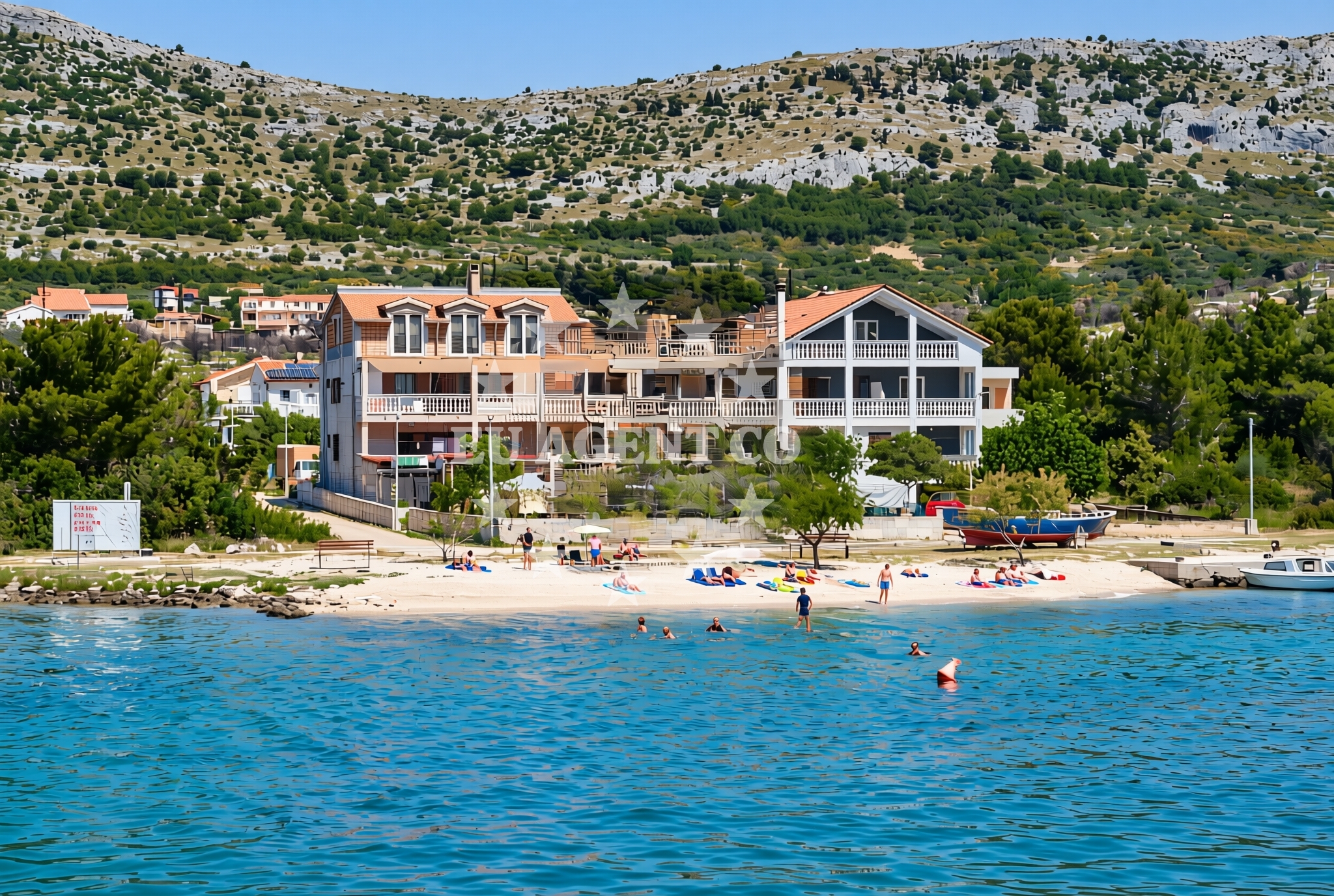
The beach is a narrow, pebbly shore with scattered patches of sand, typical of the rocky coastlines found along Croatia's southern Adriatic. The water here is clear and cool, with visibility often extending several meters underwater. The surrounding terrain is characterized by low-lying hills and dense vegetation, creating a natural buffer between the beach and the inland. The absence of artificial structures means the shoreline remains largely untouched, preserving its natural character.Swimming and shore
Swimming conditions are generally safe for experienced swimmers, with the sea floor sloping gradually from the shore. The pebbles can make barefoot swimming uncomfortable, so water shoes or flippers are recommended. The shore is flanked by low dunes and scattered shrubs, which provide limited shade during the day. The beach is not suitable for young children due to the uneven terrain and the absence of lifeguard services.Facilities and activities
There are no formal facilities at the beach itself, such as restrooms, showers, or parking. Visitors are advised to bring their own supplies, as nearby settlements offer limited commercial services. The area is popular with local fishermen, and occasional boats can be seen anchoring nearby. The lack of infrastructure makes it an ideal spot for those seeking solitude or a base for exploring the surrounding coastline by kayak or small boat.Access and location
The beach is accessible via a short path from the Grlić village road, approximately 2 kilometers from the nearest inhabited area. The nearest major road is the D8 highway, which connects the region to Split and other coastal towns. The coordinates (43.630564, 15.973777) place it near the southern tip of the island of Brač, though it is technically part of the mainland coast. This location makes it a convenient stop for sailors navigating the Adriatic, with nearby anchorages and marinas within a short sailing distance.What to expect
Visitors to Grlić, Grebaštica Beach should expect a raw, undeveloped shoreline that prioritizes natural preservation over modern comforts. The beach is best suited for those seeking solitude, photography opportunities, or a base for exploring the surrounding coast. The nearby village of Grlić offers basic accommodations and local cuisine, though it is not a tourist hub. The area is particularly appealing during the shoulder seasons, when crowds are sparse and the sea is at its most inviting.Practical tips
Bring water, snacks, and sun protection, as there are no vendors on-site. Parking is limited, so arriving early is advisable. The beach is not marked on standard maps, so using GPS coordinates or local guidance is recommended for accurate navigation.Exploring the coast by yacht
For yacht charter guests, Grlić, Grebaštica Beach serves as a strategic waypoint along the southern Adriatic route. The nearby marina in Split, approximately 30 nautical miles away, offers full services for charter yachts. Sailors can anchor in nearby bays or use the well-established network of Adriatic anchorages to explore the region. The beach's proximity to the Brač Channel makes it a useful reference point for navigating between the islands of Brač and Hvar.Regional Context and Cultural Notes
Grlić is part of the Split-Dalmatia County, an area rich in medieval history and UNESCO-protected sites like the Diocletian's Palace. The region's economy has traditionally relied on fishing and shipbuilding, with a strong connection to the sea. Local festivals in nearby towns often celebrate maritime heritage, offering insight into the area's cultural ties to the Adriatic.Anchorages in the surrounding area
Anchorages in the surrounding area, including those near Grebastica and Zaboric.
- Anchorage — grebastica — 0.1 NM from beach
- Anchorage — zaboric — 1.3 NM from beach
- Anchorage — zaboric — 1.7 NM from beach
- Anchorage — zaboric — 1.7 NM from beach
- Anchorage — grebastica — 1.7 NM from beach
- Anchorage — zaboric — 2.1 NM from beach
- Anchorage — zaboric — 2.3 NM from beach
- Anchorage — dolac — 2.6 NM from beach
Distances are straight-line geographic distances, not sailing routes.
Mooring buoys in the surrounding area
Mooring buoys in the surrounding area, including the Jetty in Grebastica and others in Primosten and Krapanj.
- Jetty — grebastica — 0.5 NM from beach
- Quay — primosten — 3.4 NM from beach
- Buoy field — primosten — 3.5 NM from beach
- Hotel Spongiola jetty — krapanj — 3.7 NM from beach
- Zlatna ribica jetty — brodarica — 3.7 NM from beach
Distances are straight-line geographic distances, not sailing routes.
Marine fuel stations
Marine fuel stations located in Primosten, Rogoznica, and Šibenik, with the nearest in Primosten.
- Petrol — primosten — 3.9 NM from beach
- Flash — rogoznica — 5.9 NM from beach
- Lukoil — sibenik — 6.4 NM from beach
- Ina — sibenik — 7.1 NM from beach
Distances are straight-line geographic distances, not sailing routes.
Harbours in the surrounding area
Harbours in the surrounding area, including Krapanj, Primosten, and Brodarica, with the nearest being Krapanj.
- Krapanj — 3.5 NM from beach
- Primošten — primosten — 3.5 NM from beach
- Brodarica — 3.6 NM from beach
- Rogoznica — 6.2 NM from beach
- Zablaće — zablace — 6.5 NM from beach
- Šibenik — sibenik — 7.2 NM from beach
Distances are straight-line geographic distances, not sailing routes.
Marinas in the surrounding area
Marinas in the surrounding area, including Marina Kremik in Primosten and others in Šibenik and Rogoznica.
- Marina Kremik — primosten — 3.9 NM from beach
- Amadria Yacht Marines — sibenik — 5.9 NM from beach
- Marina Frapa — rogoznica — 6.1 NM from beach
- Marina Mandalina — sibenik — 6.2 NM from beach
- Marina Agana — 9.3 NM from beach
Distances are straight-line geographic distances, not sailing routes.
Restaurants near the beach
Restaurants near the beach, such as Pizzeria Niko in Grebastica and several options in Primosten.
- Pizzeria Niko — grebastica — 0.5 NM from beach
- Restoran Veranda — zaboric — 1.6 NM from beach
- Saricevi dvori — primosten — 3.4 NM from beach
- Konoba Antonija — primosten — 3.4 NM from beach
- Restaurant Galija — primosten — 3.4 NM from beach
- Torkul — primosten — 3.4 NM from beach
- Staro Selo — primosten — 3.5 NM from beach
Distances are straight-line geographic distances, not sailing routes.
Navigation guides for the surrounding area
Navigation guides for the surrounding area, including Luka Grebastica and Primosten.
- Luka Grebastica — 0.7 NM from beach
- Jadrtovac — 3.0 NM from beach
- Primosten — 3.3 NM from beach
- Krapanj — 3.4 NM from beach
- Luka Peles and Marina Kremik (Primosten) — 4.3 NM from beach
Distances are straight-line geographic distances, not sailing routes.
Yachts from nearby departure bases
Sailing yachts
- Dufour 382 Grand (PETAR PAN) — Primošten Marina Kremik — 3.9 NM from departure base to beach
- D&D Kufner 54 (Ella I) — Primošten Marina Kremik — 3.9 NM from departure base to beach
- Jeanneau 54 (Janska) — Primošten Marina Kremik — 3.9 NM from departure base to beach
- Dufour 460 Grand (Sulaco) — Primošten Marina Kremik — 3.9 NM from departure base to beach
- Dufour 56 (Barmaley) — Primošten Marina Kremik — 3.9 NM from departure base to beach
Catamarans
- Dufour Catamaran 48 (BRO) — Primošten Marina Kremik — 3.9 NM from departure base to beach
- Lagoon 40 (Bahia Real) — Primošten Marina Kremik — 3.9 NM from departure base to beach
- Lucia 40 (PEARL) — Primošten Marina Kremik — 3.9 NM from departure base to beach
- Lagoon 450 Flybridge (double elli) — Primošten Marina Kremik — 3.9 NM from departure base to beach
- Elba 45 (Martisnica) — Primošten Marina Kremik — 3.9 NM from departure base to beach
Distances are straight-line geographic distances, not sailing routes.