Grand, Neum Beach, Croatia
About this beach
Grand, Neum
Beach: Grand
Location: Neum
Characteristics and facilities
Pebbles, gravel
Restaurant / snack bar
Caffe bar / Drinks stand
Beach character
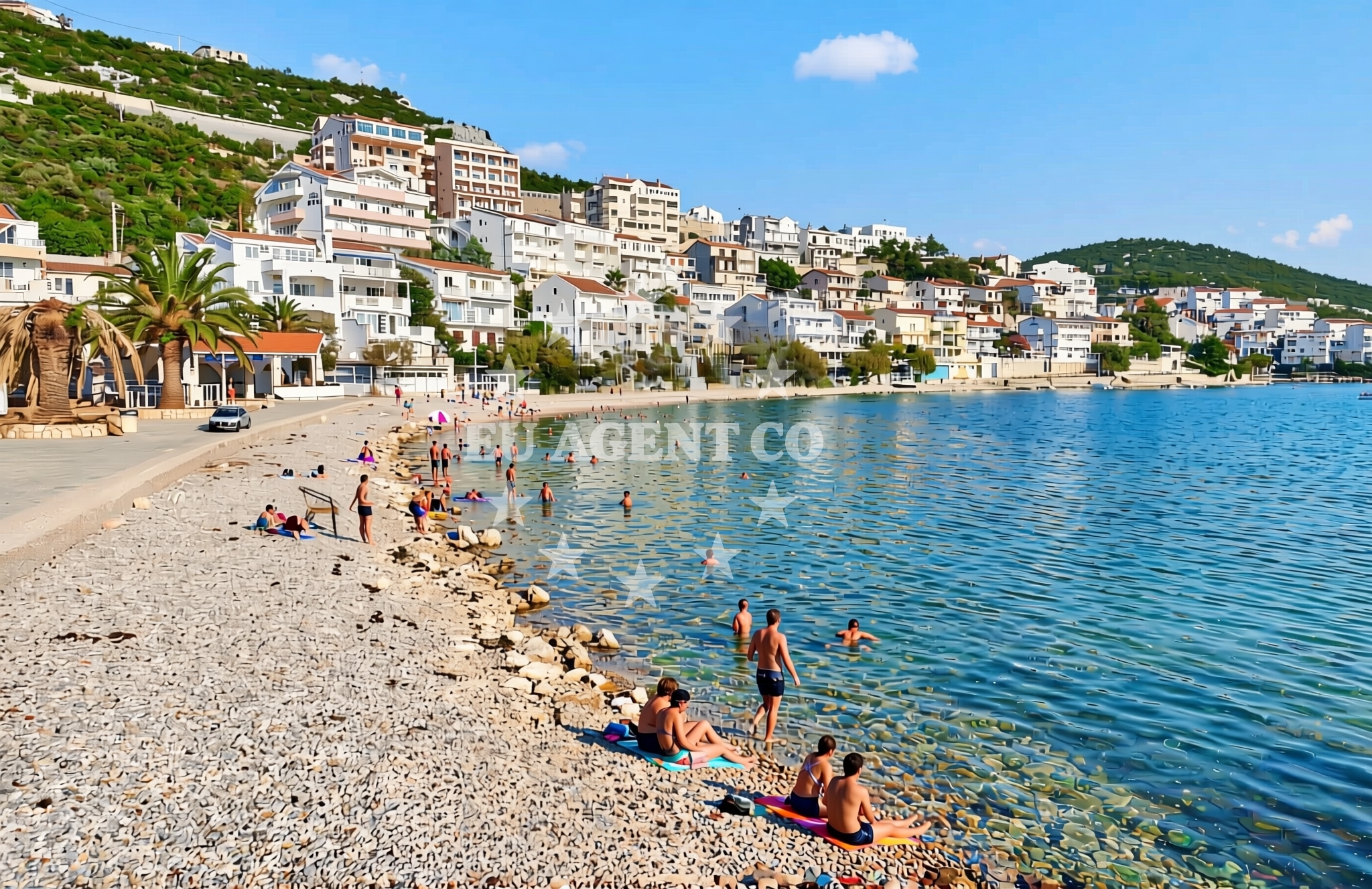
The shoreline of Grand, Neum Beach is composed primarily of pebbles and gravel, creating a firm surface that may be less ideal for barefoot walking compared to sandy alternatives. This rocky character is typical of the Adriatic coast in this region, where geological formations often shape the beach profiles. The beach does not appear to have extensive natural features such as dunes or vegetation, focusing instead on its direct access to the sea. Its proximity to Neum, a coastal town known for its historical significance and maritime connections, adds cultural context to the area.Swimming and shore
Swimming conditions at Grand, Neum Beach are influenced by the rocky shoreline. The pebbles and gravel may create uneven footing, requiring caution when entering or exiting the water. The Adriatic Sea here is generally clear, though the exact depth and current strength are not specified in available records. The beach's shore does not feature designated swimming zones, and visitors should be mindful of the terrain when wading. The presence of a caffe bar suggests that the area is frequented by tourists seeking casual refreshments during their time at the beach.Facilities and activities
The beach is equipped with a restaurant, snack bar, and caffe bar, catering to visitors seeking light meals or beverages. These facilities are likely positioned to serve both local residents and tourists. No structured activities such as water sports or guided tours are explicitly listed in the beach's catalog, though the surrounding area of Neum offers opportunities for exploring nearby historical sites, vineyards, and the Pelješac Peninsula. The absence of detailed activity listings means that visitors should consider the broader region for more dynamic experiences.Access and location
Grand, Neum Beach is located within the town of Neum, a coastal municipality in Croatia's Dubrovnik-Neretva County. The beach is accessible via local roads that connect to the town center and surrounding areas. Neum itself is positioned near the border with Bosnia and Herzegovina, making it a strategic point for those traveling between the two regions. The beach's proximity to the Adriatic Sea and its connection to the Pelješac Peninsula highlight its role as a transitional point between the mainland and the islands further south.What to expect
Visitors to Grand, Neum Beach should anticipate a rocky shoreline with pebbles and gravel, which may affect comfort levels for those preferring sandy beaches. The beach is served by basic amenities including a restaurant, snack bar, and caffe bar, ideal for casual dining. The area is likely to attract a mix of local residents and tourists, given its location within Neum. While no formal reviews are available, the beach's position near the Pelješac Peninsula suggests it may be used as a starting point for excursions to nearby islands or historical sites.Practical tips
Given the pebbly terrain, visitors may want to wear sturdy footwear for walking along the shore. Sun protection is recommended, as the Adriatic coast can experience strong sunlight. Those planning to dine at the on-site facilities should be aware that operating hours may vary seasonally. Parking details are not specified in the beach catalog, so visitors should check local signage or inquire with nearby businesses for guidance.Exploring the coast by yacht
For yacht charter guests exploring the Adriatic, Grand, Neum Beach lies along a route that connects the mainland to the Pelješac Peninsula and the islands of Korčula and Šipan. Neum's proximity to the border with Bosnia and Herzegovina makes it a logical port of call for yachts traveling between the northern and southern Adriatic. While the beach itself does not appear to be a formal anchorage, the surrounding area includes marinas and harbors that may be accessible to charter vessels. Yacht charter operators interested in this region can use the Euro-Agent Yacht Search page to explore available options for sailing in the broader Neum and Pelješac area.Regional Context and Travel Connections
Neum is a coastal town with historical ties to maritime trade, situated near the mouth of the Neretva River. The area is known for its vineyards and the production of the local wine, Plavac Mali. Travelers can reach Neum by road from Dubrovnik, approximately 40 kilometers to the north. The town also serves as a departure point for ferries to the island of Mljet, adding to its appeal for those combining land and sea exploration. The Adriatic Sea here is part of a larger network of sailing routes that extend from the northern Dalmatian coast to the Ionian Sea.Anchorages in the surrounding area
- Anchorage — klek — 2.9 NM from beach
- Anchorage — klek — 3.2 NM from beach
- Anchorage — duboka — 3.6 NM from beach
- Anchorage — brijesta — 4.0 NM from beach
- Anchorage — mali ston — 5.7 NM from beach
- Anchorage — duba — 6.6 NM from beach
- Anchorage — prapratno — 6.7 NM from beach
- Anchorage — zuljana — 7.5 NM from beach
Distances are straight-line geographic distances, not sailing routes.
Mooring buoys in the surrounding area
Mooring buoys in Brijesta, Prapratno, and Kobas are located in the surrounding area.
- Brijesta — 3.9 NM from beach
- Quay — prapratno — 6.7 NM from beach
- Jetty — blace — 7.9 NM from beach
- Quay — kobas — 8.8 NM from beach
- Lukas Taverna jetty — kobas — 8.8 NM from beach
Distances are straight-line geographic distances, not sailing routes.
Marine fuel stations
- Fuel station — sobra — mljet — 10.8 NM from beach
- Fuel station — ploce — 11.4 NM from beach
- Fuel station — korcula — 20.8 NM from beach
- Ina — dubrovnik — 25.6 NM from beach
Distances are straight-line geographic distances, not sailing routes.
Harbours in the surrounding area
Harbors in Hodilje, Mali Ston, Ston, and Opuzen are nearby.
- Hodilje — 4.8 NM from beach
- Mali Ston — 5.7 NM from beach
- Ston — 6.1 NM from beach
- Opuzen — 6.4 NM from beach
- Prapranto Ferry Harbour — prapratno — 7.0 NM from beach
- Drače — drace — 7.5 NM from beach
Distances are straight-line geographic distances, not sailing routes.
Marinas in the surrounding area
- ACI Marina Slano — 14.4 NM from beach
- Marina Lumbarda — korcula — 19.7 NM from beach
- ACI Marina Korčula — korcula — 21.3 NM from beach
- Marina Frapa Dubrovnik — 25.7 NM from beach
- ACI Marina Dubrovnik — 26.8 NM from beach
Distances are straight-line geographic distances, not sailing routes.
Navigation guides for the surrounding area
Navigation guides for Uvala Kljemtine and other nearby areas assist in planning routes.
- Uvala Lopata — 2.1 NM from beach
- Uvala Klek — 2.7 NM from beach
- Uvala Kljemtine — 2.9 NM from beach
- Uvala Bjejvica — 3.7 NM from beach
- Luka — 4.5 NM from beach
Distances are straight-line geographic distances, not sailing routes.
Yachts from nearby departure bases
Sailing yachts
- Elan 40 Impression (Karleta) — Ploče City Port — 11.4 NM from departure base to beach
- Salona 44 (SAMOA) — Ploče City Port — 11.4 NM from departure base to beach
- Sun Odyssey 349 (Porto Tolero) — Ploče City Port — 11.4 NM from departure base to beach
- Sun Odyssey 419 (Luka Ploce) — Ploče City Port — 11.4 NM from departure base to beach
- Elan 514 Impression (Cesarica III) — Ploče City Port — 11.4 NM from departure base to beach
- More 55 (MRS. ROBINSON) — Ploče City Port — 11.4 NM from departure base to beach
- Sun Odyssey 349 (Visnjica) — Ploče City Port — 11.4 NM from departure base to beach
- Elan 50 Impression (Timeless) — Slano ACI Marina — 14.4 NM from departure base to beach
Catamarans
- Lagoon 450 Fly (Alba Mouse) — Ploče City Port — 11.4 NM from departure base to beach
- Lagoon 40 (MARINERO) — Slano ACI Marina — 14.4 NM from departure base to beach
Distances are straight-line geographic distances, not sailing routes.