Gospe od Ružarija (Kuvenat), Viganj Beach, Croatia
Gospe od Ružarija (Kuvenat), Viganj Beach lies along the rugged coastline of Croatia’s Dalmatian region, where the Adriatic Sea meets the rocky terrain of the Viganj area. This stretch of shore, marked by gravel and concrete slabs, offers a straightforward access point for visitors seeking a quiet spot to enjoy the sea. While not a traditional sandy beach, its 40-meter length provides a functional space for relaxation, complemented by a nearby restaurant and drinks stand. The beach’s natural shade, provided by the surrounding landscape, adds a layer of comfort for those looking to spend time outdoors.
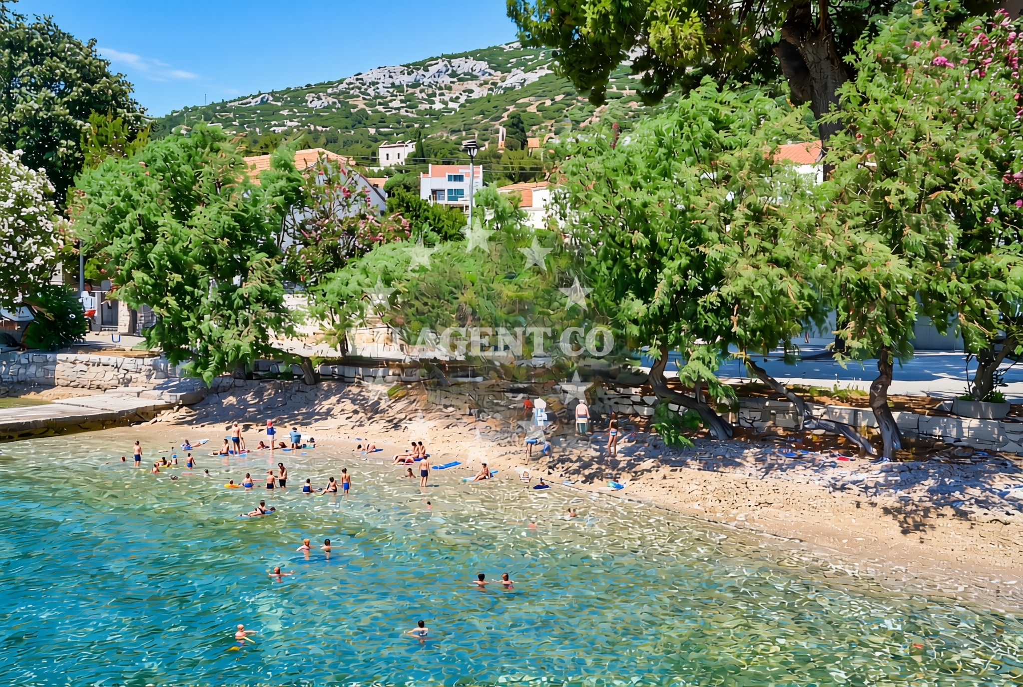
About this beach
Gospe od Ružarija (Kuvenat), Viganj
Beach: Gospe od Ružarija (Kuvenat)
Location: Viganj
Characteristics and facilities
Gravel, concrete / stone slabs
40 m
Restaurant / snack bar
Caffe bar / Drinks stand
Natural shade
Beach character
The beach’s surface is composed of gravel and stone slabs, a characteristic common to many coastal areas along Croatia’s eastern Adriatic shores. This terrain, while not ideal for swimming, creates a stable and accessible environment for visitors. The natural shade, likely cast by the nearby hills or rock formations, offers respite from direct sunlight. The beach’s proximity to a restaurant and drinks stand suggests it is a modestly developed site, catering to basic needs without extensive infrastructure. Its location in Viganj, a coastal village on the island of Šolta, situates it within a region known for its unspoiled natural beauty and historic maritime connections.
Swimming and shore
The beach’s gravelly composition makes it unsuitable for swimming, as the surface is uneven and potentially uncomfortable for prolonged use. However, the adjacent waters of the Adriatic Sea, known for their clarity and moderate temperatures, may still appeal to those seeking a brief dip or to observe marine life from the shore. The lack of structured facilities such as showers or changing rooms means visitors should plan accordingly, relying on the nearby restaurant and drinks stand for refreshments. The beach’s orientation, facing the open sea, may offer views of passing boats or distant islands, depending on the time of day and weather conditions.
Facilities and activities
Facilities at Gospe od Ružarija (Kuvenat) are minimal but functional. A restaurant and a drinks stand are available, likely serving light meals and beverages to beachgoers. The absence of additional amenities such as parking, restrooms, or lifeguard services indicates a low-key approach to management. Activities are not explicitly listed, but the beach’s location in Šolta—a region with a strong sailing tradition—suggests it may be a point of interest for boating enthusiasts passing through the area. The natural setting, with its rocky outcrops and open sea vistas, could appeal to those interested in photography or quiet contemplation.
Access and location
Access to the beach is straightforward, with no significant barriers noted in the available data. Its position in Viganj, a village on Šolta Island, places it within reach of nearby towns such as Šibenik and Split, both of which are major cultural and transportation hubs in the region. Visitors arriving by car may find road access to the area dependent on local infrastructure, while those arriving by boat may benefit from the proximity to established sailing routes along the Dalmatian coast. The beach’s coordinates (42.983347, 17.10027) situate it near the southern tip of Šolta, where the island’s rugged coastline transitions into the broader Adriatic Sea.
What to expect
Visitors to Gospe od Ružarija (Kuvenat) should expect a beach that prioritizes accessibility over luxury. The gravel and stone slabs form the primary surface, making it a practical but not scenic option for sunbathing or leisurely strolls. The nearby restaurant and drinks stand provide basic sustenance, though more extensive amenities are absent. The natural shade, while limited, offers some relief from the sun. The beach’s location in Šolta, an island with a rich maritime history, may interest those exploring the region’s sailing routes or historic sites. However, its modest scale and lack of crowds suggest it is best suited for those seeking solitude rather than a bustling coastal experience.
Practical tips
Given the beach’s gravelly surface, visitors may wish to bring sturdy footwear for walking along the shore. The absence of formal parking areas means arriving by car may require careful navigation of local roads. Those planning to spend time at the beach should consider the limited facilities and bring personal items such as sunscreen, water, and snacks if the restaurant’s offerings are insufficient. The beach’s orientation toward the open sea may provide opportunities for photography, particularly during sunrise or sunset when the light reflects off the water.
Exploring the coast by yacht
The beach’s location in Šolta, a part of Croatia’s Adriatic coast, places it within a sailing region renowned for its clear waters and historic ports. Yacht charter guests exploring the Dalmatian coast may find the area appealing, with nearby marinas in Šibenik and Split offering docking options. The open sea beyond the beach provides opportunities for cruising, anchoring, or exploring nearby islands such as Šolta itself, which is known for its vineyards and traditional fishing villages. While the beach itself is not a designated anchorage, its proximity to established sailing routes makes it a potentially useful reference point for charters navigating the region.
Regional Context and Sailing Routes
Šolta Island, where Viganj is located, is part of the Šibenik-Knin County and lies between the islands of Brač and Hvar. The area is characterized by its limestone cliffs, olive groves, and a network of small bays that have historically supported fishing and maritime trade. For yacht charter guests, the surrounding waters offer a mix of sheltered coves and open sea, with sailing routes connecting to major ports like Šibenik and Split. The region’s popularity with sailors is due to its relatively calm waters and the presence of well-equipped marinas that cater to both motor yachts and sailboats.
Anchorages in the surrounding area
Anchorages near Korcula, including those in Loviste and Badija, are within a few nautical miles of the beach.
- Anchorage — korcula — 1.2 NM from beach
- Anchorage — korcula — 1.3 NM from beach
- Anchorage — korcula — 1.5 NM from beach
- Anchorage — korcula — 1.5 NM from beach
- Anchorage — racisce — korcula — 2.5 NM from beach
- Anchorage — korcula — 2.6 NM from beach
- Anchorage — loviste — 2.7 NM from beach
- Anchorage — badija — 3.4 NM from beach
Distances are straight-line geographic distances, not sailing routes.
Mooring buoys in the surrounding area
Mooring buoys and jetties in Korcula and Loviste provide nearby options for securing vessels close to the beach.
- Jetty — korcula — 1.5 NM from beach
- Fuel jetty — korcula — 2.7 NM from beach
- Konoba Estravaganca buoys - Duba — konoba estravaganca buoys duba — loviste — 3.0 NM from beach
- Jetty — loviste — 3.9 NM from beach
- Jetty — loviste — 3.9 NM from beach
Distances are straight-line geographic distances, not sailing routes.
Marine fuel stations
- Fuel station — korcula — 2.7 NM from beach
- Fuel station — ploce — 15.3 NM from beach
- Ina — vela luka — korcula — 17.0 NM from beach
- Ina — ubli — lastovo — 18.8 NM from beach
Distances are straight-line geographic distances, not sailing routes.
Harbours in the surrounding area
- Viganj — 0.1 NM from beach
- Kučišće — kucisce — 0.7 NM from beach
- Korčula W harbour — korcula — 1.9 NM from beach
- Korčula E harbour — korcula — 2.1 NM from beach
- Orebić — orebic — 3.3 NM from beach
- Račišće — racisce — korcula — 3.6 NM from beach
Distances are straight-line geographic distances, not sailing routes.
Marinas in the surrounding area
- ACI Marina Korčula — korcula — 2.2 NM from beach
- Marina Lumbarda — korcula — 4.7 NM from beach
- Marina Tučepi — marina tucepi — 16.9 NM from beach
- Marina Korkyra — vela luka — korcula — 17.1 NM from beach
- Marina Solitudo — lastovo — 17.9 NM from beach
Distances are straight-line geographic distances, not sailing routes.
Restaurants near the beach
Restaurants in Korcula, including Mimi's Bistro and Aterina, are located near the beach, offering dining options within a short distance.
- Restaurant — korcula — 1.5 NM from beach
- Mimi's Bistro at Tara's Lodge — korcula — 1.5 NM from beach
- Mimi's Bistro at Tara's Lodge — korcula — 1.5 NM from beach
- Restaurant — korcula — 2.0 NM from beach
- Restaurant — korcula — 2.0 NM from beach
- Aterina — korcula — 2.0 NM from beach
- Adio Mare — korcula — 2.0 NM from beach
Distances are straight-line geographic distances, not sailing routes.
Navigation guides for the surrounding area
Navigation guides for areas such as Uvala Vrbovica and Luka Racisce assist in planning routes around the beach and nearby waters.
- Uvala Vrbovica — 1.2 NM from beach
- Uvala Banja — 1.6 NM from beach
- Uvala Kneza — 2.3 NM from beach
- Luka Racisce — 3.4 NM from beach
- Otocic Badija — 3.5 NM from beach
Distances are straight-line geographic distances, not sailing routes.
Yachts from nearby departure bases
Sailing yachts
- Elan 40 Impression (Karleta) — Ploče City Port — 15.2 NM from departure base to beach
- Sun Odyssey 349 (Porto Tolero) — Ploče City Port — 15.2 NM from departure base to beach
- Salona 44 (SAMOA) — Ploče City Port — 15.2 NM from departure base to beach
- Elan 514 Impression (Cesarica III) — Ploče City Port — 15.2 NM from departure base to beach
- More 55 (MRS. ROBINSON) — Ploče City Port — 15.2 NM from departure base to beach
- Sun Odyssey 419 (Luka Ploce) — Ploče City Port — 15.2 NM from departure base to beach
- Sun Odyssey 349 (Visnjica) — Ploče City Port — 15.2 NM from departure base to beach
- Bavaria 40 Cruiser (LADY BUTTERFLY) — Tučepi Port — 16.9 NM from departure base to beach
Catamarans
- Lagoon 450 Fly (Alba Mouse) — Ploče City Port — 15.2 NM from departure base to beach
Motor yachts
- Princess V53 (Chablis) — Makarska Port — 18.9 NM from departure base to beach
Distances are straight-line geographic distances, not sailing routes.