Gornja uvala istok, Drvenik (Gradac) Beach, Croatia
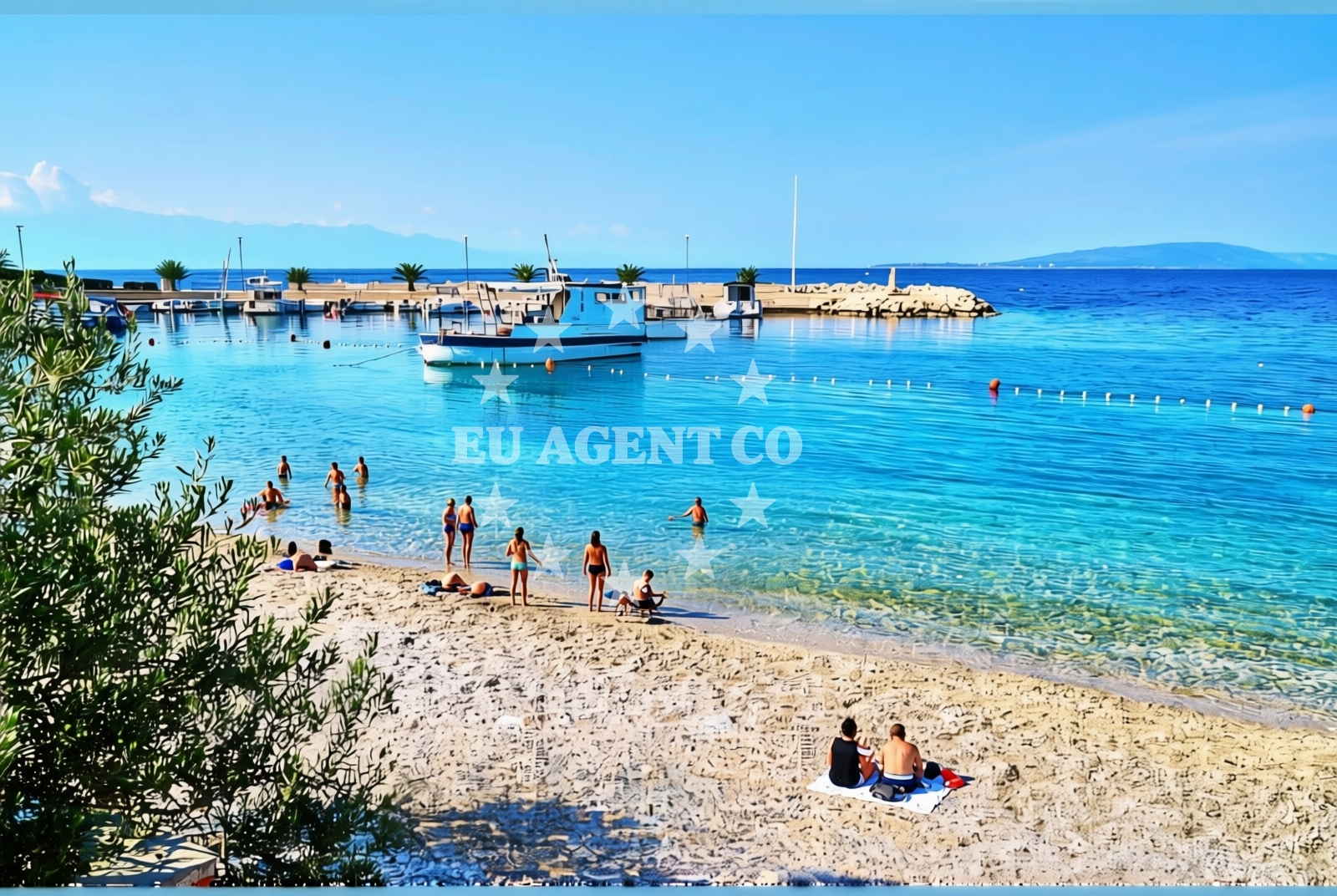
About this beach
Gornja uvala istok, Drvenik (Gradac)
Beach: Gornja uvala istok
Location: Drvenik (Gradac)
Characteristics and facilities
Gravel
100 m
Restaurant / snack bar
Caffe bar / Drinks stand
Natural shade
Beach character
The beach's gravel composition creates a unique texture underfoot, ideal for walking or sunbathing. While not suited for swimming, the 100-meter length provides a short but distinct coastal experience. Natural shade is available, likely from rocky outcrops or vegetation, offering respite from the sun. The beach's proximity to a restaurant, snack bar, and drinks stand makes it a convenient spot for light meals or refreshments.Swimming and shore
Due to its gravel substrate, Gornja uvala istok is not a swimming-focused beach. The shoreline is more suited for leisurely strolls or picnics. The beach's compact size means visitors can easily explore its full length within a short time. The natural shade provides a welcome contrast to the open areas, making it a versatile spot for different activities.Facilities and activities
On-site facilities include a restaurant, snack bar, and drinks stand, catering to visitors seeking light meals or beverages. While no specific activities are listed, the beach's setting suggests it could be a starting point for coastal walks or photography. The absence of structured amenities means visitors should plan accordingly for any additional needs.Access and location
Gornja uvala istok is situated in Drvenik (Gradac), a coastal area in Croatia. Its coordinates place it along the Adriatic Sea's eastern shore, near other settlements and natural landmarks. The beach's location may offer views of the surrounding coastline, though specific access details like parking or road proximity are not documented in the catalog.What to expect
Expect a gravel beach with a 100-meter stretch, natural shade, and on-site dining options. The beach's character is defined by its rocky shoreline and proximity to refreshments. While not ideal for swimming, it provides a tranquil setting for relaxation. The area's coastal context suggests opportunities for exploring nearby waters or settlements, though specific details about surrounding attractions are not included in the catalog.Practical tips
Given the gravel surface, consider wearing comfortable footwear. The on-site restaurant and snack bar make it easy to enjoy a meal without leaving the beach. As with any coastal visit, sun protection and hydration are advisable, especially during warmer months.Exploring the coast by yacht
The Adriatic coast near Drvenik (Gradac) is a popular sailing region, with Euro-Agent offering yacht charters for exploring the area. While Gornja uvala istok itself is not an anchorage, nearby waters may appeal to sailors seeking scenic routes or sheltered bays. Yacht charter guests can use this beach as a reference point for navigating the surrounding coastline.Regional Context
Drvenik (Gradac) is part of the broader Dalmatian coast, known for its dramatic cliffs and clear waters. The area is accessible via coastal roads and may connect to other Adriatic settlements. While specific details about nearby towns or attractions are not provided in the catalog, the region's reputation for sailing and natural beauty aligns with Euro-Agent's yacht charter services.Anchorages in the surrounding area
Anchorages near Drvenik include options in Sučuraj and Selca Kod Bogomolja, offering convenient mooring spots in the central Dalmatia region.
- Anchorage — drvenik — 0.7 NM from beach
- Anchorage — sucuraj — hvar — 3.8 NM from beach
- Anchorage — sucuraj — hvar — 4.7 NM from beach
- Anchorage — sucuraj — hvar — 5.2 NM from beach
- Anchorage — sucuraj — hvar — 5.3 NM from beach
- Anchorage — selca kod bogomolja — hvar — 5.6 NM from beach
- Anchorage — selca kod bogomolja — hvar — 5.6 NM from beach
- Anchorage — selca kod bogomolja — hvar — 6.9 NM from beach
Distances are straight-line geographic distances, not sailing routes.
Mooring buoys in the surrounding area
- Drvenik - Ferry dock — drvenik ferry dock — 0.6 NM from beach
- Brist — 3.2 NM from beach
- Jetty — sucuraj — hvar — 3.6 NM from beach
- Konoba Gambo buoys — selca kod bogomolja — hvar — 7.3 NM from beach
- Kraj - Soline — kraj soline — drasnice — 7.9 NM from beach
Distances are straight-line geographic distances, not sailing routes.
Marine fuel stations
Marine fuel stations in Ploce, Korcula, and Makarska supply essential refueling options for vessels traveling through central and south Dalmatia.
- Fuel station — ploce — 9.6 NM from beach
- Fuel station — korcula — 12.7 NM from beach
- Ina — makarska — 13.8 NM from beach
- Fuel station — sumartin — brac — 19.3 NM from beach
Distances are straight-line geographic distances, not sailing routes.
Harbours in the surrounding area
- Drvenik — 0.8 NM from beach
- Zaostrog — 1.0 NM from beach
- Sućuraj — sucuraj — hvar — 3.6 NM from beach
- Gradac — 4.4 NM from beach
- Živogošće — zivogosce — 5.1 NM from beach
- Igrane — 6.0 NM from beach
Distances are straight-line geographic distances, not sailing routes.
Marinas in the surrounding area
- Marina Tučepi — marina tucepi — 11.2 NM from beach
- ACI Marina Korčula — korcula — 12.7 NM from beach
- Marina Lumbarda — korcula — 14.1 NM from beach
- Marina Ramova — krvavica — 16.1 NM from beach
- Marina Baška Voda — marina baska voda — 18.6 NM from beach
Distances are straight-line geographic distances, not sailing routes.
Restaurants near the beach
Restaurants in Sučuraj provide dining options close to the beach, with easy access from nearby harbors and anchorages.
- Restaurant — sucuraj — hvar — 3.6 NM from beach
- Riblji Restoran — sucuraj — hvar — 3.6 NM from beach
Distances are straight-line geographic distances, not sailing routes.
Navigation guides for the surrounding area
Navigation guides for Uvala Drvenik and nearby areas like Hvar and Gradac assist in planning routes through central Dalmatia.
- Uvala Drvenik (Donja Vala) — 0.4 NM from beach
- OTOK HVAR — 3.0 NM from beach
- Gradac — 4.7 NM from beach
- Uvala Divna — 8.3 NM from beach
- Trpanj — 8.3 NM from beach
Distances are straight-line geographic distances, not sailing routes.
Yachts from nearby departure bases
Yachts departing from Ploče and Tučepi offer sailing opportunities to the beach, with options ranging from sail boats to motoryachts.
Sailing yachts
- Elan 40 Impression (Karleta) — Ploče City Port — 9.6 NM from departure base to beach
- More 55 (MRS. ROBINSON) — Ploče City Port — 9.6 NM from departure base to beach
- Sun Odyssey 349 (Porto Tolero) — Ploče City Port — 9.6 NM from departure base to beach
- Sun Odyssey 419 (Luka Ploce) — Ploče City Port — 9.6 NM from departure base to beach
- Elan 514 Impression (Cesarica III) — Ploče City Port — 9.6 NM from departure base to beach
- Salona 44 (SAMOA) — Ploče City Port — 9.6 NM from departure base to beach
- Sun Odyssey 349 (Visnjica) — Ploče City Port — 9.6 NM from departure base to beach
- Bavaria 40 Cruiser (LADY BUTTERFLY) — Tučepi Port — 11.2 NM from departure base to beach
Catamarans
- Lagoon 450 Fly (Alba Mouse) — Ploče City Port — 9.6 NM from departure base to beach
Motor yachts
- Princess V53 (Chablis) — Makarska Port — 13.6 NM from departure base to beach
Distances are straight-line geographic distances, not sailing routes.