Framina (Istočna obala), Kaprije (Kaprije) Beach, Croatia
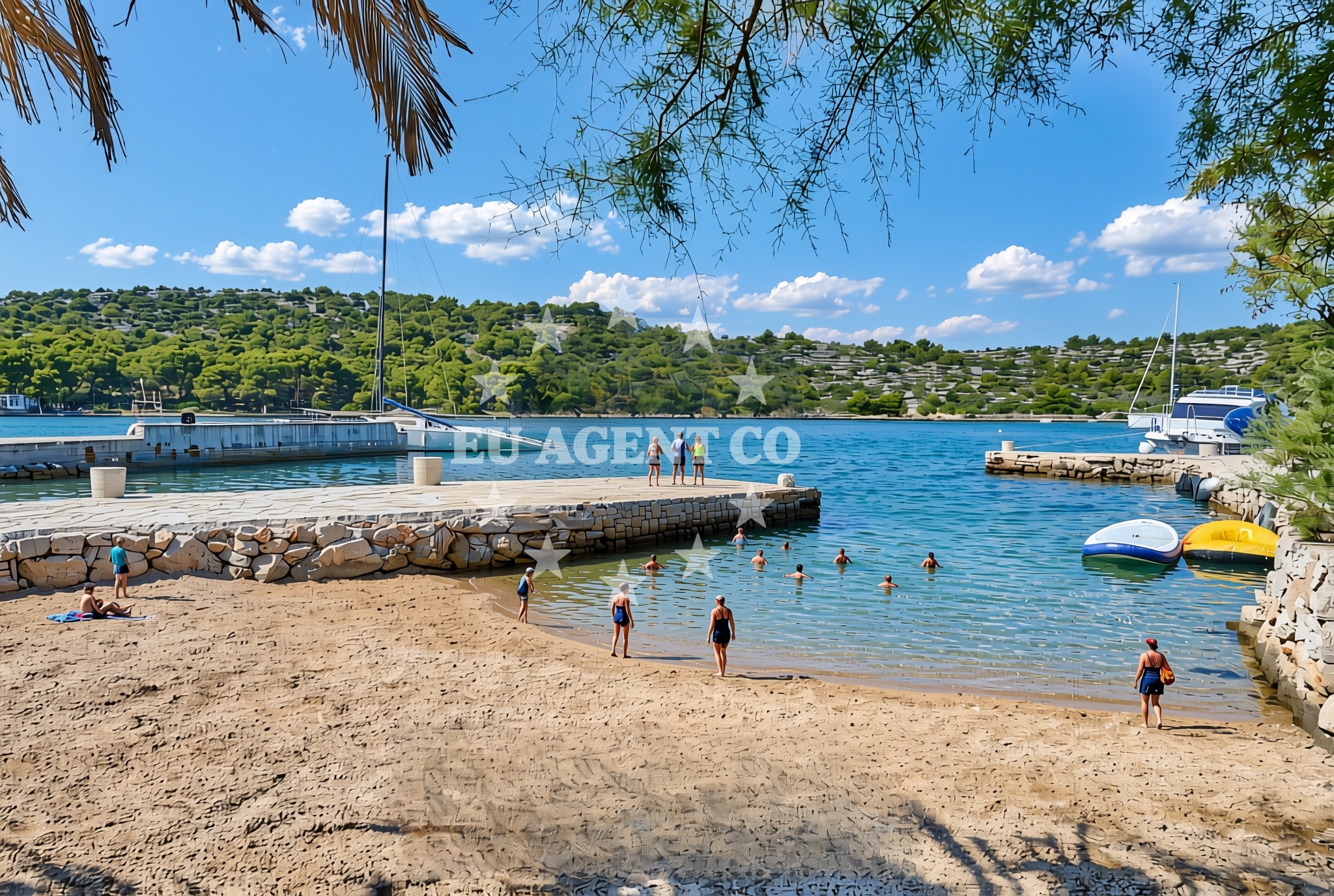
About this beach
Framina (Istočna obala), Kaprije (Kaprije)
Beach: Framina (Istočna obala)
Location: Kaprije (Kaprije)
Characteristics and facilities
Gravel, concrete / stone slabs
250 m
Restaurant / snack bar
Caffe bar / Drinks stand
Beach character
The beach consists of gravel and concrete slabs, offering a utilitarian shoreline rather than a lounging-focused environment. Its length of 250 meters makes it suitable for brief strolls or as a passing point for those navigating the island. The immediate vicinity includes a restaurant and a café bar, providing limited on-site dining options for visitors.Swimming and shore
Swimming is not a primary activity at Framina Beach due to its rocky and gravelly composition. The shore is characterized by exposed slabs and minimal sand, making it more practical for foot traffic than for sunbathing or water-based recreation. The nearby facilities, however, offer a place to pause and enjoy refreshments during coastal excursions.Facilities and activities
The beach is accompanied by a restaurant and a café bar, both located within a short walking distance. These establishments cater to visitors seeking light meals or beverages. No other structured activities or facilities are listed for the beach itself, though the surrounding area of Kaprije may offer additional opportunities for exploration.Access and location
Framina Beach is located on Kaprije Island, a small islet in the northern Adriatic Sea. The island is part of the Istrian Peninsula and lies near the mainland towns of Rovinj and Pula. Access to Kaprije is typically via ferry from the mainland, making it a destination for day-trippers and yacht charter guests exploring the region. The beach's coordinates (43.686551, 15.710556) place it within a network of coastal landmarks that include the Brijuni Islands and the Rovinj harbor.What to expect
Visitors to Framina Beach should expect a short, gravelly shoreline with limited amenities. The beach is best suited for those passing through Kaprije Island, with the restaurant and café bar serving as the primary on-site offerings. The location's proximity to Rovinj and Pula means that extended stays or deeper exploration of the area would likely involve visiting these nearby towns. The beach's character is more functional than recreational, aligning with its role as a coastal access point.Practical tips
Given the beach's gravelly surface, visitors may wish to wear sturdy footwear. The lack of extensive facilities means that planning meals or refreshments in advance is advisable. Those arriving by yacht may find the nearby waters suitable for anchoring, though specific mooring details should be confirmed through Euro-Agent's yacht search tools.Exploring the coast by yacht
For yacht charter guests, Framina Beach offers a convenient stopover on Kaprije Island, which lies within the broader Istrian sailing area. The island's proximity to Rovinj and Pula makes it a strategic location for exploring the northern Adriatic. Yacht charterers interested in this region can use Euro-Agent's yacht search form to find vessels available for trips that include Kaprije and surrounding coastal routes.Regional Context: Kaprije Island and the Istrian Peninsula
Kaprije Island is one of the smallest inhabited islands in the Adriatic, known for its rugged terrain and historical significance. The Istrian Peninsula, where Kaprije is located, is a region of diverse landscapes, from coastal towns like Rovinj to the vineyards of the interior. Framina Beach, while modest in size, reflects the practical coastal character of this area, where natural features often take precedence over leisure-focused amenities.Anchorages in the surrounding area
Anchorages in the surrounding area include Kaprije and Zmajan, offering options for mooring near the beach.
- Anchorage — kaprije — 0.5 NM from beach
- Anchorage — kaprije — 1.3 NM from beach
- Vanjska — kaprije — 1.6 NM from beach
- Zmajan — 1.6 NM from beach
- Anchorage — zmajan — 1.9 NM from beach
- Anchorage — zmajan — 2.1 NM from beach
- Remetić — remetic — kaprije — 2.1 NM from beach
- Anchorage — zmajan — 2.4 NM from beach
Distances are straight-line geographic distances, not sailing routes.
Mooring buoys in the surrounding area
Mooring buoys in the surrounding area include Konoba Neptun and Konoba G8, located close to the beach.
- Buoy field — kaprije — 0.1 NM from beach
- Konoba Neptun berths — kaprije — 0.1 NM from beach
- Konoba Nozdra G8 jetty — kaprije — 0.5 NM from beach
- Konoba G8 buoys — kaprije — 0.5 NM from beach
- Konoba Antonio buoys — kaprije — 0.5 NM from beach
Distances are straight-line geographic distances, not sailing routes.
Marine fuel stations
- Petrol — tribunj — 4.3 NM from beach
- Ina — vodice — 5.2 NM from beach
- Ina — jezera — murter — 6.6 NM from beach
- Lukoil — sibenik — 8.1 NM from beach
Distances are straight-line geographic distances, not sailing routes.
Harbours in the surrounding area
- Kaprije — 0.1 NM from beach
- Muna — zirje — 2.8 NM from beach
- Tribunj — 4.3 NM from beach
- Prvić Šepurine — prvic sepurine — 4.4 NM from beach
- Konoba Stari Nanini at Prvić Port — prvic — 4.5 NM from beach
- Vodice — 5.0 NM from beach
Distances are straight-line geographic distances, not sailing routes.
Marinas in the surrounding area
- Marina Tribunj — 4.3 NM from beach
- ACI Marina Vodice — 5.2 NM from beach
- ACI Marina Jezera — murter — 6.5 NM from beach
- Amadria Yacht Marines — sibenik — 7.3 NM from beach
- Marina Zaton — zaton near sibenik — 7.6 NM from beach
Distances are straight-line geographic distances, not sailing routes.
Restaurants near the beach
Restaurants near the beach include Konoba Toni and Konoba Sampjer, situated in close proximity.
- Konoba Toni — kaprije — 0.1 NM from beach
- Konoba Sampjer — kaprije — 0.1 NM from beach
- Restaurant — kaprije — 0.1 NM from beach
- Kate — kaprije — 0.1 NM from beach
- Mackova Lula — kaprije — 0.1 NM from beach
- Liberty — kaprije — 0.1 NM from beach
- Lola — kaprije — 0.1 NM from beach
Distances are straight-line geographic distances, not sailing routes.
Navigation guides for the surrounding area
Navigation guides for the surrounding area include Luka Muna and Tučepi, aiding in route planning.
- Luka Muna — 2.7 NM from beach
- Tučepi — 3.6 NM from beach
- MAINLAND COAST AND MURTER — 3.7 NM from beach
- Tribunj — 4.5 NM from beach
- Uvala Sovlje — 4.7 NM from beach
Distances are straight-line geographic distances, not sailing routes.
Yachts from nearby departure bases
Yachts from nearby departure bases include models like Sessa C38 and Bavaria 29 Sport, operating out of Tribunj.
Motor yachts
- Sessa C38 (Lana) — Tribunj — 4.3 NM from departure base to beach
Motor boats
- Bavaria 29 Sport (Nena) — Tribunj — 4.3 NM from departure base to beach
- Bavaria 32 Sport (Dora) — Tribunj — 4.3 NM from departure base to beach
- Azimut 43 (Bruna 2) — Tribunj — 4.3 NM from departure base to beach
- Regal Commodore 2860 (1115 VD) — Tribunj — 4.3 NM from departure base to beach
- Four Winns 278 Vista (985 VD) — Tribunj — 4.3 NM from departure base to beach
- Beneteau Flyer 660 Sundeck (Ante) — Tribunj — 4.3 NM from departure base to beach
- Bavaria 300 (Luna) — Tribunj — 4.3 NM from departure base to beach
- Galeon Galia 700 (Lana) — Tribunj — 4.3 NM from departure base to beach
- Sealine SC35 (Lara) — Tribunj — 4.3 NM from departure base to beach
Distances are straight-line geographic distances, not sailing routes.