Crkvice sjever, Kuna Pelješka Beach, Croatia
5 photos
About this beach
Crkvice sjever, Kuna Pelješka
Beach: Crkvice sjever
Location: Kuna Pelješka
Characteristics and facilities
Gravel, concrete / stone slabs
20 m
Beach character
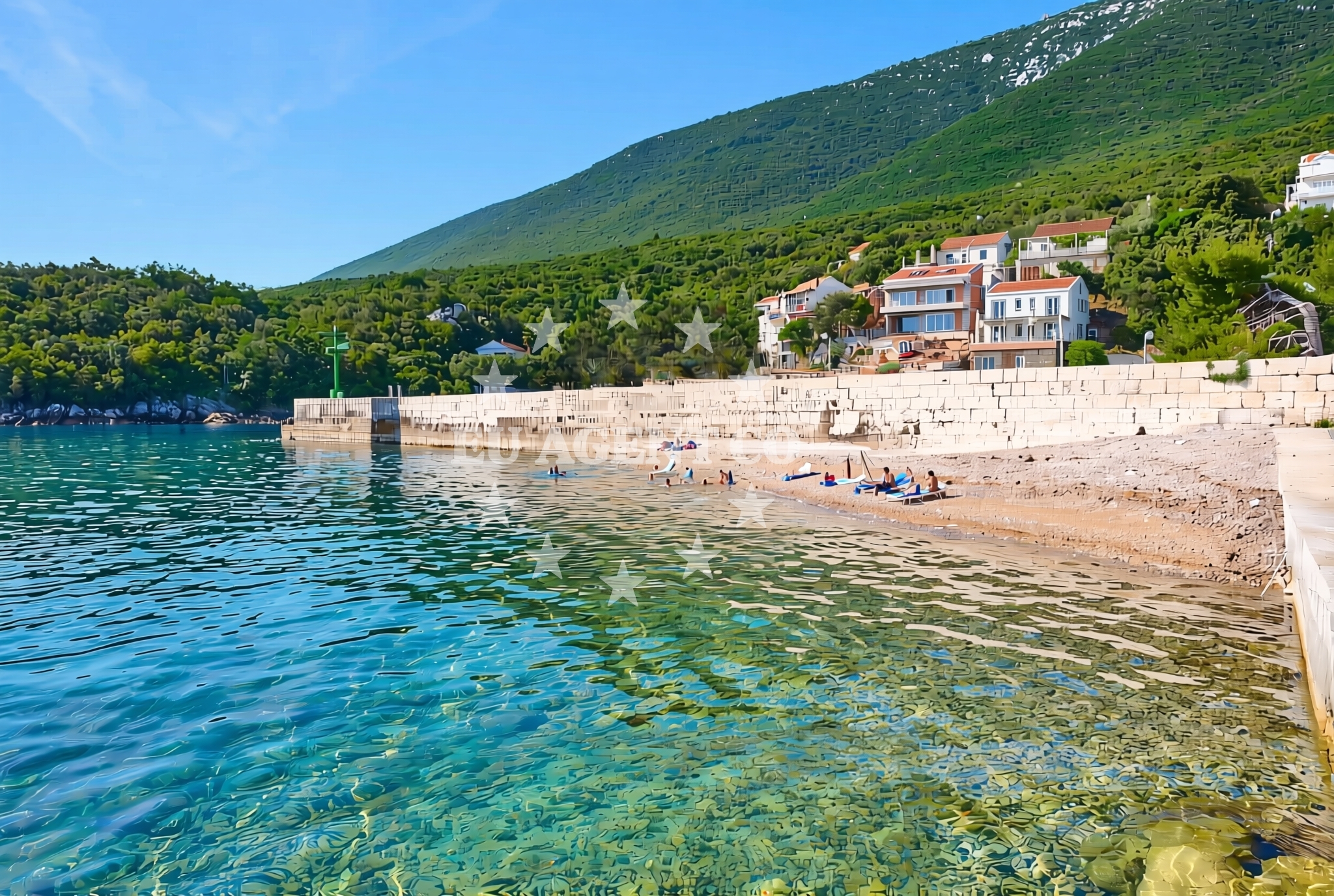
The beach's shoreline is composed of gravel and concrete/stone slabs, creating a unique texture that contrasts with the smooth sands of other Adriatic shores. Its short length means it is best suited for brief walks or as a vantage point to observe the surrounding coastal landscape. The area is likely to be less crowded than more developed beaches, offering a tranquil setting for those who prefer solitude or a more rugged coastal aesthetic.Swimming and shore
Swimming conditions at Crkvice sjever, Kuna Pelješka Beach are not explicitly detailed in available records. The gravel and stone slabs along the shore may make direct access to the water challenging, though the beach’s proximity to the Adriatic Sea suggests it is near open waters. Visitors should be mindful of the terrain when entering the sea, as the rocky shoreline could affect comfort and safety for swimmers.Facilities and activities
No specific facilities or activities are listed for Crkvice sjever, Kuna Pelješka Beach itself. However, its location in the Kuna Pelješka area may provide access to nearby amenities in the surrounding settlement. The beach does not appear to host structured activities, but its natural setting could appeal to those interested in photography, birdwatching, or simply enjoying the unspoiled coastline.Access and location
Located in Crkvice sjever, the beach is part of the Kuna Pelješka region, a coastal area in Croatia known for its natural beauty and traditional villages. The exact access route is not detailed in available records, but the beach’s proximity to the Adriatic Sea suggests it is near established coastal pathways. Visitors are advised to use local maps or consult with residents for the most accurate directions to this secluded spot.What to expect
Visitors to Crkvice sjever, Kuna Pelješka Beach should expect a short, gravelly shoreline that contrasts with the sandy beaches typical of the Adriatic. The beach’s limited length and rugged terrain make it ideal for those seeking a quiet, less-developed coastal experience. Its location in the Kuna Pelješka area may offer opportunities to explore nearby settlements or natural landmarks, though no specific facilities are listed for the beach itself.Practical tips
Given the beach’s gravel and stone slab shoreline, visitors may want to wear sturdy footwear for comfort. The short length of the beach means it is best suited for brief exploration or as a scenic stop along a coastal journey. Due to the lack of detailed information on access, it is recommended to verify local conditions before visiting.Exploring the coast by yacht
Crkvice sjever, Kuna Pelješka Beach lies within the broader Adriatic sailing region, an area popular with yacht charter guests for its diverse coastline and picturesque islands. While the beach itself is not marked as a marina or anchorage, its location near the Adriatic Sea suggests it could be a point of interest for sailors exploring the surrounding waters. For those interested in yacht charter options in the region, the Euro-Agent Yacht Search Page provides detailed information on available vessels and sailing routes.Regional Context and Nearby Settlements
The Kuna Pelješka area is part of the broader Adriatic coast, known for its traditional villages and natural landscapes. Nearby settlements may offer additional amenities, though specific details for Crkvice sjever are not detailed in available records. The region’s proximity to the Adriatic Sea makes it a potential starting point for sailing excursions, with opportunities to explore nearby islands and coastal towns.Anchorages in the surrounding area
- Anchorage — crikvice — 0.1 NM from beach
- Anchorage — trstenik — 3.7 NM from beach
- Anchorage — trstenik — 3.9 NM from beach
- Anchorage — podobuce — 4.2 NM from beach
- Anchorage — trstenik — 4.2 NM from beach
- Anchorage — trpanj — 4.3 NM from beach
- Anchorage — blace — 4.8 NM from beach
- Anchorage — duba — 5.2 NM from beach
Distances are straight-line geographic distances, not sailing routes.
Mooring buoys in the surrounding area
- Jetty — blace — 4.9 NM from beach
- Brijesta — 8.1 NM from beach
- Restaurant Moro buoys — stupe — 8.1 NM from beach
- Brist — 8.9 NM from beach
- Vrnik Arts Club buoys — 9.4 NM from beach
Distances are straight-line geographic distances, not sailing routes.
Marine fuel stations
- Fuel station — ploce — 5.4 NM from beach
- Fuel station — korcula — 10.0 NM from beach
- Fuel station — sobra — mljet — 17.9 NM from beach
- Ina — makarska — 24.8 NM from beach
Distances are straight-line geographic distances, not sailing routes.
Harbours in the surrounding area
- Sresar — rat — 3.5 NM from beach
- Trstenik — 3.7 NM from beach
- Drače — drace — 4.3 NM from beach
- Trpanj — 5.1 NM from beach
- Ploče — ploce — 5.4 NM from beach
- Žuljana — zuljana — 6.2 NM from beach
Distances are straight-line geographic distances, not sailing routes.
Marinas in the surrounding area
- Marina Lumbarda — korcula — 9.4 NM from beach
- ACI Marina Korčula — korcula — 10.5 NM from beach
- Marina Tučepi — marina tucepi — 22.2 NM from beach
- ACI Marina Slano — 25.4 NM from beach
- Marina Ramova — krvavica — 27.1 NM from beach
Distances are straight-line geographic distances, not sailing routes.
Navigation guides for the surrounding area
- Trstenik — 3.9 NM from beach
- Bl ace — 5.0 NM from beach
- Trpanj — 5.0 NM from beach
- Place (Kardeljeva) — 5.3 NM from beach
- Uvala Divna — 7.8 NM from beach
Distances are straight-line geographic distances, not sailing routes.
Yachts from nearby departure bases
Sailing yachts
- Elan 40 Impression (Karleta) — Ploče City Port — 5.3 NM from departure base to beach
- Sun Odyssey 419 (Luka Ploce) — Ploče City Port — 5.3 NM from departure base to beach
- More 55 (MRS. ROBINSON) — Ploče City Port — 5.3 NM from departure base to beach
- Elan 514 Impression (Cesarica III) — Ploče City Port — 5.3 NM from departure base to beach
- Sun Odyssey 349 (Porto Tolero) — Ploče City Port — 5.3 NM from departure base to beach
- Salona 44 (SAMOA) — Ploče City Port — 5.3 NM from departure base to beach
- Sun Odyssey 349 (Visnjica) — Ploče City Port — 5.3 NM from departure base to beach
- Bavaria 40 Cruiser (LADY BUTTERFLY) — Tučepi Port — 22.2 NM from departure base to beach
Catamarans
- Lagoon 450 Fly (Alba Mouse) — Ploče City Port — 5.3 NM from departure base to beach
Motor yachts
- Princess V53 (Chablis) — Makarska Port — 24.6 NM from departure base to beach
Distances are straight-line geographic distances, not sailing routes.
Frequently asked questions
Are there facilities available at Crkvice sjever, Kuna Pelješka Beach?
The beach itself does not list specific facilities, but its location in the Kuna Pelješka area may provide access to nearby amenities in the surrounding settlement.Is Crkvice sjever, Kuna Pelješka Beach suitable for swimming?
While the beach is near the Adriatic Sea, its gravel and stone slab shoreline may make direct access to the water challenging. Visitors should assess the terrain before entering the sea.Nearby beaches
Crkvice jug, Kuna Pelješka Beach
Crkvice jug
0.2 km
Plaza Osobjava
Kudinovi?i 35, Janjina
1.7 km
Kuna Pelješka: beaches and coves (2)
Kuna Pelješka
2.5 km
Osobjava: beaches and coves (1)
Osobjava
3.1 km
Pijavičino: beaches and coves (1)
Pijavičino
3.9 km
Velika Prapratna istok, Oskorušno
Velika Prapratna istok
4.1 km
Plaza Velika Prapratna
Luka bb, Trpanj
4.3 km
Potomje: beaches and coves (2)
Potomje
5.0 km