Bucavac, Grebaštica Beach, Croatia
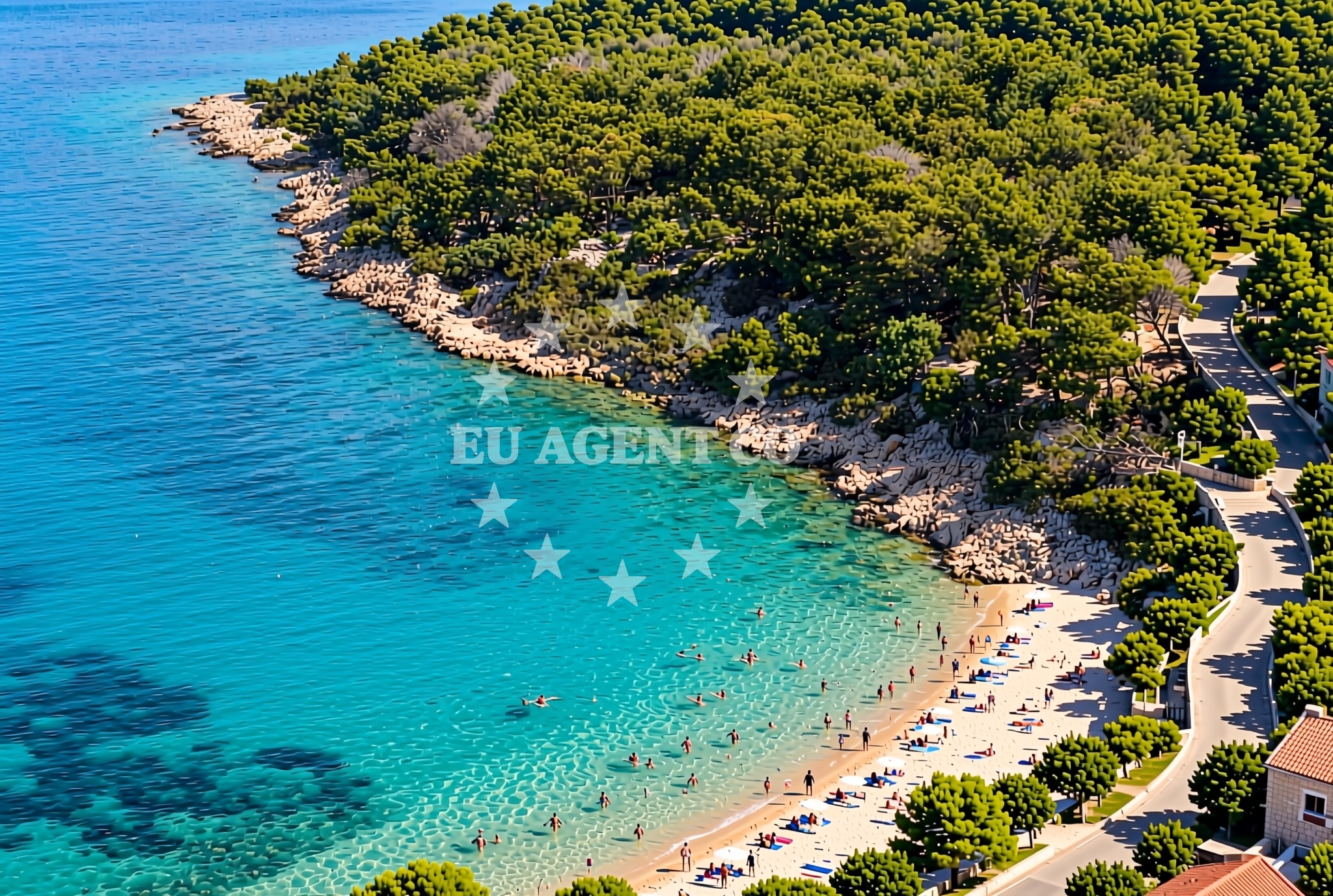
About this beach
Bucavac, Grebaštica
Beach: Bucavac
Location: Grebaštica
Beach character
Though no detailed natural features are recorded for Bucavac, Grebaštica Beach, its name implies a connection to the broader Grebaštica area, which may include rocky outcrops, sandy stretches, or a mix of both. The Adriatic coast in this region is known for its varied shorelines, ranging from pebbly coves to wider sandy beaches. Visitors to the area may find opportunities for relaxation on the beach, though specific amenities or facilities are not detailed in the available records.Swimming and shore
The Adriatic Sea surrounding Bucavac is characterized by clear waters and a generally sheltered coastline, which can make it a suitable area for swimming. However, specific conditions such as water depth, wave activity, or shore stability are not documented for this beach. The broader region is known for its mild climate, making it a favorable destination for coastal activities during the warmer months.Facilities and activities
No formal amenities or structured activities are listed for Bucavac, Grebaštica Beach. The absence of detailed records suggests that the beach may be a more natural, undeveloped shoreline. Nearby settlements like Bucavac may offer basic services, but specific facilities such as parking, restrooms, or shaded areas are not confirmed for the beach itself. Visitors are encouraged to explore the surrounding area for additional services.Access and location
Bucavac, Grebaštica Beach is located in the village of Bucavac, which is part of the broader coastal network of the Adriatic. Access to the beach likely involves local roads leading to the village, though specific pathways or parking arrangements are not detailed. The beach's coordinates (43.640922, 15.941971) place it within a region that is accessible by land and sea, with nearby towns and ports potentially offering connections to other parts of the Croatian coast.What to expect
Bucavac, Grebaštica Beach is positioned within a coastal setting that reflects the natural and cultural heritage of the Adriatic. While specific beach conditions are not documented, the area is likely to offer a quiet, unspoiled shoreline typical of smaller Croatian villages. The surrounding region may provide opportunities for exploration, including nearby towns, historical sites, or natural attractions. For detailed information, visitors are encouraged to consult local resources or use the Euro-Agent beaches map for further context.Practical tips
Given the lack of specific beach details, visitors are advised to check local conditions and availability of nearby services. The Euro-Agent beaches map (https://euro-agent.com/?open=beaches_map) can provide additional insights into the broader coastal area, including potential routes or points of interest.Exploring the coast by yacht
For those interested in yacht charter experiences, the Adriatic coastline near Bucavac offers a range of sailing opportunities. The region is part of a popular sailing route, with nearby marinas and anchorages accessible to charter guests. Euro-Agent Yacht Charter (https://euro-agent.com/?open=form) can assist with finding suitable vessels and planning itineraries that include this part of the Croatian coast. The area's natural beauty and maritime traditions make it an appealing destination for sailors exploring the Adriatic.Regional Context and Sailing Opportunities
The Adriatic Sea is a favored destination for yacht charters, with its clear waters, mild climate, and diverse coastal landscapes. Bucavac's location places it within a region that is accessible to charter guests exploring the Dalmatian coast. Nearby ports and marinas may offer docking options, while the surrounding waters provide opportunities for scenic sailing. Euro-Agent Yacht Charter can help arrange trips that include this area, connecting visitors with vessels suited to the region's maritime character.Anchorages in the surrounding area
Anchorages in Grebastica and Zaboric are located near Bucavac, Grebaštica Beach.
- Anchorage — grebastica — 0.2 NM from beach
- Anchorage — zaboric — 0.2 NM from beach
- Anchorage — zaboric — 0.2 NM from beach
- Anchorage — zaboric — 0.8 NM from beach
- Anchorage — zaboric — 0.8 NM from beach
- Anchorage — zaboric — 1.1 NM from beach
- Anchorage — grebastica — 1.4 NM from beach
- Anchorage — brodarica — 1.8 NM from beach
Distances are straight-line geographic distances, not sailing routes.
Mooring buoys in the surrounding area
- Jetty — grebastica — 1.1 NM from beach
- Hotel Spongiola jetty — krapanj — 2.4 NM from beach
- Zlatna ribica jetty — brodarica — 2.5 NM from beach
- Quay — primosten — 3.4 NM from beach
- Buoy field — primosten — 3.5 NM from beach
Distances are straight-line geographic distances, not sailing routes.
Marine fuel stations
Marine fuel stations in Primosten, Šibenik, and Rogošnica serve the vicinity of Bucavac, Grebaštica Beach.
- Petrol — primosten — 4.3 NM from beach
- Lukoil — sibenik — 5.2 NM from beach
- Ina — sibenik — 5.9 NM from beach
- Flash — rogoznica — 6.5 NM from beach
Distances are straight-line geographic distances, not sailing routes.
Harbours in the surrounding area
Harbors in Krapanj, Brodarica, Primosten, and Šibenik are situated within reach of Bucavac, Grebaštica Beach.
- Krapanj — 2.1 NM from beach
- Brodarica — 2.3 NM from beach
- Primošten — primosten — 3.4 NM from beach
- Zablaće — zablace — 5.1 NM from beach
- Zlarin — 5.9 NM from beach
- Šibenik — sibenik — 6.0 NM from beach
Distances are straight-line geographic distances, not sailing routes.
Marinas in the surrounding area
- Marina Kremik — primosten — 4.3 NM from beach
- Amadria Yacht Marines — sibenik — 4.5 NM from beach
- Marina Mandalina — sibenik — 5.0 NM from beach
- Marina Frapa — rogoznica — 6.7 NM from beach
- Marina Zaton — zaton near sibenik — 9.6 NM from beach
Distances are straight-line geographic distances, not sailing routes.
Restaurants near the beach
Restaurants in Grebastica, Zaboric, and Primosten offer dining choices close to Bucavac, Grebaštica Beach.
- Restoran Veranda — zaboric — 0.8 NM from beach
- Pizzeria Niko — grebastica — 1.0 NM from beach
- Restaurant Hotel Spongiola — krapanj — 2.4 NM from beach
- Zlatna ribica — brodarica — 2.5 NM from beach
- Konoba Antonija — primosten — 3.3 NM from beach
- Restaurant Galija — primosten — 3.3 NM from beach
- Torkul — primosten — 3.3 NM from beach
Distances are straight-line geographic distances, not sailing routes.
Navigation guides for the surrounding area
Navigation guides for Grebastica, Krapanj, and Primosten assist with route planning near Bucavac, Grebaštica Beach.
- Luka Grebastica — 0.9 NM from beach
- Jadrtovac — 2.0 NM from beach
- Krapanj — 2.1 NM from beach
- Primosten — 3.4 NM from beach
- Luka Peles and Marina Kremik (Primosten) — 4.7 NM from beach
Distances are straight-line geographic distances, not sailing routes.
Yachts from nearby departure bases
Sailing yachts
- Dufour 382 Grand (PETAR PAN) — Primošten Marina Kremik — 4.3 NM from departure base to beach
- Jeanneau 54 (Postira) — Primošten Marina Kremik — 4.3 NM from departure base to beach
- Sun Odyssey 379 (b'elli) — Primošten Marina Kremik — 4.3 NM from departure base to beach
- D&D Kufner 54 (Ella I) — Primošten Marina Kremik — 4.3 NM from departure base to beach
- Dufour 460 Grand (Sulaco) — Primošten Marina Kremik — 4.3 NM from departure base to beach
Catamarans
- Dufour Catamaran 48 (BRO) — Primošten Marina Kremik — 4.3 NM from departure base to beach
- Neel 47 (Hope ) — Primošten Marina Kremik — 4.3 NM from departure base to beach
- Lagoon 40 (wave elli) — Primošten Marina Kremik — 4.3 NM from departure base to beach
- Lagoon 450 Flybridge (double elli) — Primošten Marina Kremik — 4.3 NM from departure base to beach
- Elba 45 (Martisnica) — Primošten Marina Kremik — 4.3 NM from departure base to beach
Distances are straight-line geographic distances, not sailing routes.