Brodarica Beaches and Coves: A Coastal Escape in Croatia
Brodarica, a quiet coastal village in Croatia's Dubrovnik-Neretva County, is home to a series of beaches and coves that line the Adriatic Sea. Nestled near the historic town of Cavtat, this area offers a tranquil alternative to busier coastal destinations. The region's limestone cliffs, olive groves, and medieval architecture create a landscape that feels both ancient and untouched. While Brodarica itself remains a modest settlement, its proximity to major Adriatic sailing routes makes it a strategic point for those exploring the Pelješac Peninsula and the broader Dalmatian coast.
About this beach
Brodarica: beaches and coves
Beach character
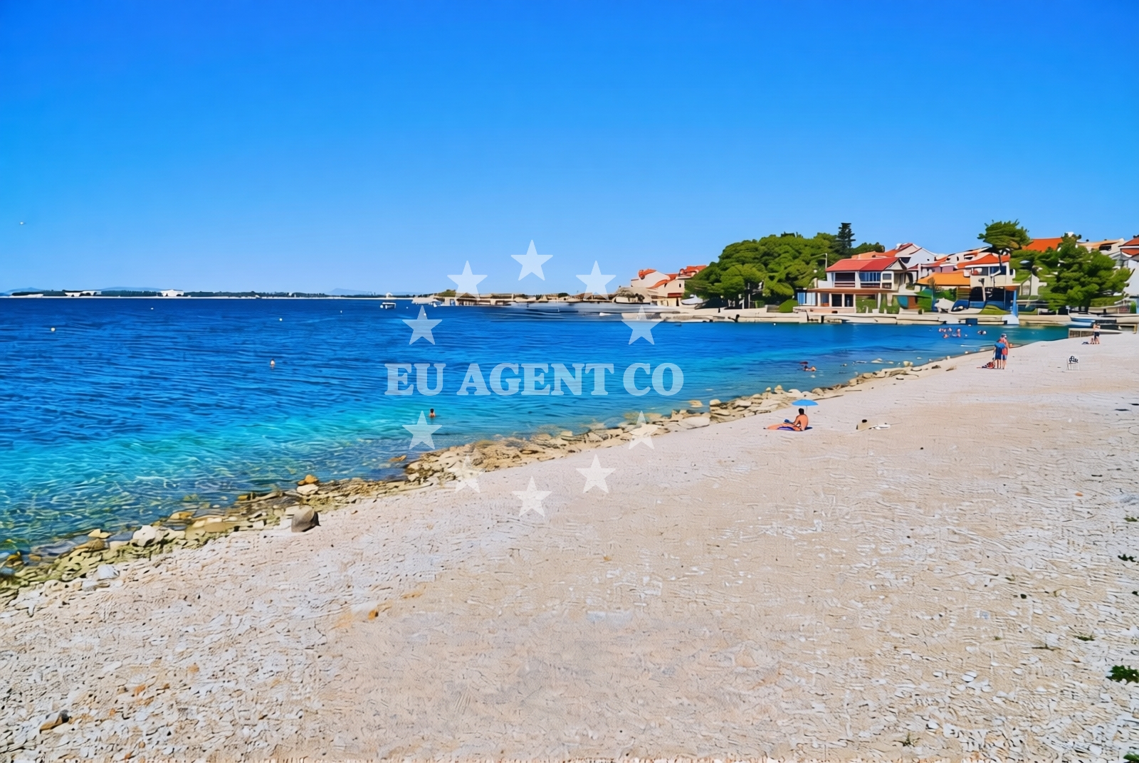
The beaches and coves of Brodarica are defined by their integration with the surrounding terrain. Shallow, pebbled shorelines give way to clearer waters as you move toward the open sea, a common feature along this stretch of Croatia's coast. The area's topography creates natural amphitheaters that shelter smaller coves, offering visitors a mix of open beachfront and more secluded spots. These characteristics align with the broader Adriatic pattern of coastal erosion and sedimentation, where limestone formations dominate the shoreline.
Swimming and shore
The waters off Brodarica are typical of the Adriatic, with temperatures peaking in late summer and clarity often exceeding 20 meters. The shallower coves near the village are ideal for calm swimming, while the open sea beyond the headlands offers more challenging conditions for experienced swimmers. The shorelines are primarily composed of pebbles and small stones, with limited sandy patches concentrated near the village. This composition reflects the region's geological history, where marine deposits have shaped the coastline over millennia.
Facilities and activities
While Brodarica itself lacks modern amenities, its connection to Cavtat provides access to basic services including restaurants, shops, and accommodation. The village's limited infrastructure preserves its rural character, making it an appealing destination for those seeking simplicity. Activities centered around the beach include snorkeling in the clearer waters beyond the coves and hiking along the coastal trails that connect Brodarica to nearby settlements. The region's maritime heritage is also evident in the presence of small fishing boats that operate from the nearby port of Cavtat.
Access and location
Brodarica is accessible via a minor road that connects to the main coastal highway near Cavtat. This positioning places it within easy reach of major Adriatic ports, including Dubrovnik and Split, while maintaining a degree of isolation that characterizes many of Croatia's smaller coastal villages. The village's coordinates (43.6812662, 15.9178489) place it in a strategic location for yacht charter guests exploring the Pelješac Peninsula, with sailing routes to the islands of Mljet and Korčula passing within a short distance.
What to expect
Visitors to Brodarica should expect a landscape shaped by natural processes rather than modern development. The beaches and coves offer a mix of accessibility and seclusion, with the most sheltered spots requiring a short walk from the village. The area's appeal lies in its unspoiled character, with minimal infrastructure that preserves the coastal environment. Those seeking luxury amenities will find them concentrated in Cavtat, while Brodarica's quieter nature makes it suitable for travelers prioritizing solitude and connection with the Adriatic landscape.
Practical tips
Given the absence of formal facilities in Brodarica, visitors should plan to bring essentials like water, sunscreen, and snacks. The village's proximity to Cavtat means that most services are available within a short drive, though this may be less practical for those arriving by yacht. The coastal trails near Brodarica offer opportunities for walking, but visitors should be prepared for uneven terrain and limited signage.
Exploring the coast by yacht
For yacht charter guests, Brodarica's location offers strategic advantages. The village sits on the eastern edge of the Pelješac Peninsula, a region renowned for its sailing routes and scenic anchorages. Yachts can easily access Brodarica from Cavtat's marina, which serves as a gateway to the broader Adriatic. The surrounding waters are part of a sailing area that includes the Elaphiti Islands, Mljet, and the coastal towns of Koločep and Lopud. Charterers exploring this region may find Brodarica a useful reference point for navigating the narrow channels and limestone inlets that characterize the area.
Historical Context of the Region
The Brodarica area has historical ties to the medieval Dubrovnik Republic, which controlled much of the Adriatic coast. Remnants of this era can be seen in the nearby town of Cavtat, where Venetian architecture and fortifications remain intact. The region's strategic position made it a hub for maritime trade, a legacy that continues to influence the local economy through tourism and yacht chartering.
Anchorages in the surrounding area
- Anchorage — brodarica — 1.1 NM from beach
- Anchorage — zaboric — 1.8 NM from beach
- Anchorage — zaboric — 1.9 NM from beach
- Anchorage — zaboric — 2.2 NM from beach
- Anchorage — zlarin — 2.4 NM from beach
- Anchorage — zaboric — 2.4 NM from beach
- Anchorage — grebastica — 2.5 NM from beach
- Anchorage — zaboric — 2.7 NM from beach
Distances are straight-line geographic distances, not sailing routes.
Mooring buoys in the surrounding area
Mooring options include the Zlatna ribica jetty located in Brodarica, just 0.21 nautical miles from the beach.
- Zlatna ribica jetty — brodarica — 0.2 NM from beach
- Hotel Spongiola jetty — krapanj — 0.4 NM from beach
- Jetty — grebastica — 3.6 NM from beach
- Sv. Nikola — sv nikola — zablace — 3.7 NM from beach
- Buoy field — zlarin — 4.1 NM from beach
Distances are straight-line geographic distances, not sailing routes.
Marine fuel stations
Marine fuel stations are situated in Sibenik and Primosten, with Lukoil in Sibenik being 2.55 nautical miles away.
- Lukoil — sibenik — 2.6 NM from beach
- Ina — sibenik — 3.3 NM from beach
- Petrol — primosten — 6.8 NM from beach
- Ina — vodice — 7.5 NM from beach
Distances are straight-line geographic distances, not sailing routes.
Harbours in the surrounding area
- Brodarica — 0.4 NM from beach
- Krapanj — 0.5 NM from beach
- Zablaće — zablace — 2.7 NM from beach
- Šibenik — sibenik — 3.4 NM from beach
- Zlarin — 3.8 NM from beach
- Jadria — 4.0 NM from beach
Distances are straight-line geographic distances, not sailing routes.
Marinas in the surrounding area
Marinas in Sibenik, such as Marina Mandalina, are approximately 2.4 nautical miles from Brodarica.
- Amadria Yacht Marines — sibenik — 2.1 NM from beach
- Marina Mandalina — sibenik — 2.4 NM from beach
- Marina Kremik — primosten — 6.8 NM from beach
- Marina Zaton — zaton near sibenik — 7.0 NM from beach
- ACI Marina Vodice — 7.6 NM from beach
Distances are straight-line geographic distances, not sailing routes.
Restaurants near the beach
Restaurants near the beach include Zlatna ribica in Brodarica and Hotel Spongiola in Krapanj, both within a short distance.
- Zlatna ribica — brodarica — 0.2 NM from beach
- Restaurant Hotel Spongiola — krapanj — 0.4 NM from beach
- Restoran Veranda — zaboric — 2.3 NM from beach
- Blue Frog — sibenik — 2.4 NM from beach
- Pizzaria Zora — zablace — 2.6 NM from beach
- Omega — sibenik — 2.6 NM from beach
- Pizzeria Zora — sibenik — 3.4 NM from beach
Distances are straight-line geographic distances, not sailing routes.
Navigation guides for the surrounding area
Navigation guides reference nearby points such as Jadrtovac and Šibenik, which are 0.95 and 3.18 nautical miles away respectively.
- Krapanj — 0.5 NM from beach
- Jadrtovac — 0.9 NM from beach
- Šibenik — 3.2 NM from beach
- Luka Grebastica — 3.3 NM from beach
- Luka Zlarin — 3.7 NM from beach
Distances are straight-line geographic distances, not sailing routes.
Yachts from nearby departure bases
Sailing yachts
- Elan Impression 50.1 (Evana) — Šibenik Marina Mandalina — 2.4 NM from departure base to beach
- Hanse 548 (Supernova II) — Šibenik Marina Mandalina — 2.4 NM from departure base to beach
- Dufour 44 (Dama) — Šibenik Marina Mandalina — 2.4 NM from departure base to beach
Catamarans
- Lagoon 42 (Maximus) — Šibenik Marina Mandalina — 2.4 NM from departure base to beach
- Astrea 42 (Adriatic Breeze) — Šibenik Marina Mandalina — 2.4 NM from departure base to beach
- Bali Catspace (Free Flow) — Šibenik Marina Mandalina — 2.4 NM from departure base to beach
Motor yachts
- Azimut Grande 26M (First Horizon) — Šibenik Marina Mandalina — 2.4 NM from departure base to beach
- Azimut Magellano 60 (Olivia) — Šibenik Marina Mandalina — 2.4 NM from departure base to beach
Motor boats
- Bavaria Virtess 420 Fly (CALENI) — Šibenik Marina Mandalina — 2.4 NM from departure base to beach
- Ferretti 450 (Dream) — Šibenik Marina Mandalina — 2.4 NM from departure base to beach
Distances are straight-line geographic distances, not sailing routes.