Brdonja jug, Vir (Vir) Beach, Croatia
6 photos
About this beach
Brdonja jug, Vir (Vir)
Beach: Brdonja jug
Location: Vir (Vir)
Characteristics and facilities
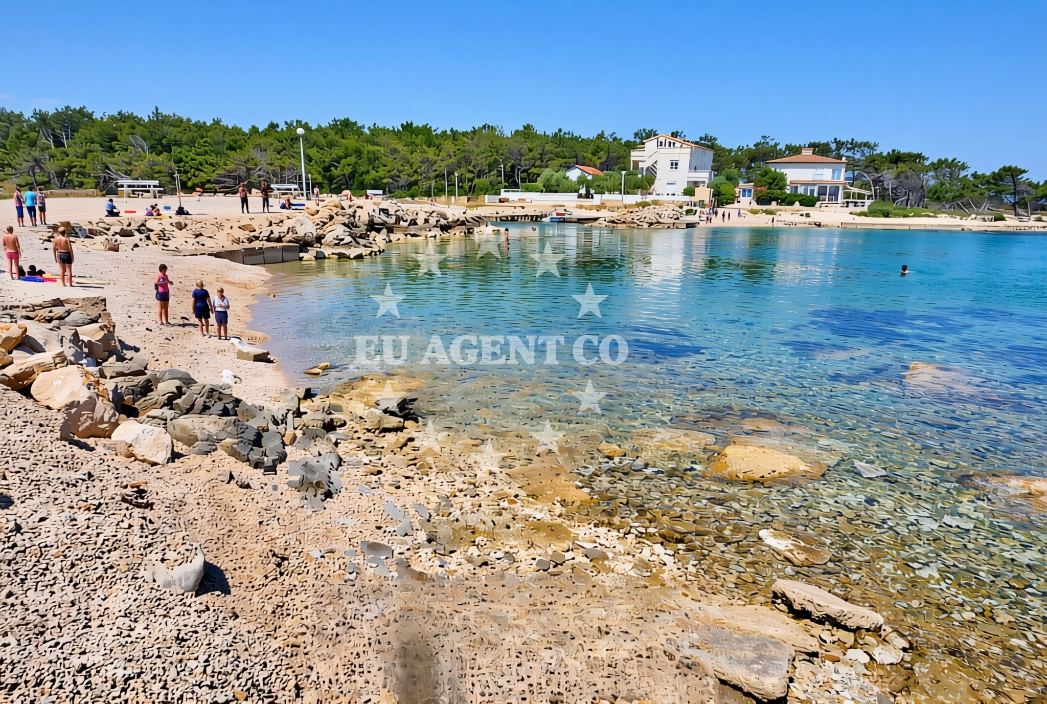
Gravel, concrete / stone slabs, rocks
110 m
Beach character
The beach's surface is composed of gravel, concrete slabs, and exposed rock formations, creating a terrain that is more suited to those seeking a rugged coastal experience rather than a conventional sandy shoreline. Its compact length of 110 meters suggests it is a modest stretch of coast, likely used by locals for informal access rather than as a primary tourist destination. The absence of structured amenities or facilities in the catalog indicates that the beach operates in a largely natural state, consistent with the unspoiled character of many Adriatic shorelines.Swimming and shore
The beach's rocky and gravelly composition may limit its suitability for swimming, though the Adriatic Sea's generally mild temperatures make it a viable option for those accustomed to such conditions. The shoreline's steepness and lack of sandy areas suggest that it is not a typical swimming beach, but rather a coastal stretch that could be used for anchoring or mooring small vessels. The surrounding waters are part of the broader Adriatic sailing region, known for its clear waters and navigable routes between islands.Facilities and activities
The beach lacks explicitly listed facilities or structured activities in the catalog. Its natural composition suggests it is not equipped for recreational amenities such as showers, changing rooms, or lifeguard services. However, the Vir area itself is part of a larger coastal network that includes marinas, anchorages, and yacht charter bases, which may offer services for visitors seeking to explore the region by boat.Access and location
Located on the island of Vir, Brdonja jug is part of a coastal area that has historically been connected to maritime trade and yacht charter operations. The island's position in the Adriatic Sea places it within reach of major sailing routes that extend from the Istrian Peninsula to the Dalmatian Coast. While the beach itself does not appear to have direct road access in the catalog, the Vir settlement is served by ferry routes and is near several marinas that cater to both private and charter yachts.What to expect
Brdonja jug offers a straightforward coastal experience defined by its natural gravel and rocky terrain. Visitors should expect a short, unobstructed shoreline that is more suited to those seeking a quiet, undeveloped stretch of coast rather than a fully serviced beach. The area's connection to the Adriatic sailing scene means it may be of interest to yacht charter guests exploring the Vir region, though the beach itself does not appear to be a primary docking or anchoring point.Practical tips
Given the beach's rocky composition, visitors should consider footwear suitable for uneven surfaces. The beach's modest length means it is best suited for brief visits or as a point of interest within a broader coastal exploration of the Vir area.Exploring the coast by yacht
The Vir region is a well-established area for yacht charter operations, with several marinas and anchorages within proximity. While Brdonja jug itself does not appear to be a primary docking location, the surrounding waters are part of the Adriatic sailing routes that connect to major yacht charter hubs. Euro-Agent's yacht search platform can help locate vessels available for charter in the Vir area, offering access to the broader Adriatic coastline.Regional Context: Vir Island and the Adriatic Sailing Network
Vir Island, where Brdonja jug is located, is part of the Adriatic's historic maritime corridor. The island's strategic position between the Istrian Peninsula and the Dalmatian Coast has made it a key point for both commercial and leisure sailing. Nearby settlements offer marinas and yacht services, supporting the region's reputation as a sailing destination. The surrounding waters are known for their navigability and scenic routes, making them a popular choice for charter yachts exploring the Adriatic.Anchorages in the surrounding area
- Anchorage — vir — 0.6 NM from beach
- Anchorage — vir — 1.0 NM from beach
- Anchorage — lozice — vir — 1.1 NM from beach
- Anchorage — vir — 1.4 NM from beach
- Anchorage — povljana — pag — 1.9 NM from beach
- Anchorage — vir — 2.0 NM from beach
- Anchorage — lozice — vir — 2.0 NM from beach
- Anchorage — vir — 2.2 NM from beach
Distances are straight-line geographic distances, not sailing routes.
Mooring buoys in the surrounding area
- Vir — 0.9 NM from beach
- Punta Skala — petrcane — 7.7 NM from beach
- Jetty — ljubac — 9.7 NM from beach
- Jetty — simuni — pag — 10.2 NM from beach
- Jetty — molat — 10.3 NM from beach
Distances are straight-line geographic distances, not sailing routes.
Marine fuel stations
- Ina — zadar — 13.3 NM from beach
- Ina — preko — ugljan — 14.9 NM from beach
- Fuel station — sukosan — 18.1 NM from beach
- Ina — zaglav — dugi otok — 21.9 NM from beach
Distances are straight-line geographic distances, not sailing routes.
Harbours in the surrounding area
- Povljana — pag — 2.2 NM from beach
- Privlaka — 3.2 NM from beach
- Košljun — kosljun pag — 5.0 NM from beach
- Nin — 5.9 NM from beach
- Mulo — nin — 6.5 NM from beach
- Miškovići — miskovici — pag — 6.5 NM from beach
Distances are straight-line geographic distances, not sailing routes.
Marinas in the surrounding area
- ACI Marina Šimuni — simuni — pag — 11.0 NM from beach
- Marina Borik — zadar — 12.3 NM from beach
- Vitrenjak Zadar — 12.5 NM from beach
- Marina Zadar — 13.2 NM from beach
- Olive Island Marina — sutomiscica — ugljan — 13.5 NM from beach
Distances are straight-line geographic distances, not sailing routes.
Restaurants near the beach
- Restaurant — vir — 0.7 NM from beach
- Viranka — 0.7 NM from beach
- Monica — vir — 0.9 NM from beach
- Restaurant — vir — 1.0 NM from beach
- Grill Marion — vir — 1.5 NM from beach
- Restaurant — vir — 2.1 NM from beach
- Lanterna — povljana — pag — 2.4 NM from beach
Distances are straight-line geographic distances, not sailing routes.
Navigation guides for the surrounding area
- OTOK PAG — 1.6 NM from beach
- Privlaka — 3.3 NM from beach
- Luka Jazi — 10.0 NM from beach
- Uvala Bliznica — 10.1 NM from beach
- Muline — 10.3 NM from beach
Distances are straight-line geographic distances, not sailing routes.
Yachts from nearby departure bases
Sailing yachts
- First 45 (Egeria) — Šimuni Kolan ACI Marina — 11.0 NM from departure base to beach
- Bavaria 44 (Medena) — Zadar Marina Borik — 12.3 NM from departure base to beach
Catamarans
- Leopard 50 (Solaia) — Zadar Marina Borik — 12.3 NM from departure base to beach
Motor yachts
- Ferretti 780 (TESORO) — Zadar Marina Borik — 12.3 NM from departure base to beach
Motor boats
- Merry Fisher 895 — Povljana Marina — 2.4 NM from departure base to beach
- BWA Sport 22GT (BWA ) — Pag City Port — 8.1 NM from departure base to beach
- Rancraft RM21 (Dugi otok) — Zadar Diklo Port — 11.0 NM from departure base to beach
- Rancraft RM19 (Daycruiser) — Zadar Diklo Port — 11.0 NM from departure base to beach
- Rancraft RS Cinque.5 — Zadar Diklo Port — 11.0 NM from departure base to beach
- Merry Fisher 895 — Zadar Marina Borik — 12.3 NM from departure base to beach
Distances are straight-line geographic distances, not sailing routes.
Nearby beaches
Plaza Brdonja
9 Ulica Brdonja XIII, Vir
0.1 km
Mala Slatina zapad, Vir (Vir) Beach
Mala Slatina zapad
0.2 km
Mala Slatina istok, Vir (Vir) Beach
Mala Slatina istok
0.3 km
Marina, Vir (Vir) Beach
Marina
0.6 km
Vela Slatina istok, Vir (Vir)
Vela Slatina istok
0.7 km
Plaza Velika Slatina
21 Ulica Velika Slatina V, Vir
0.8 km
Vela Slatina zapad, Vir (Vir)
Vela Slatina zapad
0.8 km
Plaza Lucica
34 Lučica n°1, Vir
0.9 km