Bratuš, Krvavica Beach, Croatia
Bratuš, Krvavica Beach lies along the rugged coastline of Croatia’s central Dalmatian coast, offering a unique gravel shoreline that contrasts with the region’s more common pebble or sandy beaches. Located in the village of Bratuš, the beach stretches 210 meters along the Adriatic Sea, providing a quiet stretch of coast with basic amenities for visitors. Its proximity to the town of Supetar on the nearby island of Brac makes it a convenient stop for those exploring the islands of the Split-Dalmatia region.
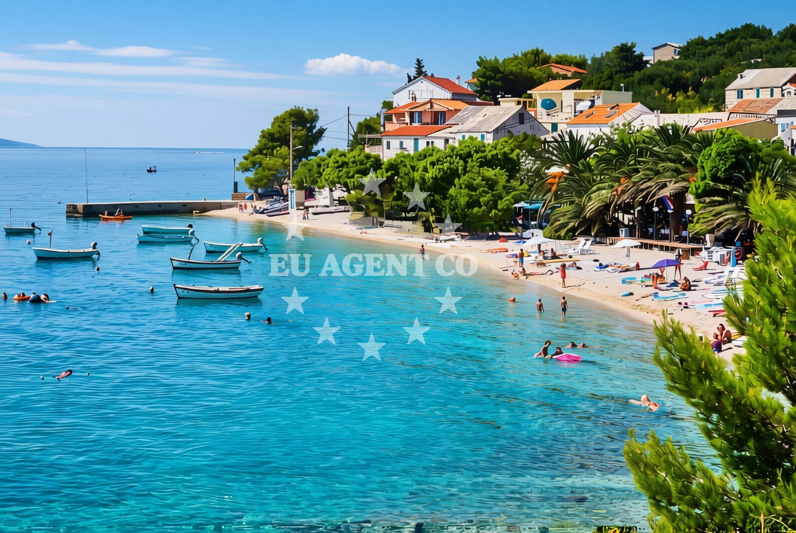
About this beach
Bratuš, Krvavica
Beach: Bratuš
Location: Krvavica
Characteristics and facilities
Gravel
210 m
Restaurant / snack bar
Caffe bar / Drinks stand
Natural shade
shower
Beach character
The beach is characterized by its gravel composition, which creates a distinct texture underfoot and offers a different experience compared to smoother shorelines. While not ideal for sunbathing, the gravel provides a stable surface for walking and offers natural drainage. The beach is relatively short, measuring 210 meters in length, and is flanked by rocky outcrops that contribute to its rugged appeal. The area is shaded by natural vegetation, offering limited relief from the sun, though visitors should bring their own shade solutions for extended stays.
Swimming and shore
The gravel shoreline may present challenges for swimming, as the uneven surface can make entering and exiting the water less straightforward. However, the beach’s position along the Adriatic coast means it benefits from the region’s generally clear and warm waters, typical of the Mediterranean. The shore itself is accessible via a short path from the nearby village of Bratuš, with no formal parking or road access reported in the catalog. The natural shade provided by nearby vegetation offers some respite, though visitors should be prepared for direct sunlight exposure in open areas.
Facilities and activities
Basic facilities include a restaurant/snack bar and a cafe/bar/drinks stand, catering to visitors seeking refreshments. A shower is available, though no additional amenities such as toilets, umbrellas, or sunbeds are listed. The beach’s simplicity aligns with its character as a more rustic coastal spot, appealing to those seeking a low-key beach experience. While no specific activities are documented, the surrounding area of Bratuš and Supetar offers opportunities for hiking, cycling, and exploring nearby vineyards and historic sites.
Access and location
Bratuš, Krvavica Beach is situated in the village of Bratuš on the island of Brac, Croatia. Its coordinates (43.328331, 16.97819) place it near the northern coast of Brac, close to the town of Supetar, which serves as a hub for visitors to the island. The beach is accessible via local roads connecting Bratuš to Supetar and the rest of the island. Given its proximity to Supetar’s marinas and yacht charter bases, the beach is within easy reach of sailing excursions along the Dalmatian coast.
What to expect
Expect a gravel shoreline with limited sunbathing options, complemented by a restaurant, cafe, and shower. The beach’s proximity to Supetar and Brac’s marinas makes it a convenient location for yacht charter guests exploring the area. While the facilities are minimal, the beach’s natural setting and coastal position offer opportunities to enjoy the Adriatic Sea’s scenery and the surrounding island landscapes.
Practical tips
Bring a towel or mat for comfort on the gravel surface, and consider using the shower facility before or after swimming. The beach’s lack of formal parking means arriving early may be necessary during peak hours. For extended stays, nearby Supetar offers more extensive amenities, including restaurants, shops, and marinas.
Exploring the coast by yacht
Bratuš, Krvavica Beach lies within the sailing area of the Brac island coast, a popular route for yacht charters in the Adriatic. Its proximity to Supetar’s marinas and the broader Split-Dalmatia region makes it a useful reference point for sailors navigating the area. Yacht charter guests may find the beach a convenient spot for a quick stop, though its gravel shoreline may not be ideal for anchoring or extended stays. The surrounding waters are known for their clarity and mild currents, supporting a range of sailing activities from day trips to longer cruises along the Dalmatian coast.
Regional Context and Surrounding Attractions
The beach is part of the Brac island landscape, renowned for its limestone cliffs, vineyards, and historic sites. Nearby, the village of Bratuš offers traditional Croatian architecture and a quiet atmosphere, while Supetar provides access to the island’s main marinas, restaurants, and cultural attractions. The broader Split-Dalmatia region is a hub for yacht charter activity, with routes extending to Hvar, Vis, and the Pelješac Peninsula. Visitors may combine a stay at Bratuš with excursions to these destinations, leveraging the area’s well-developed nautical infrastructure.
Anchorages in the surrounding area
- Anchorage — promajna — 0.5 NM from beach
- Anchorage — makarska — 2.4 NM from beach
- Anchorage — sumartin — brac — 4.2 NM from beach
- Anchorage — povlja — brac — 5.0 NM from beach
- Anchorage — povlja — brac — 5.3 NM from beach
- Anchorage — povlja — brac — 5.7 NM from beach
- Anchorage — povlja — brac — 6.1 NM from beach
- Anchorage — povlja — brac — 6.1 NM from beach
Distances are straight-line geographic distances, not sailing routes.
Mooring buoys in the surrounding area
Mooring buoys in krvavica, basko polje, and povlja are located close to Bratuš, Krvavica Beach.
- Quay — krvavica — 0.4 NM from beach
- Baško Polje — basko polje — baska voda — 1.4 NM from beach
- Konoba Rojen jetty — povlja — brac — 7.9 NM from beach
- Restaurant Pipo jetty — povlja — brac — 8.0 NM from beach
- Restaurant Pipo buoys — povlja — brac — 8.1 NM from beach
Distances are straight-line geographic distances, not sailing routes.
Marine fuel stations
Marine fuel stations in makarska, sumartin, and bol provide refueling options near Bratuš, Krvavica Beach.
- Ina — makarska — 2.6 NM from beach
- Fuel station — sumartin — brac — 5.6 NM from beach
- Fuel station — bol — brac — 14.7 NM from beach
- Ina — vrboska — hvar — 16.0 NM from beach
Distances are straight-line geographic distances, not sailing routes.
Harbours in the surrounding area
Harbours in makarska, brela, and sumartin are situated in proximity to Bratuš, Krvavica Beach.
- Harbour — makarska — 2.1 NM from beach
- Makarska — 2.7 NM from beach
- Brela — 3.0 NM from beach
- Stomarica — 4.2 NM from beach
- Tučepi — tucepi — 5.3 NM from beach
- Sumartin — brac — 5.3 NM from beach
Distances are straight-line geographic distances, not sailing routes.
Marinas in the surrounding area
- Marina Ramova — krvavica — 0.3 NM from beach
- Marina Baška Voda — marina baska voda — 2.2 NM from beach
- Marina Tučepi — marina tucepi — 5.2 NM from beach
- ACI Marina Vrboska — hvar — 16.0 NM from beach
- Marina Lav — podstrana — 21.6 NM from beach
Distances are straight-line geographic distances, not sailing routes.
Restaurants near the beach
Restaurants in krvavica, baska voda, and makarska offer dining options close to Bratuš, Krvavica Beach.
- Restaurant Ramova — krvavica — 0.4 NM from beach
- Restoran King — baska voda — 2.3 NM from beach
- Restoran Ivo — makarska — 2.5 NM from beach
- Konoba Feral — brela — 3.1 NM from beach
- Marko — brela — 3.1 NM from beach
Distances are straight-line geographic distances, not sailing routes.
Navigation guides for the surrounding area
Navigation guides for su martin, uvala studena, and podgora assist in exploring near Bratuš, Krvavica Beach.
- Su martin — 5.1 NM from beach
- Uvala Studena — 6.7 NM from beach
- Podgora — 6.9 NM from beach
- Uvala Luka — 7.7 NM from beach
- Mi mice — 8.6 NM from beach
Distances are straight-line geographic distances, not sailing routes.
Yachts from nearby departure bases
Yachts departing from baška voda operate in the vicinity of Bratuš, Krvavica Beach.
Sailing yachts
- Oceanis 45 (FORTUNE) — Baška Voda — 2.2 NM from departure base to beach
- Sun Odyssey 39i (Mia Pia) — Baška Voda — 2.2 NM from departure base to beach
- Elan 50 Impression (FINES DE CLAIRES) — Baška Voda — 2.2 NM from departure base to beach
- Bavaria Cruiser 37 (AURORA) — Baška Voda — 2.2 NM from departure base to beach
- Elan 45 Impression (" MONACO ") — Baška Voda — 2.2 NM from departure base to beach
- Bavaria 50 (NINA AC) — Baška Voda — 2.2 NM from departure base to beach
- Elan 384 Impression (Lissa) — Baška Voda — 2.2 NM from departure base to beach
- Oceanis 38.1 (Baby Dory) — Baška Voda — 2.2 NM from departure base to beach
Catamarans
- Lagoon 450 (LAMANTIN) — Baška Voda — 2.2 NM from departure base to beach
Motor yachts
- Canados 86 (Karisma) — Baška Voda — 2.2 NM from departure base to beach
Distances are straight-line geographic distances, not sailing routes.