Bošac sjever, Gradac Beach, Croatia
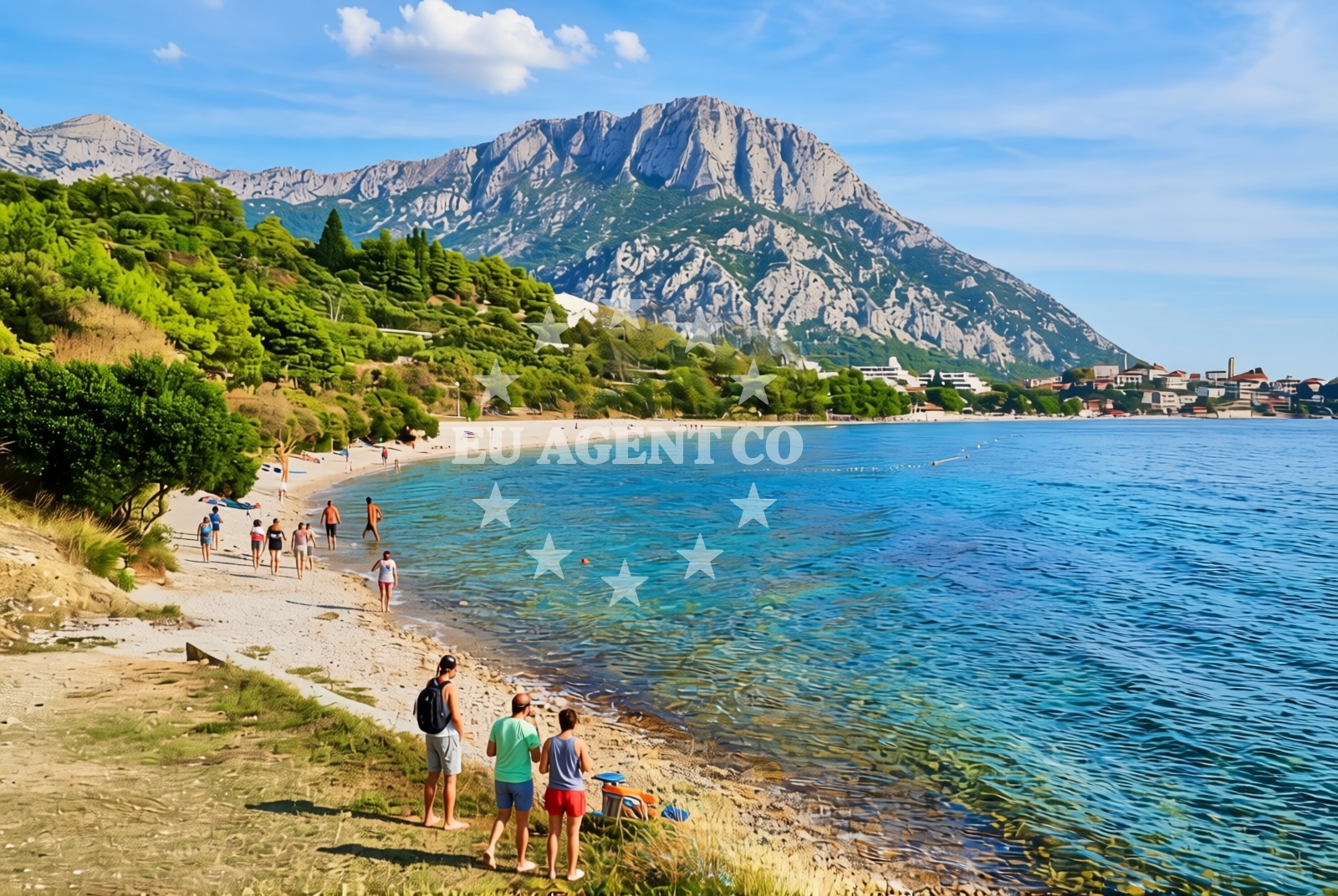
About this beach
Bošac sjever, Gradac
Beach: Bošac sjever
Location: Gradac
Characteristics and facilities
Gravel
200 m
Natural shade
Training ground
Beach character
The beach is defined by its gravel surface, which contrasts with the fine sands of many Adriatic shores. This texture may appeal to those looking for a unique walking or recreational surface. Natural shade is available, likely provided by low-lying vegetation or rocky outcrops, though the extent of coverage is not specified. The presence of a training ground indicates the area has been utilized for structured activities, though its current function or accessibility remains unclear. The beach's relatively short length and lack of formal facilities position it as a secluded spot, potentially more suited to local use than mass tourism.Swimming and shore
Swimming conditions at Gradac Beach are not explicitly detailed in available records, but the gravel shoreline may present challenges for traditional water activities. The beach's natural features, such as its uneven surface and potential for erosion, suggest it is not designed for sunbathing or leisurely relaxation. Instead, the area might be more appropriate for low-impact activities like walking or exploring the training ground. The absence of marked swimming zones or safety infrastructure implies visitors should exercise caution, particularly if the beach is used for training purposes.Facilities and activities
There are no formal amenities listed for Gradac Beach, including showers, restrooms, or parking. The training ground appears to be the primary structured feature, though its current use is unspecified. Visitors should not expect lifeguards, umbrellas, or other services typically found at tourist beaches. The gravel surface may limit recreational options, but the natural setting offers opportunities for photography, hiking, or historical inquiry related to the training ground's past use.Access and location
Gradac Beach is located in Bošac sjever, a northern extension of the Bošac peninsula. The exact road access or nearby settlements are not detailed in the catalog, but the beach's coordinates (43.112371°N, 17.335239°E) place it near the broader Dalmatian coast. Visitors may need to navigate local roads or trails to reach the site, as no parking facilities are noted. The beach's proximity to the Adriatic Sea means it is accessible by sea, though no marinas or anchorages are explicitly mentioned in the catalog.What to expect
Visitors to Gradac Beach should prepare for a minimalist coastal experience. The gravel shoreline may require sturdy footwear, and the lack of amenities means self-sufficiency is essential. The training ground's historical or current use could influence the beach's atmosphere, though specifics are not available. The beach's natural shade and short length make it a potentially tranquil spot, though its suitability for swimming or relaxation depends on conditions not fully described in the catalog.Practical tips
Bring appropriate footwear for the gravel surface, and consider the beach's potential use for training activities when planning visits. Since no facilities are listed, pack essentials like water, snacks, and sun protection. The beach's historical context may interest visitors seeking off-the-beaten-path destinations, but confirm local guidelines before exploring the training ground.Exploring the coast by yacht
For yacht charter guests, Gradac Beach lies within the broader sailing region of the Adriatic coast, near routes connecting the Dalmatian islands to the mainland. While no specific marinas or anchorages are detailed for this exact location, the surrounding area offers established yacht bases in towns like Split and Šibenik. Charterers exploring the northern Adriatic may find this beach a point of interest for its unique geography, though its practicality as a stopover depends on navigational conditions and proximity to larger ports.Historical and Geographical Context
Bošac sjever is part of the Bošac peninsula, a historically significant area with ties to medieval fortifications and military use. The peninsula's rugged terrain and strategic coastal position have influenced its development, with Gradac Beach potentially reflecting this legacy through its training ground. The region's maritime history, including its role in Adriatic trade routes, adds depth to the beach's context for those interested in nautical heritage.Anchorages in the surrounding area
Anchorages near Bošac sjever, Gradac Beach include options in Ploce, Drvenik, and Hvar, offering nearby mooring spots.
- Anchorage — ploce — 3.5 NM from beach
- Anchorage — drvenik — 4.6 NM from beach
- Anchorage — sucuraj — hvar — 6.7 NM from beach
- Anchorage — trpanj — 6.8 NM from beach
- Anchorage — sucuraj — hvar — 7.6 NM from beach
- Anchorage — sucuraj — hvar — 8.1 NM from beach
- Anchorage — duba peljeska — 8.1 NM from beach
- Anchorage — crikvice — 8.4 NM from beach
Distances are straight-line geographic distances, not sailing routes.
Mooring buoys in the surrounding area
Mooring buoys in the surrounding area include Brist, Drvenik Ferry Dock, and Sučuraj-Hvar jetty, with the closest at Brist.
- Brist — 0.7 NM from beach
- Drvenik - Ferry dock — drvenik ferry dock — 4.6 NM from beach
- Jetty — sucuraj — hvar — 6.5 NM from beach
- Jetty — blace — 9.2 NM from beach
- Konoba Gambo buoys — selca kod bogomolja — hvar — 10.3 NM from beach
Distances are straight-line geographic distances, not sailing routes.
Marine fuel stations
- Fuel station — ploce — 5.7 NM from beach
- Fuel station — korcula — 12.5 NM from beach
- Ina — makarska — 17.8 NM from beach
- Fuel station — sumartin — brac — 23.2 NM from beach
Distances are straight-line geographic distances, not sailing routes.
Harbours in the surrounding area
Harbours in the surrounding area include Gradac, Zaostrog, and Drvenik, with the closest being Gradac.
- Gradac — 0.5 NM from beach
- Zaostrog — 3.0 NM from beach
- Drvenik — 4.7 NM from beach
- Ploče — ploce — 5.6 NM from beach
- Sućuraj — sucuraj — hvar — 6.5 NM from beach
- Trpanj — 6.8 NM from beach
Distances are straight-line geographic distances, not sailing routes.
Marinas in the surrounding area
Marinas in the surrounding area include Korcula, Lumbarda, Tučepi, and Ramova, with the nearest in Korcula.
- ACI Marina Korčula — korcula — 12.7 NM from beach
- Marina Lumbarda — korcula — 13.4 NM from beach
- Marina Tučepi — marina tucepi — 15.2 NM from beach
- Marina Ramova — krvavica — 20.0 NM from beach
- Marina Baška Voda — marina baska voda — 22.5 NM from beach
Distances are straight-line geographic distances, not sailing routes.
Navigation guides for the surrounding area
Navigation guides for the surrounding area include Gradac, Uvala Drvenik, and Hvar, providing route information.
- Gradac — 0.7 NM from beach
- Uvala Drvenik (Donja Vala) — 4.4 NM from beach
- Place (Kardeljeva) — 5.8 NM from beach
- OTOK HVAR — 5.8 NM from beach
- Trpanj — 6.7 NM from beach
Distances are straight-line geographic distances, not sailing routes.
Yachts from nearby departure bases
Yachts depart from Ploče City Port, Tučepi Port, and Makarska Port, with several options based in Ploče.
Sailing yachts
- Elan 40 Impression (Karleta) — Ploče City Port — 5.6 NM from departure base to beach
- Sun Odyssey 349 (Porto Tolero) — Ploče City Port — 5.6 NM from departure base to beach
- Salona 44 (SAMOA) — Ploče City Port — 5.6 NM from departure base to beach
- Sun Odyssey 419 (Luka Ploce) — Ploče City Port — 5.6 NM from departure base to beach
- More 55 (MRS. ROBINSON) — Ploče City Port — 5.6 NM from departure base to beach
- Elan 514 Impression (Cesarica III) — Ploče City Port — 5.6 NM from departure base to beach
- Sun Odyssey 349 (Visnjica) — Ploče City Port — 5.6 NM from departure base to beach
- Bavaria 40 Cruiser (LADY BUTTERFLY) — Tučepi Port — 15.2 NM from departure base to beach
Catamarans
- Lagoon 450 Fly (Alba Mouse) — Ploče City Port — 5.6 NM from departure base to beach
Motor yachts
- Princess V53 (Chablis) — Makarska Port — 17.6 NM from departure base to beach
Distances are straight-line geographic distances, not sailing routes.