Bok od Supetra, Nečujam (Šolta) Beach, Croatia
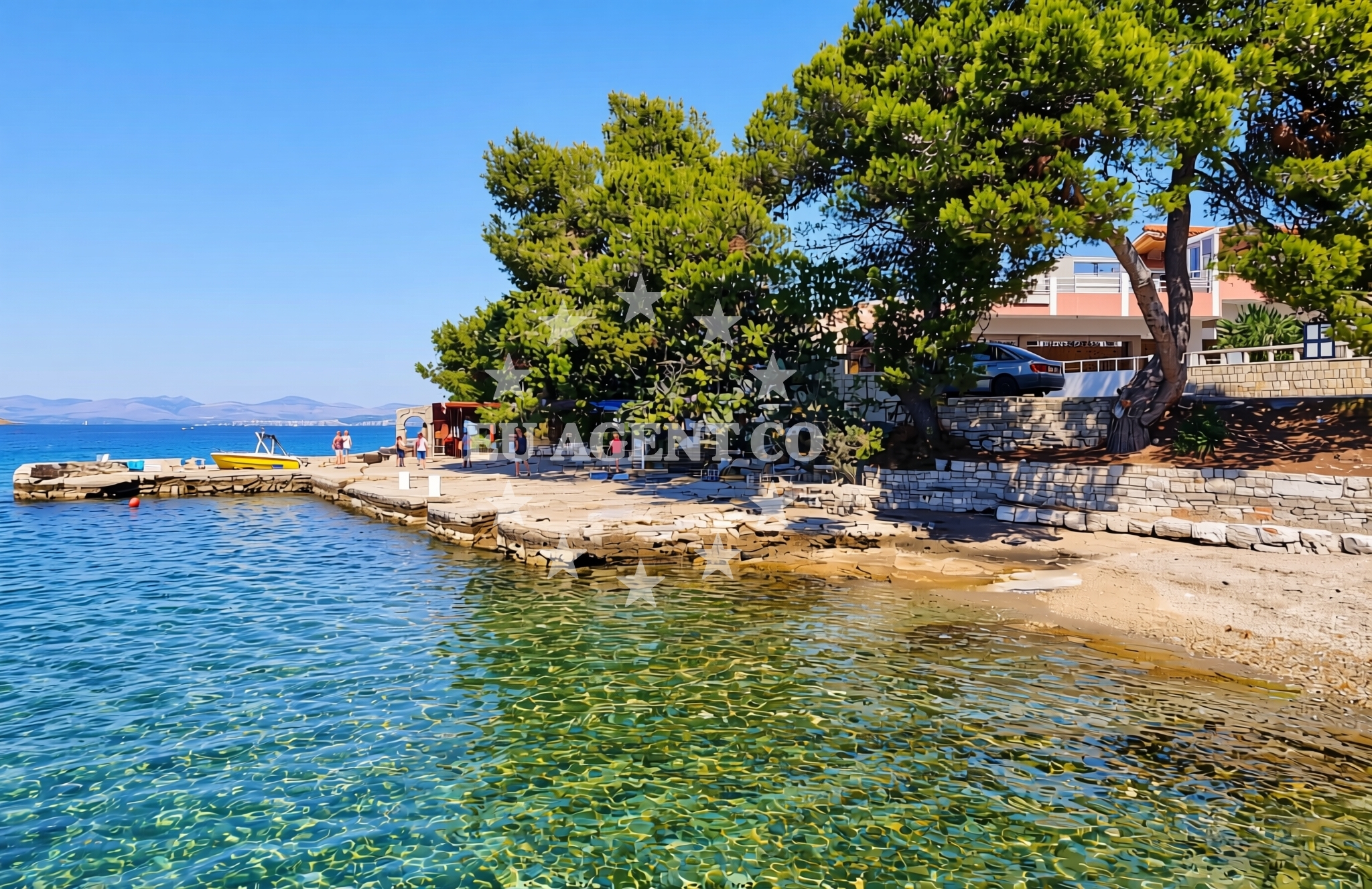
About this beach
Bok od Supetra, Nečujam (Šolta)
Beach: Bok od Supetra
Location: Nečujam (Šolta)
Characteristics and facilities
Gravel, concrete / stone slabs
Caffe bar / Drinks stand
Natural shade
Beach character
The beach is composed of gravel and concrete/stone slabs, offering a stark contrast to the typical sandy shores of the Adriatic. Natural shade is available from overhanging rock formations and vegetation, providing respite from the sun. A caffe bar/drinks stand is present, though the beach lacks additional amenities such as showers, toilets, or changing rooms. The gravel surface may make it less ideal for swimming but suitable for walking or sunbathing on the slabs.Swimming and shore
Swimming conditions are not explicitly detailed in the beach’s records, but the gravelly terrain suggests it may not be the primary spot for water activities. The shore is relatively undeveloped, with no structured beachfront infrastructure. The natural shade from rock formations offers limited protection for those spending extended time on the beach.Facilities and activities
The sole facility is a caffe bar/drinks stand, which may offer basic refreshments. There are no organized activities, rentals, or marked recreational zones. The beach’s simplicity aligns with its status as a local rather than tourist-focused shoreline.Access and location
Access to the beach is via roads leading to Nečujam on Šolta Island. Šolta itself is accessible by ferry or private boat from nearby mainland towns such as Supetar, Bol, or Split. The island is part of the Šolta–Pakleni Islands Nature Park, known for its vineyards, olive groves, and secluded coves. The beach’s location makes it a potential stop for sailors exploring the central Dalmatian coast.What to expect
Expect a gravelly shoreline with concrete/stone slabs, natural shade from rock formations, and a caffe bar for light refreshments. The beach is not equipped with modern amenities like showers or parking. Its simplicity suits visitors seeking a low-key coastal experience rather than a fully serviced resort beach.Practical tips
Wear comfortable footwear for the gravel surface. The caffe bar may have limited hours, so arrive early if refreshments are desired. Check local ferry schedules for access to Šolta Island, as the beach is not directly reachable by road from the mainland.Exploring the coast by yacht
For yacht charter guests, Bok od Supetra is a minor waypoint in the central Adriatic sailing route. The surrounding area of Šolta and nearby islands like Hvar and Brac are popular for cruising, with marinas in Supetar and Bol offering docking options. While the beach itself is not a marina, its proximity to these facilities makes it a potential anchorage or stop for sailors exploring the region’s vineyard-clad islands and clear waters.Šolta Island’s Cultural and Natural Setting
Šolta is one of the Šolta–Pakleni Islands, a group protected for their biodiversity and historical significance. The island’s landscape includes fertile land for agriculture, with vineyards producing local wines. Nečujam, where the beach is located, is a small village with traditional stone houses, reflecting the island’s rural character. The area’s appeal lies in its tranquility and unspoiled natural beauty, contrasting with the busier islands further west.Anchorages in the surrounding area
Anchorages near the beach include options in Necujam and Rogac on Solta.
- Anchorage — necujam — solta — 0.6 NM from beach
- Anchorage — necujam — solta — 0.6 NM from beach
- Anchorage — necujam — solta — 0.7 NM from beach
- Anchorage — necujam — solta — 0.7 NM from beach
- Anchorage — rogac — solta — 1.1 NM from beach
- Anchorage — rogac — solta — 1.6 NM from beach
- Anchorage — solta — 1.9 NM from beach
- Anchorage — solta — 2.0 NM from beach
Distances are straight-line geographic distances, not sailing routes.
Mooring buoys in the surrounding area
- Jetty — necujam — solta — 0.2 NM from beach
- Resturant Sveti Petar bouy — necujam — solta — 0.3 NM from beach
- Pasarela restaurant jetty — rogac — solta — 1.2 NM from beach
- Buoy field — solta — 1.9 NM from beach
- Lonely Paradise restaurant buoys — solta — 1.9 NM from beach
Distances are straight-line geographic distances, not sailing routes.
Marine fuel stations
Fuel stations are located in Rogac on Solta, as well as in Milna Brac, Trogir, and Split.
- Fuel station — rogac — solta — 1.3 NM from beach
- Ina — milna brac — 6.2 NM from beach
- Ina — trogir — 8.3 NM from beach
- Ina — split — 8.5 NM from beach
Distances are straight-line geographic distances, not sailing routes.
Harbours in the surrounding area
Harbours in the area include Rogac and Stomorska on Solta, along with options in Brac and Ciovo.
- Rogač — rogac — solta — 1.3 NM from beach
- Stomorska — solta — 1.4 NM from beach
- Bobovišće — bobovisce — brac — 6.3 NM from beach
- Milna — milna brac — 6.4 NM from beach
- Sutivan — brac — 6.7 NM from beach
- Slatine — ciovo — 6.8 NM from beach
Distances are straight-line geographic distances, not sailing routes.
Marinas in the surrounding area
Marinas are located in Maslinica on Solta, as well as in Milna Brac and Split.
- Marina Martinis Marchi — maslinica — solta — 5.3 NM from beach
- Marina Vlaška — milna brac — 6.0 NM from beach
- Marina Milna Kanarija — milna brac — 6.3 NM from beach
- ACI Marina Milna — milna brac — 6.4 NM from beach
- ACI Marina Split — 8.3 NM from beach
Distances are straight-line geographic distances, not sailing routes.
Restaurants near the beach
Restaurants near the beach include options in Necujam and Rogac, such as Restaurant Punta and Sveti Petar.
- Restaurant Punta — necujam — solta — 0.2 NM from beach
- Sveti Petar — necujam — solta — 0.3 NM from beach
- Konoba Mareta — necujam — solta — 0.6 NM from beach
- Stara Kuća — rogac — solta — 1.2 NM from beach
- Pasarela — rogac — solta — 1.2 NM from beach
- Hundred Seas Luna — stomorska — solta — 1.5 NM from beach
- Restoran Pizzeria Turanj — stomorska — solta — 1.5 NM from beach
Distances are straight-line geographic distances, not sailing routes.
Navigation guides for the surrounding area
Navigation guides cover nearby areas like Uvala Necujam, Rogac, and Stomorska.
- Uvala Necujam — 0.2 NM from beach
- Rogac — 1.0 NM from beach
- Stomorska — 1.5 NM from beach
- Uvala Tatinja — 2.0 NM from beach
- Uvala Donja Krusica — 2.7 NM from beach
Distances are straight-line geographic distances, not sailing routes.
Yachts from nearby departure bases
Yachts depart from Šolta Rogač, offering both sail boats and catamarans.
Sailing yachts
- Cyclades 50.5 (Orinoco) — Šolta Rogač — 1.3 NM from departure base to beach
- Oceanis 50 Family (Mississippi) — Šolta Rogač — 1.3 NM from departure base to beach
- Sun Odyssey 449 (Tortuga) — Šolta Rogač — 1.3 NM from departure base to beach
- Cyclades 39.3 (Patagonia) — Šolta Rogač — 1.3 NM from departure base to beach
- Cyclades 43.4 (Himalaya) — Šolta Rogač — 1.3 NM from departure base to beach
Catamarans
- Lagoon 42 (Galapagos) — Šolta Rogač — 1.3 NM from departure base to beach
- Lagoon 40 (Solentia) — Šolta Rogač — 1.3 NM from departure base to beach
- Lagoon 450 Flybridge (Samogon) — Šolta Rogač — 1.3 NM from departure base to beach
- Lagoon 450 (Madagascar) — Šolta Rogač — 1.3 NM from departure base to beach
- Lagoon 400 (Greenland) — Šolta Rogač — 1.3 NM from departure base to beach
Distances are straight-line geographic distances, not sailing routes.