Bobovik Zapad Beach, Vir, Croatia
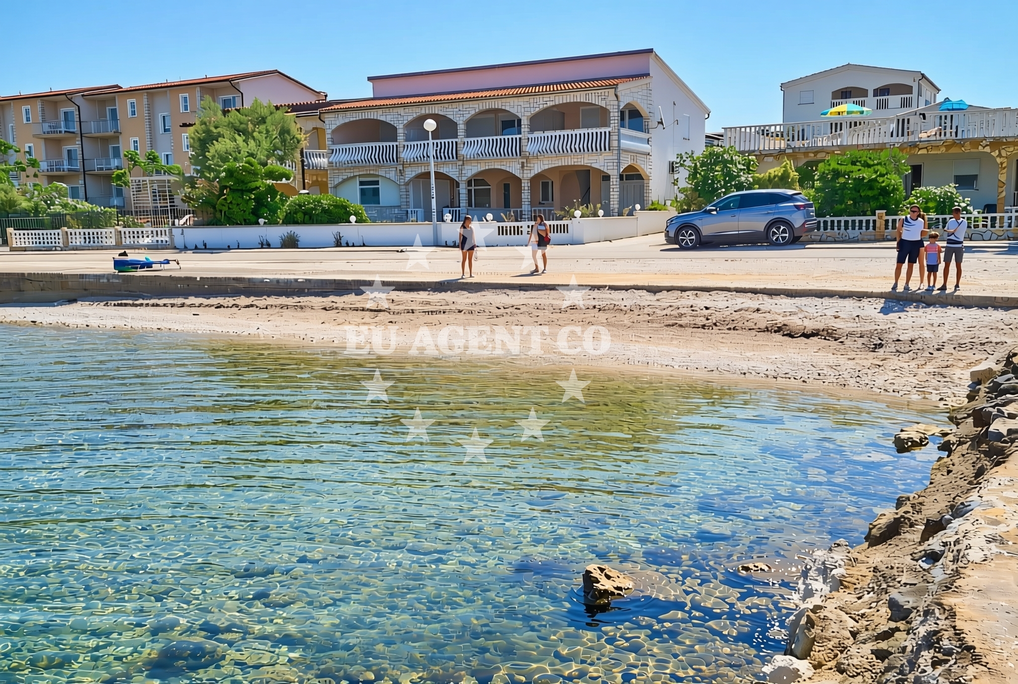
About this beach
Bobovik zapad, Vir (Vir)
Beach: Bobovik zapad
Location: Vir (Vir)
Characteristics and facilities
Gravel, concrete / stone slabs
240 m
Beach character
The beach's surface composition of gravel and concrete slabs defines its practical character. This configuration suggests a focus on accessibility rather than recreational amenities. The 240-meter length provides a linear shoreline that may be suitable for those seeking a direct path to the water's edge. No specific facilities or structures are documented in the beach's authoritative features, indicating a minimalistic approach to coastal development.Swimming and shore
While no specific swimming conditions are detailed in the beach's records, the Adriatic coastline near Vir is generally known for its clear waters and moderate currents. The gravelly shoreline may present challenges for barefoot swimmers, though the concrete slabs could offer stable entry points for those arriving by boat or vehicle.Facilities and activities
No structured amenities or recreational activities are explicitly listed for Bobovik Zapad Beach. The absence of detailed facilities suggests a focus on the natural shoreline rather than developed beachfront infrastructure. Visitors should consider the practical nature of the beach's surface when planning their visit.Access and location
Situated in the settlement of Vir, this beach lies within the broader context of Croatia's Adriatic coastline. The island of Vir itself is part of the larger Šibenik-Knin County, positioned between the islands of Šolta and Brač. The beach's coordinates (44.309127°N, 15.096482°E) place it in a region known for its maritime history and sailing opportunities.What to expect
Visitors to Bobovik Zapad Beach should anticipate a shoreline defined by gravel and concrete surfaces, with no additional facilities documented. The beach's practical orientation suggests it may serve more as a transit point than a recreational destination. The 240-meter length provides a straightforward coastal experience, with the surrounding Vir settlement offering potential for further exploration.Practical tips
Given the beach's gravel and concrete composition, appropriate footwear is recommended for comfort. The lack of detailed facilities means visitors should plan accordingly for any specific needs. The beach's location within Vir provides opportunities to explore the island's maritime connections and coastal pathways.Exploring the coast by yacht
For yacht charter guests, the proximity of Bobovik Zapad Beach to the Vir settlement highlights its potential as a reference point within the Adriatic sailing routes. The region is part of a broader network of coastal towns and islands that form key waypoints for Adriatic cruises. Euro-Agent's yacht search platform can help identify vessels operating in this area, with options ranging from motor yachts to sailing boats that may use nearby marinas as bases.Regional Context of Vir
The island of Vir is part of Croatia's Dalmatian coast, known for its historic fortifications and strategic maritime position. The settlement of Vir itself has long been a hub for maritime activity, with its location between the islands of Šolta and Brač making it a natural stop for sailors navigating the Adriatic. This context positions Bobovik Zapad Beach within a broader network of coastal points that have historically supported both commercial and recreational maritime traffic.Anchorages in the surrounding area
Anchorages in the surrounding area, including those located near Vir.
- Anchorage — vir — 0.2 NM from beach
- Anchorage — vir — 0.9 NM from beach
- Anchorage — vir — 1.4 NM from beach
- Anchorage — vir — 1.5 NM from beach
- Anchorage — lozice — vir — 1.8 NM from beach
- Anchorage — povljana — pag — 1.8 NM from beach
- Anchorage — povljana — pag — 2.1 NM from beach
- Anchorage — lozice — vir — 2.8 NM from beach
Distances are straight-line geographic distances, not sailing routes.
Mooring buoys in the surrounding area
Mooring buoys in the surrounding area, including Vir and distant locations like Punta Skala.
- Vir — 0.9 NM from beach
- Punta Skala — petrcane — 7.3 NM from beach
- Jetty — ljubac — 8.9 NM from beach
- Buoy field — muline — ugljan — 10.2 NM from beach
- Jetty — ugljan — 10.3 NM from beach
Distances are straight-line geographic distances, not sailing routes.
Marine fuel stations
- Ina — zadar — 12.8 NM from beach
- Ina — preko — ugljan — 14.6 NM from beach
- Fuel station — sukosan — 17.7 NM from beach
- Ina — zaglav — dugi otok — 21.7 NM from beach
Distances are straight-line geographic distances, not sailing routes.
Harbours in the surrounding area
Harbours in the surrounding area, including Povljana and Privlaka, within a few nautical miles.
- Povljana — pag — 2.1 NM from beach
- Privlaka — 2.8 NM from beach
- Košljun — kosljun pag — 5.2 NM from beach
- Nin — 5.3 NM from beach
- Mulo — nin — 5.8 NM from beach
- Miškovići — miskovici — pag — 5.9 NM from beach
Distances are straight-line geographic distances, not sailing routes.
Marinas in the surrounding area
Marinas in the surrounding regions, including ACI Marina Šimuni and Zadar Marina Borik, further from the beach.
- ACI Marina Šimuni — simuni — pag — 11.4 NM from beach
- Marina Borik — zadar — 11.8 NM from beach
- Vitrenjak Zadar — 12.1 NM from beach
- Marina Zadar — 12.8 NM from beach
- Olive Island Marina — sutomiscica — ugljan — 13.2 NM from beach
Distances are straight-line geographic distances, not sailing routes.
Restaurants near the beach
Restaurants near the beach, including those in Vir and nearby areas like Povljana.
- Restaurant — vir — 0.6 NM from beach
- Restaurant — vir — 0.7 NM from beach
- Viranka — 0.7 NM from beach
- Monica — vir — 0.8 NM from beach
- Grill Marion — vir — 0.9 NM from beach
- Restaurant — vir — 1.4 NM from beach
- Mornar — povljana — pag — 2.4 NM from beach
Distances are straight-line geographic distances, not sailing routes.
Navigation guides for the surrounding area
Navigation guides for the surrounding area, covering locations such as Otok Pag and Uvala Bliznica.
- OTOK PAG — 1.0 NM from beach
- Privlaka — 2.9 NM from beach
- KrusCica and Uvala KrusCica Duboka — 10.0 NM from beach
- Uvala Bliznica — 10.1 NM from beach
- Muline — 10.2 NM from beach
Distances are straight-line geographic distances, not sailing routes.
Yachts from nearby departure bases
Yachts from nearby departure bases, including Povljana Marina and Zadar Diklo Port, within a short distance.
Sailing yachts
- First 45 (Egeria) — Šimuni Kolan ACI Marina — 11.5 NM from departure base to beach
- Dufour 450 Grand (Tibitoo) — Zadar Marina Borik — 11.8 NM from departure base to beach
Catamarans
- Sunreef 60 (SINATA) — Zadar Marina Borik — 11.8 NM from departure base to beach
Motor yachts
- Ferretti 780 (TESORO) — Zadar Marina Borik — 11.8 NM from departure base to beach
Motor boats
- Merry Fisher 895 — Povljana Marina — 2.3 NM from departure base to beach
- BWA Sport 22GT (BWA ) — Pag City Port — 8.3 NM from departure base to beach
- Rancraft RS Cinque.5 — Zadar Diklo Port — 10.5 NM from departure base to beach
- Rancraft RM21 (Dugi otok) — Zadar Diklo Port — 10.5 NM from departure base to beach
- Rancraft RM19 (Daycruiser) — Zadar Diklo Port — 10.5 NM from departure base to beach
- Merry Fisher 895 (Miami Vice) — Zadar Marina Borik — 11.8 NM from departure base to beach
Distances are straight-line geographic distances, not sailing routes.